| Turn map |
Directions & comments |
|
|

Woolwich Wharf Stop_position Start (a footpath).

After 30 m pass a seat (4 m on your right)., has a backrest.

After another 9 m pass the "Hunters Hill Council Community Notice Board" (5 m on your right).
Then pass a seat (on your right)., has a backrest.

After another 6 m pass the toilet (5 m on your right). This toilet is wheelchair accessible., equipped with a hand-washing basin.

After another 15 m find the "Woolwich Wharf" (5 m on your right).
After another 7 m pass the "The Great North Walk" (on your right).

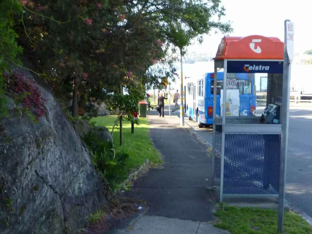
After another 6 m pass the pay phone (on your right).
After another 15 m pass a seat (30 m on your left)., has a backrest.
|
|
|

From the Valentia Street veer right, to head along Valentia Street (a residential road).

After another 15 m pass the playground (15 m on your left).

After another 15 m pass the water tap (8 m on your left).
After another 135 m pass the "View Street Reserve" (about 75 m ahead).
|
|
|

At the intersection of The Point Road & Valentia Street turn left, to head along The Point Road (a highway|tertiary).

After another 90 m (at the intersection of The Point Road & Angelo Street) continue straight, to head along The Point Road.
After another 220 m (at the intersection of The Point Road & Mayfield Avenue) continue straight, to head along The Point Road.
After another 45 m (at the intersection of The Point Road & Hunter Street) continue straight, to head along The Point Road.
|
|
|
After another 70 m (at the intersection of Gale Street & The Point Road) continue straight, to head along Gale Street.
After another 105 m (at the intersection of Gale Street & Hunter Lane) continue straight, to head along Gale Street.
After another 15 m (at the intersection of Gale Street & Collingwood Street) continue straight, to head along Gale Street.
After another 50 m pass a seat (80 m on your left)., has a backrest.
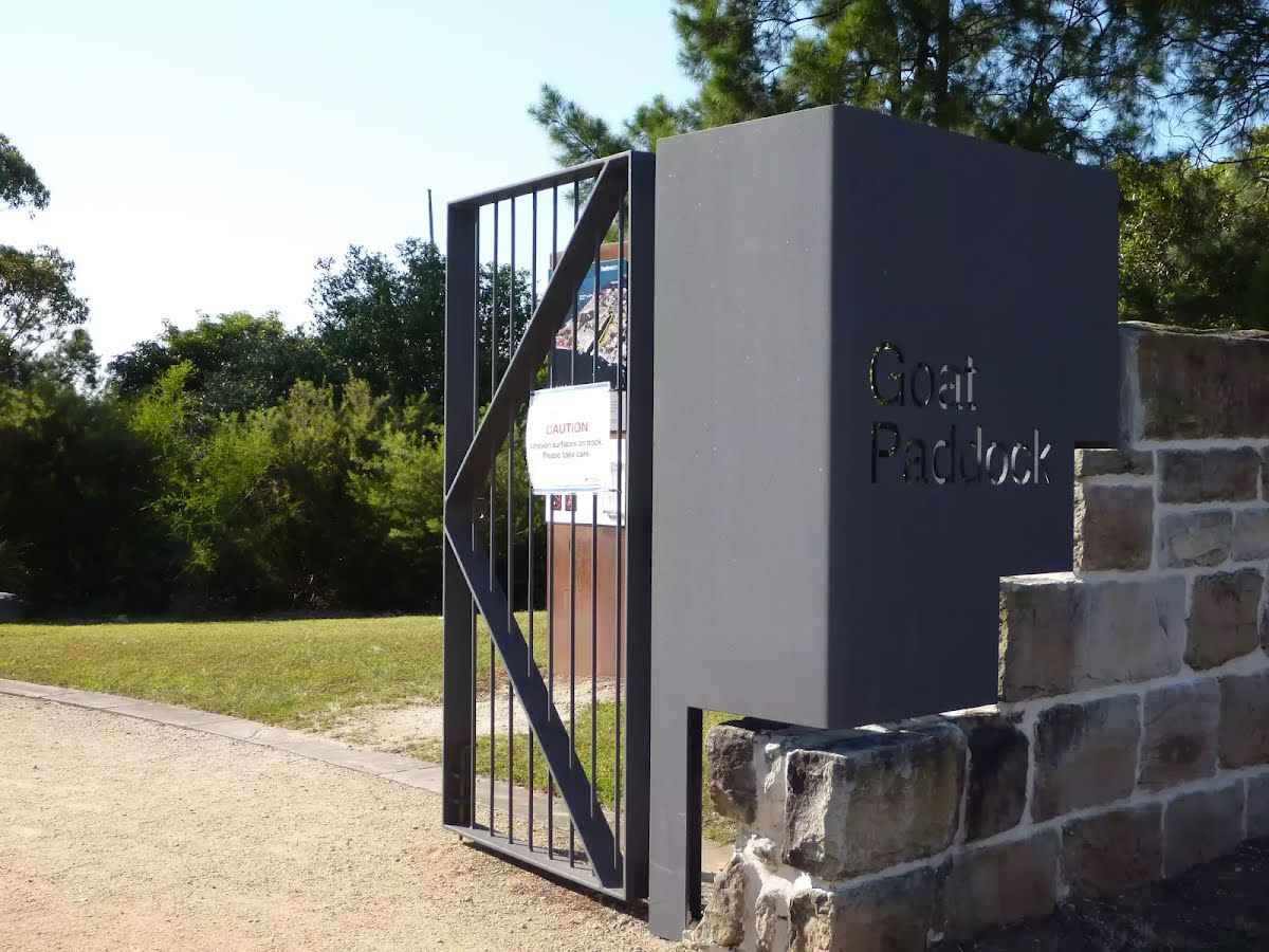
After another 45 m find the "Goat Paddock" (15 m on your left).
|
|
|
At the intersection of Woolwich Road & Gale Street veer right, to head along Woolwich Road.
|
|
|
After another 40 m (from the Woolwich Road) turn left (a footpath).

After another 75 m find the "Woolwich Lookout" (4 m on your left).
|
|
|
Veer right.
After another 8 m continue straight.

After another 25 m pass the car park (75 m on your left).
|
|
|

After another 40 m (at the intersection of Edgecliff Road & Clarke Road) veer left, to head along Edgecliff Road (a residential road).
After another 130 m pass the car park (45 m on your left).
After another 65 m (at the intersection of Alfred Street & Margaret Street) continue straight, to head along Alfred Street.
After another 115 m pass the car park (45 m on your left).
|
|
|
From the Alfred Street continue straight (a steps).

Then head up the steps (about 15 m long)
|
|
|

After another 80 m (from the The Great North Walk) turn right, to head along The Great North Walk.
|
|
|
After another 50 m (from the The Great North Walk) continue straight, to head along The Great North Walk.
After another 60 m pass the sign (on your right).
Then pass a seat (on your left)., has a backrest.
After another 15 m find the "Kellys Bush" (on your right).
|
|
|
After another 8 m (at the intersection of Prince George Parade & The Great North Walk) continue straight, to head along Prince George Parade (a residential road).
|
|
|
After another 5 m (at the intersection of Prince Edward Parade & Prince George Parade) turn right, to head along Prince Edward Parade.
After another 25 m pass a seat (10 m on your left)., has a backrest.
After another 8 m pass the park (5 m on your left).
After another 100 m pass the "Great North Walk" (25 m on your left).
|
|
|
At the intersection of Gladstone Avenue & Prince Edward Parade turn right, to head along Gladstone Avenue.
|
|
|
After another 120 m (at the intersection of Woolwich Road & Gladstone Avenue) turn left, to head along Woolwich Road (a highway|tertiary).
|
|
|
After another 120 m (at the intersection of Serpentine Road & Woolwich Road) turn right, to head along Serpentine Road (a residential road).
|
|
|
After another 60 m (from the Serpentine Road) turn left (a walking track).

Then head down the surface|paved steps (about 5 m long)
|
|
|

After another 55 m (at the intersection of Vernon Street & The Great North Walk) turn sharp left, to head along Vernon Street (a residential road).
|
|
|
After another 40 m (at the intersection of The Great North Walk & Vernon Street) turn right, to head along The Great North Walk (a steps).
Then head down the surface|paved steps (about 85 m long)
From the The Great North Walk turn left, to head along The Great North Walk (a walking track).
|
|
|
After another 180 m (from the The Great North Walk) veer left, to head along The Great North Walk.
|
|
|
After another 25 m (at the intersection of Vernon Street & The Great North Walk) veer right, to head along Vernon Street (a residential road).
After another 15 m (at the intersection of Vernon Street & Brookes Street) continue straight, to head along Vernon Street.
After another 65 m (at the intersection of Vernon Street & St Ives Avenue) continue straight, to head along Vernon Street.
|
|
|
After another 60 m (at the intersection of Woolwich Road & Vernon Street) turn right, to head along Woolwich Road (a highway|tertiary).
After another 35 m (at the intersection of Woolwich Road & Glenview Road) continue straight, to head along Woolwich Road.
After another 85 m pass a seat (50 m on your left)., has a backrest.
After another 30 m (at the intersection of Woolwich Road & Futuna Street) continue straight, to head along Woolwich Road.
After another 40 m (at the intersection of Woolwich Road & Jeanneret Avenue) continue straight, to head along Woolwich Road.
|
|
|
After another 105 m (at the intersection of Crescent Street & Woolwich Road) turn right, to head along Crescent Street (a residential road).
After another 45 m (at the intersection of Crescent Street & Futuna Street) continue straight, to head along Crescent Street.
|
|
|
After another 50 m (at the intersection of Garrick Avenue & Crescent Street) turn left, to head along Garrick Avenue.

After another 200 m find the "Ivy Alley" (35 m on your left).
After another 95 m pass a seat (55 m on your left)., has a backrest.
|
|
|
At the intersection of Passy Avenue & The Great North Walk turn right, to head along Passy Avenue (a residential road).
After another 70 m (at the intersection of Passy Avenue & Rooke Lane) continue straight, to head along Passy Avenue.
|
|
|
After another 70 m (at the intersection of Ambrose Street & Passy Avenue) turn left, to head along Ambrose Street.
|
|
|
After another 120 m (at the intersection of Woolwich Road & Ambrose Street) turn right, to head along Woolwich Road (a highway|tertiary).
After another 25 m (at the intersection of Woolwich Road & Foss Street) continue straight, to head along Woolwich Road.
|
|
|
After another 55 m (from the Alexandra Street) continue straight, to head along Alexandra Street.
After another 60 m (at the intersection of Alexandra Street & Ady Street) continue straight, to head along Alexandra Street.
After another 30 m find the "Hunters Hill Shops" (9 m on your left).
After another 75 m pass the "Hillman Orchard" (15 m on your right).
After another 25 m (at the intersection of Alexandra Street & Ellesmere Avenue) continue straight, to head along Alexandra Street.
After another 20 m pass the pay phone (10 m on your right).
After another 10 m pass a seat (10 m on your right)., has a backrest.

After another 135 m pass the artwork (10 m on your right).
At the intersection of Alexandra Street & D'Aram Street continue straight, to head along Alexandra Street.

After another 45 m pass the shelter (7 m on your right).
At the intersection of Alexandra Street & Stanley Road continue straight, to head along Alexandra Street.
After another 25 m (from the Alexandra Street) continue straight, to head along Alexandra Street.
|
|
|
After another 6 m (at the intersection of Ferdinand Street & Alexandra Street) turn right, to head along Ferdinand Street (a residential road).
After another 60 m (at the intersection of Ferdinand Street & Cullens Lane) continue straight, to head along Ferdinand Street.
|
|
|
After another 55 m (at the intersection of Madeline Street & Ferdinand Street) turn left, to head along Madeline Street.
After another 95 m (at the intersection of Madeline Street & Lot Lane) continue straight, to head along Madeline Street.
After another 35 m head up the steps (about 40 m long)
|
|
|
From the Mount Street turn right, to head along Mount Street (a residential road).
After another 95 m (at the intersection of Mount Street & Sea Street) continue straight, to head along Mount Street.
|
|
|
After another 50 m (at the intersection of The Great North Walk & Mount Street) turn left, to head along The Great North Walk (a footpath).

After another 20 m head through the bollard.
After another 230 m pass the shelter (15 m on your left).
Then pass the "Pleasure Grounds" (8 m on your right).
Then pass the sign (8 m on your right).
After another 10 m pass a seat (10 m on your right)., has a backrest.
After another 75 m pass the shelter (15 m on your left).
Then head up the steps (about 15 m long)
Then pass the "Great North Walk" (on your right).
|
|
|
At the intersection of Reiby Road & The Great North Walk turn right, to head along Reiby Road (a residential road).
|
|
|
After another 105 m (at the intersection of The Great North Walk & Reiby Road) continue straight, to head along The Great North Walk (a footpath).
|
|
|
After another 205 m (at the intersection of Joubert Street North & The Great North Walk) turn left, to head along Joubert Street North (a residential road).
|
|
|
After another 40 m (at the intersection of Figtree Road & Joubert Street North) turn right, to head along Figtree Road.
After another 180 m (at the intersection of Figtree Road & Abigail Street) continue straight, to head along Figtree Road.
|
|
|
After another 180 m (at the intersection of Ryde Road & Figtree Road) turn right, to head along Ryde Road (a road).
After another 75 m (at the intersection of Ryde Road & Luke Street) continue straight, to head along Ryde Road.
After another 15 m (from the Ryde Road) continue straight, to head along Ryde Road.
After another 25 m (at the intersection of Ryde Road & Martin Street) continue straight, to head along Ryde Road.
|
|
|
After another 440 m (at the intersection of Boronia Avenue & Ryde Road) turn right, to head along Boronia Avenue (a residential road).

After another 35 m pass the picnic table (15 m on your left).
Then pass a seat (35 m on your left)., has a backrest.

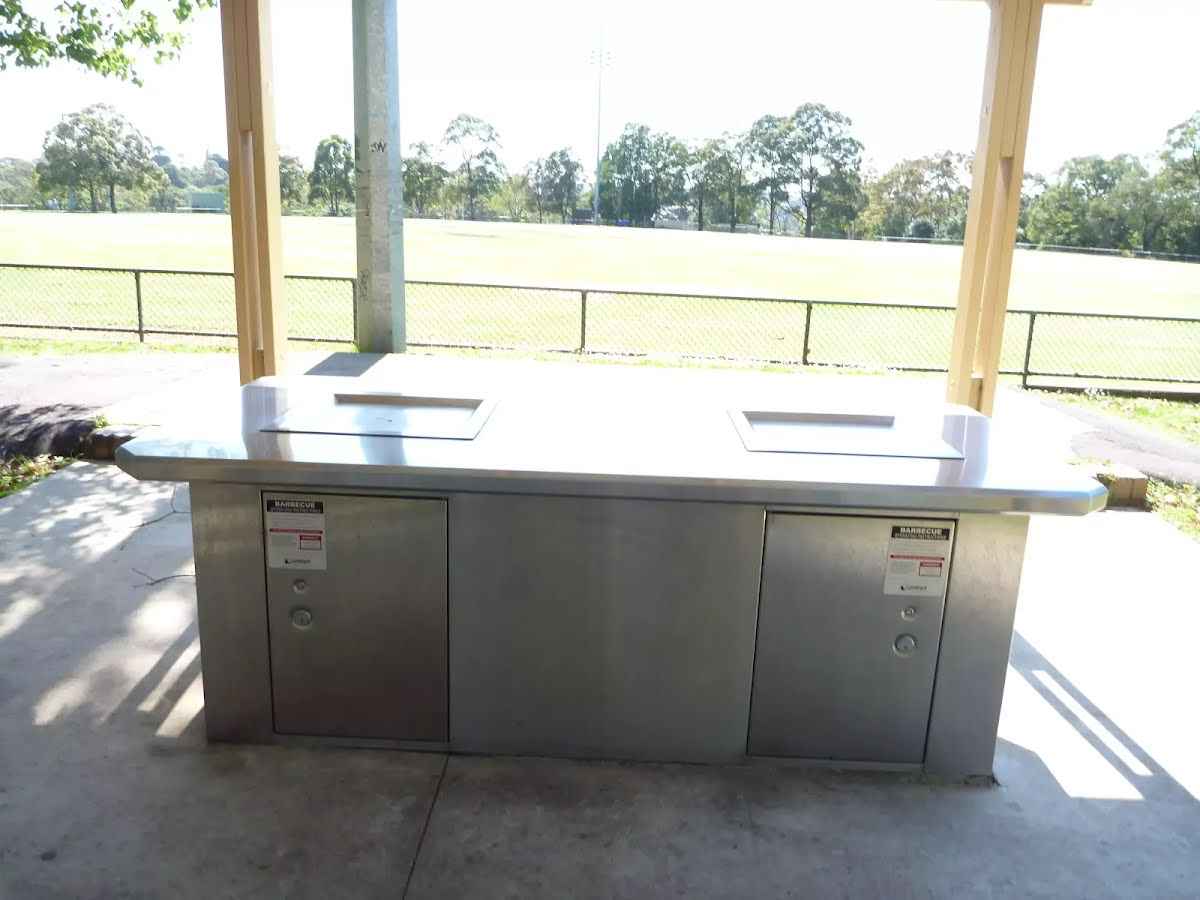
Then pass the BBQ (60 m on your left).
Then find the "Boronia Park" (15 m on your left).
After another 10 m pass the playground (20 m on your left).
After another 15 m pass a seat (15 m on your left)., has a backrest.
After another 210 m (from the Boronia Avenue) continue straight, to head along Boronia Avenue.
|
|
|
After another 25 m (from the The Great North Walk) continue straight, to head along The Great North Walk.
After another 80 m head down the steps (about 25 m long)
After another 145 m pass the shelter (15 m on your right).
|
|
|
At the intersection of Princes Street & The Great North Walk turn left, to head along Princes Street (a service road).
|
|
|
After another 35 m (at the intersection of The Great North Walk & Princes Street) turn right, to head along The Great North Walk (a footpath).
After another 10 m pass the "The Great North Walk" (7 m on your left).

After another 115 m cross the bridge (about 8 m long)

After another 7 m pass the "Tipperary Falls" (75 m on your left).
|
|
|
After another 115 m (from the The Great North Walk) veer right, to head along The Great North Walk (a walking track).
|
|
|
After another 20 m (from the The Great North Walk) veer right, to head along The Great North Walk.
|
|
|
After another 255 m (from the The Great North Walk) continue straight, to head along The Great North Walk.
After another 15 m head down the 9 steps (about 5 m long)
After another 215 m head up the 18 steps (about 15 m long)
After another 60 m head down the 10 steps (about 6 m long)
After another 15 m head up the 11 steps (about 7 m long)
After another 60 m head down the 32 stone steps (about 15 m long)
After another 35 m head up the 8 steps (about 5 m long)
|
|
|
After another 70 m (from the The Great North Walk) turn left, to head along The Great North Walk.
After another 10 m head up the 21 steps (about 15 m long)
|
|
|
After another 4 m (from the The Great North Walk) veer right, to head along The Great North Walk.
After another 305 m head up the 6 stone steps (about 4 m long)
After another 15 m head down the 17 steps (about 10 m long)
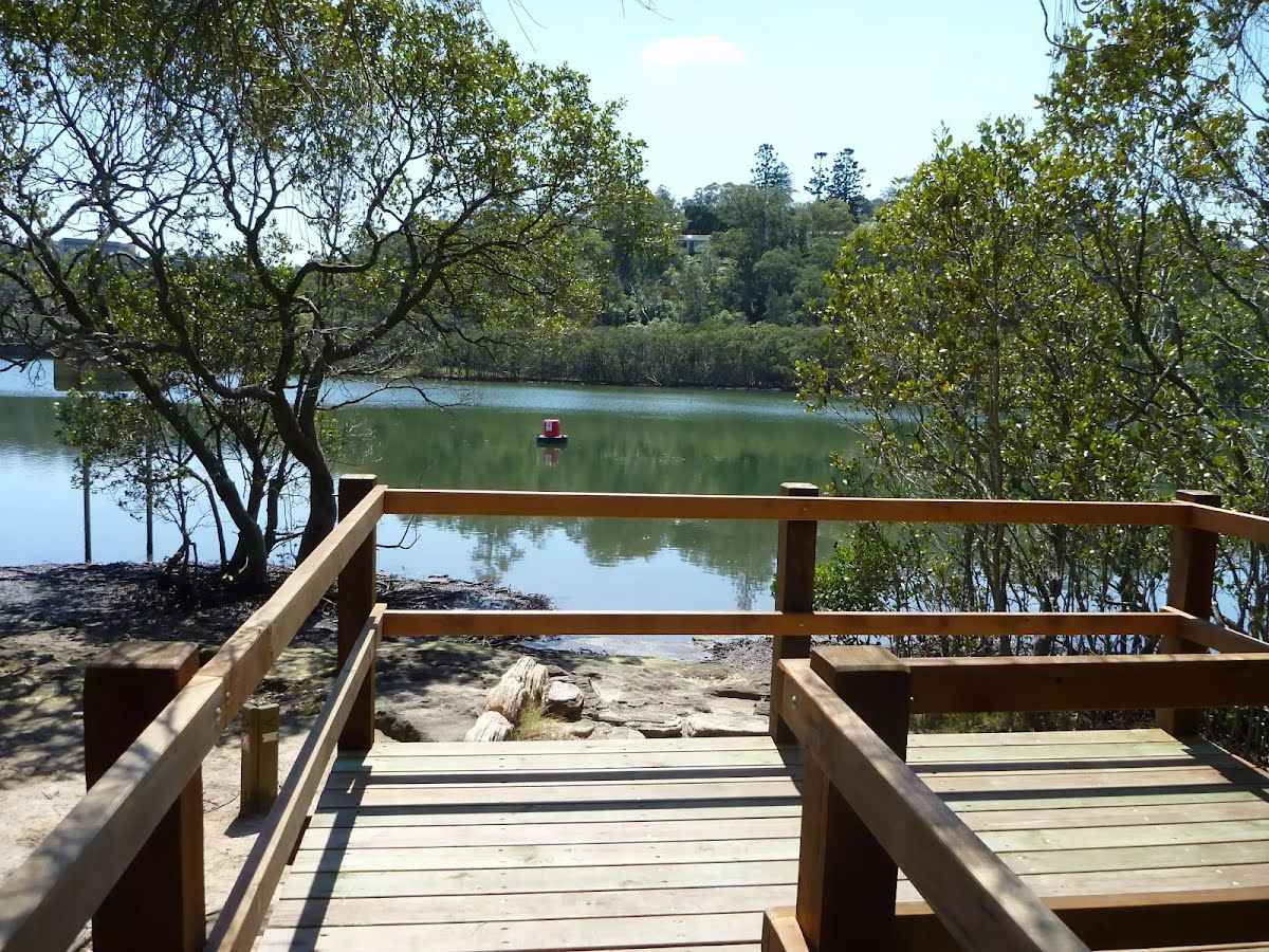
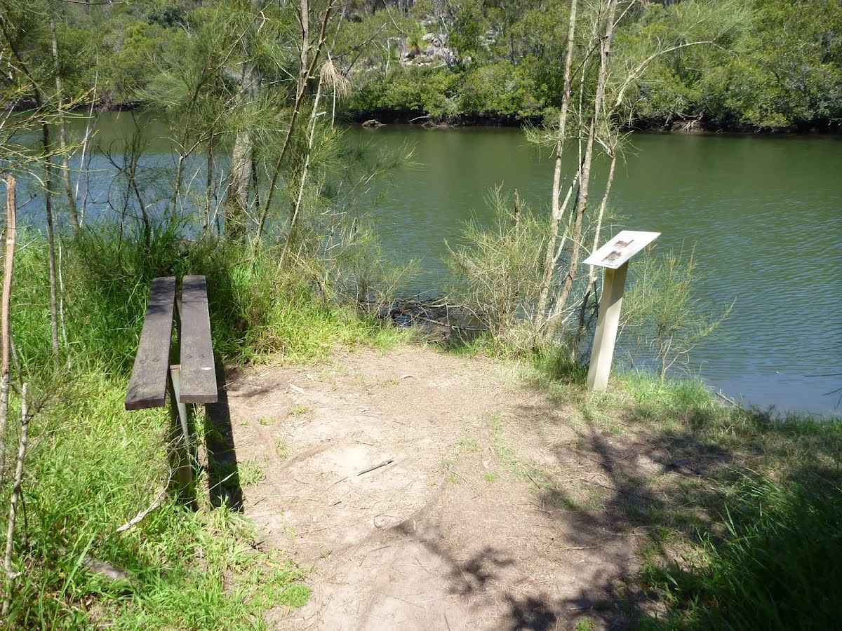
After another 160 m find the "Mangrove viewing platform" (10 m on your right).
Then pass the "A Saltmarsh Sanctuary" (10 m on your right).
Then pass a seat (10 m on your right)., has no backrest.
|
|
|
After another 15 m (from the The Great North Walk) continue straight, to head along The Great North Walk.
After another 180 m head up the 6 steps (about 4 m long)
After another 15 m head up the 3 steps (about 3 m long)
After another 9 m head down the 7 steps (about 7 m long)
After another 245 m (at the intersection of Pains Road & The Great North Walk) continue straight, to head along Pains Road (a residential road).
|
|
|
After another 20 m (from the Pains Road) continue straight (a footpath).
|
|
|
After another 135 m veer right.
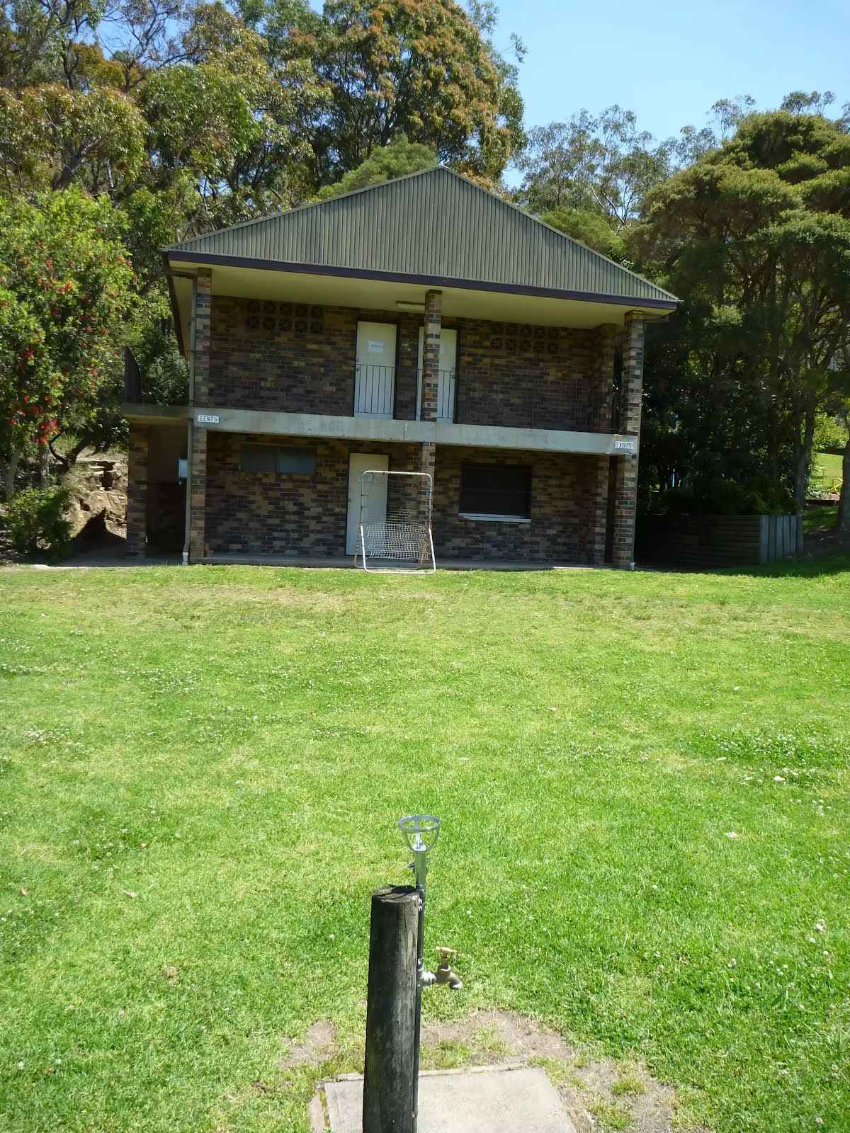
After another 10 m pass the water tap (70 m on your left).
Then pass the toilet (70 m on your left). This toilet is wheelchair accessible.
|
|
|
Veer right.
After another 30 m pass the picnic table (on your left).
After another 30 m pass the shelter (on your left).
Then pass the picnic table (on your left).
Then pass the "The Great North Walk" (10 m on your left).
Then find the "Buffalo Creek Reserve" (70 m on your left).
Then pass the "Buffalo Creek Track Head" (10 m on your left).
|
|
|
After another 4 m veer right.
After another 15 m pass the sign (5 m on your left).
Then head down the 36 wooden steps (about 25 m long)
|
|
|
After another 75 m (from the The Great North Walk) turn right, to head along The Great North Walk.
Then cross the bridge (about 15 m long)
Then head up the 16 stone steps (about 6 m long)
|
|
|
After another 45 m (at the intersection of The Great North Walk & Sugarloaf Track) turn right, to head along The Great North Walk.
After another 35 m head up the 12 earthen steps (about 20 m long)
After another 40 m head up the 19 earthen steps (about 40 m long)
After another 180 m head down the 26 earthen steps (about 30 m long)
After another 8 m pass the sign (about 10 m ahead).
|
|
|
At the intersection of The Great North Walk & Sugarloaf Point Trail turn left (a vehicle track).

After another 195 m pass the "Sugarloaf Hill" (75 m on your left).
|
|
|
Continue straight.
After another 10 m pass the car park (35 m on your left).
|
|
|
From the The Great North Walk turn right, to head along The Great North Walk (a footpath).
After another 10 m pass a seat (on your left)., has a backrest.
Then pass the "Lane Cove National Park" (on your left).
After another 9 m head down the 16 earthen steps (about 8 m long)
After another 25 m head down the 13 wooden steps (about 10 m long)
After another 245 m head down the 8 earthen steps (about 3 m long)
After another 120 m pass the sign.
After another 115 m cross the bridge (about 10 m long)
|
|
|
After another 9 m (from the The Great North Walk) turn right, to head along The Great North Walk.
After another 10 m pass the sign (on your right).
After another 90 m (from the The Great North Walk) continue straight, to head along The Great North Walk.
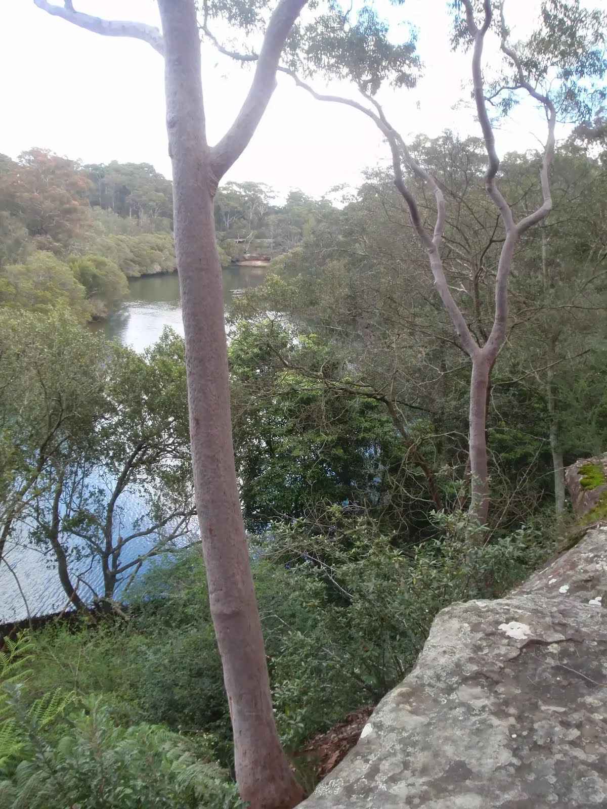
After another 40 m come to the viewpoint (15 m on your right).
After another 75 m come to the viewpoint (15 m on your right).
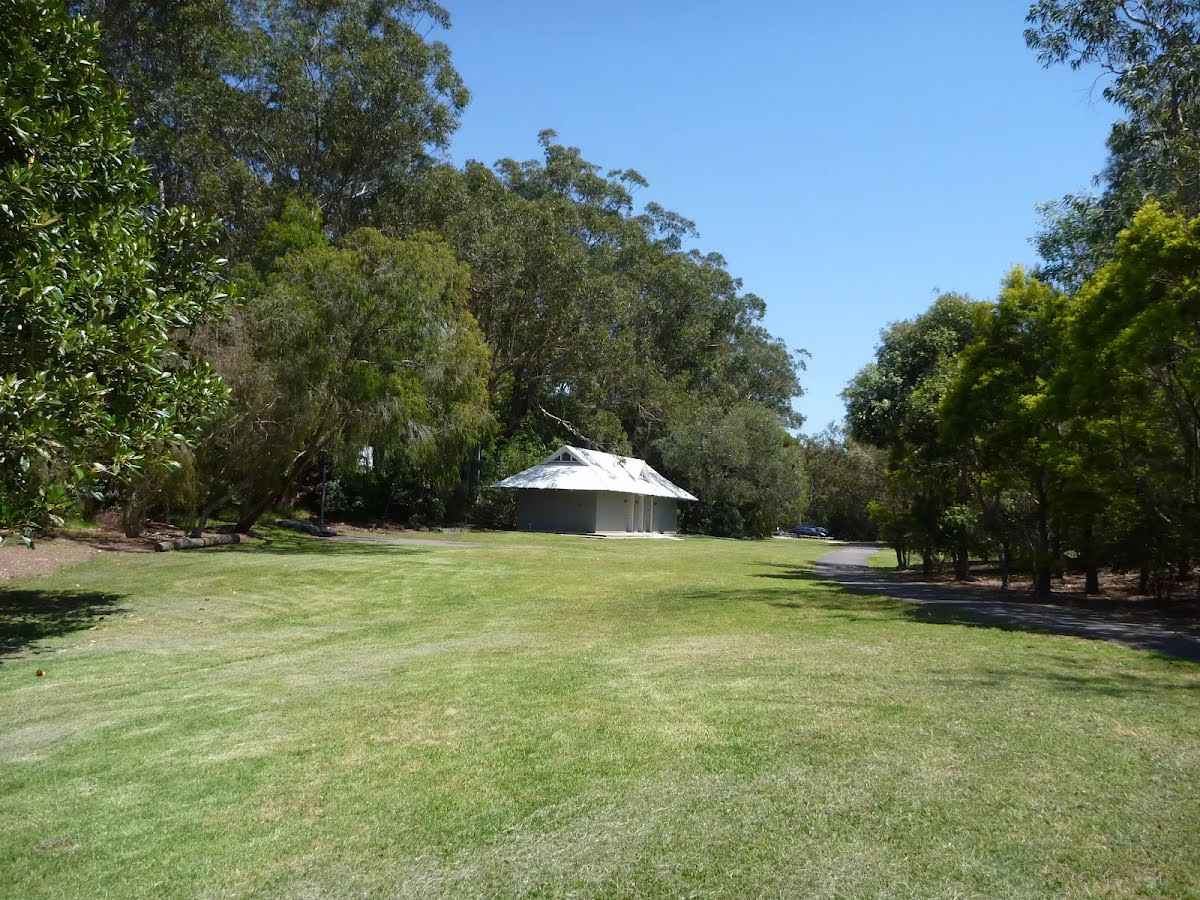
After another 660 m pass the toilet (about 35 m ahead).
07:00-19:00
Then pass the playground (about 55 m ahead).
Then pass the water tap (35 m on your left).
After another 25 m pass the shelter (on your right).
After another 30 m find the "Magdala Park" (15 m on your right).
Then pass the car park (on your left).
|
|
|
After another 80 m turn right.
After another 7 m pass the "The Great North Walk" (on your left).
|
|
|
After another 40 m veer right.
After another 45 m head through the bicycle barrier.
Then cross the bridge (about 150 m long)
After another 150 m head through the bicycle barrier.
Then head through the bollard.
After another 15 m head through the bollard.

After another 60 m pass the emergency call device (about 55 m ahead).
Then pass the emergency call device (65 m on your right).
Then pass the park (70 m on your right).
07:00-21:00
Then pass the emergency call device (70 m on your right).
|
|
|
Turn left.
After another 15 m pass the emergency call device (35 m on your right).
Then pass the emergency call device (20 m on your right).
|
|
|
Continue straight.
|
|
|
After another 15 m continue straight.
After another 110 m cross the bridge (about 95 m long)
|
|
|
Continue straight.
After another 30 m pass the artwork (20 m on your right).
After another 15 m pass the "Mowbray Park" (40 m on your right).
|
|
|
After another 50 m turn left.
Then head down the concrete steps (about 15 m long)
After another 85 m pass the "The Great North Walk" (5 m on your left).
|
|
|
From the Fairyland Track continue straight, to head along Fairyland Track.
After another 15 m pass the "Lane Cove National Park" (7 m on your left).
After another 55 m head down the 11 steps (about 9 m long)
After another 60 m cross the bridge (about 4 m long)
After another 70 m cross the bridge (about 10 m long)
After another 20 m pass the "Binary Cafe" (70 m on your left).
Mo-Fr 06:00-15:00
|
|
|
After another 120 m (from the Fairyland Track) continue straight, to head along Fairyland Track.
|
|
|
After another 15 m (from the Fairyland Track) continue straight, to head along Fairyland Track.
|
|
|
After another 15 m (from the Fairyland Track) continue straight, to head along Fairyland Track.
After another 10 m cross the bridge (about 3 m long)
|
|
|
After another 165 m (at the intersection of Fairyland Track & Old Access Road) turn right, to head along Fairyland Track.
After another 155 m pass the "Fairyland Pleasure Grounds Board" (5 m on your right).
Then cross the bridge (about 10 m long)
|
|
|
After another 15 m (from the Fairyland Track) continue straight, to head along Fairyland Track.
After another 55 m pass a seat (15 m on your right)., has no backrest.
|
|
|
From the Fairyland Track veer left, to head along Fairyland Track.
After another 8 m find the "Fairyland" (15 m on your right).
Then come to the viewpoint (15 m on your right).
|
|
|
From the Fairyland Track continue straight, to head along Fairyland Track.
|
|
|
After another 40 m (from the Fairyland Track) continue straight, to head along Fairyland Track.
After another 80 m pass the "Fairyland Pleasure Grounds Map" (7 m on your right).
After another 215 m come to the viewpoint (10 m on your right).
|
|
|
From the Fairyland Track continue straight, to head along Fairyland Track.
After another 50 m find the "Lookout" (20 m on your right).
Then come to the viewpoint (10 m on your right).
|
|
|
From the Fairyland Track continue straight, to head along Fairyland Track.
After another 100 m cross the bridge (about 2 m long)
After another 20 m pass the "Lane Cove National Park" (on your left).
|
|
|
After another 6 m (at the intersection of Quebec Road & River Avenue) turn left, to head along Quebec Road (a residential road).

After another 190 m pass the "Northern Suburbs Memorial Gardens and Crematorium" (65 m on your left).
|
|
|
After another 15 m (at the intersection of Fairyland Avenue & Quebec Road) continue straight, to head along Fairyland Avenue.
|
|
|
After another 80 m (at the intersection of Fairyland Avenue & Lobelia Street) continue straight, to head along Fairyland Avenue.
|
|
|
After another 140 m (from the Fairyland Avenue) turn left, to head along Fairyland Avenue.
After another 15 m pass the water tap (20 m on your right).
After another 15 m pass the playground (8 m on your right).
After another 15 m pass the playground (20 m on your right).
After another 8 m pass the "Mulhall Park" (on your right).
|
|
|
At the intersection of River Avenue & Fairyland Avenue turn left, to head along River Avenue.
After another 125 m pass the park (8 m on your right).
After another 15 m pass the "Kobada Park" (10 m on your left).
After another 320 m pass the "Greens Flat" (9 m on your right).
Then pass the picnic table (40 m on your right)., has no backrest.
|
|
|
After another 25 m (from the River Avenue) continue straight, to head along River Avenue.
|
|
|
After another 75 m (at the intersection of River Avenue & River Lane) continue straight, to head along River Avenue.
|
|
|
After another 7 m (from the River Avenue) continue straight, to head along River Avenue.
After another 30 m pass the "Alfred Cook Park" (7 m on your right).
|
|
|
After another 10 m (at the intersection of River Avenue & Lane Cove Valley Walk) continue straight, to head along River Avenue.
Then pass the "The Great North Walk" (on your left).
After another 8 m pass a seat (40 m on your left).
|
|
|
At the intersection of River Avenue & The Great North Walk veer right (a footpath).
"Chatswood West, Delhi Rd at River Ave".
About 75 m past the end is "03".
About 70 m past the end is a shelter.
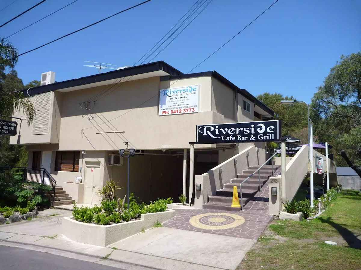
About 55 m past the end is "Riverside Cafe Bar & Grill".
About 20 m past the end is a pay phone.
About 40 m past the end is a seat., has no backrest.
|
|
|

The end.
|