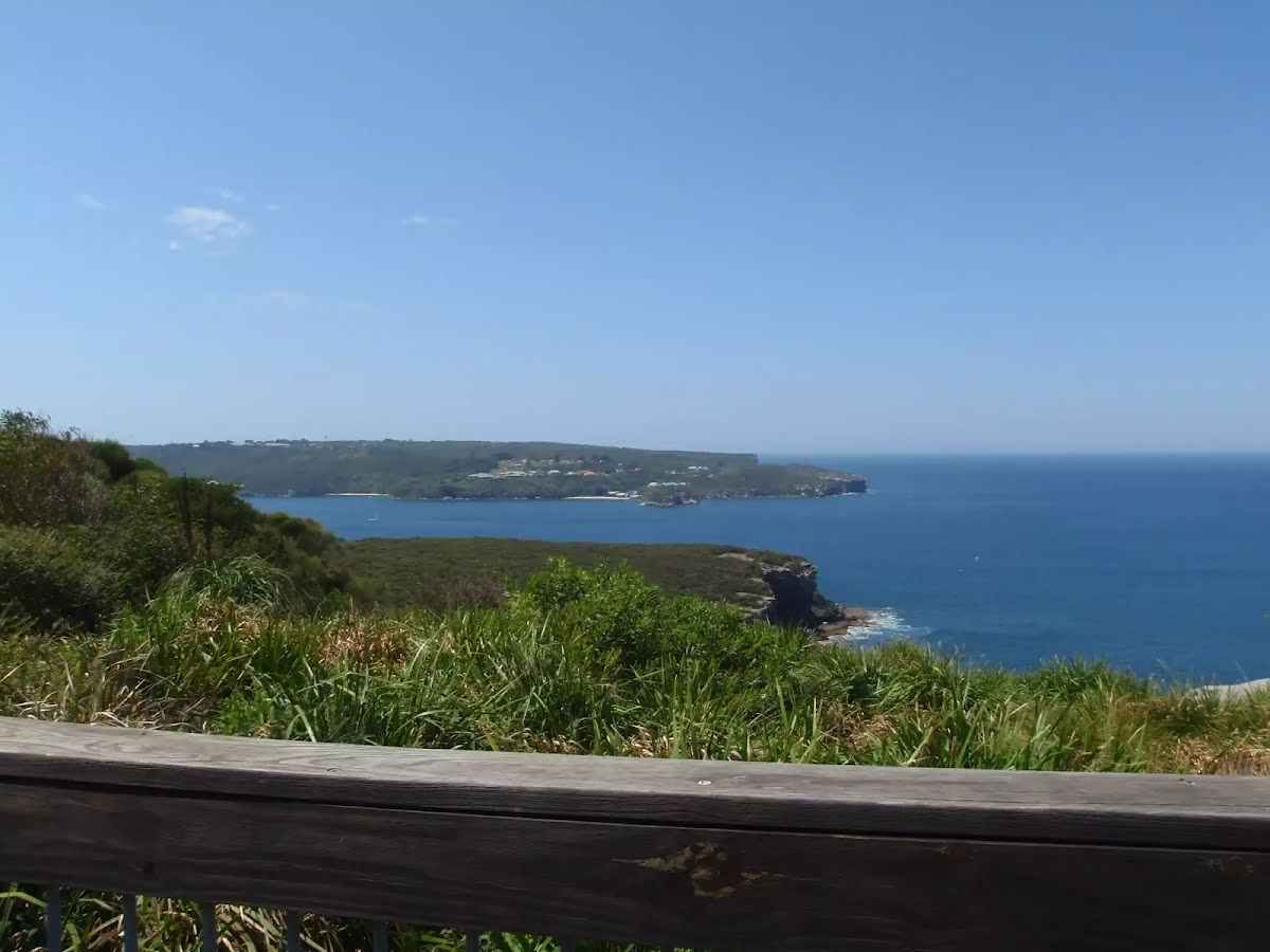
Starting from Manly, this one way walk follows the track around North Harbour bay to Dobroyd Head where you can stop for nice views over the North Harbour Nature Reserve across the bay. The walk then continues following the coast past Clotarf and Brady's Point to Spit Bridge. Cross the bridge and continue along the shore through Parriwi Park, Rosherville Reserve to Hunters Bay. Finsih your walk at Middle Head Road, where you can catch a bus. Let us begin by acknowledging the Traditional Custodians of the land on which we travel today, and pay our respects to their Elders past and present.
Before you start any bushwalk ensure you;
• Tell someone you trust where you are going and what to do if you are overdue
• Have adequate equipment, supplies, skills & knowledge for the whole journey
• Consider the impact of weather forecasts, park/track closures & fire dangers
• Can respond to emergencies & call for help at any point
• Are healthy and fit enough for this journey
If not, change plans and stay safe. It is okay to delay and ask people for help.
After another 15 m pass the shelter (10 m on your right).
After another 20 m pass the "Grand Esplanade Public Parking" (75 m on your right).
After another 140 m pass the picnic table (on your right).
After another 35 m pass the water tap (on your right).
After another 20 m (from the Manly to Spit Bridge Walk) continue straight.
After another 30 m pass the "West Esplanade Park" (15 m on your right).
Then pass a seat (5 m on your right).
After another 35 m pass the toilet (20 m on your right). This toilet is wheelchair accessible., equipped with a hand-washing basin.
Then pass the "Manly Cove Cafe" (on your right).
After another 45 m come to the viewpoint (40 m on your right).
After another 75 m pass the "Manly Pier Pavillion" (6 m on your right).
Then head up the concrete steps (about 20 m long)
After another 20 m pass the artwork (on your right).
From the Manly to Spit Bridge Walk turn left, to head along Manly to Spit Bridge Walk (a footpath).
Then pass the artwork (on your on).
Then pass a seat (4 m on your left).
After another 265 m pass a seat (on your left).
After another 20 m pass a seat (on your left).
After another 140 m pass a seat (on your left).
After another 130 m pass the toilet (8 m on your left).
After another 65 m pass the picnic table (6 m on your left)., has a backrest.
Then pass the water tap (on your on).
After another 8 m pass a seat (on your left).
After another 40 m pass a seat (on your left)., has a backrest.
After another 35 m (at the intersection of Manly to Spit Bridge Walk & Arlington Drive) continue straight, to head along Manly to Spit Bridge Walk.
After another 50 m pass a seat (5 m on your left)., has a backrest.
After another 50 m pass the picnic table (7 m on your left).
After another 250 m pass the park (on your left).
After another 15 m (at the intersection of Manly to Spit Bridge Walk & Bolingbroke Parade) continue straight, to head along Manly to Spit Bridge Walk.
After another 350 m pass a seat (on your left)., has a backrest.
After another 15 m (from the Manly to Spit Bridge Walk) continue straight, to head along Manly to Spit Bridge Walk (a highway|cycleway).
After another 65 m (from the Manly to Spit Bridge Walk) veer left, to head along Manly to Spit Bridge Walk (a footpath).
After another 100 m pass the "North Harbour Reserve" (40 m on your left).
After another 130 m (from the Manly to Spit Bridge Walk) turn left, to head along Manly to Spit Bridge Walk.
After another 15 m (from the Manly to Spit Bridge Walk) veer left, to head along Manly to Spit Bridge Walk (a steps).
Then head up the surface|paved steps (about 20 m long)
After another 45 m pass a seat (on your right)., has a backrest.
Then pass the water tap (45 m on your right).
Then pass the BBQ (35 m on your right).
Then pass the picnic table (25 m on your right).
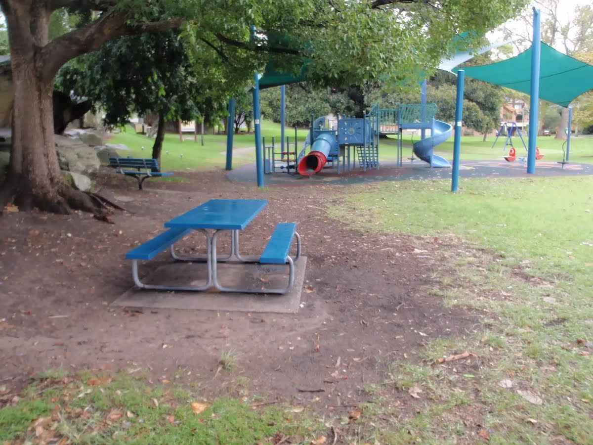
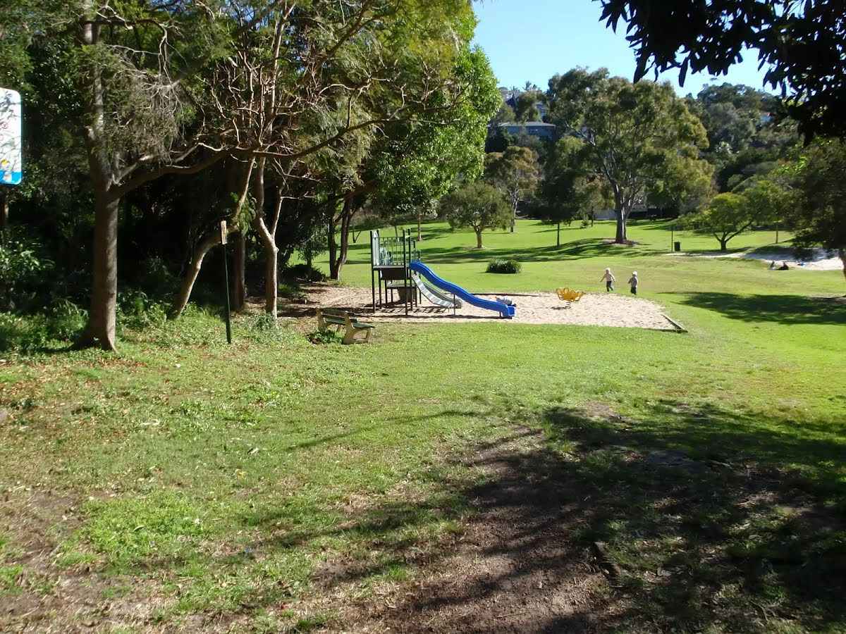
After another 140 m pass the playground (55 m on your right).
From the Manly to Spit Bridge Walk veer right, to head along Manly to Spit Bridge Walk.
After another 30 m find the "North Harbour Reserve" (20 m on your right).
North Harbour Reserve is a large open parkland on the intersection of Lower Beach and Condamine Streets. The park has shaded play equipment for children, free Electric BBQ's, tap water, picnic tables, Garbage/recycling bins, some shady trees, and a public toilet (at the top end of the park). The park looks across the top of North Harbour and provides some great views. The 'Shop at the Park' provides cafe food and lunch.
Then pass the BBQ (25 m on your right).
Then pass the water tap (25 m on your right).
Then find the "Shop at the Park" (about 70 m ahead).
Then pass the "Small 90deg parking" (about 20 m ahead).
From the Manly to Spit Bridge Walk turn left, to head along Manly to Spit Bridge Walk.
After another 120 m (from the Manly to Spit Bridge Walk) turn left, to head along Manly to Spit Bridge Walk.
After another 55 m head through the bollard.
Then cross the bridge (about 30 m long)
Then pass the waterfall (4 m on your left).
After another 35 m head through the bollard.
From the Gourlay Avenue veer left, to head along Gourlay Avenue (a vehicle track).
After another 300 m head through/around the gate.
At the intersection of Manly to Spit Bridge Walk & Gourlay Avenue continue straight, to head along Manly to Spit Bridge Walk (a footpath).
After another 255 m pass the toilet (6 m on your right). This toilet is wheelchair accessible.
Then pass a seat (4 m on your right)., has a backrest.
After another 90 m pass the water tap (9 m on your left).
After another 30 m pass the BBQ (on your left).
Then pass the picnic table (10 m on your left).
Then pass a seat (10 m on your left)., has a backrest.
After another 40 m pass the sign (10 m on your left).
After another 65 m find the "Forty Baskets Reserve" (on your on).
Forty Baskets Reserve is a beach side parkland and swimming area, east of Beatty St, Balgowlah Heights. The yellow sand beach faces east, towards Manly and North Head, and is fairly well protected from large waves. The reserve has picnic tables, a bubbler (drinking fountain), tap, swings, netted swimming area, open grassy area, some shady trees, and a large toilet/shower and change area. The toilet has a fancy electronic and self-cleaning system, very cool (sounds silly, but check it out). The toilets and showers are accessible to people in wheelchairs, and a wide sealed footpath provides roll-in access from the end of Gourlay Ave.
After another 380 m head up the earthen steps (about 20 m long)
After another 165 m pass the toilet (7 m on your right). This toilet is male, female and equipped with a hand-washing basin.
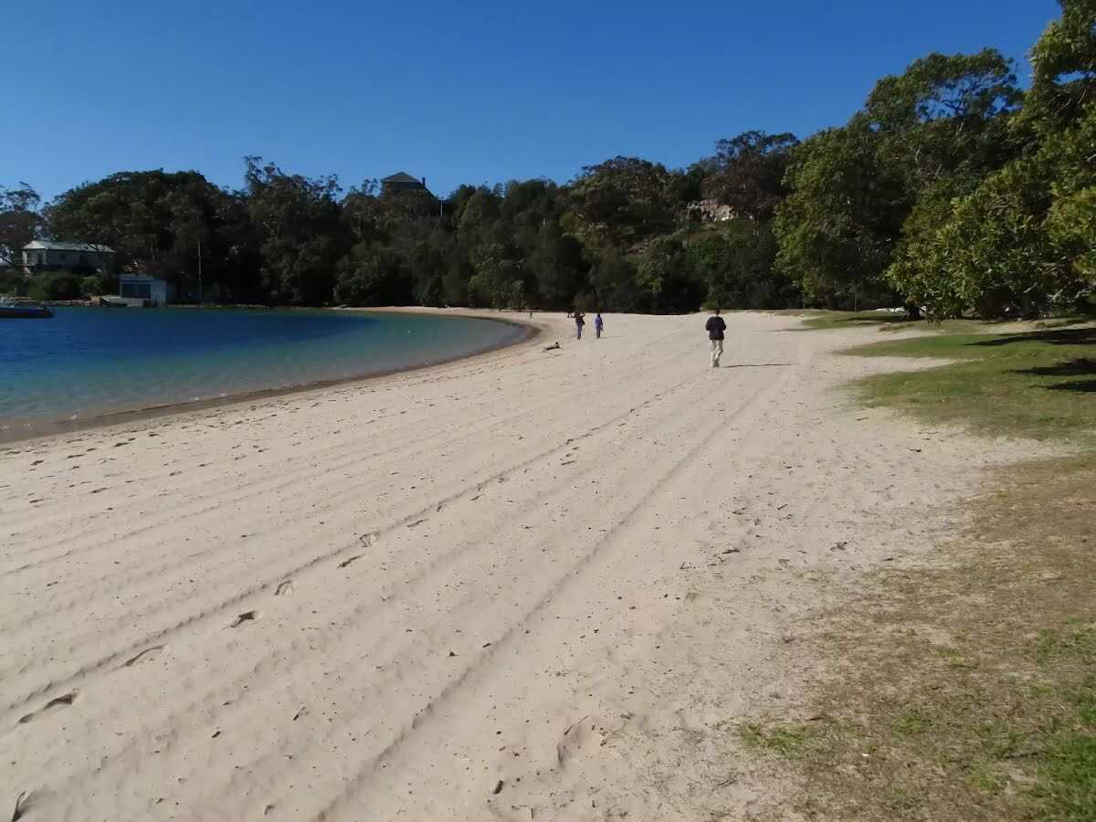
After another 65 m find the "Reef Beach" (15 m on your left).
Reef Beach is a strip of sand facing north-east, towards the Manly Ferry Terminal in North Harbour. The beach is in Sydney Harbour National Park and has toilet facilities about 80m behind the beach. The beach was once a nudist beach, but clothing is no longer optional. The beach is fairly well protected from surf and provides a great place to rest and enjoy the views when walking around Dobroyd Head.
After another 20 m head up the steps (about 210 m long)
From the Manly to Spit Bridge Walk continue straight, to head along Manly to Spit Bridge Walk.
After another 310 m pass a seat (25 m on your left)., has no backrest.
Then come to the viewpoint (25 m on your left).
After another 100 m (from the Manly to Spit Bridge Walk) continue straight, to head along Manly to Spit Bridge Walk.
After another 8 m pass the sign (on your left).
After another 100 m come to the viewpoint (on your on).
Then head up the earthen steps (about 105 m long)
After another 15 m pass a seat (on your left)., has a backrest.
After another 55 m (from the Manly to Spit Bridge Walk) veer right (a highway|).
After another 150 m pass the "Tania Park" (50 m on your right).
After another 110 m come to the viewpoint (15 m on your left).
Then pass the car park (about 25 m ahead).
After another 40 m find the "Crater Cove Lookout" (on your left).
From this fenced lookout, vistas far out to sea can be enjoyed, with Middle and South Heads just in view. Many yachts sail past, with the container ships out to sea. This is a popular spot for watching the start of the Sydney to Hobart race, or for watching whales as they pass by Sydney.
Then come to the "Crater Cove Lookout" (4 m on your left).
After another 10 m (from the Manly to Spit Bridge Walk) turn left, to head along Manly to Spit Bridge Walk.
After another 6 m pass a seat (30 m on your right).
After another 550 m come to the viewpoint (15 m on your right).
After another 20 m head down the steps (about 70 m long)
Then find the "Grotto Point Engravings" (35 m on your left).
The engravings at Grotto Point depict kangaroos, fish and what appears to be boomerangs. The engravings are in quite good condition, considering their age. We have already lost so much of this region's history that historians are not entirely sure if this is the land of the Gayamagal or the Cammeraygal clan. Please take a great deal of care at this site to ensure the longevity of this history.
After another 15 m pass a seat (on your right).
Then pass the "Grotto Point Aboriginal Site" (on your left).
Then head down the steps (about 40 m long)
After another 60 m (at the intersection of Manly to Spit Bridge Walk & Grotto Point Lighthouse) continue straight, to head along Manly to Spit Bridge Walk.
Then pass the sign (on your left).
After another 390 m find the "Castle Rock Beach" (30 m on your left).
Castle Rock Beach can be found a short walk down from the Manly-to-Spit walking track, near Ogilvy Road. This small, secluded beach is a great spot for those wanting a quieter day at the beach, instead of the more popular and larger beaches in the area.
After another 10 m (from the Manly to Spit Bridge Walk) turn right, to head along Manly to Spit Bridge Walk (a steps).
Then head up the concrete steps (about 30 m long)
From the Manly to Spit Bridge Walk turn left, to head along Manly to Spit Bridge Walk (a walking track).
After another 120 m come to the viewpoint (on your on).
After another 315 m (from the Manly to Spit Bridge Walk) veer left, to head along Manly to Spit Bridge Walk.
After another 245 m pass the water tap (9 m on your right).
After another 6 m (from the Manly to Spit Bridge Walk) continue straight, to head along Manly to Spit Bridge Walk.
After another 135 m pass the "Clontarf Reserve" (4 m on your right).
After another 215 m (from the Manly to Spit Bridge Walk) turn right, to head along Manly to Spit Bridge Walk.
After another 75 m pass the toilet (30 m on your right). This toilet is male and female.
After another 10 m pass the BBQ (25 m on your right).
After another 15 m pass the "Clontarf Reserve" (45 m on your right).
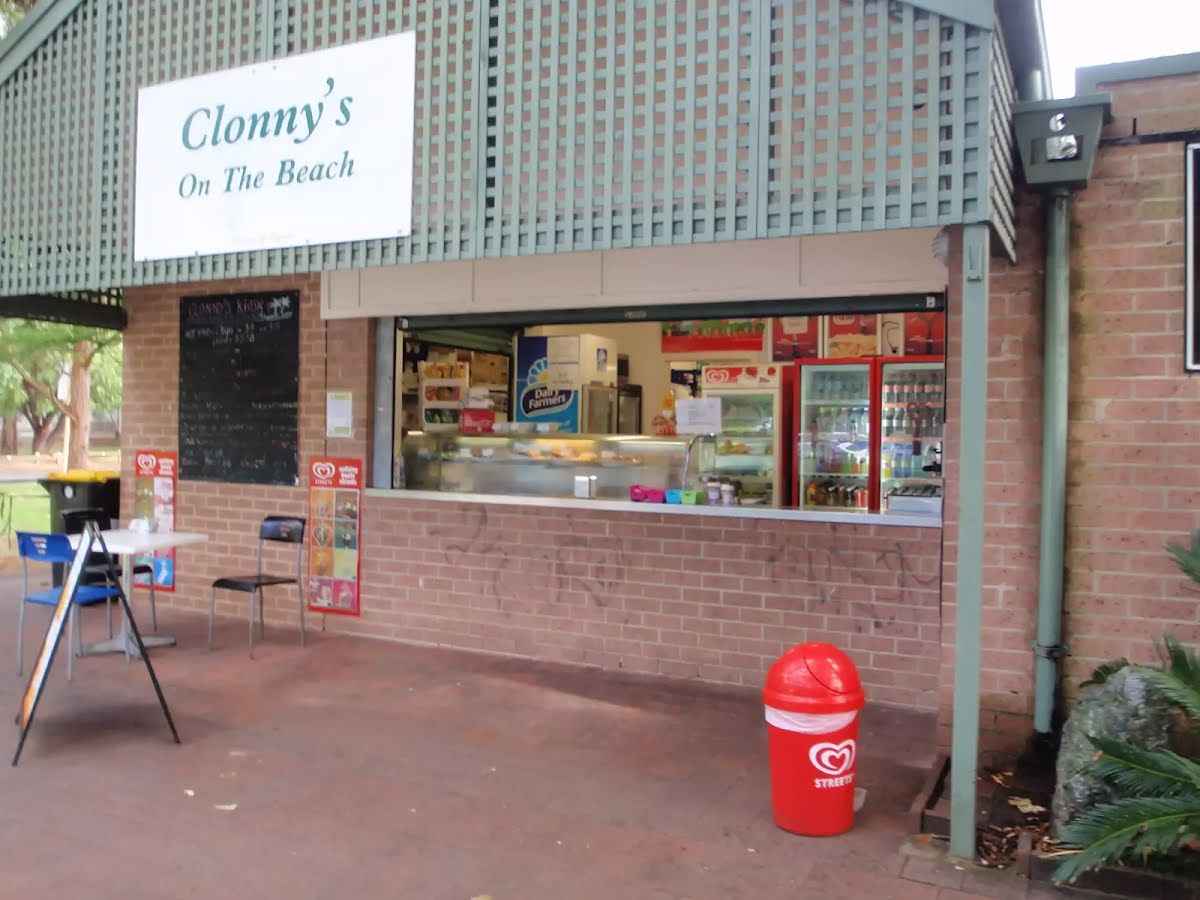
After another 10 m pass the "Clonny's On The Beach" (8 m on your right).
After another 55 m pass a seat (25 m on your left).
After another 8 m find the "Clonny's" (25 m on your right).
Clonny's is a neat kiosk and restaurant inside Clontarf Reserve. The kiosk is open 7 days (but may close dependant on weather and demand) and serves ice creams, drinks, chips, hot foods, and coffee. For those seeking something finer the restaurant is open for lunch on Saturdays and Sundays serving a 2 course meal for $55. Phone on (02) 9948 2373.
After another 6 m find the "Clontarf Reserve" (on your right).
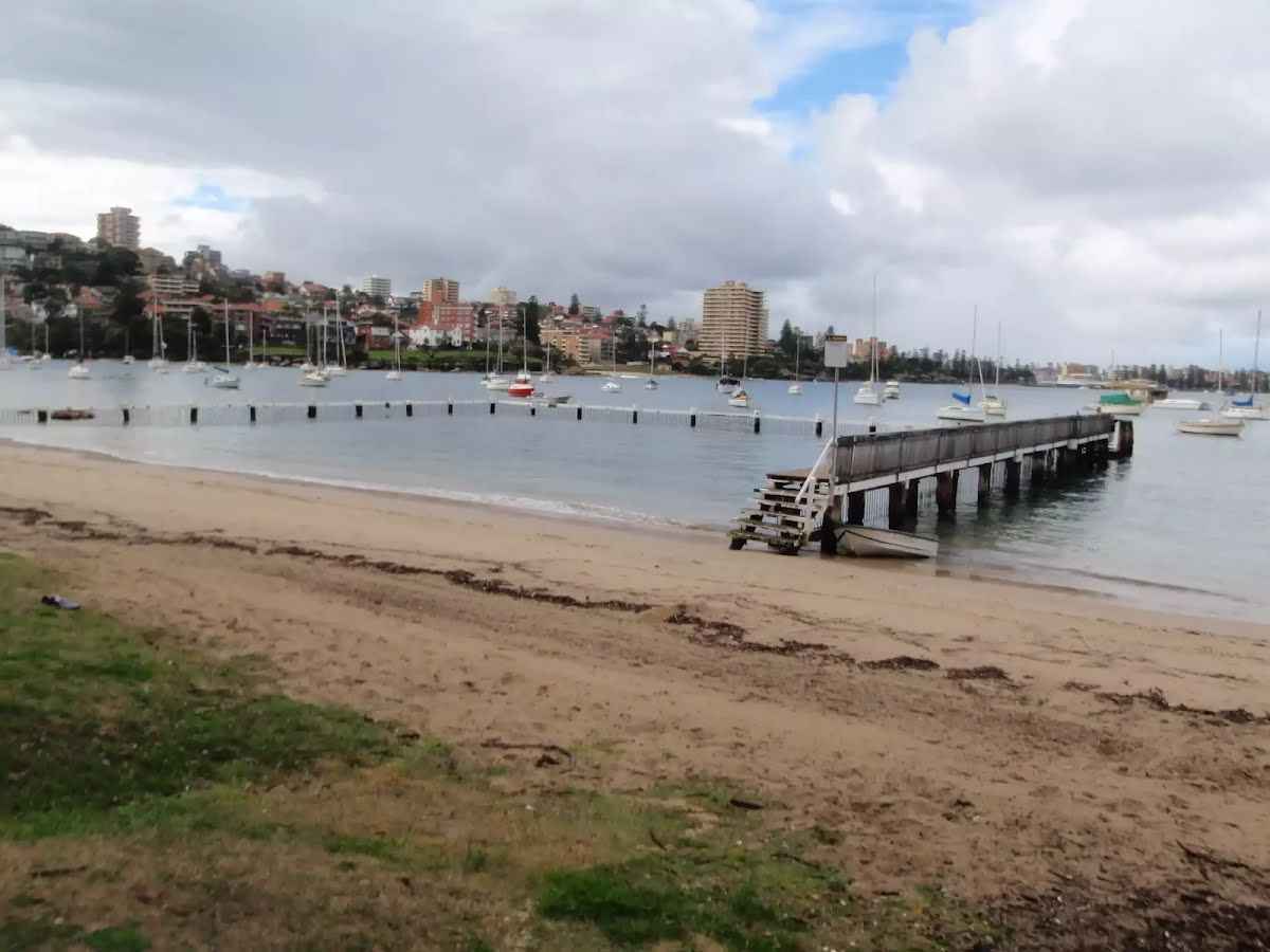
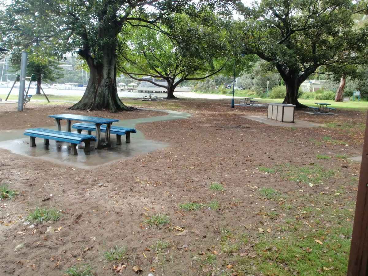
Clontarf Reserve is a great picnic area and beach on Sandy Bay Rd, Clontarf. The large park provides great facilities with picnic tables, covered shelters, shaded children's play ground, a kiosk & restaurant, and toilets. The beach in the park has a netted swimming area. The park also has tap water, a public phone, showers and garbage/recycling facilities. There are plenty of shade trees in the park. There is a fee for parking in and around the reserve and the park is well managed by Manly Council.
After another 30 m pass the water tap (5 m on your right).
After another 35 m pass the sign (on your left).
After another 45 m pass the "Clontarf Reserve" (25 m on your left).
After another 85 m pass the restaurant (25 m on your left).
After another 255 m pass the water tap (on your right).
After another 40 m (from the Manly to Spit Bridge Walk) continue straight, to head along Manly to Spit Bridge Walk (a highway|).
After another 15 m head up the steps (about 40 m long)
After another 200 m pass a seat (9 m on your left).
After another 470 m pass the shelter (75 m on your right).
Then cross the bridge (about 15 m long)
After another 55 m head up the surface|paved steps (about 20 m long)
After another 25 m head up the surface|paved steps (about 30 m long)
After another 205 m pass the "Spit to Manly Walk" (on your right).
From the Manly to Spit Bridge Walk continue straight, to head along Manly to Spit Bridge Walk.
After another 20 m pass the car park (20 m on your right).
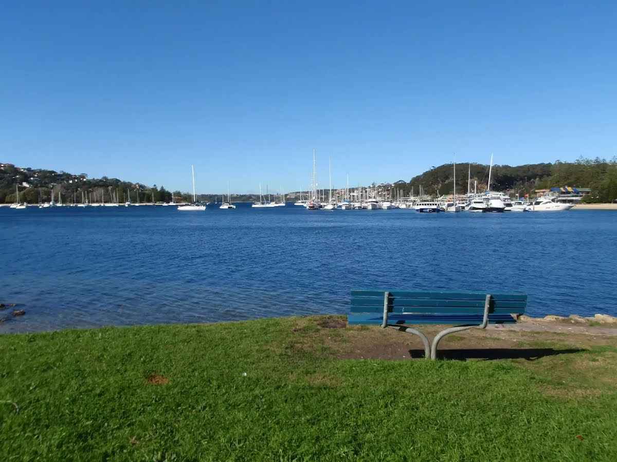
Then find the "Ellery's Punt Reserve" (on your left).
Ellery's Punt Reserve is a very nice grassed area on the north eastern side of the Spit Bridge. The reserve has road access and parking, and seems to be a popular spot for fishing from the bank. There is also seating and shaded areas.
After another 15 m pass a seat (20 m on your right)., has a backrest.
After another 25 m pass the car park (35 m on your right).
After another 4 m (from the Manly to Spit Bridge Walk) turn around, to head along Manly to Spit Bridge Walk (a highway|).
After another 10 m cross the bridge (about 225 m long)
Then pass the "Ellerys Punt Reserve" (on your left).
After another 155 m pass the "Ellery Park" (15 m on your right).
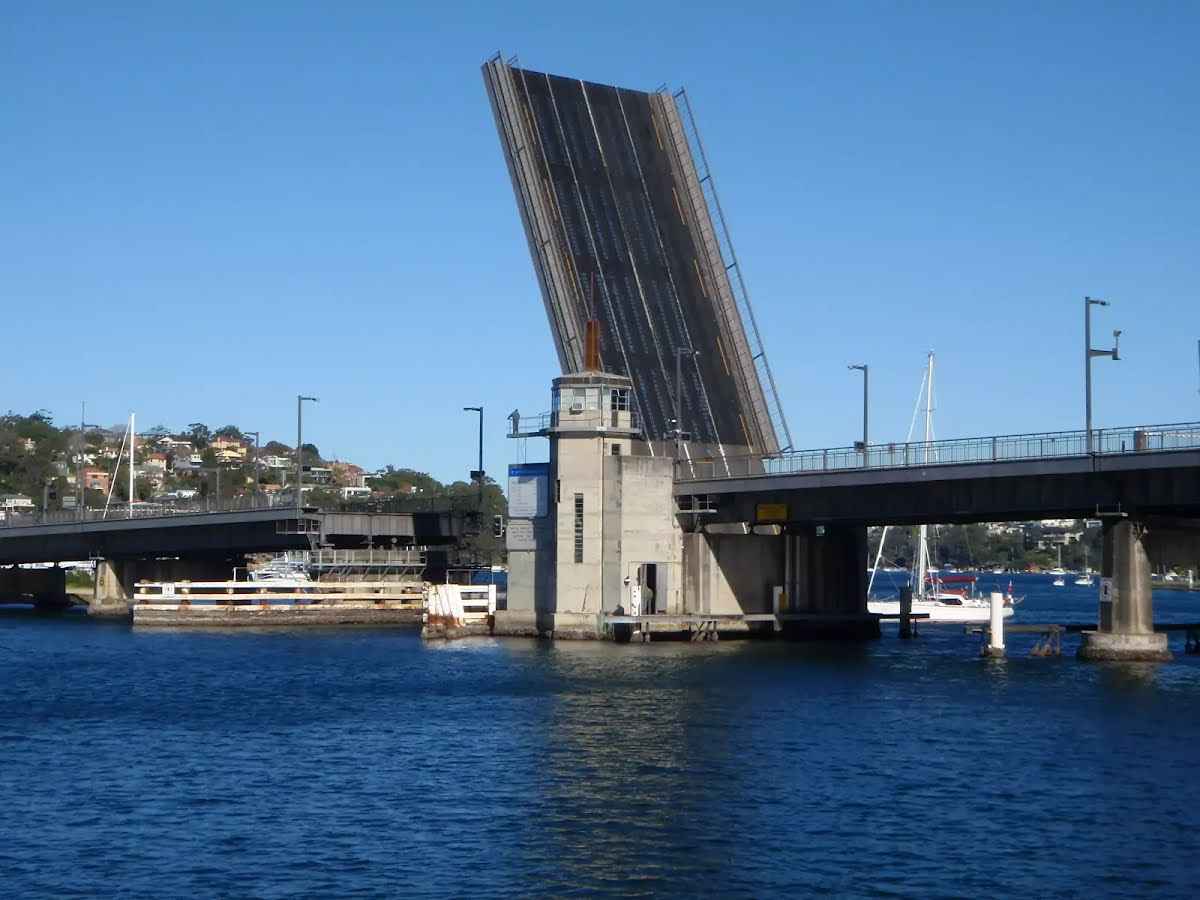
After another 20 m find the "Spit Bridge" (5 m on your right).
The Spit Bridge was originally built in 1924 to replace the punt service. The current Spit Bridge was built during the 1950's. The bridge is a bascule bridge, as it's middle section can be raised to allow tall ships through. This ability of the bridge does, however, stop traffic on a major arterial road, which has caused the bridge to be the centre of some controversy. The Spit Bridge carries the Spit Rd and the Manly Scenic Walkway.
After another 130 m pass the "Living Seawalls" (30 m on your right).
Then pass a seat (35 m on your right).
Then pass the "The Spit Reserve (East)" (9 m on your left).
After another 40 m pass the "Plonk!" (25 m on your left).
Then pass the restaurant (70 m on your right). This restaurant is wheelchair accessible.
After another 30 m find the "Sydney Harbour Kayaks" (on your left).
Sydney Harbour Kayaks, at the southern end of the Spit Bridge, provide sales and rentals of kayaks. One hour in a single plastic kayak costs $20, and a double $40. The enterprise also provides tours of the harbour, catering for individuals through to large groups. For further information and bookings, contact: info@sydneyharbourkayaks.com.au or (02) 99604389
Continue straight.
After another 8 m pass the "Spit East Reserve" (on your left).
After another 25 m pass the water tap (4 m on your left).
After another 60 m pass the playground (about 55 m ahead).
Then pass the shelter (on your right).
After another 45 m pass the toilet (45 m on your right). This toilet is wheelchair accessible.
sunrise-sunset
This toilet is male, female and equipped with a hand-washing basin.
Continue straight.
After another 15 m pass the water tap (60 m on your right).
After another 25 m pass the "Spit West Reserve Parking Area" (35 m on your right).
After another 115 m pass the "Grumpini's Pizza" (7 m on your left).
Then pass the "Spit East Reserve Parking Area" (8 m on your left).
After another 7 m (from the Parriwi Road) continue straight (a walking track).
After another 9 m veer left.
After another 70 m pass the "Parriwi Park" (30 m on your right).
After another 45 m come to the viewpoint (70 m on your right).
Then pass a seat (75 m on your right)., has a backrest.
After another 150 m find the "Spit Syphon" (8 m on your right).
The Spit Syphon was built between 1922 and 1925 by the Public Works Department. It was necessary in order to pump sewage from the north without interfering with water transport. The building is styled with Egyptian influences as displayed by its tall, square concrete walls.
After another 235 m come to the "Parriwi Lookout" (35 m on your right).
After another 235 m pass the "Rosherville Lighthouse Reserve" (5 m on your right).
Then pass the "Rosherville Lighthouse" (65 m on your right).
After another 20 m pass a seat (45 m on your right)., has a backrest.
Then come to the viewpoint (45 m on your right).
After another 185 m come to the viewpoint (25 m on your right).
Then pass a seat (25 m on your right)., has a backrest.
Then pass the "Rosherville Reserve" (5 m on your right).
After another 85 m find the "Chinamans Beach and Reserve" (on your on).
Chinamans Beach and Reserve are wonderful places to have a picnic or a swim, with lots of areas to sit in the sun or shade beside the clear water. The beach does not provide any surf with its north-easterly aspect, but is perfect for launching your kayak or boat into the harbour. Chinamans Reserve has some parking, play equipment, toilets and road access by McLean Cres.
After another 830 m pass the "Wyargine Reserve" (35 m on your right).
After another 190 m (from the Low Tide Route) continue straight.
After another 165 m come to the "Carroll's Lookout" (45 m on your right).
After another 25 m pass the "Leahy Park" (15 m on your right).
After another 85 m turn right.
After another 45 m pass a seat (15 m on your right)., has a backrest.
Then pass the "Beach House" (55 m on your right).
Then head down the surface|paved steps
Then pass the water tap (on your right).
After another 25 m pass the "The Bathers' Pavilion" (9 m on your right). This restaurant is wheelchair accessible.
After another 15 m pass a seat (on your right)., has a backrest.
After another 45 m pass the cafe (7 m on your right).
Then pass the "Bathers Pavilion" (25 m on your right). This toilet is wheelchair accessible.
sunrise-sunset
After another 9 m pass a seat (5 m on your right)., has a backrest.
After another 20 m pass the water tap (on your right).
After another 45 m pass the "Billy" (20 m on your right).
After another 25 m continue straight.
After another 10 m find the "Balmoral Beach" (7 m on your left).
Balmoral Beach takes its name from the royal castle at Braemar in Scotland. This is a beautiful beach, with a great foreshore walk overlooking the sandy beach. The beach is a popular spot with locals and visitors, for sun baking, swimming and having a picnic. Balmoral Beach has very little surf, with a sheltered, easterly aspect. There is also a shark-net swimming area, toilets, shops, cafes and plenty of beach to share on a sunny day.
After another 6 m pass a seat (35 m on your left)., has a backrest.
After another 65 m pass the "Pasture of Balmoral" (75 m on your right). This cafe is wheelchair accessible.
Continue straight.
After another 20 m pass the "Public Toilet The Tramshed, Balmoral Beach" (on your right).
Mostly sunny. Slight chance of a shower along the coastal fringe in the evening. Near zero chance of rain elsewhere. Light winds becoming southerly 15 to 20 km/h in the middle of the day then becoming light in the evening.
Fire Danger Rating: No Rating
UV Alert: Sun protection not recommended, UV Index predicted to reach 2 [Low]
Monday 21 July
12°C → 18°C
Shower or two. 50% chance of rain 0 → 2mm
Partly cloudy. The chance of morning fog in the outer west. Medium chance of showers. Light winds.
Tuesday 22 July
12°C → 19°C
Possible shower. 40% chance of rain 0 → 1mm
Partly cloudy. Slight chance of a shower, most likely in the evening. Light winds becoming northeasterly 15 to 25 km/h during the afternoon then becoming light during the evening.
Wednesday 23 July
13°C → 18°C
Shower or two. 70% chance of rain 0 → 3mm
Partly cloudy. Medium chance of showers, most likely in the morning and afternoon. Light winds.
Thursday 24 July
11°C → 16°C
Sunny. 20% chance of rain
Sunny. Light winds becoming south to southeasterly 15 to 20 km/h during the day.
Friday 25 July
10°C → 18°C
Shower or two. 70% chance of rain 0 → 5mm
Partly cloudy. High chance of showers, most likely later in the day. Light winds becoming northeasterly 15 to 20 km/h during the day.
Saturday 26 July
13°C → 17°C
Shower or two. 70% chance of rain 0 → 6mm
Partly cloudy. High chance of showers, most likely during the morning. Winds northwesterly 15 to 25 km/h.
Closed areas: North Head partial closure Some parts of North Head in Sydney Harbour National Park are closed due to fire damage and geological instability. The closed areas include:
Bluefish Point
Old Man's Hat
Cannae Point
Quarantine Head
Wastewater Treatment Plant emergency access road
Do not enter the closed areas. Penalties apply for non-compliance. For more information, please contact the National Parks Contact Centre on 1300 072 757 or Sydney North area office on 02 9451 3479 between 9.30am and 4pm, Monday to Friday.
Closed areas: Fort Denison closed Service upgrades and extensive conservation works on the fort are ongoing throughout 2025. Fort Denison – Muddawahnyuh remains closed to visitors during this time.
Standard work hours during the construction phase will be between:
Other planned events: North Head Scenic Drive gate opening times The North Head Scenic Drive gate opening times are:
AEDT From 7 October 2024 to 6 April 2025 - 5am to 8.30pm
AEST From 7 April 2025 to 5 October 2025 - 6am to 6pm
Closed areas: Bluefish Point closed The Bluefish Point bushland area is closed for public safety and to protect the landscape and important plant and animal communities.
Access to rock pools is difficult and dangerous. Please stay on sign-posted walking tracks when visiting Sydney Harbour National Park for your safety and observe warning signs in the area.
Other planned events: 1080 pest management operation NSW National Parks and Wildlife Service will be conducting a baiting program using manufactured baits, fresh baits and Canid Pest Ejectors (CPEs) containing 1080 poison (sodium fluroacetate) for the control of foxes.
The program is continuous and ongoing between Saturday 1 February 2025 and Thursday 31 July 2025 in the following areas of Sydney Harbour National Park:
Chowder Bay
Dobroyd Head
Bradleys Head
Georges Head
Middle Head
North Head (North Head includes the adjoining land of Sydney Harbour Federation Trust, Australian Institute of Police Management and Quarantine Station).
Please don’t touch baits or ejector devices. All baiting locations are identifiable by signs.
Domestic pets are not permitted in NSW national parks and reserves. Pets and working dogs may be affected (1080 is lethal to cats and dogs). Pets and working dogs must be restrained or muzzled in the vicinity and must not enter the baiting location. In the event of accidental poisoning seek immediate veterinary assistance.
Fox baiting in these reserves is aimed at reducing their impact on threatened species. Penalties apply for non-compliance. For more information, contact the local park office on:
Middle Head: 02 9960 6266 (business hours)
NPWS after-hours call centre: 1300 056 294 (after hours)
North Head Sanctuary, Many (Harbour Trust Lands): 02 8969 2128 (business hours).