| Turn map |
Directions & comments |
|
|

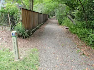
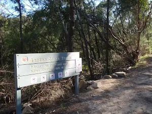
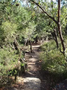
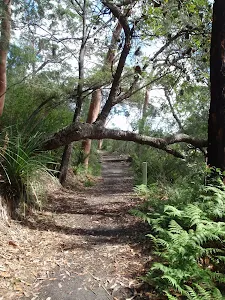
At the intersection of Two Creeks Track & Slade Avenue Start heading along Two Creeks Track (a vehicle track).

Macks Place (about 8 m back from the start).
|
|
|

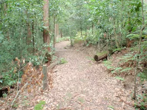
After another 165 m (from the Two Creeks Track) continue straight, to head along Two Creeks Track.

After another 70 m pass the shelter (10 m on your left).
After another 20 m (from the Two Creeks Track) continue straight, to head along Two Creeks Track.
After another 180 m (from the Two Creeks Track) continue straight, to head along Two Creeks Track.

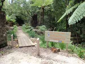
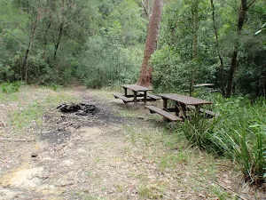
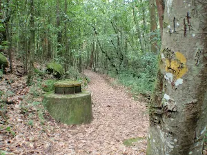
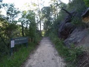
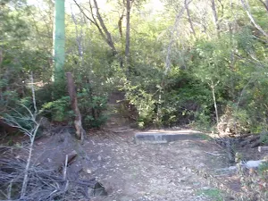
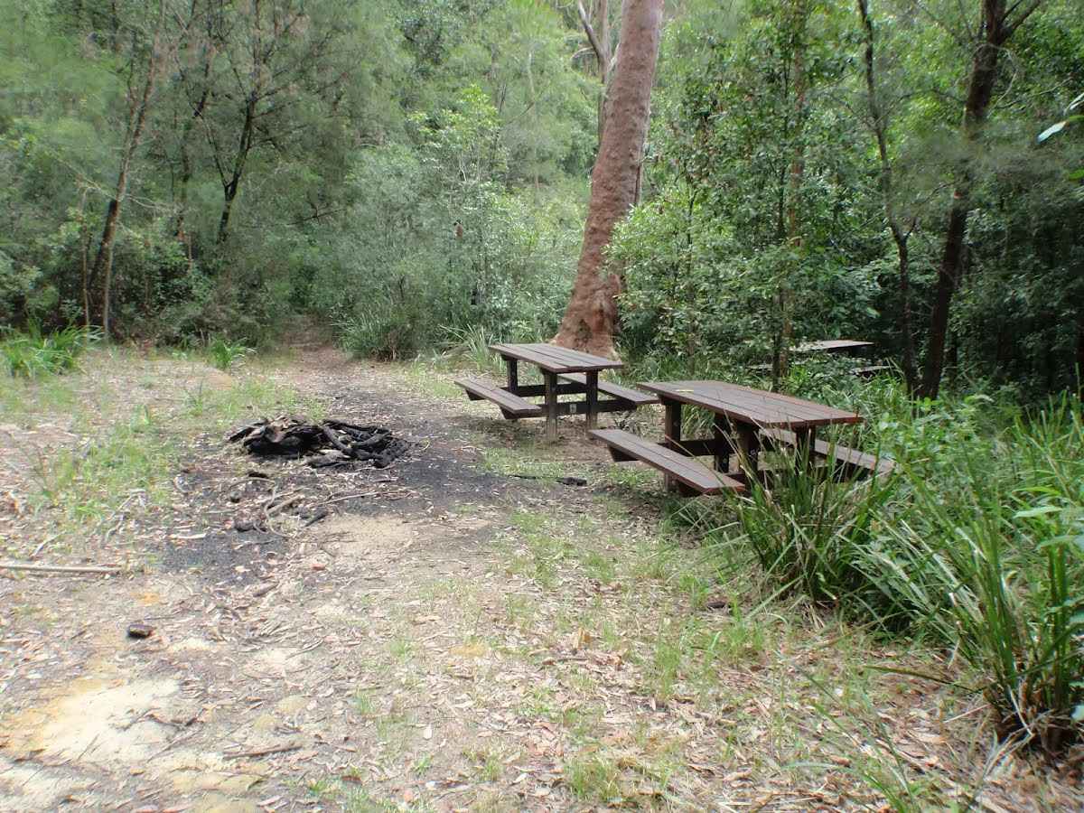
After another 10 m find the "Seven Little Australians Picnic Area" (on your left).
|
|
|
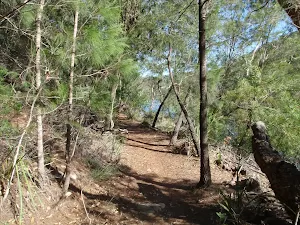
From the Two Creeks Track continue straight, to head along Two Creeks Track.

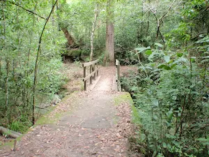
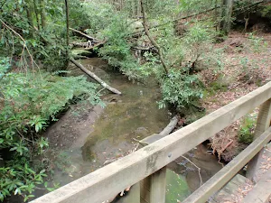
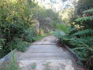
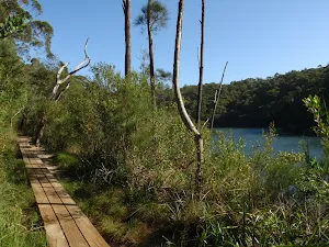
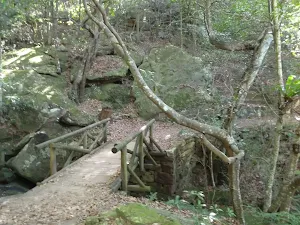
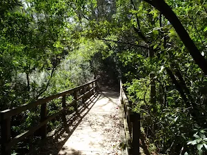
After another 30 m cross the bridge (about 5 m long)
|
|
|

After another 9 m (from the Two Creeks Track) turn left, to head along Two Creeks Track.

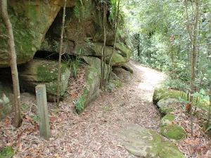
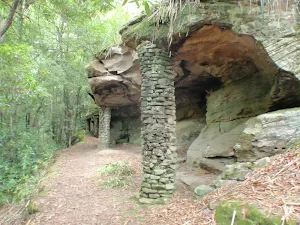
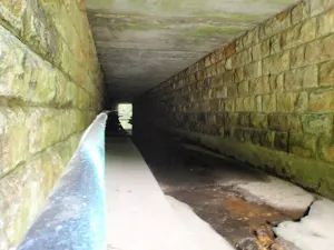
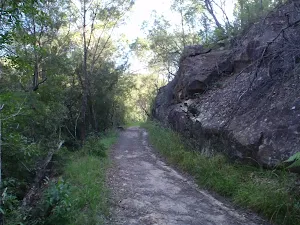
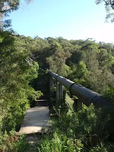
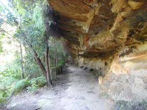
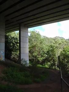
After another 105 m head through the tunnel (about 75 m long)

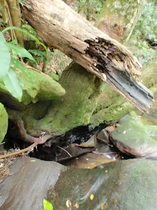
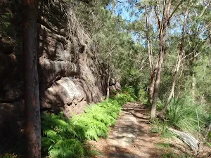
After another 35 m find the "Gordon Creek waterfall" (10 m on your right).
|
|
|
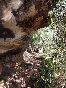
From the Two Creeks Track continue straight, to head along Two Creeks Track.

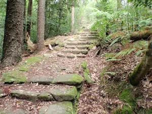
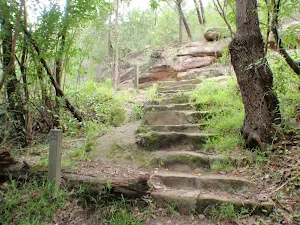
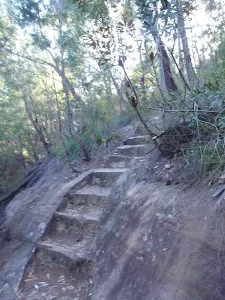
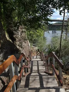
After another 15 m head up the earthen steps (about 20 m long)

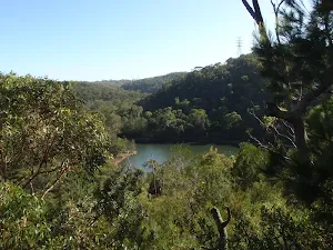
After another 20 m come to the viewpoint (about 75 m ahead).
|
|
|
From the Two Creeks Track turn left, to head along Two Creeks Track (a vehicle track).
|
|
|
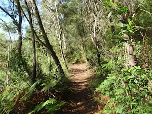
After another 220 m (from the Two Creeks Track) continue straight, to head along Two Creeks Track.
|
|
|
The starting point of an alternate route. An alternate route avoiding the national park, making the track pet-friendly. To take the alternate route turn right here. Details below.
After another 320 m (from the Two Creeks Track) continue straight, to head along Two Creeks Track.
After another 285 m cross the bridge (about 8 m long)
|
|
|

After another 310 m (from the Two Creeks Track) veer right, to head along Two Creeks Track.
After another 65 m (at the intersection of Two Creeks Track & Gordon Creek Track) continue straight, to head along Two Creeks Track.

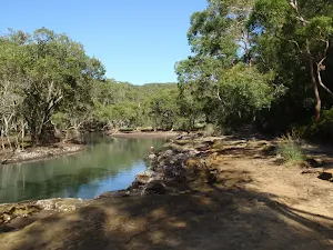
After another 185 m pass the "Gordon Creek Bridge" (5 m on your left).
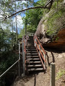
After another 90 m head up the earthen steps (about 45 m long)
After another 55 m head up the earthen steps (about 20 m long)
After another 180 m come to the viewpoint.
After another 190 m (from the Two Creeks Track) continue straight, to head along Two Creeks Track.
After another 640 m (from the Two Creeks Track) continue straight, to head along Two Creeks Track.
|
|
|
After another 20 m (from the Two Creeks Track) continue straight, to head along Two Creeks Track. Keep left.
|
|
|
The alternate route finishes here. Turn right to rejoin the main route at the 3.6 km waypoint. Details below.
After another 280 m (at the intersection of Two Creeks Track & Manuwi Track) veer right, to head along Two Creeks Track.
After another 400 m pass the "World War 1".
From the Two Creeks Track continue straight, to head along Two Creeks Track.
|
|
|
After another 100 m (from the Two Creeks Track) continue straight, to head along Two Creeks Track.
After another 75 m pass the shelter (on your right).
After another 140 m cross the bridge (about 15 m long)
Then pass the waterfall (8 m on your right).

After another 185 m pass a seat (on your right)., has a backrest.
|
|
|
At the intersection of Two Creeks Track & Little Digger Track turn left, to head along Two Creeks Track.
After another 5 m cross the bridge (about 10 m long)
|
|
|

After another 5 m (from the Two Creeks Track) veer left, to head along Two Creeks Track.
|
|
|

After another 55 m (from the Two Creeks Track) turn right, to head along Two Creeks Track.
After another 150 m (from the Two Creeks Track) continue straight, to head along Two Creeks Track.
|
|
|
After another 20 m (from the Two Creeks Track) continue straight, to head along Two Creeks Track.
After another 600 m (from the Two Creeks Track) continue straight, to head along Two Creeks Track.
After another 510 m pass the "Marjorie's Glen".
|
|
|
From the Two Creeks Track continue straight, to head along Two Creeks Track.
After another 80 m pass the "Roseville Park 1892" (on your left).
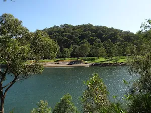
After another 30 m pass the "Crossing Middle Harbour" (7 m on your left).
|
|
|
After another 20 m (from the Two Creeks Track) veer right, to head along Two Creeks Track.
After another 125 m pass a seat (25 m on your left).
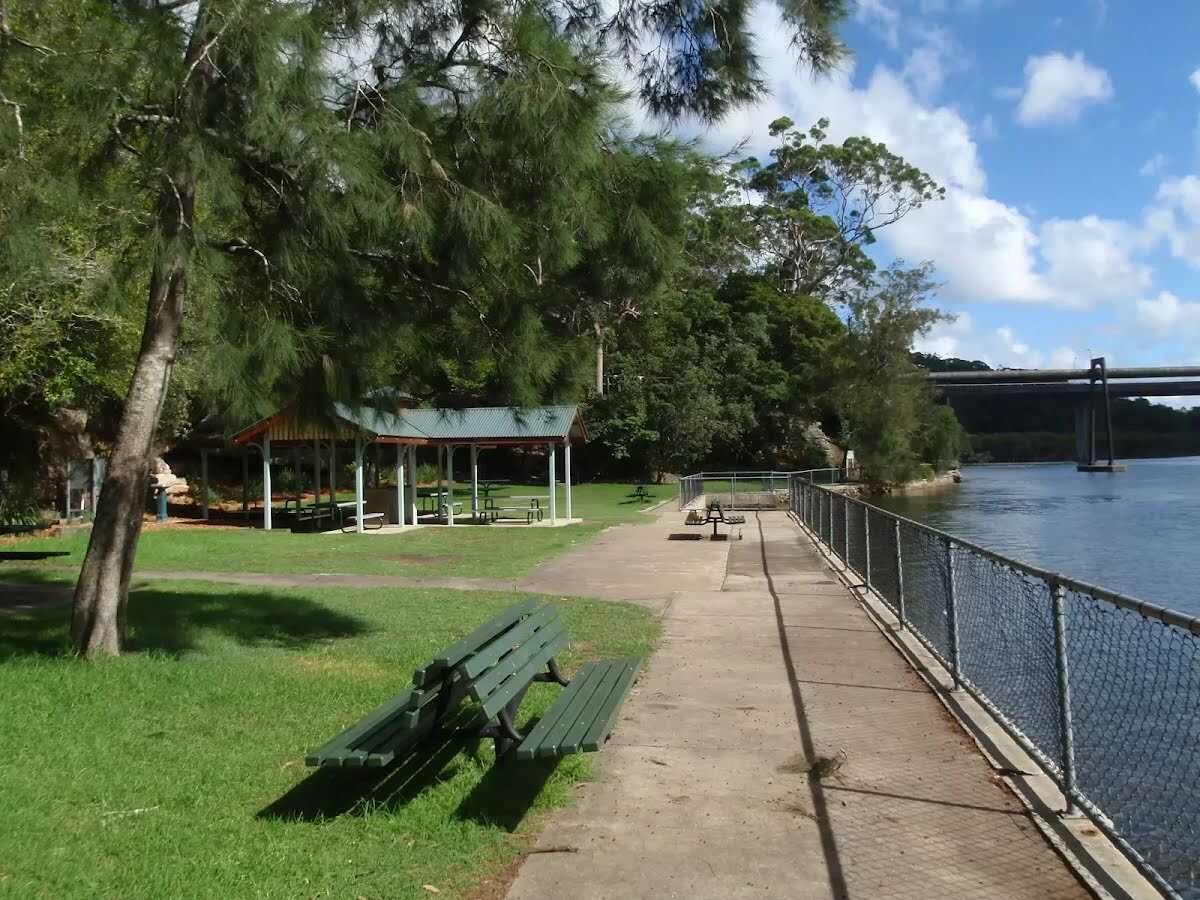
About 25 m past the end is a picnic table.
About 30 m past the end is a seat.
About 35 m past the end is a shelter.
About 40 m past the end is a picnic table.

About 40 m past the end is a BBQ.
About 40 m past the end is a picnic table.
About 45 m past the end is a picnic table.
About 50 m past the end is a seat.
About 50 m past the end is a picnic table.
|
|
|
The starting point of an optional sidetrip. Optional side trip to Echo Point park. To start this optional side trip veer right here. On returning from this side trip veer right when you get back to this intersection. Details below.

Continue another 0 m to find at the intersection of Babbage Road & Two Creeks Track at the end.
|
| Turn map |
Directions & comments |
|
|
At the intersection of Babbage Road & Two Creeks Track Start heading along Babbage Road (a residential road).
After 40 m pass the picnic table (20 m on your left).
After another 6 m pass a seat (25 m on your left).
After another 20 m pass the shelter (15 m on your left).
Then pass the BBQ (20 m on your left).

After another 100 m pass the playground (20 m on your left).

After another 135 m pass the car park (10 m on your left).
|
|
|

From the Babbage Road turn sharp left (a footpath).

After another 25 m head through/around the gate.

After another 25 m pass the toilet (10 m on your left).
|
|
|
Continue straight.
After another 7 m head up the surface|paved steps
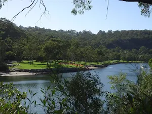
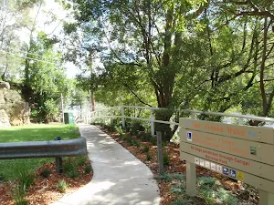
After another 15 m find the "Echo Point Park" (20 m on your left).

Then pass the water tap (on your left).

After another 45 m pass the "Echo on the Point" (65 m on your right).
|
|
|
Continue straight.
After another 15 m (from the Two Creeks Track) continue straight (a steps).

Then head down the wooden steps (about 15 m long)
|
|
|
The end.

Turn around and retrace your steps back the 420 m to the main route.
|
An alternate route avoiding the national park, making the track pet-friendly.
| Turn map |
Directions & comments |
|
|
From the Two Creeks Track Start (a walking track).
After 100 m pass a seat.
|
|
|
After another 6 m (from the Robinson Street) turn left, to head along Robinson Street (a residential road).
|
|
|
After another 335 m (from the Robinson Street) turn right (a footpath).
After another 85 m (from the Damour Avenue) continue straight.
|
|
|
After another 125 m (from the Tryon Road) turn left, to head along Tryon Road (a residential road).
After another 330 m (at the intersection of Tryon Road & Robinson Street) continue straight, to head along Tryon Road.
|
|
|
After another 235 m (at the intersection of Coopernook Avenue & Tryon Road) turn right, to head along Coopernook Avenue.
After another 90 m (at the intersection of Coopernook Avenue & Tarago Place) continue straight, to head along Coopernook Avenue.
|
|
|
After another 95 m (at the intersection of Wellington Road & Coopernook Avenue) turn left, to head along Wellington Road.
After another 300 m pass the "East Lindfield Park" (10 m on your left).
After another 80 m (at the intersection of Wellington Road & Carlyle Road) continue straight, to head along Wellington Road.
After another 160 m (at the intersection of Wellington Road & Ulmarra Place) veer left, to head along Wellington Road (a service road).
After another 20 m head through/around the gate.
After another 2 m (at the intersection of Wellington Road & Manuwi Track) continue straight, to head along Wellington Road.
|
|
|
After another 65 m (at the intersection of Manuwi Track & Wellington Road) turn left, to head along Manuwi Track (a walking track).
|
|
|
After another 55 m (from the Manuwi Track) veer right, to head along Manuwi Track.
After another 115 m head down the steps (about 30 m long)
|
|
|
Continue another -0 m to find at the intersection of Manuwi Track & Two Creeks Track at the end.
At the end of this alternate route, rejoin the main route.
|