| Start | (-33.7733965,151.1351308) |
| Mode | Bus Car (There is free parking available.) |
| Directions | From Lane Cove Road Exit
|
| Finish | (-33.7929912,151.156169) |
| Mode (end) | Car Shuttle Bus Car (There is free parking available.) |
| Turn map | Directions & comments |
|---|---|
 |
|
 |
|
 |
|
 |
The starting point of an optional sidetrip. An optional side trip to Blue Hole. To start this optional side trip turn right here. On returning from this side trip veer right when you get back to this intersection. Details below.
|
 |
|
 |
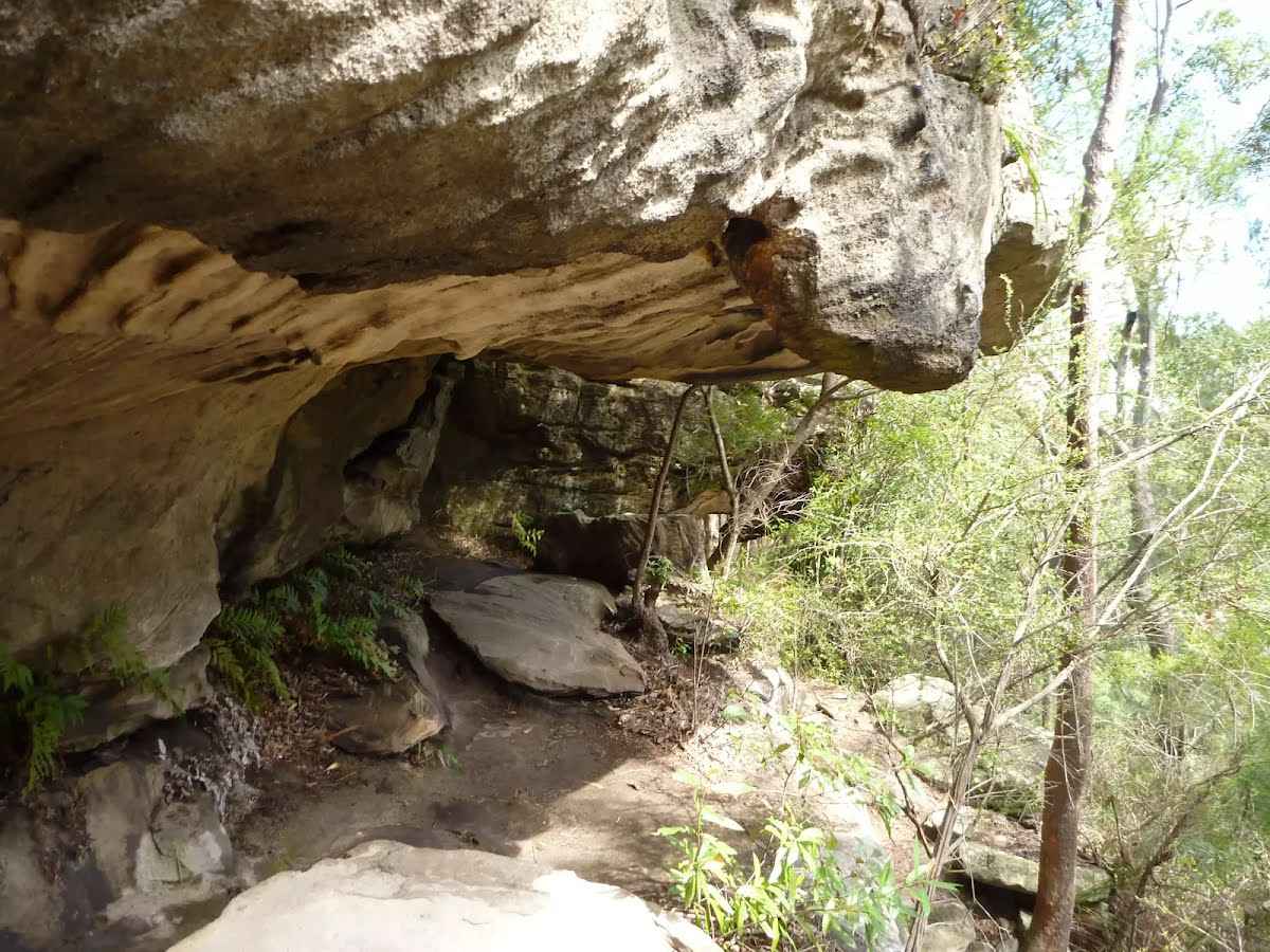 This fairly large sandstone overhang is found on the eastern side of the Lane Cove Valley. The walking track leads through the two caves that run in series, with the northern cave being larger. The lip of the overhang hangs down a bit, providing some extra protection from wind and rain. The cave also provide some shade and a cooler spot on hot days, and there are also a couple of well placed boulders forming nice seats.
|
 |
|
 |
|
 |
|
 |
|
 |
|
 |
|
 |
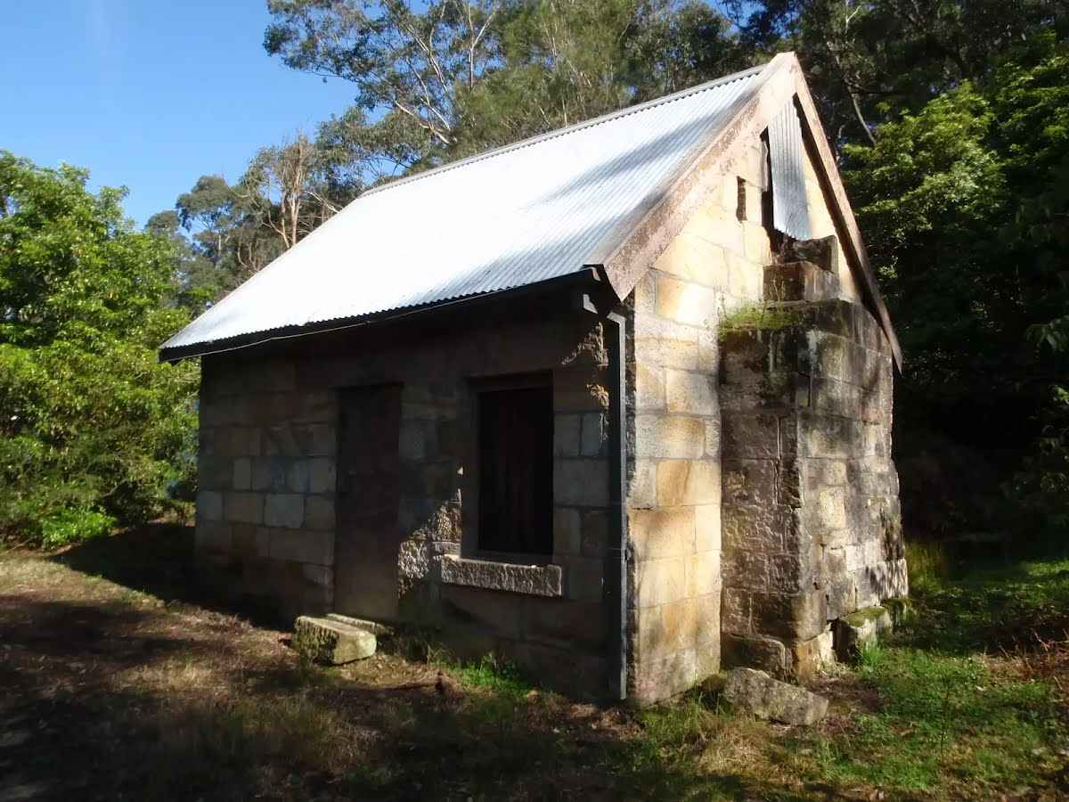
The starting point of an optional sidetrip. An optional side trip to Baker's Cottage. To start this optional side trip turn sharp left here. On returning from this side trip turn right when you get back to this intersection. Details below.
|
 |
|
 |
|
 |
|
 |
|
 |
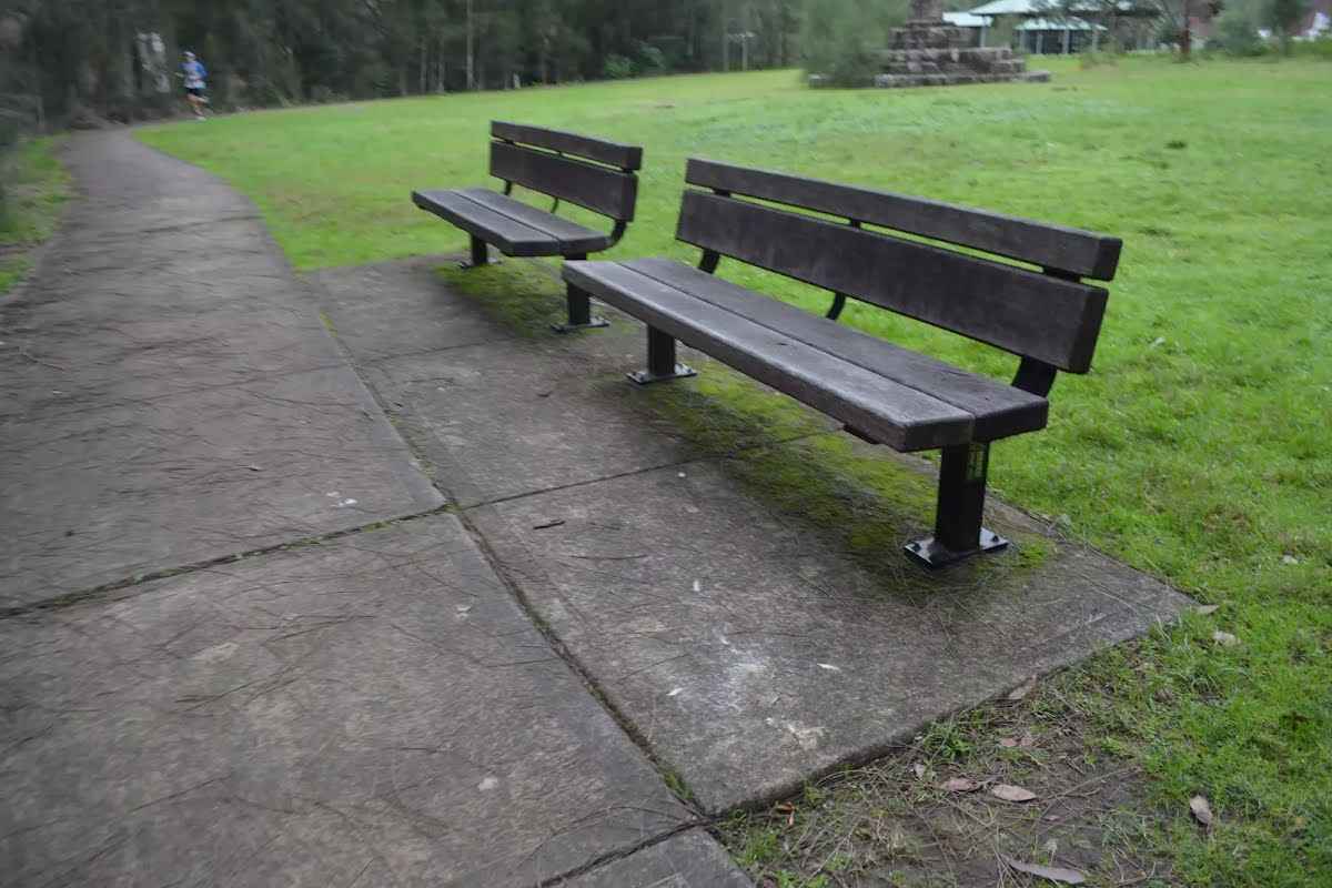
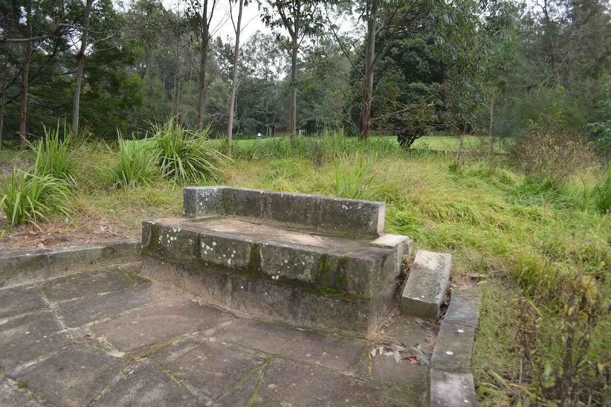 A stone seat, 42cm high, 60cm deep and 1.7m wide with a 22cm high arm and 22cm backrest.
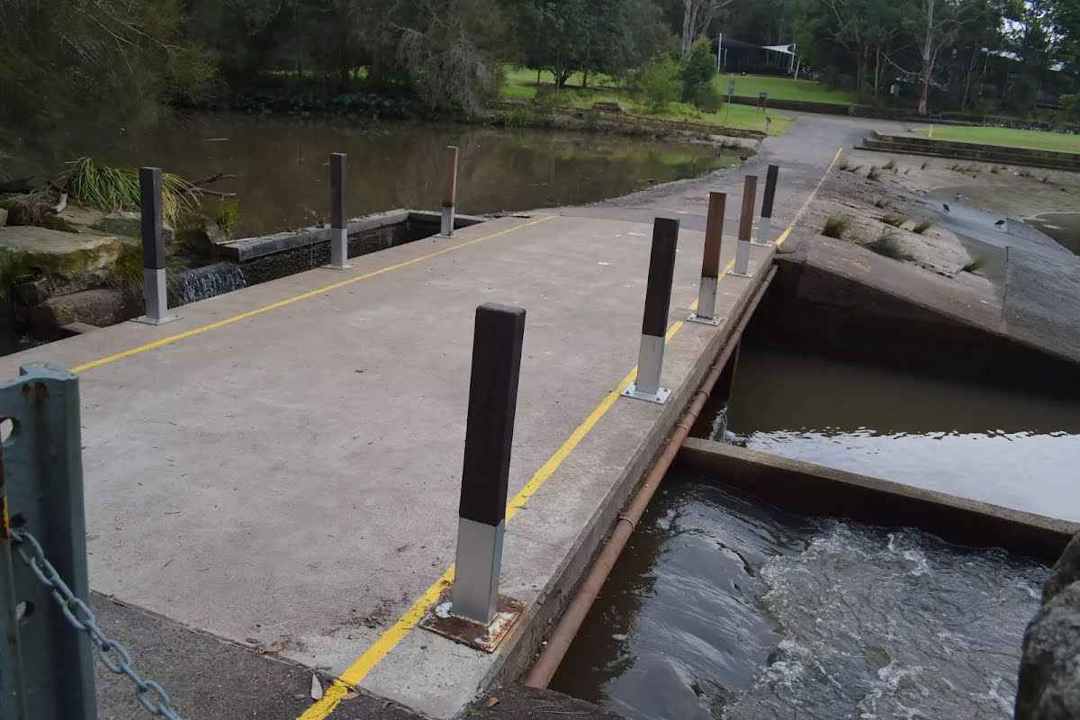
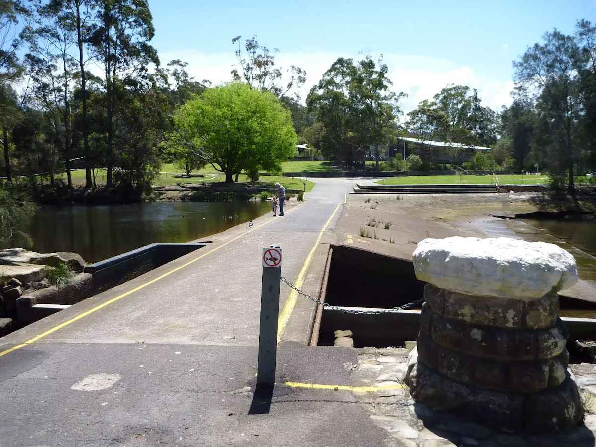 The Lane Cove River Weir was built in 1938 during the depression. The motivation for building the lake was to make the area more appealing for visitors' picnics. The weir created environmental issues such as silting and a decline in native fish populations. In more recent years, a 'fish ladder' has been constructed to allow fish to undertake their natural migration route for breeding. The weir proves an easy way for walkers to cross the Lane Cove River whilst enjoying the views up and downstream.
|
 |
|
 |
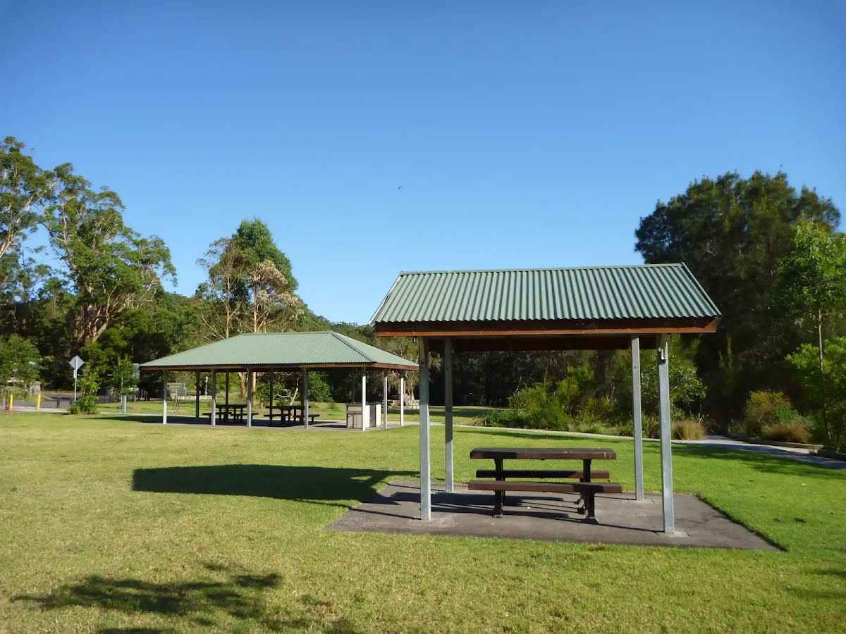 Koonjeree Picnic Area is at the southern end of Lane Cove National Park, just near Fullers Bridge. The picnic area boasts free gas barbecues, flushing toilets, town tap water, picnic tables and shelters, a large open area and car parking. On the bank of the Lane Cove River, this is a pleasant spot to enjoy the park.
|
 |
|
 |
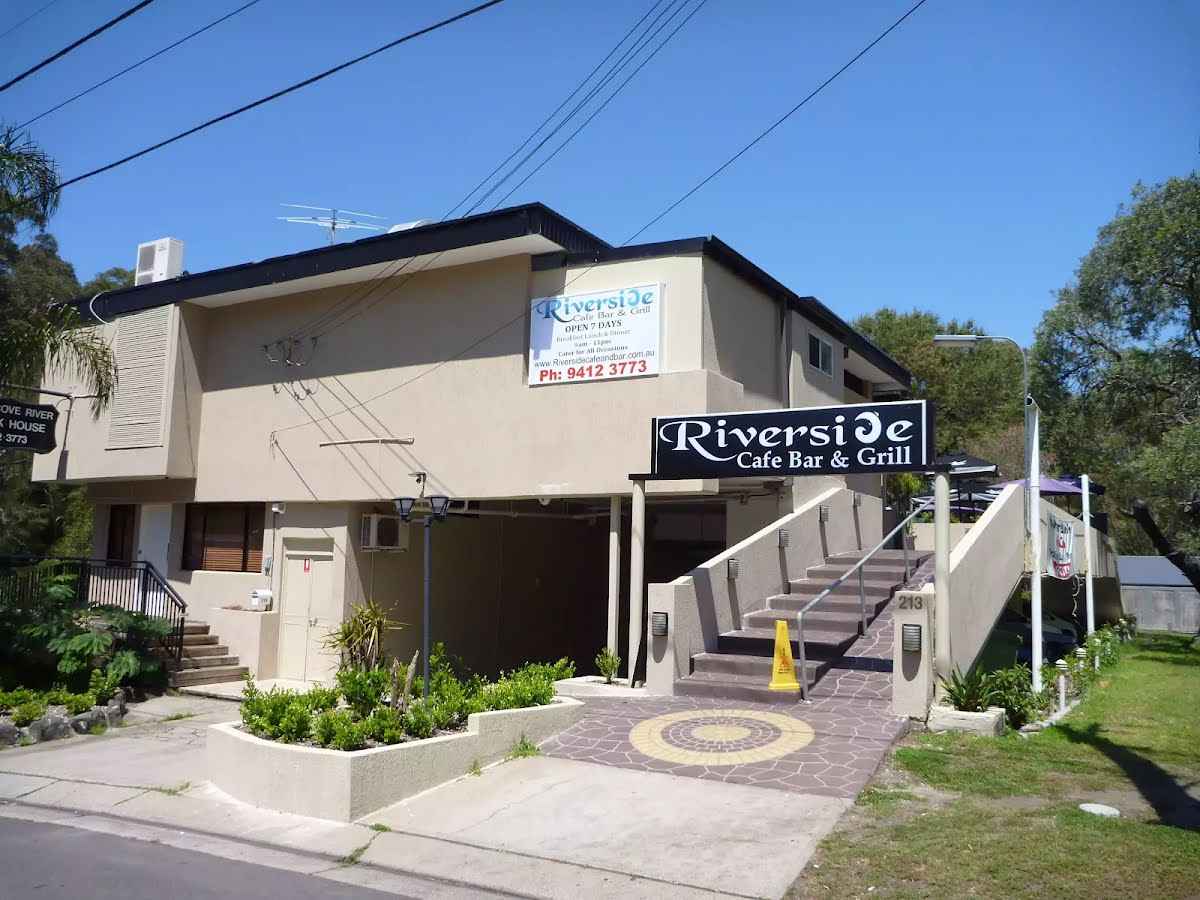 The Riverside Cafe is found at the end of service road on the south-west corner of Fullers Bridge. The nicely renovated building looks over the Lane Cove River and is open 7 days, serving breakfast, lunch and dinner. The food is cafe-style and meals are priced upwards from $13. Ph: (02) 9412 3773.
|
 |

|
|
Class 4/6 Hard track |
|---|---|
| Length | 5.7 km |
| Time | 1 h 30 min to 2 h 30 min |
| Quality of track | Rough track, where fallen trees and other obstacles are likely (4/6) |
| Gradient | Short steep hills (3/6) |
| Signage | Directional signs along the way (3/6) |
| Infrastructure | Limited facilities, not all cliffs are fenced (3/6) |
| Experience Required | Some bushwalking experience recommended (3/6) |
| Weather | Storms may impact on navigation and safety (3/6) |
| Item | From Start | Name & link to notes |
|---|---|---|
Toilet
| 4.3 km | [toilet] |
Toilet
| 4.5 km | [toilet] |
Toilet
| 4.8 km | [toilet] |
Toilet
| 5.3 km | [toilet] |
Seat
| 5.3 km | Seat |
Seat
| 5.5 km | Seat |