Starting at North Ryde train station this walk explores a stretch of the Lane Cove River, visiting the historic Fairlylands Pleasure Grounds along the way. The walk starts by wandering through the Riverside Corporate Park and soon comes alongside the Lane Cove River to join the Great North Walk. Here we follows the GNW though Fairylands before exploring a few streets in Chatswood West. After the weir, this walk leaves the main spine of the Great North Walk to explore the lovely River Side Track, through many picnic areas and up to the Lane Cove Tourist Park. Here the you wander along the roads back to the train station. Let us begin by acknowledging the Traditional Custodians of the land on which we travel today, and pay our respects to their Elders past and present.
Before you start any bushwalk ensure you;
• Tell someone you trust where you are going and what to do if you are overdue
• Have adequate equipment, supplies, skills & knowledge for the whole journey
• Consider the impact of weather forecasts, park/track closures & fire dangers
• Can respond to emergencies & call for help at any point
• Are healthy and fit enough for this journey
If not, change plans and stay safe. It is okay to delay and ask people for help.
Turn on to Warringah Freeway, M1 then drive for 65 m
Keep right onto Warringah Freeway, M1 and drive for another 4.7 km
Keep right onto Lane Cove Tunnel, M2 and drive for another 5.1 km
Keep left onto Epping Road Offramp, M2 and drive for another 870 m
Turn right onto Delhi Road, A38 and drive for another 460 m
Turn sharp right onto Delhi Road, A38 and drive for another 105 m
Getting started From the top of 'North Ryde' train station, this walk follows the footpath downhill beside Delhi Rd, past the bus stop. The footpath soon leads across a driveway with traffic lights then, about 200m from the train station, passes 'Delhi Convenience Store' (open 7am-7pm M-F & 10am-4pm weekends Ph: 02 9889 8822). Soon after this shop, the walk crosses Julius Ave (at the traffic lights) to come to the intersection in front of the 'Riverside Corporate Park West Entrance'. Turn right: From the intersection, this walk follow the footpath beside 'Julius Ave' heading into the signposted 'Riverside Corporate Park West Entrance'. After about 150m, this walk veers left at the roundabout to continue along Julius Ave for another 400m, passing a few CSIRO and commercial buildings to come to the entrance of 'The Village' shopping complex (on your left).....
Turn map
Directions & comments
North Ryde Start (a footpath).
The Sparrow's Mill (about 55 m back from the start).
After another 95 m continue straight, to head along Julius Avenue.
After another 7 m turn left.
After another 20 m turn left, to head along Julius Avenue.
After another 30 m continue straight, to head along Julius Avenue.
After another 245 m continue straight, to head along Julius Avenue.
After another 125 m continue straight, to head along Julius Avenue.
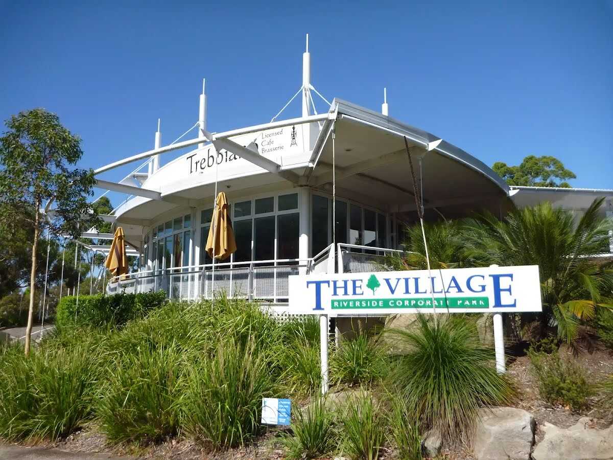
After another 15 m find the "The Village" (20 m on your left).
This pleasant shopping village is found at the intersection of Newbigin Cl and Julius Ave within the Riverside Corporate Park. The shopping complex is home to a couple of cafes, a chiropractor, copy centre and a few other shops. As this is in a corporate area, the shops are only open weekdays. Trebbiano Cafe PH: (02) 9889 2405.
After another 10 m (at the intersection of Julius Avenue & Newbigin Close) veer right, to head along Julius Avenue.
After another 65 m (at the intersection of Richardson Place & Julius Avenue) turn right, to head along Richardson Place.
After another 70 m turn right, to head along Richardson Place.
After another 175 m veer right, to head along Richardson Place.
After another 45 m continue straight, to head along Richardson Place.
After another 40 m head through/around the gate.
Continue straight.
After another 65 m turn sharp left.
After another 175 m pass the "Binary Cafe" (20 m on your left).
Mo-Fr 06:00-15:00
After another 90 m veer left, to head along Fairyland Track.
After another 15 m continue straight, to head along Fairyland Track.
After another 10 m cross the bridge (about 3 m long)
After another 165 m (at the intersection of Fairyland Track & Old Access Road) turn right, to head along Fairyland Track.
After another 155 m pass the "Fairyland Pleasure Grounds Board" (5 m on your right).
Then cross the bridge (about 10 m long)
After another 15 m continue straight, to head along Fairyland Track.
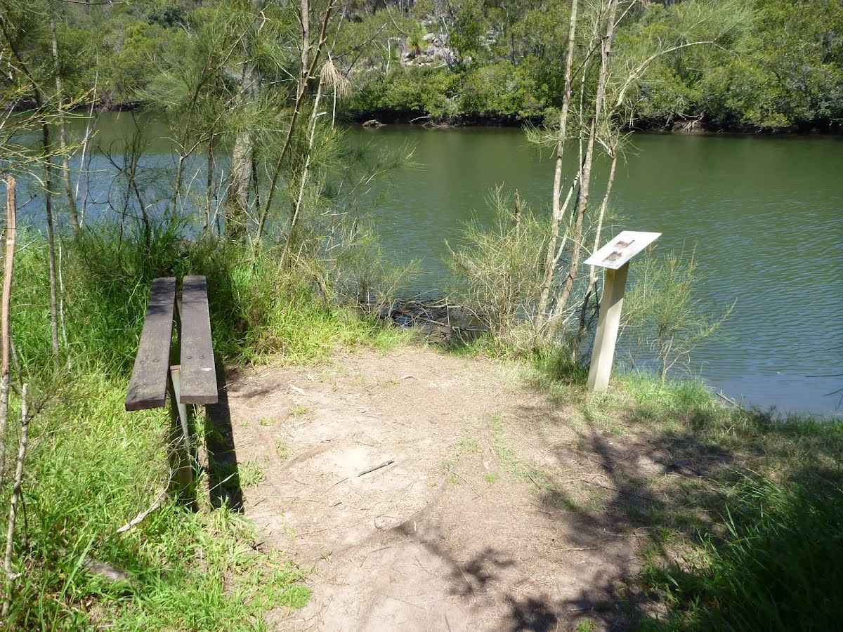
After another 55 m pass a seat (15 m on your right)., has no backrest.
Then pass the "Mowbray Park" (60 m on your right).
Veer left, to head along Fairyland Track.
After another 8 m find the "Fairyland" (15 m on your right).
Once formally known as 'Fairyland Pleasure Grounds', and casually as 'The Rest', this site was similar to several others in Sydney. The land was purchased by Robert Swan in 1896 and encompassed about 17 acres in total. Part of the land was cleared for a market garden, growing strawberries and melons. By the early 1900s, the market garden had closed and the area had become a popular picnic and play ground, for people arriving mostly by boat. This was a very popular spot to visit for a special day out. Today, the buildings have (mostly) gone and the cleared area has grown back, but it still can offer a relaxing picnic and lunch spot by the river.
Then come to the viewpoint (15 m on your right).
Continue straight, to head along Fairyland Track.
After another 120 m pass the "Fairyland Pleasure Grounds Map" (7 m on your right).
After another 215 m come to the viewpoint (10 m on your right).
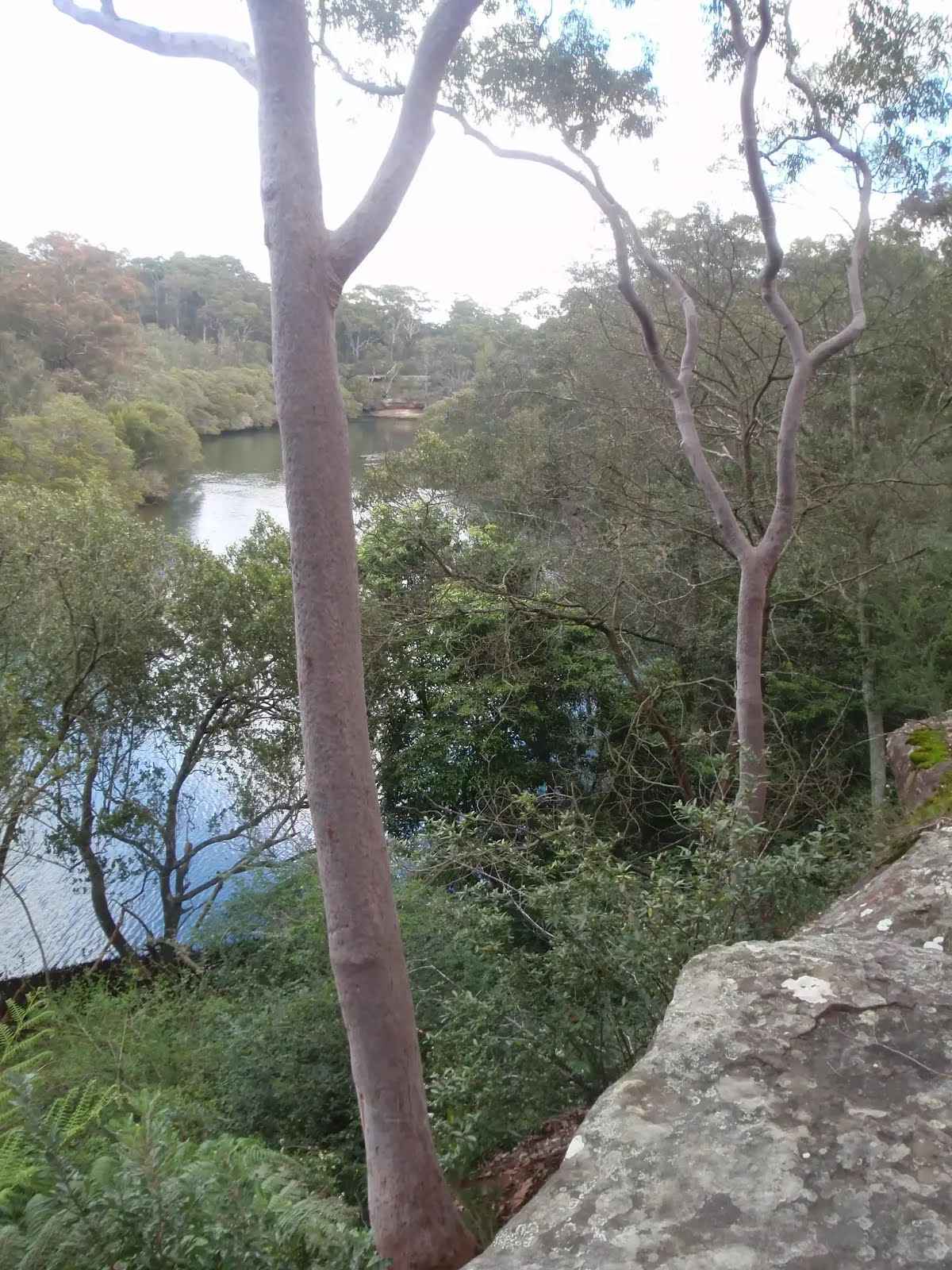
After another 25 m find the "Lookout" (20 m on your right).
This small, informal and unfenced viewpoint is atop a large natural rock platform, between Fairyland and River Ave. There are a few in the area, but this is the most distinct. From here, there are nice views down the Lane Cove River. The area is unfenced and there is a significant drop off the side.
After another 90 m cross the bridge (about 2 m long)
After another 20 m pass the "Lane Cove National Park" (on your left).
After another 15 m pass the park (40 m on your right).
At the intersection of Quebec Road & Fairyland Track turn left, to head along Quebec Road (a residential road).
After another 210 m (at the intersection of Quebec Road & Fairyland Avenue) turn left, to head along Quebec Road (a service road).
After another 15 m continue straight, to head along Quebec Road.
After another 175 m continue straight, to head along Quebec Road.
After another 170 m pass the "Main car park" (70 m on your left).
Then pass the "Northern Suburbs Memorial Gardens and Crematorium" (4 m on your left).
After another 50 m head through/around the gate.
After another 180 m turn right, to head along The Great North Walk.
After another 70 m pass a seat (on your left).
After another 30 m pass the "The Great North Walk" (on your right).
At the intersection of River Avenue & The Great North Walk continue straight (a footpath).
After another 5 m pass the "Alfred Cook Park" (10 m on your right).
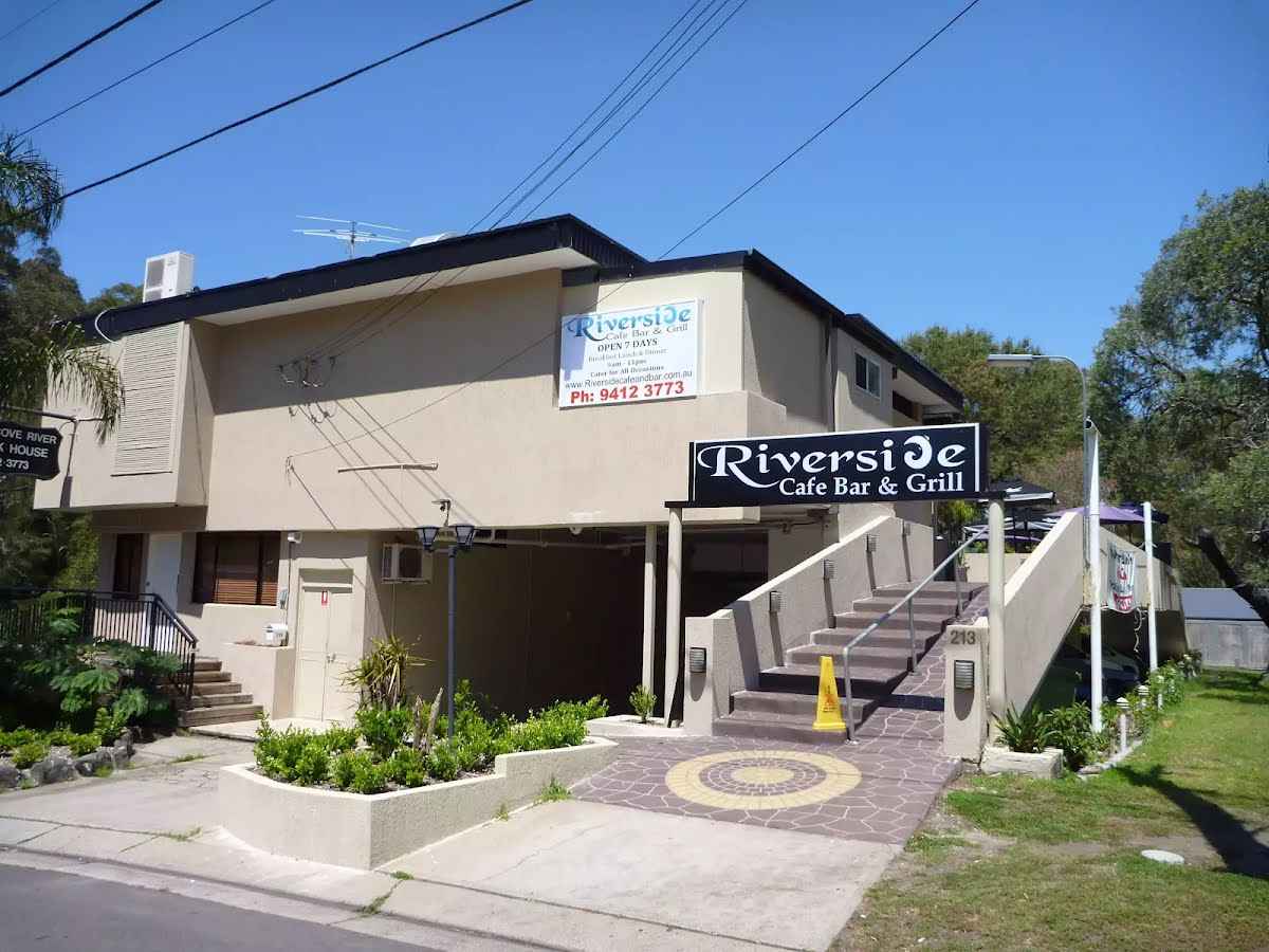
After another 55 m find the "Riverside Cafe Bar & Grill" (20 m on your right).
The Riverside Cafe is found at the end of service road on the south-west corner of Fullers Bridge. The nicely renovated building looks over the Lane Cove River and is open 7 days, serving breakfast, lunch and dinner. The food is cafe-style and meals are priced upwards from $13. Ph: (02) 9412 3773.
After another 25 m continue straight.
After another 75 m continue straight.
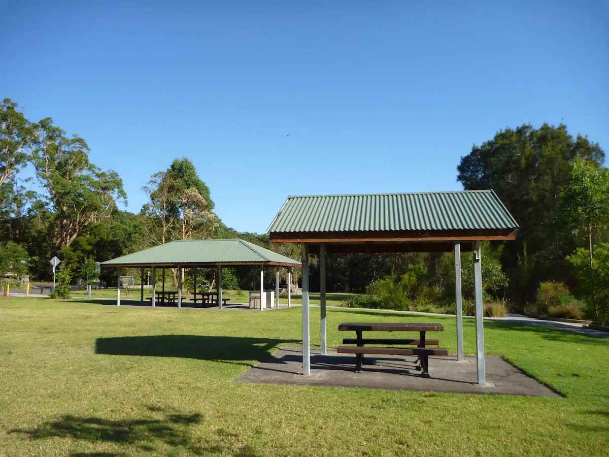
After another 30 m find the "Koonjeree Picnic Area" (4 m on your left).
Koonjeree Picnic Area is at the southern end of Lane Cove National Park, just near Fullers Bridge. The picnic area boasts free gas barbecues, flushing toilets, town tap water, picnic tables and shelters, a large open area and car parking. On the bank of the Lane Cove River, this is a pleasant spot to enjoy the park.
Turn sharp left.
After another 20 m continue straight.
Then pass the BBQ (5 m on your left).
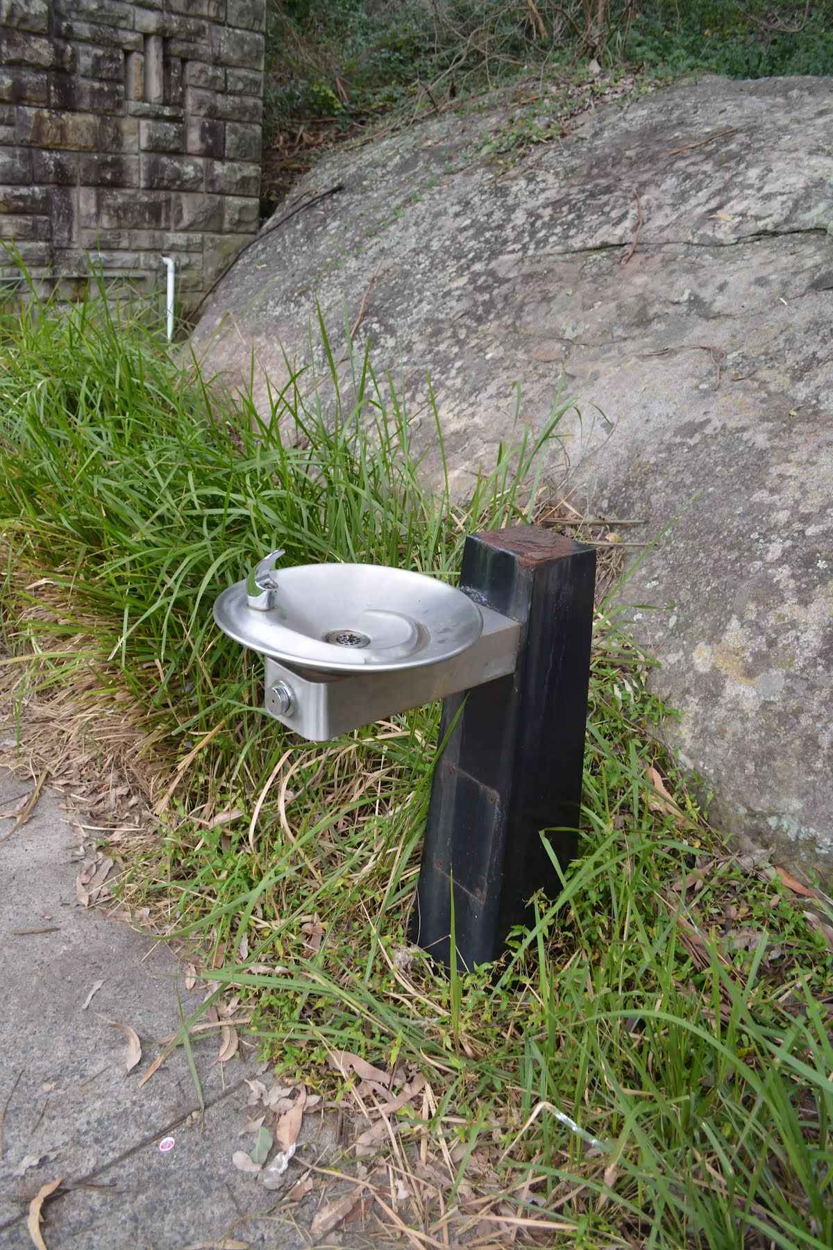
After another 50 m pass the water tap (about 15 m ahead).
Then find the "Potable Water" (about 20 m ahead).
Drinking fountain, 87cm high.
Then pass the car park (25 m on your left).
Turn right, to head along Riverside Drive.
Then pass the toilet (20 m on your left).
After another 25 m pass the car park (7 m on your left).
After another 8 m veer right.
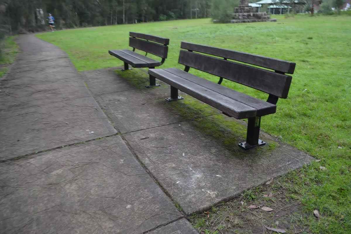
After another 30 m find the "Seat" (about 25 m ahead).
Two timber seats, 40cm high, 38cm deep and 1.8m wide with a 35cm backrest and no arm rests.
Turn left, to head along Riverside Walk.
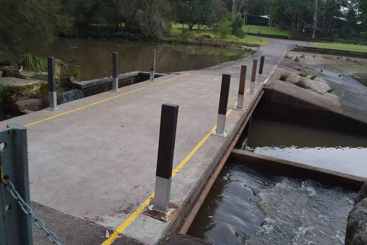
After another 10 m find the "Trip Hazard" (15 m on your right).
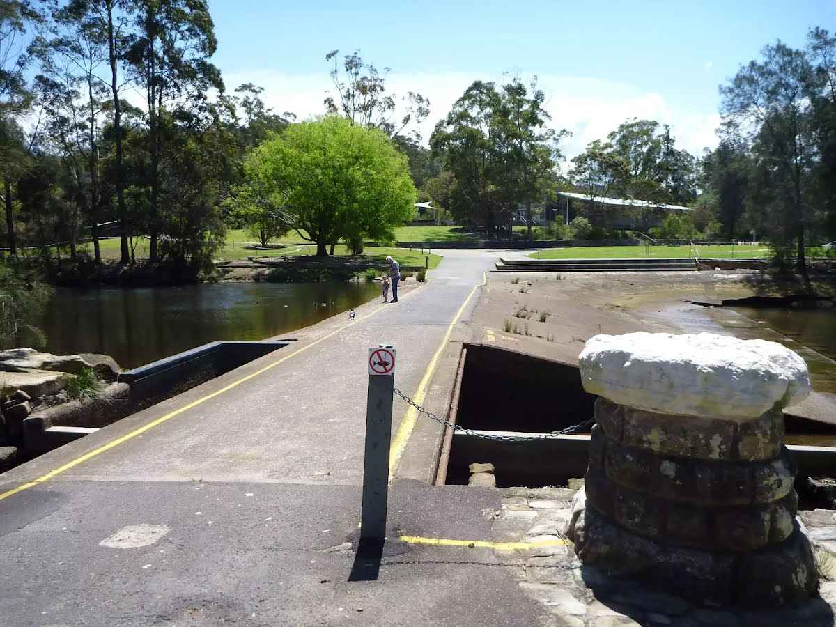
The edges of the weir are ungraded and there is a significant drop with water hazards. Keep clear of edges.
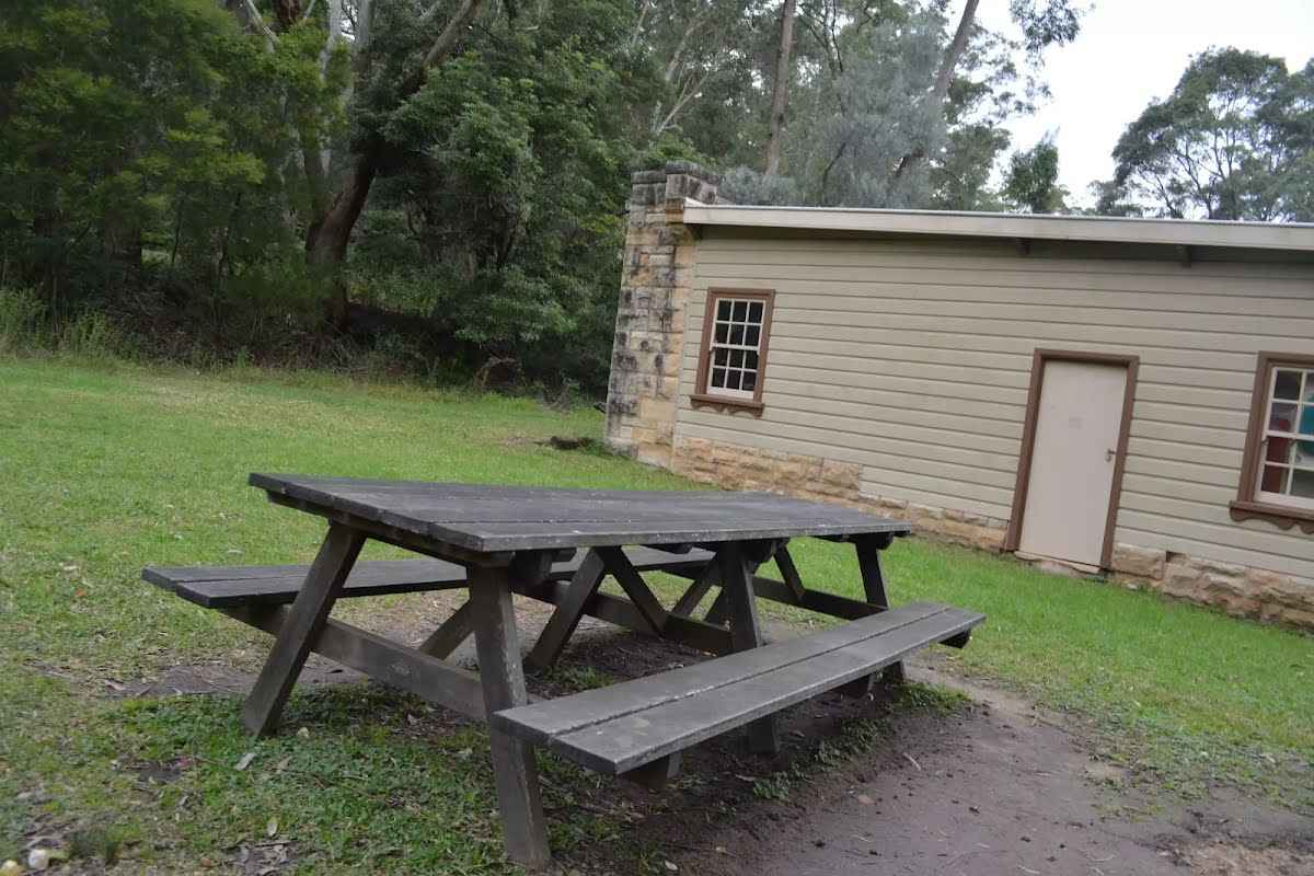
After another 15 m pass the picnic table (70 m on your right)., has no backrest.
Then find the "Lane Cove Weir" (30 m on your right).
The Lane Cove River Weir was built in 1938 during the depression. The motivation for building the lake was to make the area more appealing for visitors' picnics. The weir created environmental issues such as silting and a decline in native fish populations. In more recent years, a 'fish ladder' has been constructed to allow fish to undertake their natural migration route for breeding. The weir proves an easy way for walkers to cross the Lane Cove River whilst enjoying the views up and downstream.
After another 10 m pass the picnic table (70 m on your right)., has no backrest.
After another 25 m find the "Seat" (50 m on your right).
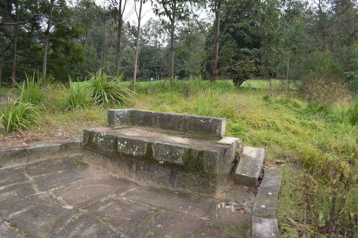
A stone seat, 42cm high, 60cm deep and 1.7m wide with a 22cm high arm and 22cm backrest.
Then find the "Lane Cove River Lookout" (on your right).
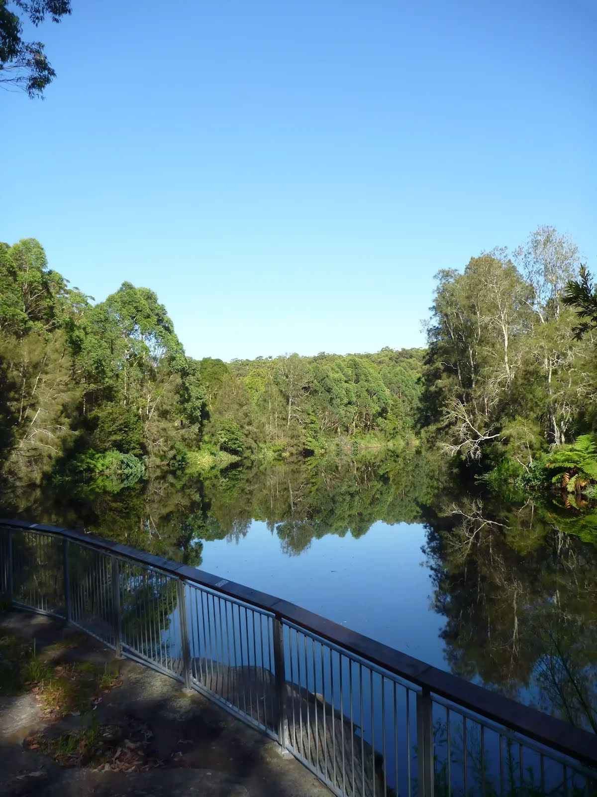
Found along the timber boardwalk on the banks of the Lane Cove River, just up stream from the weir, is this lovely viewing platform. The boardwalk and platform are fenced (1.1m high), there are two main seats and a stepped area for extra seating. The views extend upstream for about 250m and is a great spot to watch water birds and the occasional paddle boat.
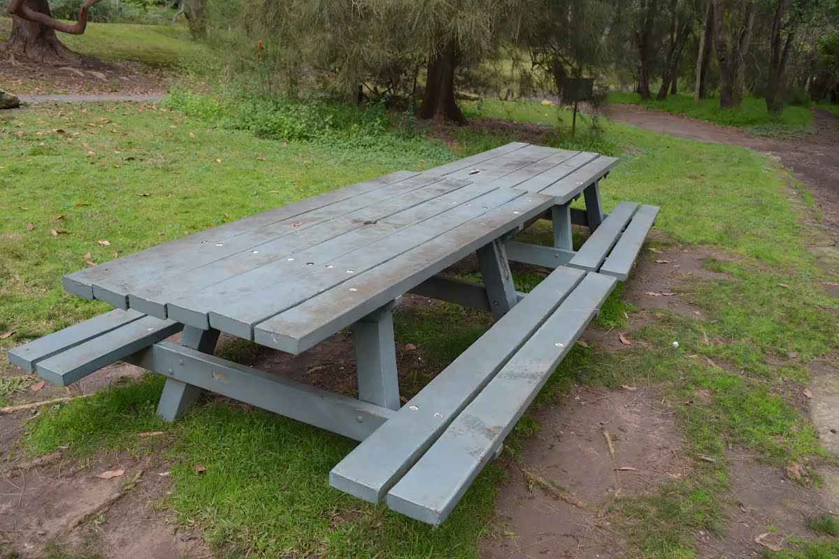
After another 205 m find the "Picnic Table" (15 m on your left).
A timber slat picnic table under a tree. The table is 72cm high, 92cm deep and 2.1m wide. The seats are 34cm high, 30cm deep and 2.1m wide (no backrest).
After another 25 m find the "Potable Water" (15 m on your left).
A water tap on the grass, handle is 84cm high.
After another 45 m find the "Picnic Table" (30 m on your left).
A timber slat picnic table under a tree. The table is 78cm high, 92cm deep and 2.1m wide. The seats are 45cm high, 30cm deep and 2.1m wide (no backrest).
After another 5 m find the "Illoura Picnic Area" (20 m on your left).
The Illoura Picnic Area in Lane Cove National Park, is an open grassy area beside the river and about 140m downstream of the Boatshed. The picnic area has a water tap, picnic tables and wood fired BBQ. On the other side of the Riverside Drive is a small toilet block. The eastern edge of the picnic area is a large brick picnic shelter.
After another 75 m find the "Illoura Picnic Shelter" (15 m on your left).
The park brick picnic shelter is on the bank of the Lane Cove River, near the Boatshed. There are two picnic tables in the shelter. The tables are 78cm high, 93cm deep and 2.1m wide. The second table is 4.3m wide. The seats are 44cm high, 29cm deep and 2.1m wide. The second table has seats that are 3.7m. Outside the shelter is another picnic table and wood BBQ. The picnic shelter is nestled in a grove of trees between the carpark and the open grassy Illoura picnic area. There is a small toilet block across the road
After another 65 m find the "Picnic Table" (7 m on your left).
The table is 73cm high, 74cm deep and 3m wide. The seats are 41cm high, 29cm deep and 3m wide (no backrest).
After another 35 m find the "Lane Cove Boatshed" (25 m on your left).
Lane Cove Boatshed, in Lane Cove National Park, is situated on the bank of the (you guessed it) Lane Cove River. You can hire rowboats, kayaks, pedal boats, bikes and canoes, for different ways to enjoy the river. The shop also sells ice-creams, chips and drinks. The shed is open on weekend from 10am - 5pm. During summer school holidays, the shop is also open from 12-5pm. For more info, call Greg on 0418600695.
After another 35 m find the "Picnic Table" (on your left).
2 tables are 73cm high, 90cm deep and 2.1m wide. The seats are 36cm high, 31cm deep and 2.1m wide (no backrest).
After another 145 m pass the BBQ (10 m on your left).
Then cross the bridge (about 2 m long)
After another 135 m head up the 12 metal steps (about 4 m long)
After another 255 m head through the bollard.
Continue straight.
After another 95 m pass the toilet (10 m on your left).
PH, Sa-Su
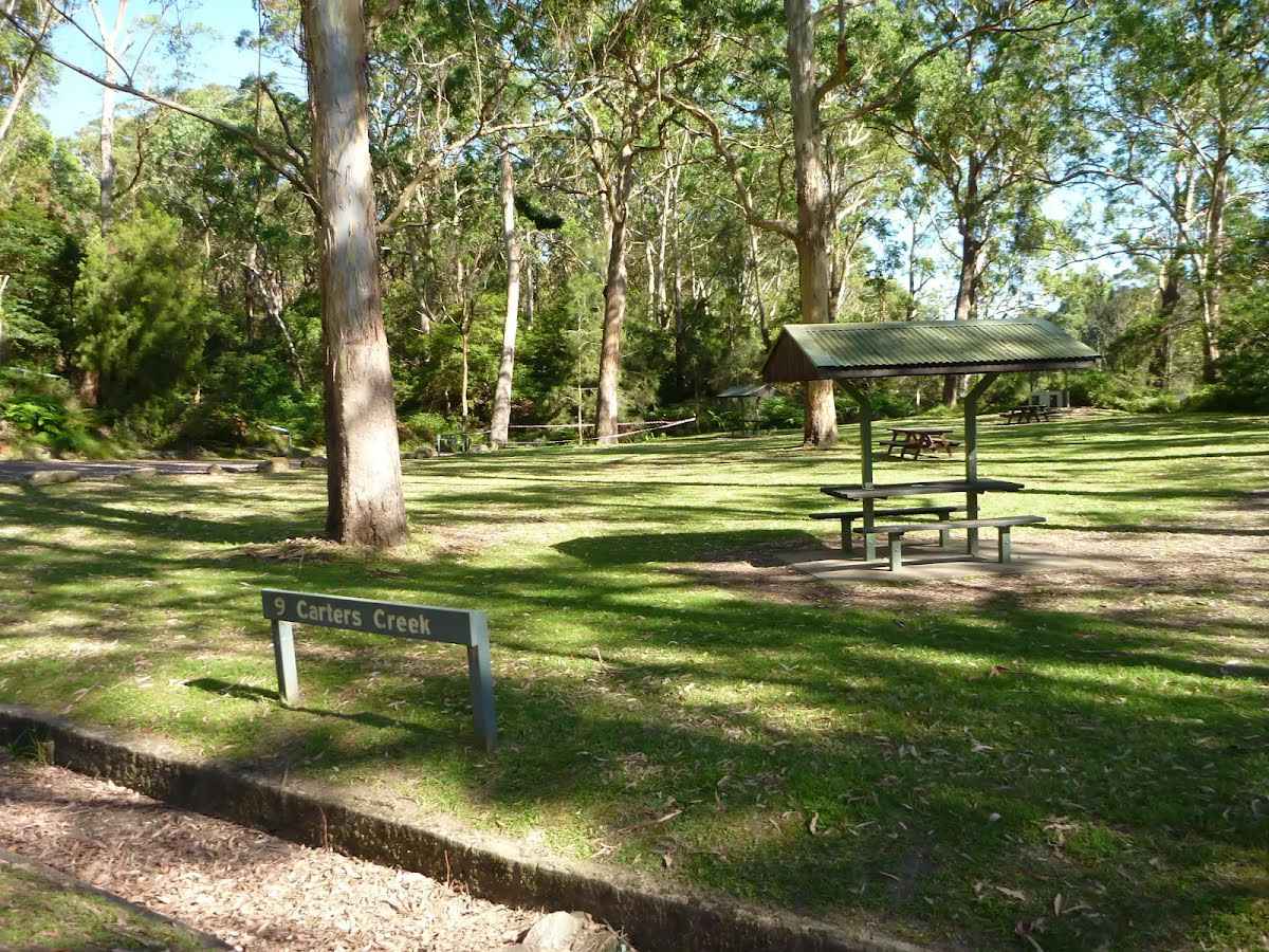
After another 35 m find the "9 Carters Creek" (7 m on your right).
Carters Creek Picnic Area is the ninth formal picnic space along this stretch of the Lane Cove River. This picnic area is home to a couple of sheltered picnic tables, a gas BBQ a large open grassy area, garbage bins, toilets and a car park. There is some limited access to the river view. A pleasant spot among the tall gums.
After another 20 m to find the car park.
After another 135 m continue straight, to head along Riverside Walk.
After another 150 m turn left.
Then pass the car park (8 m on your right).
After another 110 m continue straight.
Then head down the steps (about 9 m long)
After another 250 m turn left.
After another 85 m continue straight.
After another 70 m continue straight.
After another 70 m veer right.
Then pass the picnic table (50 m on your left).
After another 20 m pass the toilet (20 m on your right).
Continue straight.
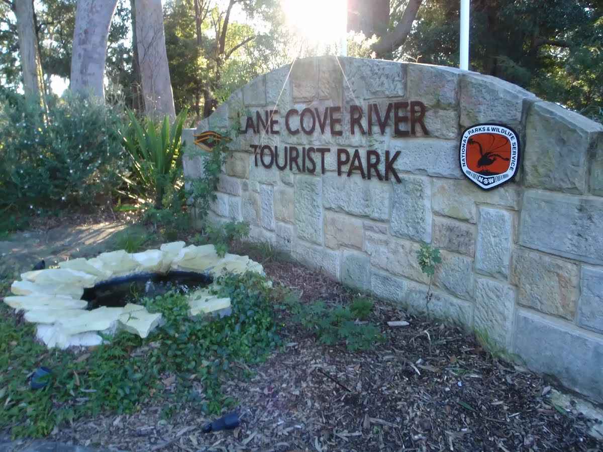
After another 35 m find the "Lane Cove River tourist park" (7 m on your right).
This is a well-established caravan park on the edge of Lane Cove National Park, offering a variety of camp sites from tent to powered sites for caravans and even en suite cabins. The campsite is a great point to access many wonderful walks in Lane Cove Valley. There are many facilities including a laundry, toilets, showers (including facilities for people with disabilities and with infants), recreation room, Internet kiosk (with free access to Wildwalks.com), wireless Internet, BBQ's and a pool. There is bike hire available and the reception has basic supplies for sale (bread, milk, snacks, newspapers).
After another 20 m continue straight.
After another 6 m turn left, to head along Plassey Road.
After another 60 m pass the BBQ (25 m on your left).
After another 10 m pass the picnic table (15 m on your left).
After another 220 m continue straight, to head along Plassey Road.
After another 230 m continue straight, to head along Plassey Road.
After another 15 m (at the intersection of Plassey Road & Entrance Drive) continue straight, to head along Plassey Road.
After another 55 m continue straight, to head along Plassey Road.
After another 110 m continue straight, to head along Plassey Road.
Then pass the "Macquarie Park Cemetery and Crematorium" (9 m on your right).
After another 25 m turn right.
After another 15 m continue straight.
After another 135 m continue straight.
After another 120 m turn left.
Continue another 10 m to find North Ryde at the end.
North Ryde Fairyland Circuit
Grading
Class 4/6
Hard track
Length
6.8 km
Time
2 h 15 min to 2 h 30 min
Quality of track
Rough track, where fallen trees and other obstacles are likely (4/6)
Gradient
Very steep (4/6)
Signage
Directional signs along the way (3/6)
Infrastructure
Generally useful facilities (such as fenced cliffs and seats) (1/6)
Experience Required
Some bushwalking experience recommended (3/6)
Weather
Weather generally has little impact on safety (1/6)
Some facilities on route
Campsite: There is one 5.8 km from the start.
Toilet: There are 3 on route, on average they are 1.7 km apart with the largest gap of 3.6 km.
Seat: There are 4 on route, on average they are 1.4 km apart with the largest gap of 3.1 km.
Partly cloudy. Patches of frost in the outer west early this morning. Patchy morning fog in the outer west. High chance of showers along the coastal fringe, medium chance elsewhere. Winds southwesterly 15 to 25 km/h tending southerly 20 to 30 km/h near the coast during the morning then becoming light in the evening.
Fire Danger Rating: No Rating
UV Alert: Sun protection not recommended, UV Index predicted to reach 2 [Low]
Saturday 19 July
5°C → 18°C
Sunny. 10% chance of rain
Mostly sunny. Areas of frost and the chance of fog in the outer west in the morning. Slight chance of a shower along the coastal fringe, near zero chance elsewhere. Light winds.
Sunday 20 July
3°C → 17°C
Partly cloudy. 20% chance of rain
Partly cloudy. Areas of morning frost in the west. Slight chance of a shower. Light winds becoming southerly 15 to 25 km/h during the day then becoming light during the evening.
Partly cloudy. The chance of morning fog in the west. Slight chance of a shower. Light winds becoming southeasterly 15 to 20 km/h during the day then becoming light during the afternoon.
Tuesday 22 July
6°C → 20°C
Mostly sunny. 10% chance of rain
Mostly sunny. Light winds becoming northeasterly 15 to 20 km/h during the day.
Wednesday 23 July
8°C → 20°C
Shower or two. 70% chance of rain 0 → 3mm
Cloudy. High chance of showers. Light winds becoming northerly 15 to 20 km/h during the day.
Thursday 24 July
8°C → 19°C
Possible shower. 40% chance of rain 0 → 1mm
Partly cloudy. Medium chance of showers, most likely during the morning. Winds west to northwesterly 15 to 20 km/h tending northeast to southeasterly during the day.
Other planned events: Toilet closures in Lane Cove National Park Some toilets within this park will be closed during the week, opening only on weekends, public holidays and during school holidays. The closed toilets are at:
Carters Creek (Area 9)
Scribbly Gums (Area 17)
Haynes Flat (Area 32)
This does not apply to bookings. Where there are bookings, toilets will be open.
For more information, please contact the NPWS Chatswood area office on 02 8448 0400.
Closed areas: Road and picnic area closures Lane Cove Depot Road and part of Max Allen Road, along with the adjacent picnic areas, will be closed from 31 March 2025 to 15 September 2025 due to essential geotechnical works. Weather events may extend these works.
The following areas will be closed to all pedestrians, cyclists and vehicles:
Lane Cove Depot Road
Max Allen Road will have no public access beyond Lane Cove Cafe and area office.
Turrumburra, Bakers Flat, Casuarina Point, Cormorant Corner, Haynes Flat and Thistlethwaites picnic areas.
Please follow all signs and instructions of NPWS staff and contractors. Penalties apply for non-compliance. For more information, contact the local NPWS office on 02 8448 0400.
Closed areas: Sugarloaf carpark closed Sugarloaf carpark in Lane Cove National Park is no longer open to the public. We apologise for any inconvenience.
For more information, please contact the NPWS Chatswood Area office on 02 8448 0400. Penalties apply for non-compliance.
Other planned events: 1080 pest management NSW National Parks and Wildlife Service will be conducting a baiting program using manufactured baits and fresh baits containing 1080 poison (sodium fluroacetate) for the control of foxes. The program is continuous and ongoing between 1 February 2025 and 31 July 2025 in Lane Cove National Park. Don’t touch baits. Penalties apply for non-compliance.
All baiting locations are identifiable by signs.
Domestic pets are not permitted in NSW national parks and reserves. Pets and working dogs may be affected (1080 is lethal to cats and dogs). Pets and working dogs must be restrained or muzzled in the vicinity and must not enter the baiting location. In the event of accidental poisoning seek immediate veterinary assistance.
For more information, contact the local park office on:
Lane Cove 8448 0400 (business hours)
NPWS after-hours call centre: 1300 056 294 (after hours)