Forresters Beach to Crackneck Beach
Darkinjung & Guringai Country

2 h 15 min to 2 h 30 min

5.7 km
return

↑ 268 m
↓ -268 m

Very challenging
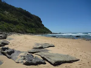
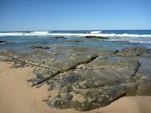
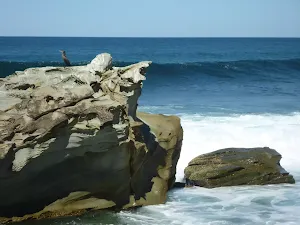
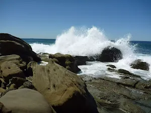
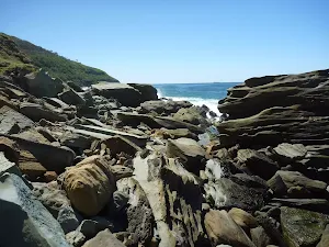
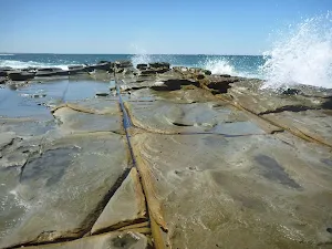
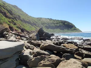
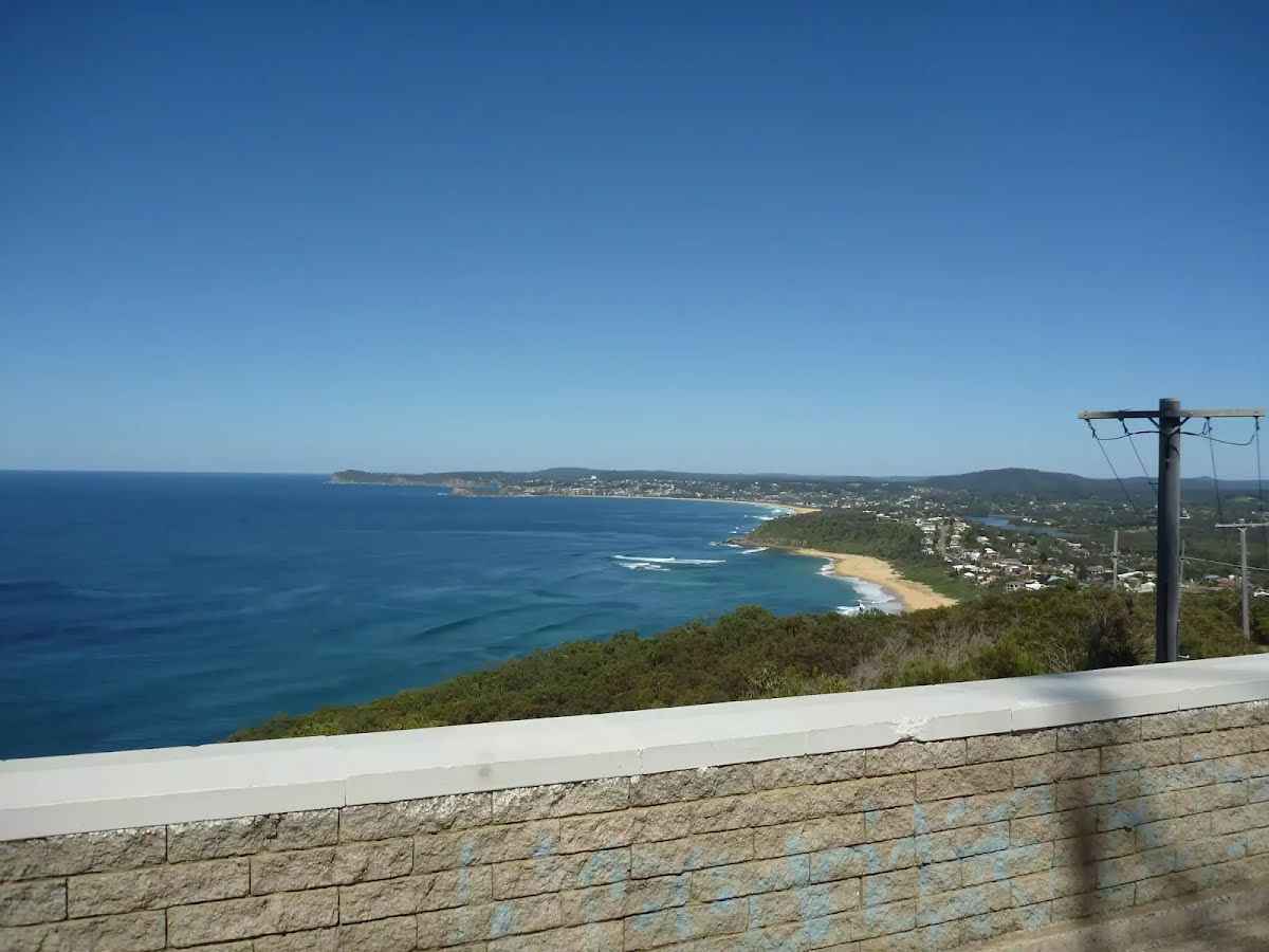
A great walk along the boulder strewn shoreline to the unnamed beach below Crackneck Lookout. Much of this walk is very exposed to the ocean and should not be attempted at high tide or during rough seas. Plenty of rock hopping over the boulders makes the walking harder but also makes the scenery more interesting. The shapes and textures in the rock, combined with the imposing hills and low cliffs of the coastline give quite dramatic scenery and atmosphere for the walk. Let us begin by acknowledging the Darkinjung & Guringai people, Traditional Custodians of the land on which we travel today, and pay our respects to their Elders past and present. 
Show all
Beach access. | Photo by admin, 2009.
Looking across Forresters beach. | Photo by admin, 2009.
Along Forresters beach. | Photo by admin, 2009.
Northern end of Forresters beach. | Photo by admin, 2009.
Interesting rocks on Forresters Beach. | Photo by admin, 2009.
Imposing hill and rocky shoreline. | Photo by admin, 2009.
Rock texture. | Photo by admin, 2009.
Shoreline scenery. | Photo by admin, 2009.
Erosion art. | Photo by admin, 2009.
Mind the waves. | Photo by admin, 2009.
Rusty old engine block. | Photo by admin, 2009.
Not an easy path. | Photo by admin, 2009.
Beautiful coastline views. | Photo by admin, 2009.
Rugged coastline. | Photo by admin, 2009.
Interesting texture and shapes. | Photo by admin, 2009.
Plenty of boulder hopping along the way. | Photo by admin, 2009.
Rounded rocks on Crackneck beach. | Photo by admin, 2009.
Rocky beach below Crackneck lookout. | Photo by admin, 2009.
Downloads GPX PDF


Warning
This journey requires significant bushwalking experience, specialised equipment and navigation skills.
Please ensure you and your group well prepared and equiped for this journey.

+
-
Safer Bushwalks
Tips on staying safe on track
Before you start any bushwalk ensure you;
• Tell someone you trust where you are going and what to do if you are overdue
• Have adequate equipment, supplies, skills & knowledge for the whole journey
• Consider the impact of weather forecasts, park/track closures & fire dangers
• Can respond to emergencies & call for help at any point
• Are healthy and fit enough for this journey
If not, change plans and stay safe. It is okay to delay and ask people for help.
+
-
Getting There
Transport options and directions
Start (-33.4109777,151.4654535)
Mode Bus Car (There is free parking available.)
DirectionsFrom Central Coast Highway, A49
  • Turn on to Dane Drive, A49 then drive for 6.5 km
  • At roundabout, take exit 2 onto The Entrance Road, A49 and drive for another 3.6 km
  • At roundabout, take exit 2 onto The Entrance Road, A49 and drive for another 710 m
  • At roundabout, take exit 1 onto The Entrance Road, A49 and drive for another 1.6 km
  • At roundabout, take exit 2 onto The Enterence Road, A49 and drive for another 100 m
  • Continue onto The Entrance Road, A49 and drive for another 870 m
  • At roundabout, take exit 2 onto Crystal Street and drive for another 540 m
  • Turn left onto South Scenic Road and drive for another 275 m
+
-
Track Notes
Turn by turn instructions & maps
Getting started
From the top of the beach access track, this walk goes over the low gate and follows the management trail steeply down the hill. The walk passes a shower area, to the right, and continues a short distance down the boarded trail to Forresters Beach.....
Turn map Directions & comments
Start.
After 130 m find the "Forresters Beach" (20 m on your right).
Forresters Beach
Forresters Beach

Forresters Beach is the name of a township and beach on the Central Coast of NSW. There are public toilets and a beach access path near the intersection of Crystal St and Kalakau Ave, and a beach access path near the bottom of Henrys Rd.
+
-
Forresters Beach is the name of a township and beach on the Central Coast of NSW. There are public toilets and a beach access path near the intersection of Crystal St and Kalakau Ave, and a beach access path near the bottom of Henrys Rd.

After another 2.7 km come to a park.
About 185 m past the end is a car park.
Turn around here and retrace the main route for 2.9 km to get back to the start.
"Crackneck Beach".
Crackneck Beach
Crackneck Beach

This unnamed beach is below Crackneck Lookout and can be reached with some difficulty by walking along the very rocky shoreline from Forresters Beach, to the south, or from Bateau Bay beach, to the north. The beach is covered in rounded rocks about the size of a fist.
+
-
This unnamed beach is below Crackneck Lookout and can be reached with some difficulty by walking along the very rocky shoreline from Forresters Beach, to the south, or from Bateau Bay beach, to the north. The beach is covered in rounded rocks about the size of a fist.

+
-
Terrain
Know the Hills, grading & facilities

Forresters Beach to Crackneck Beach


Grading
Class 5/6
Very challenging
Length 5.7 km
Time 2 h 15 min to 2 h 30 min
Quality of track Rough unclear track (5/6)
Gradient Short steep hills (3/6)
Signage Minimal directional signs (4/6)
Infrastructure No facilities provided (5/6)
Experience Required Moderate level of bushwalking experience recommended (4/6)
Weather Foretasted & unexpected storms and severe weather may impact on navigation and safety (4/6)
+
-
Articles
Discover more details to thrive on track
+
-
Reviews & Feedback
Share your experience
+
-
Weather & Alerts
Check forecasts & closures
Show Full Weather
Alerts and Closures
Show all alerts
Show all alerts
Show all alerts
+
-
Other Journeys
Discover nearby and similar journeys
Some of the information and maps on this page was generated using data from the awesome © OpenStreetMap contributors.
Please see how you can embed some widgets, access data and other stuff to that might be helpful.