

BEST WALKS IN AUSTRALIAMatt McClelland aka Wildwalks

Having written a few “Best of” lists in the past, I am pretty comfortable being told I am wrong. We all approach our walks in different ways and for different reasons. Some of us walk for fitness, a sense of adventure, to spend time with friends, to spend time away from friends, to challenge ourselves, to fish, to forget, to remember and sometimes just because we can.
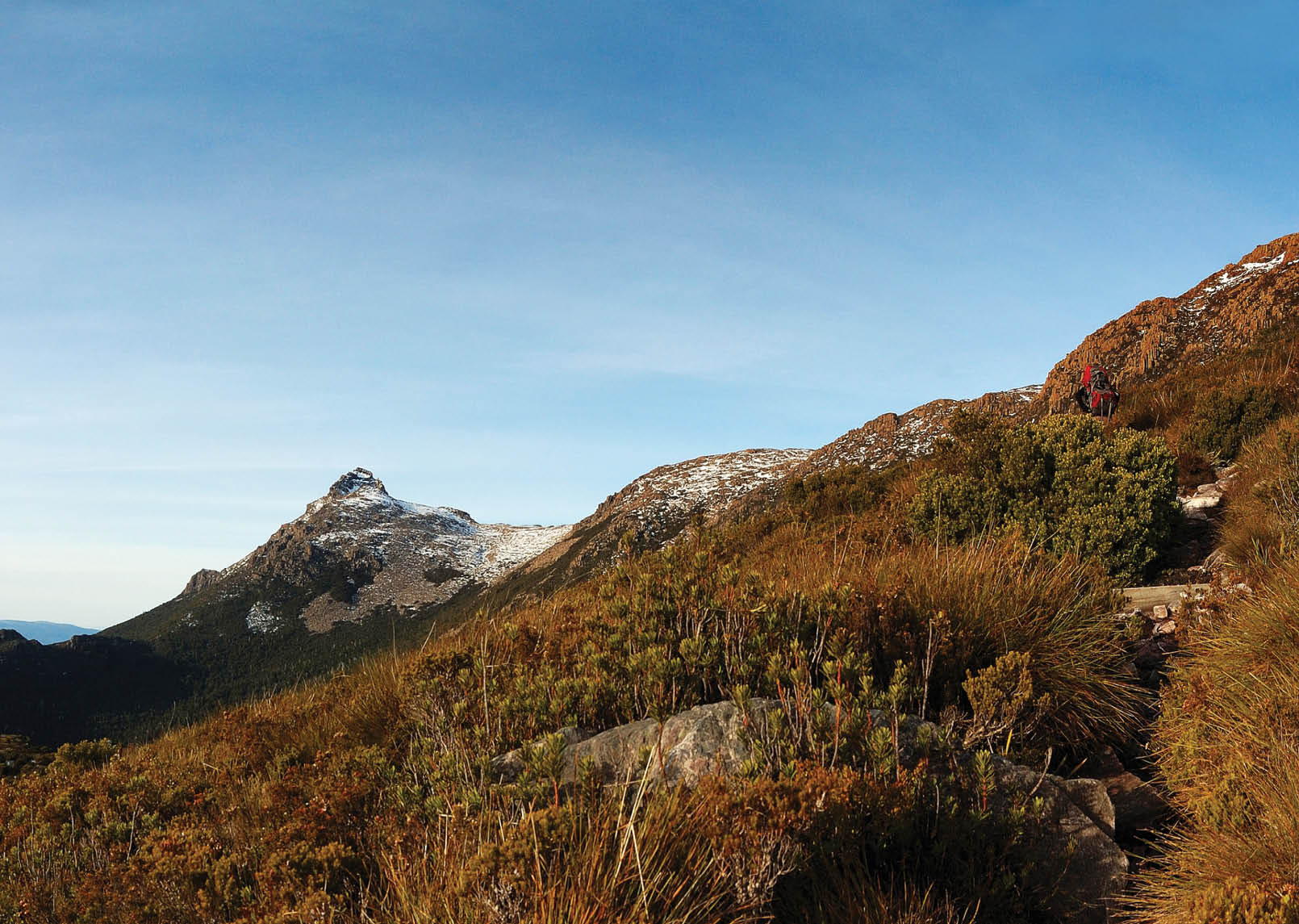
Competition: Tasmania September 2010
Mt AnneSubmitted by Samuel Hach
6 | BWA October 2014

There are some walks and times of year that suit our goals better. There are also some walks that are more compatible with a wider range of goals. We reflect on our best walks, generally not because of the walks but because of the experiences we had. In light of this I needed to come up with a way of writing this article that was not about me.
I decided to tackle this article using a democratic approach. This is not my opinion, but the combined ideas and suggestions from a wide variety of bushwalkers from an online survey. Thanks to all those who took the time to contribute I hope you enjoyed the process.
Going through the results was interesting. We had over 400 walks to consider, with a significant consensus on the top few walks in each state. Even though I never defined what “best” means, it seems that with such strong agreement, the results should be meaningful. The only eligibility criterion for each walk is that it needed to be on a formal track, since we have a policy of not promoting off track walks.
In the survey I also asked what is the best resource and why they rated the walk so highly. So instead of just giving you a description of each walk I have taken the most typical reasons people gave for liking
each walk and used that as the pitch on the following pages. I have also included a link to the most popular resources provided during the voting phase.
The next few pages are the key results, but if you are a little nerdy, here are a few statistics from the survey.
NSW Bushwalkers provided the highest number of votes (129) followed by our Tasmanian friends (100). The votes for walk by location of the walk are Tasmania 153, NSW 117, Victoria 64, Queensland 24, Western Australia 21, Northern Territory 13, ACT 4, and South Australia 3. I think this means the results from the top three states should be pretty helpful, and the other states results are be more negotiable. People tended to vote for walks in their own state about three out of four times. All states had votes for walks in their area from people in other states, as well as from locals. Tasmania was the only state that attracted votes across all the other states. So if we were handing out awards at this point it would seem that Tasmania would get the most popular bushwalking destination award.
I could keep talking statistics all day, perhaps I should just get out of the way and let you enjoy the list of walks. Maybe it will form your bushwalking bucket list.
BWA October 2014 | 7
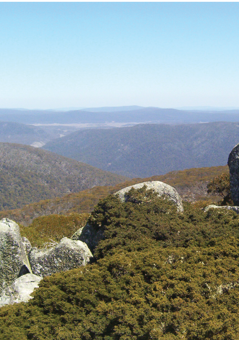
Mount Ginini, Namadgi National Park

Mt Ginnini to Mt Gingera & return
14 km, 4 hours, tripadvisor.com.au/Spectacular alpine scenery along the top of the Brindabella Range with great views of Kosciuszko and Brindabella National Parks. The summit of Mt Gingera also has beautiful bare rock and boulder formations and is snow-capped in win-ter. A great place to watch the sun set and then walk safely back to the Mt Ginnini car park, which is easily accessible from Canberra most of the year.
Square Rock Walk
9 km, 4 hours, tams.act.gov.au/Great views from Square Rock and can be extended by returning via Smokers Trail.
Yerrabi Track
4 km, 2 hours, tams.act.gov.au/
Interesting vegetation changes along the way, through a lovely patch of forest, and spectacular views from the top, across to the mountains which define the ACT / NSW border, plus a glimpse of Hospital Creek Hut far below.
Canberra Centenary Trail north
145 km, 7 days, tams.act.gov.au/
Sections 2 and 3 of the Centenary Trail from Watson to Hall village (or in the reverse direction) offer spectacular scenery, historical sites, and abundant wildlife, and is a great tranquil escape from urban Canberra. The ACT government has built a unique lookout at the highest point on the summit of One Tree Hill, a site of great historical significance in the early surveys to establish the ACT border. Border markers over 100 years old are found regularly along the walk.


Australian Capital Territory
8 | BWA October 2014
Looking at Garie Beach and the coast from the north
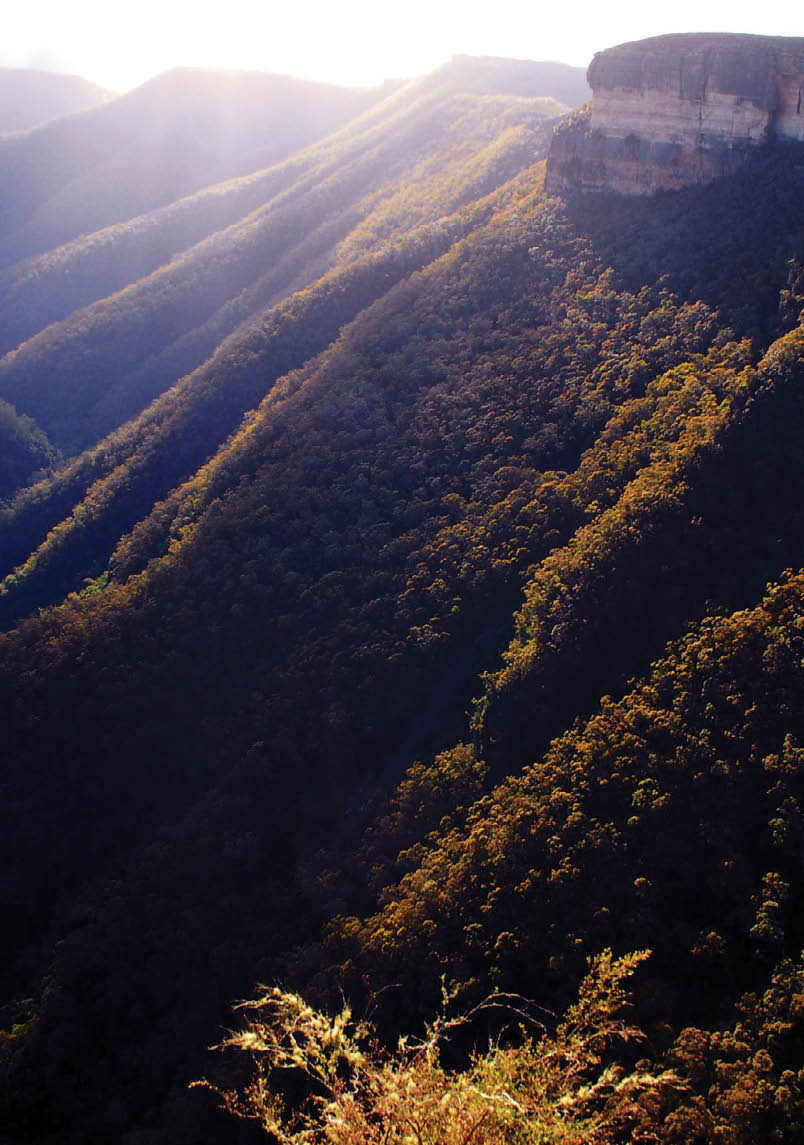
Kanangra Wallsby Iandsmith


National Pass (Wentworth Falls)
5 km, 4 hours, wildwalks.com/
You get a bit of everything. Waterfalls, stunning cliffs, up and down climbs and the unique Undercliff Track to boot. I like it when you’re up against the cliff face at the bottom walking to or from Wentworth Falls.well. Fabulous.
Grand Canyon
5 km, 3.5 hours, wildwalks.com/Evans Lookout, Horse Track, Rodriguez Pass, Grand Canyon Circuit. A relatively compact walk into Govetts Gorge featuring expansive vistas through to the Grose Valley, visiting waterfalls and traversing most of the fabulous Grand Canyon. Great in any season and remains mostly cool and shady in summer. Steep walk in and out of the valley/canyon is strenuous but those with good fitness will find that this rewarding walk can be done in a reasonably short day.
Kanangra to Katoomba Walk
45 km, 3 days, bushwalkingnsw.com/Hilltop to Katoomba via Kanangra Walls. A great multi-day trip that can be done by public transport (plus taxi) taking in some of the best of the Blue Mountains and including the relatively little visited Nattai/Wollondilly area. Lots of great alternatives between Yerranderie and Kanangra and the possibility of a food drop at Kanangra allowing extra time for exploring.
Mt Solitary and Kedumba Valley Circuit
33.8 km, 3 days, wildwalks.com/Easy access and great views across Kedumba Valley. Mt Solitary itself, the views of the Blue Mountains that most people don’t see.
Coast Track, Royal National Park
27.4 km, 2 days (or one big day), wildwalks.com/Spectacular coastal scenery, preserved natural beaches, the jewel of Wattamolla, camping at North Era with only deer, frogs and blue wrens, then out to Otford via sublime Burning Palms and Werong lookout. Accessible by public transport.


New South Wales
BWA October 2014 | 9
Larapinta Trailby Nathan Stuart


Kings Canyon Rim Walk
6 km loop, 3-4 hours, parksandwildlife.nt.gov.au/
Stunning scenery including cliffs, a waterhole, ancient flora.
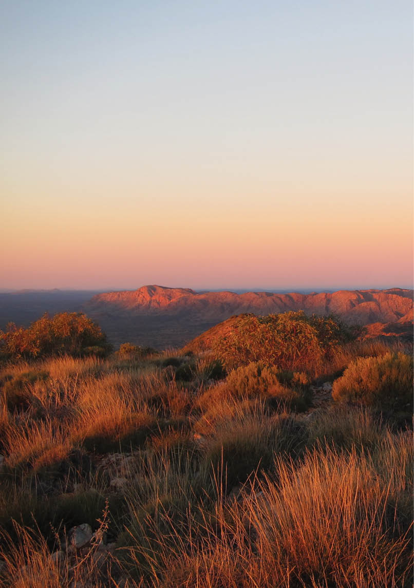
Larapinta Trail
110 km, 6 days, larapintatrail.com.au/The best sections are from Ormiston Gorge through to Jay Creek. These sections have some of the most challenging and beautiful walking in Australia.And it is so unmistakably Australian; spinifex, red ranges, wide open spaces, water holes, there is something very spiritual out in this landscape. There is constant diversity in the walking track - lots of challenges to keep you interested and give you a sense of satisfaction at the end of the days walk.It’s usually clear and there isn’t any mud! Pretty much guaranteed good views.Some of the best high elevation campsites.
Jatbula
62 km, 5-6 days, parksandwildlife.nt.gov.au/The lovely native art that you feel you are privileged to see. And the end of the day has water holes, waterfalls or pools - bliss in the warm country.


Northern Territory
10 | BWA October 2014
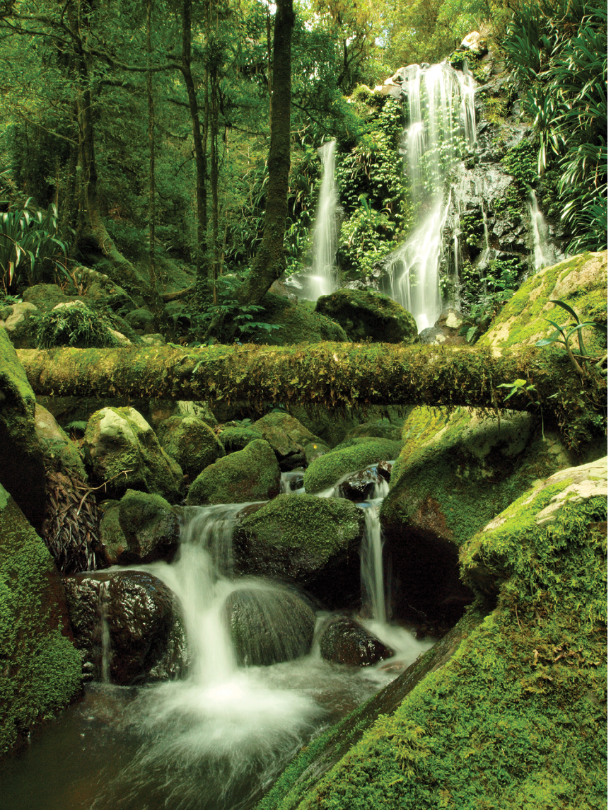
Chalahn Falls on Toolona Creek Circuit Lamington NP, Queensland by Al and Bruce Paton

Carnarvon Gorge, Carnarvon NP
22 km return, 8 hours, nprsr.qld.gov.au/
This must be one of Australia’s top five walks full stop. It has gorges, 22 creek crossings, beautiful waterfalls, stunning scenery like the Amphitheatre and art as well. Fabulous.
Toolona Creek Circuit
17.4 km return, 6 hours, nprsr.qld.gov.au/
Track passes waterfall after waterfall after waterfall in beautiful rainforest along the creek... then passes by antarctic beech tree forests and lookouts with great views! Even more amazing when there is light rain and low-lying mist about.
Thorsborne Trail, Hinchinbrook Island NP
32 km, 2 days, nprsr.qld.gov.au/
Remote, warm, clear pools to swim, views across mountains, lagoons, bays, fauna and flora that is magical.


Queensland
BWA October 2014 | 11
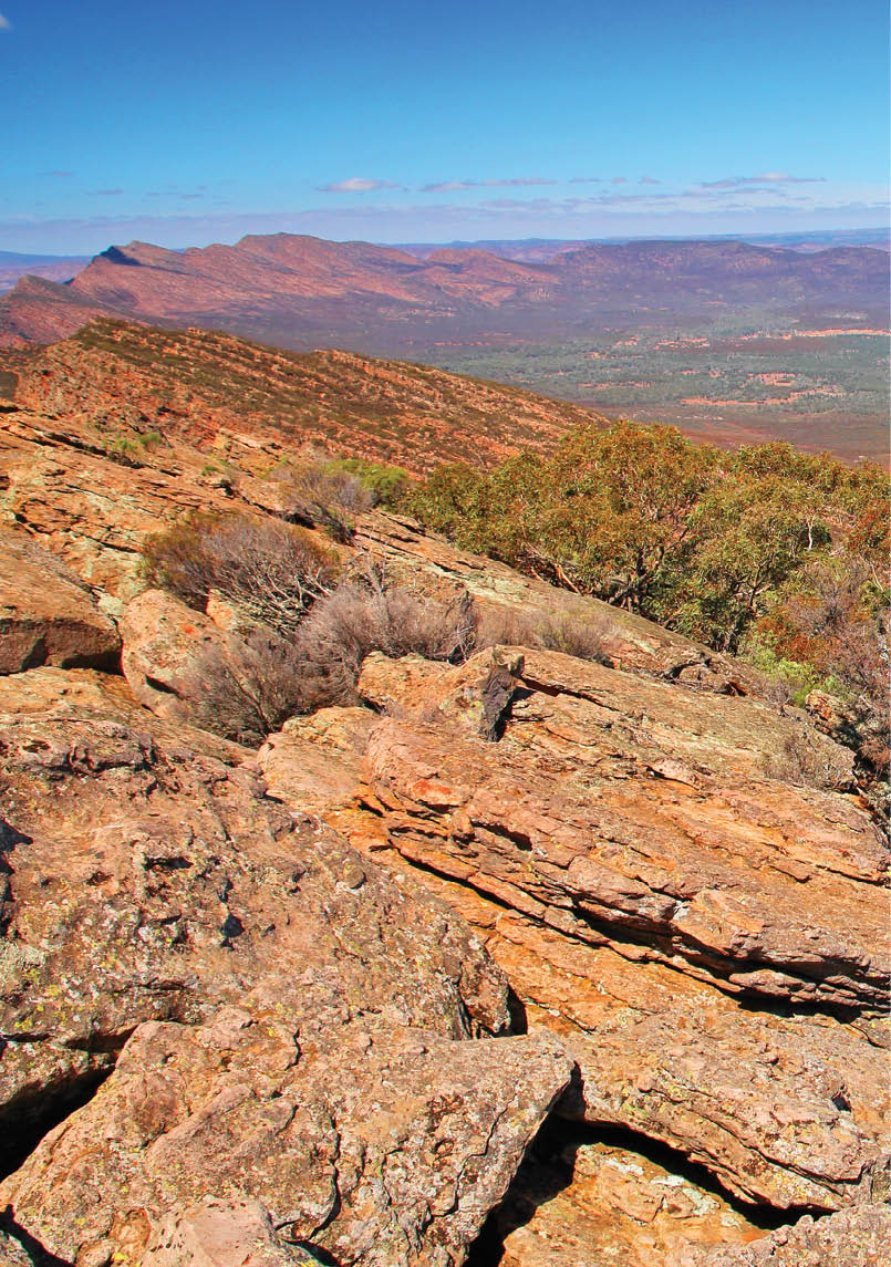


St Marys Peak
21.7 km return, 9 hours, everytrail.com/Challenging, long hike to the highest peak in the Flinders Ranges with views of the Flinders Ranges, salt lakes and the surrounding plains.
Gammon Ranges
50 km, 6 days, bushwalk.com/This is an untracked area, but any walk that covers features such as Mt McKinley, McKinley Bluff, Junction Waterhole, The Terraces, Rover Rockhole, Cleft Peak and Bunyip Chasm would make a good multi day hike. It needs to be in the cooler months as high temperatures would be deadly.It is remote country where water is a chief concern, but here you know you are walking on the exposed bones of the earth. Plants are really tough and the rock is colourful and towers around you. It is a desert range and you approach it with deep respect for its harshness.

Australian outback and Flinders Ranges by Totajla
South Australia
12 | BWA October 2014
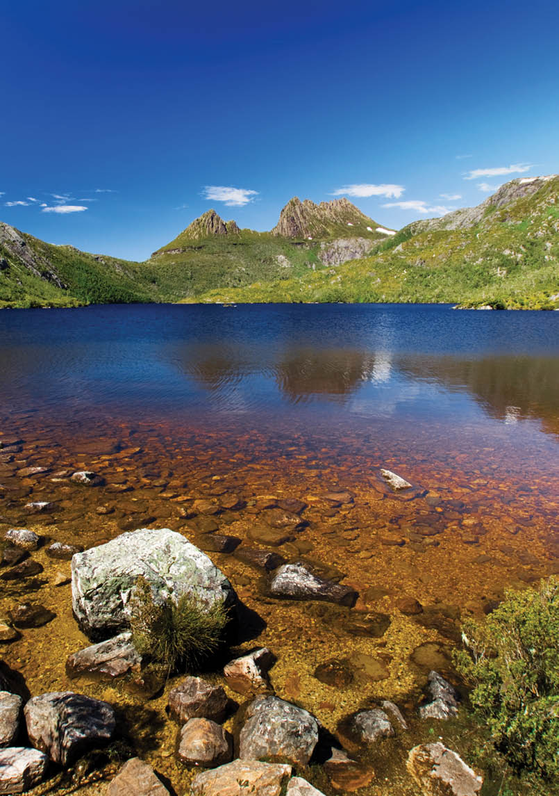
Beautiful lake at Cradle Mountain by Kwest


Mount Anne
15 km, 7-8 hours, wildtigertasmania.com/This is a tough day walk, but gives grandstand views over Lake Peddar and the mountains of the South West and over the amazing Lake Judd to Schnells Ridge. You need to spend time wandering over the Eliza Plateau to look over the cliff edges. Schnells Ridge is a mini taste of what the Western Arthurs is like, with the white quartzite peaks and plunging sides into glacial lakes, while the bulk of the Mt Anne block is classic Dolerite carved into serrated ridgelines and cliff faces up to 600 metres high.
Cradle Mountain
6.4 km one way, 6-8 hours return walk, parks.tas.gov.au/This walk needs to be as a loop walk via the Twisted Lakes. Although a very popular walk, the concentration of mountain scenery and dramatic alpine lakes is hard to match in a day walk anywhere else. It is best walked in fine weather in autumn when the fagus is in full colour.
Mount Murchison
5 km, 4 hours, theabels.dreamhosters.com/Visually as impressive as the Eastern and Western Arthurs but in an easily accessible daywalk.
Frenchmans Cap
46 km, 4 days, parks.tas.gov.au/Variety of landscape, vegetation and views. Great hut facilities. Unique, accessible but still a challenge. Amazing history, Aboriginal and European. Amazing amazing amazing and also has the best toilet view in Australia and lots and lots and lots of mud.
Western Arthurs
72 km, 6 days, thehikinglife.com//Spectacular views all along the range. Excellent track work (once above the plains). Well sited campsites with brilliant views. Good challenge! It is a loop walk so no need for car shuffle..
Overland Track
65 km, 6 days, parks.tas.gov.au/Great variety of environments and scenery, well managed track, well maintained huts and campsites. Lots of good side trip options and good length. The scenery makes it a winner though. Each day is different and side walks are a highlight. Some of the huts are great - particularly Pelion.


Tasmania
BWA October 2014 | 13
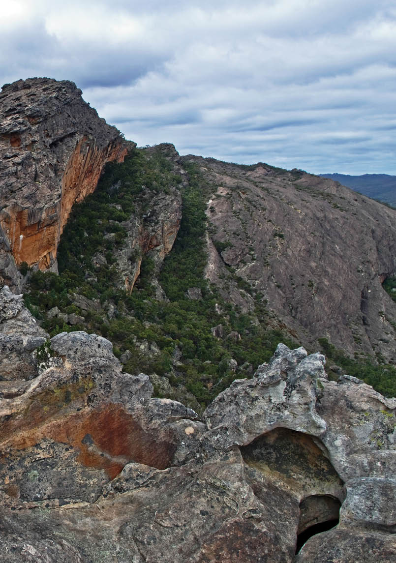
Eroded rock of Stapylton by Brian Eglinton


Hollow Mountain to Mount Stapylton
5-6 km walk, 5 hours, archive.bigben.id.au/This is an older pad rather than a clearly marked track. It is a short walk, but is a real thrill due to the concentrated rock structures that need to be negotiated. Beginning with a sharp climb up to Hollow Mountain which is then climbed from the inside, and then traversing the ridgeline to Mount Stapylton negotiating three chasms along the way. A loop can be made by following the normal path back to the road and then along it back to the Hollow Mountain car park.
Mount Feathertop
21 km, 8 hours, bushwalkingvictoria.org.au/Views, length, physical challenge, alpine environment.
Cathedral Range Circuit
10 km, 5 hours, bushwalkingblog.com.au/Mixture of track gradings. Great views from Sugarloaf Peak. Easy access from Melbourne. Circuit from Neds Gully or Cooks Mill.
Southern Circuit, Wilsons Promontory
41.8 km, 3 days, parkweb.vic.gov.au/Fantastic scenery, challenging in parts, good camping. Some of the best beaches in Australia, despite the cold water.
Mt Speculation & The Crosscut Saw
27 km return, 6 hours each way, ozhiking.wordpress.com/Incredible views from a ridge walk. Great campsites at both ends. Water is scarce at Mac Springs. I often go from the Upper Howqua up Stanleys Name Spur.
Mount Bogong
60 km, 5 days, parkweb.vic.gov.au/The highest peak in Victoria. Lots of opportunities to choose different length walks with different campsites. I love Tawonga Huts, Wallaces Hut, Ropers Hut and Cleve Cole Hut as camp sites. Views from Timms Spur are outstanding. Sit-ting in Duane Creek near Ropers Hut after a long day is wonderful.
The Viking Circuit, Alpine National Park
40 km, 4 days, trailsandtracks.blogspot.com.au/It has it all, scenic plus, alpine, remote, a tad of climbing/rock scrambling. In all it has a bit of mongrel in it, you’d call it a three dayer. Two wheel drive gets there easy.


Victoria
14 | BWA October 2014
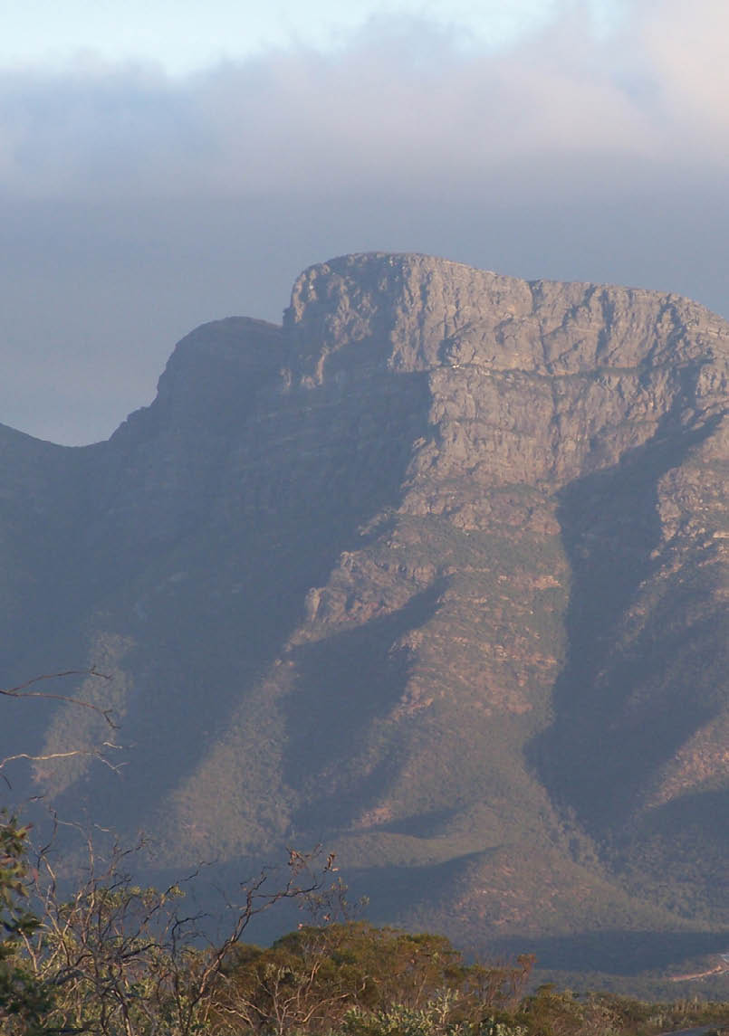


Bluff Knoll, Stirling Range National Park
6 km return, 3-4 hours, trailswa.com.au/Stirling Ridge Walk. The best “challenging” walk. Mostly completed as a multi-day hike, do it as a one day for a solid challenge. The trail is not marked, the terrain varies a lot - there are lots of scrabbles and hills to climb up and down. Rewards are many - the views are superb and the ridge line is ruggedly beautiful.
Bibbulmun Track
1000 km, Multiple days, bibbulmuntrack.org.au/Near on 1000 kilometres of trail from Kalamunda to Albany, 8 towns, jarrah and karri forest, coastal scenery and a life-changing experience.
Pilgrim Trail
201 km, 8 days, pilgrimtrail.com.au/This is an eight day walk that can be broken down into easy sections. It takes the walker from the busy CBD to the only Monastery town in Australia - New Norcia - founded in the 19th century by Spanish Benedictine monks. It travels through some of WA’s best state forests and has many stories to tell along the way.
Cape to Cape
135 km, 7 days, capetocapetrack.com.au/Fantastic coastal scenery, whales, wildflowers, karri forest, cliff top paths.

Bluff Knoll
Western Australia
BWA October 2014 | 15