


Western Australia Offers A Hike For Everyone
Edith Thomas, Western Walking Club

Western Australia might be one of the most isolated parts of the continent but it offers great hikes for the locals, people from the eastern states, as well as our numerous overseas visitors. Our unique landscape offers some incredible walks so it is no wonder bushwalkers return time and again for yet another adventure.
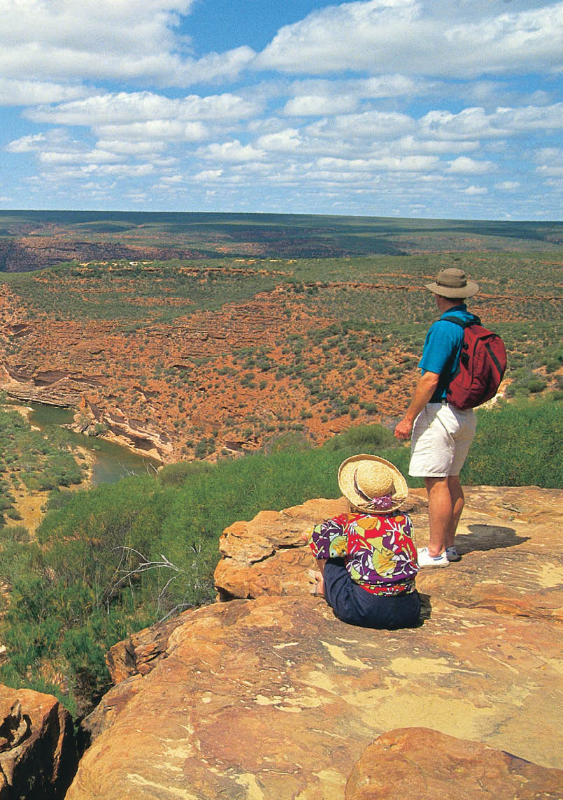
Wildflower and Hamersley Road, from East Mount BarrenCredit to Tourism WA
6 | BWA August 2015
Our best known bushwalk is the world-famous Bibbulmun Track. This fantastic asset offers a thousand kilometre long hike, winding through spectacular wilderness from the outskirts of Perth to the historic town of Albany on the south coast. It is a joy to wake in one of the shelters to the early morning bird song, with mist thick in the valley and the sun’s warming rays promising another glorious day.
In spring walking the Track is like walking through a beautiful garden surrounded by WA’s famous wildflowers. Be it orchids, a bush of vivid blue leschenaultia, or carpets of everlastings, nature is at its colourful best.
Bushwalkers are tough and plod along to the welcome haven of the shelter at the end of the day. To sit around the campfire, swapping stories with other walkers from all parts of the world makes it worthwhile. It is appreciated by all to be able to use the Track and the facilities for free. Eventually one arrives at a little town along the way where the welcoming town folk can provide a hot shower, great food and accommodation.
Slowly the Track winds through the forest towards the spectacular Southern Ocean coastline to follow towards the finish of the
adventure. Of course if one does not have six to eight weeks to spare, there are lots of opportunities to hike for an hour, a day or a week.
In Albany a favourite of ours is the Bald Head walk. The highlight of this 16 kilometre track is walking along a narrow ledge of the isthmus on the Flinders Peninsula. It is exhilarating hiking high above the rugged shoreline. Sometimes we take time to view yet another wildflower we have not seen before. Reaching Bald Head, a large granite rock is a good place for a lunch stop before heading back.
Situated in the Margaret River wine region, the Cape to Cape Track spans 135 kilometres between the lighthouses of Cape Leeuwin and Cape Naturaliste. This challenging but spectacular walk hugs the coast along pristine beaches, dramatic cliffs and through towering karri forest. To tackle the whole track in one trip is a great challenge (usually five to seven days), but multiple vehicle access points allow entry for day walks and shorter sections. The overnight options include some very basic camping areas for walkers only, campgrounds with more facilities and vehicle access and, this being a tourist mecca,
East Mount BarrenCredit to Edith Thomas
BWA August 2015 | 7
plenty of other accommodation right up to the highest levels of luxury and pampering.
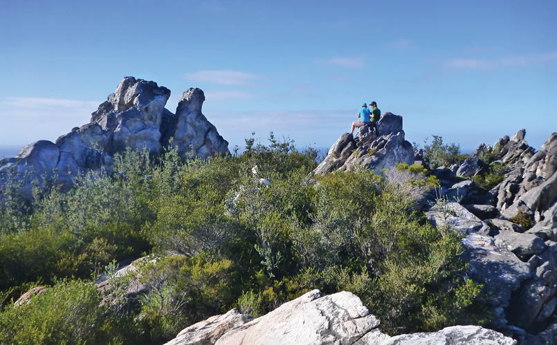
On the trail of the Queen of Sheba orchid we head for the Stirling Ranges in the Great Southern region. To hike up Bluff Knoll is very popular with visitors, but our favourite is Mt Toolbrunup. At first it is an easy hike up a small track in the forest. Slowly we pick our way up towards the peak and our effort is well rewarded. Reaching the top, a tennis court-size flat rock gives us a 360˚ view over the Stirling Ranges. We spy Mt Trio, Mt Hassell, Mt Talyuberlup, Mt Magog among others to be climbed another day. If one is lucky to be in the Stirlings at the end of August there is a good chance to find the elusive Queen of Sheba at the base of Mt Trio. If you keep your eyes open you will find dozens of different orchids amongst other wildflowers. For the more adventurous the Stirling Ridge walk will appeal.
For those who want to venture further afield Fitzgerald River National Park features a tantalising variety of landscapes to explore, from rolling plains, colourful breakaways, rugged peaks and headlands, to stunning bays and inlets where southern right whales shelter close to shore in winter with their newborn calves. Follow the Hakea Trail or visit the nearby West and East Mt Barren walks.
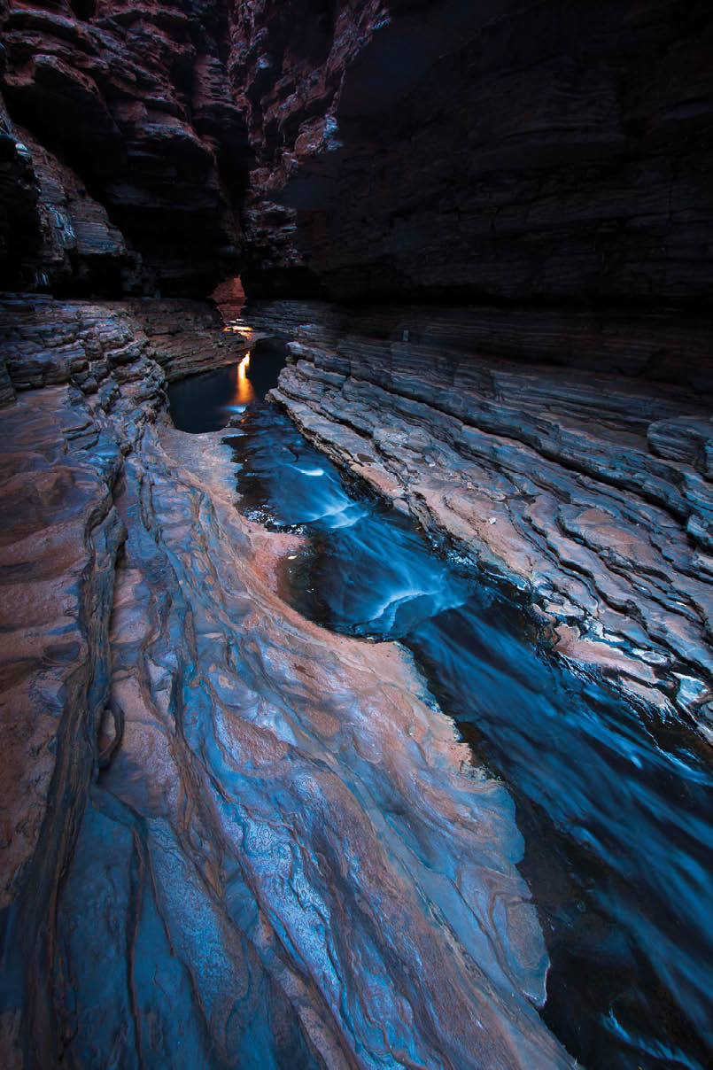
In the state’s north-west a visit to the incredible Karijini National Park is well worth the long drive. Here you’ll discover WA’s most spectacular gorges. A steep ladder leads down to Hancock Gorge. There is no track as such so we find our own way along the deep narrowing gorge. To proceed to the deep pool we need to place our feet on either side of the gorge walls while a stream gushes deep beneath us. The water is icy cold as the sun does not penetrate down here. We come upon a sign telling us not to proceed past here unless we registered with the ranger so return and descend the cliff to Handrail Pool at the other end of the circuit. Others later return to complete the hike, encountering numerous pools along the way. Stories of having to brave numerous cold water swims might not appeal to everyone - this adventure is not for the fainthearted.
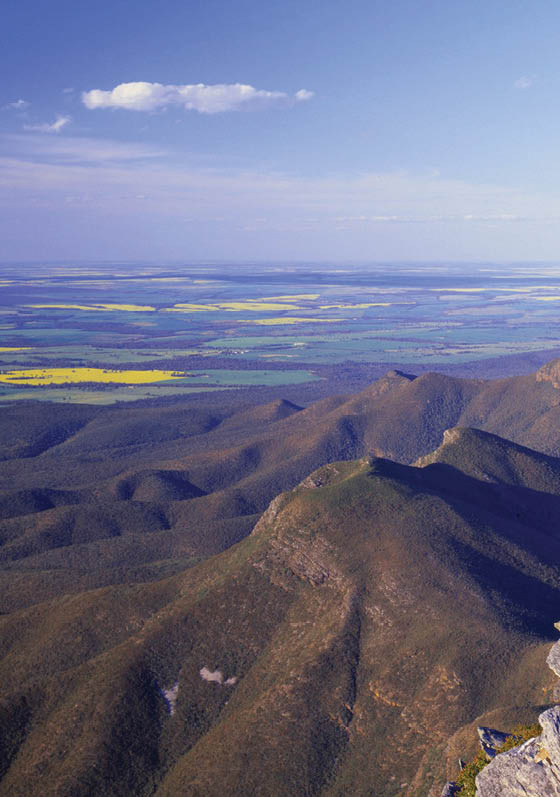
An easy but absolutely beautiful hike is from Fortescue Falls to Circular Pool. We descend along the falls into the gorge. The way zig zags among steep rock rich in iron-ore, rock gardens, rock gardens, and delicate ferns clinging to the cliffs. There is the opportunity to explore other walks, including Hamersley Gorge, before we continue to Mt Augustus. This 1000 metre high monocline, twice the size of Ayers Rock, offers two options to reach the top. We opt for the easier way up amongst the trees that give way to low scrub towards the top. The descent over huge boulders makes a great alternative. Back at the camp we watch a magical sunset over the rock.
The Kimberley region’s Purnululu National Park, also known as the Bungle Bungles, must be the most unique part of the country. While most of us think of the beehive-like domes it is famous for, there is so much more to explore in the area. Hiking in Piccanniny Gorge we marvel at natures might that carved the rocks into incredible shapes over the centuries. We meet a large water monitor lizard on the edge of a pool. Reflections of the beehives provide a perfect photo opportunity and the lizard does not seem to mind being the centre of attention.
Some distance away is Echidna Gorge. As we make our way along the gorge, feeling very insignificant amongst the towering rocks, the gap narrows as we head deeper, at times only a metre wide. There is only a sliver of blue sky above, then the sun lights up the gorge for a few awe-inspiring minutes. We make our way as far as possible, turning around when a huge boulder blocks our way. Interestingly it consists of small pebbles cemented together, unlike any other rock around.
This is a short introduction to bushwalking in WA. There is definitely something for everyone, from the tall Tingle Trees around Walpole, to the rugged Southern Ocean, to the real outback. From a short hike in John Forrest National Park to a multi-day hike on the Bibbulmun Track. Come on over and enjoy our unique part of Australia.
The following pages are a compilation of best walks based on a survey by readers from last edition of BWA.


8 | BWA August 2015


Western Australia


Bluff Knoll (Stirling Range)
6 km return, 3-4 hours, trailswa.com.auHighest point in Stirling Range (great views, particularly to the east). Also pops up in the “40 best walks in Australia” or whatever its called. The Stirlings are a tiny range in the huge flat area of WA - incidentally look up Elders not Bureau of Meterology (which goes to a salt lake about 100 kilometres away, the Stirlings can get snow....) Fantastic views, gorgeous flowers.
Bluff Knoll view from HeroCredit to Tourism Western Australia
Hancock Gorge (Stirling Range)
135 metres return, 10 minutes, parks.dpaw.wa.gov.auAncient landscape, deep red gorge, rock scrambling and swimming to do the walk, narrow chasms, waterfalls.
10 | BWA August 2015


Western Australia


Hancock Gorge (Stirling Range)
135 metres return, 10 minutes, parks.dpaw.wa.gov.auAncient landscape, deep red gorge, rock scrambling and swimming to do the walk, narrow chasms, waterfalls.
Banded ironstone passage in Hancock Gorge Tom Brennan
Competition: Photo of the year 2010
BWA August 2015 | 11
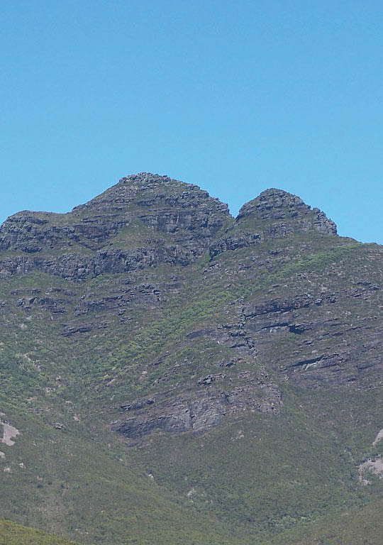
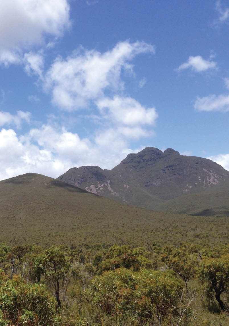
Toolbrunup Peak in the Stirling Ranges by Gnangarra

Western Australia

Toolbrunup (Stirling Range)
4 km return, 3-4 hours, parks.dpaw.wa.gov.auHighest point in Stirling Range (great views, particularly to the east). Also pops up in the “40 best walks in Australia” or whatever its called. The Stirlings are a tiny range in the huge flat area of WA - incidentally look up Elders not Bureau of Meterology (which goes to a salt lake about 100 kilometres away, the Stirlings can get snow....) Fantastic views, gorgeous flowers.
Mt Bruce (Punurrunha) Summit
(Karijini NP)
9 km return, 4-5 hours, trailswa.com.auSpectacular 360 degree views from the summit and the ridge, some short but fun scrambles.
Loop Walk Trail (Kalbarri NP)
8 km loop, 3-4 hours, fr.everytrail.comEasy walk in a wild setting, less crowded than Karijini and yet more spectacular and better thought out as a walking track.
12 | BWA August 2015

Western Australia


Cape to Cape (any section
which can be completed in a day)
20-25 km per day, capetocapetrack.com.au and Cape to cape guidebook (Jane Scott and Ray Forma) The track runs mostly along the coast. It makes use of old 4WD vehicle tracks, constructed paths and natural beach sections which are mostly sand. There are easy sections, which make excellent short walks, but some beach sections are long, and hard going if you are carrying a full pack. The full walk is well within the capability of anyone who is moderately fit, but walkers should be aware that the full walk is quite a challenge.
Mt Bruce (Punurrunha) Summit
(Karijini NP)
9 km return, 4-5 hours, trailswa.com.auSpectacular 360 degree views from the summit and the ridge, some short but fun scrambles.

Loop Walk Trail (Kalbarri NP)
8 km loop, 3-4 hours, fr.everytrail.comEasy walk in a wild setting, less crowded than Karijini and yet more spectacular and better thought out as a walking track.
Loop Lookout Kalbarri NPCredit to Tourism Western Australia
BWA August 2015 | 13

Castle Rock (Porongurup NP)
3 km return, 2.5 hours, trailswa.com.auThe Pongorups are a small ridge in a flat area, wonderful views, lovely shady walking, helmut and spider orchids. There’s a skywalk at the top of Castle so even those of us not into scrambling can reach the top. Oh, and there are great wineries in the area... sensing a theme here?

Western Australia


Cascades to Gloucester Tree
(Gloucester NP)
12 km return, half day, trailswa.com.au Well, I like to do it as a loop. There is a tourist tram which goes from Pemberton to The Cascades, a national park with a lovely walk around - yes, cascades. Cross the tramtrack and management trail and you will find the Bibbulmun track - so one gets to do a very pretty part of this iconic long distance walk. It goes for about 6 kilometres or so along Eastbrook, from there to the Gloucester tree which is one of the old firewatch trees. From there, 500 metres on the other side of the highway is the Gloucester Ridge winery - great lunches and wines. And it doesn’t matter if you over indulge, it’s an easy 3 kilometres mainly sealed path back to Pemberton. If the idea of carrying a credit card instead of a soggy sandwhich appeals, you can head off in the other direction (ie out of Pemberton, I think northbound Bibbulmun) the next day towards Big Brook Dam. One of the several “heartbreak hills” in this area, but from Big Brook Dam its 500 metres to the Hidden River Estate which is particularly welcoming to families hiddenriver.com.au/
Wanamalu Trail (Francois Peron NP)
3 km return, 1.5 hours, sharkbay.org.auGreat scenery with the ocean, red sand cliffs, yellow crabs, birds, dugongs, turtles etc... The walk is too short though and one way.
Escarpment Trail (Kennedy Range NP)
3.4 km return, 3 hours, parks.dpaw.wa.gov.auGreat isolated park, amazing camping spot. The walk is easy and fun, to the top of the range with great views.
Gloucester National ParkCredit to Tourism Western Australia
14 | BWA August 2015

Western Australia

Mt Augustus (Burringurrah) Summit
(Mount Augustus NP)
12 km return, 6 hours, trailswa.com.au Great views, aboriginal art, options of different routes to and from the summit.

Castle Rock (Porongurup NP)
3 km return, 2.5 hours, trailswa.com.auThe Pongorups are a small ridge in a flat area, wonderful views, lovely shady walking, helmut and spider orchids. There’s a skywalk at the top of Castle so even those of us not into scrambling can reach the top. Oh, and there are great wineries in the area... sensing a theme here?
Hikers Mt Augustus National ParkCredit to Tourism Western Australia
BWA August 2015 | 15

Cape to Cape Redgate BeachCredit to Tourism Western Australia


Cape to Cape Track
135 km one way, 5-8 days, capetocapetrack.com.au and Cape to cape guidebook (Jane Scott and Ray Forma)Stunning, spectacular coastal scenery, beaches, whales and dolphins, coves, some inland sections of forests, heaps of variety, and carpets of wildflowers everywhere in Spring, esp October!
Some prefer it as a series of day walks - check out “walking in circles” which is day walks based on the cape2cape. And don’t forget the Meelup - which perhaps should have been in my favourite day walks - its an extension to Dunsborough which is a lovely and very easy section from Dunsborough to Cape Naturaliste which takes in Eagle and Brunker bays. Some of the prettiest beaches around, great wildflowers. Oh, and wineries in some sections. Also, Contos is one of the best camps you’ll see.


Western Australia
16 | BWA August 2015
Stirling Rangeby Traveltelly


Stirling Range Ridge walk (Stirling Range)
28.8 km circuit, 3-4 days, Mountain Walks in the Stirling RangeThe only alpine multiday walk in WA. Great scenery and wildflowers. The Stirling Range Ridge walk offers a great escape from the typical dry and arid landscape that is more typical for Western Australia. The walk is more of a route than a track as is not marked apart from some rock cairns, but is fairly easy to follow as in most parts there is a reasonably worn path through the vegetation.

Western Australia
BWA August 2015 | 17


Bibbulmun Track
1002 km one way, 6-8 weeks, bibbulmuntrack.org.auSuperb mix of tall temperate forest and coastal scenery. The Track takes walkers through towering karri and tingle forests, down mist-shrouded valleys, over giant granite boulders and along breathtaking coastal heathlands. It passes through many of the most beautiful national parks of the south-west forests and coastline.

Western Australia
East of Dingo Beach GSCredit to Tourism Western Australia
18 | BWA August 2015


Hakea Walk Trail (Fitzgerald River NP)
23 km one way, 2 days, trailswa.com.auRemoteness.
Western Australia

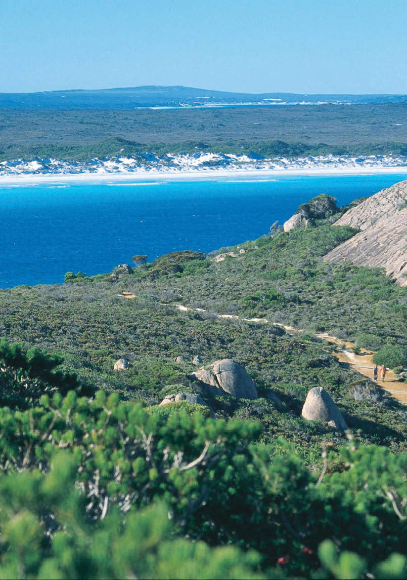
Cape le Grand Coastal Trail
15 km one way, 8-9 hours, trailswa.com.au
Goodness they seem to have listed it as a day walk. I thought it was longer; you’d certainly need shuttles for one day. Anyway there are excellent camps en route. Some of the most beautiful beaches in Australia, interesting wildlflowers, spider orchids just about any time of the year...

The Kimberley
The Kimberley is one of the last great wilderness areas, with less than 50,000 people living in an area twice the size of Victoria. The scope for walking is massive, from the major rivers like the Mitchell, Drysdale and Charnley to the ranges of the Carr Boyds and Cockburns.
BWA August 2015 | 19
