
A failed attempt at the Viking circuit in the mid-nineties has haunted me for some time. I was younger, forgot the map, a terrific storm blew in and I exhibited the early signs hypothermia. It's taken about 20 years to stomach another crack at Victoria’s premier wilderness circuit and so with a party of four chaps from the Blisters and Chafers Society and nineteen years more experience I have faced my demons. I have cleared a debt.
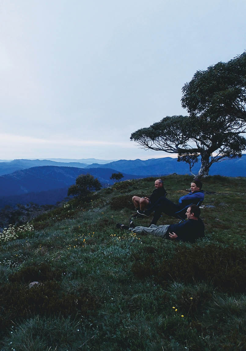
Michael Johnson, Anthony Kost and Julian Nikadie at Speculation summit at dusk on day 3 Patrick Platt

Viking Circuit
Anthony Kost

6 | BWA June 2018

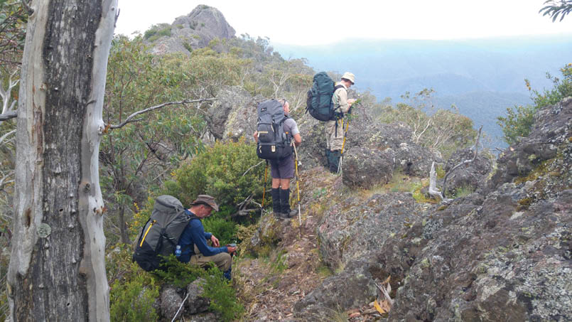
Razor on day 3Michael Johnson
We mustered at my HQ at 1630 hours on Friday 15 December 2017. The weather outlook was too be fine. Hot weather in Melbourne and slightly lower temps up high. With Platt’s car loaded we snaked through peak hour traffic on the freeway until it fanned out at Pakenham. Dinner stop was La Porchetta’s in Traralgon. Unfortunately we cannot report good value for money at this establishment. A fuel stop at the Timberline garage in Heyfield at 9pm (just before the shop closed) and then onto Licola, and the mighty 72 kilometre Tamboritha road. Three or four big red deer were spotted on the road and they made no haste in escape as we drew close. We made Howitt Hut by 2330 hours, set up camp and retired, spent.
Day 1- Howitt car park, Zeka Spur, Wonangatta RiverRising at 0700 hours to a bright sunny morning we assembled for a cooked brekky at the table near the hut and then prepared for launch. After the short drive to the Howitt car park we donned gaiters and lengthened poles. A quick pack weight check revealed some awful truths.
Kost 27 kilogramsJohnson 24 kilogramsPlatt 22 kilogramsNikadie 18 kilograms
No time to dwell on mistakes, we signed the intentions book and took to Clover Plain. Time check 0937 hours.
At spot height 1640 and 2.7 kilometres on the plain we came to the sign indicating Old Zeka Spur Track. There is no discernible track or foot pad. With the Avenza map app on hand we located ourselves and set a course, looking for the spur-like features. It wasn’t long before we found the remnants of the track being cut in, and followed it as best we could but we thwarted a lot of the time by fallen trees. Fallen trees became significantly worse and capped our pace. Every 10-15 minutes we verified our position with Avenza. After 5.2 kilometres and a spot height of 1380 metres we reached the Zeka Track at 1315 hours. We had a bite to eat and then slogged it out on the red dirt track for 4.9 kilometres. Whilst it may be a decent track for vehicles, walkers find it pretty dangerous, particularly those carrying first day loads. Steep and very slippery underfoot, much mental energy is expended as one tries to claim a firm surface to launch. The Helinox DL145’s were capable. We did pass a flowing soak that
“Whilst it may be a decent track for vehicles, walkers find it pretty dangerous, particularly those carrying first day loads.
BWA June 2018 | 7

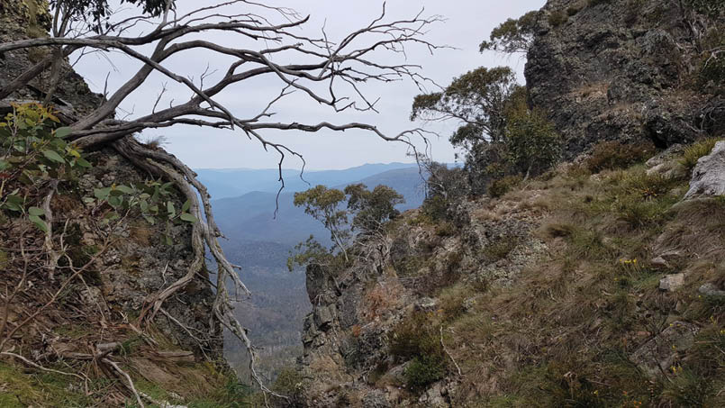
Between Razor and Mount Despair, day 3Julian Nikadie
was a welcome relief and we all drank and dabbed our foreheads. At spot height 748 metres (no marker or cairn), you can spot the old Spec road that goes up to Catherine Saddle. With its Road Permanently Closed status, it is now pretty overgrown and we elected to go bush again following a rough bearing down the spur to the river about 1.5 kilometres.
We made the river flat by 1710 hours. There are suitable campsites by the river and we spread out to give the snorers their own space to practise. After hydration and bathing of sorts, we turned our attention to meal prep and whilst hunger was not foremost on our minds, post a very athletic day we knew an appetite would soon be stalking us. Pulled pork was heated in the bag, a coleslaw mixed and wraps laid out. A special tangy bbq sauce got those taste buds jumping. Mozzies were starting to bother us in the dusk hours, we cleaned up and retired to single man’s quarters by 2030 hours.
Day 2 – Wonangatta River, Viking, Viking SaddleWe were all up by 0530 hours striking camp. One of those items that could have been left behind was the AeroPress, but alas it was not, so Johno and I enjoyed a triple shot coffee in the dawn. Weather was fine, not cold at all, in fact all the chaps reported
that the sleeping bag was draped over their bodies, far too warm to be in it. By 0730 hours we were all across the river, booted up again, and drank our litre before departure. Some of the men were fortunate enough to be able to tend to ablutions which always make for a terrific start to the day. We picked our way through the river flat following deer pads which were quite obvious. A little machete work made getting through blackberries a bit easier. The deer pads led us to a couple of wallows and then conveniently started up the spur. We stumbled upon more of a human foot pad which we suspected goes down and meets the spec road. Someone had been along this pad in the last year or so with either a machete or shears cutting some of the woody regrowth at the base, making following the track a hellava lot easier. There is some fallen timber but not nearly as bad as old Zeka. By 1030 hours we arrived at spot height 1204 metres, doing a whopping 2.34 kilometres in distance. The spine of the spur is quite rocky, and there is some cairn work reassuring the walker. The cloud had now cleared and it was sunny. The humidity of river elevation (about 610 metres) was now past us.
“There are suitable campsites by the river and we spread out to give the snorers their own space to practise.
8 | BWA June 2018

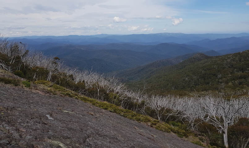
Between Catherine Saddle and Speculation, day 3Michael Johnson
At about 1130 hours we stopped for lunch amongst a rocky outcrop. Ants were keen to traverse our sweaty bodies. We moved around. We continued the push, once again through fire regrowth, rocky outcrops, fallen trees. You get the lot when coming up this spur. It was getting hot. The men of stamina mantra was wearing thin. Up ahead we could see snowgums and snowgrass features in front of a protruding ridge behind which was blue sky. This was promising, a small sign that we were making good work of the spur. Upon checking our maps it was indeed the spur that directly connects with the South Viking peak. We consolidated in a flurry of breathing and wiping of brows and at 1425 hours we made the peak, spot height 1502 metres. A cairn was acknowledged and photos taken. The party was keen to make Viking Saddle and have the water question answered. We were sick of carting the water surplus if fresh water were to be available in the saddle. Views were spectacular.
We inched our way down off the peak and across the mini saddles and spot heights to reach the rocky on ramp of the viking. We tracked up on an angle with poles ever so helpful. At spot height 1519 metres, we removed packs, lapped up the intermittent breeze and took in the 360 degree views that the Viking offered the party. Whilst resting we searched for the track down as there are
no AAWT markers or even a visible foot pad. The saddle and toil's end was only about a kilometres in distance away but we had to drop to spot height 1100 metres. The track down would be tricky, as we were all pretty spent. After some of our own track making, we came across the more substantial foot pad and followed its descent through both chimneys. The second chimney is more substantial with a rope permanently knotted. One of the chaps had a spill but was okay. As we dropped elevation we once again found ourselves dealing with fallen timber over the track that further sapped our weary bodies. At 1805 hours were welcomed into the grassy embrace of Viking Saddle. Packs were dumped at tent spots and those *&%$#! boots were removed.
Patrick set off in search of water with a radio. He would call us down with what we hoped would be good news. There was a faint but recognisable foot pad to the east that headed down into the gully for about 200 metres. At the creek crossing, which was dry, we crossed and then about 20 metres further down there is a small but usable spring with good flow. The water was icy cold; it was like drinking cold beer. We drank until we were silly with rehydration, loaded the bladders
“We drank until we were silly with rehydration ...
BWA June 2018 | 9
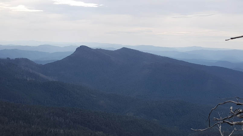
Viking Saddle, The Viking and South Viking from The Crosscut SawMichael Johnson
then headed back to camp for evening duties. Our appetite was slow to peak, given the very physical day but by the time Patrick’s mango cashew curry came around we were ready. We ate through dusk with the usual mozzies and flies and retired content by 2030 hours.
Day 3 – Viking Saddle, Razor, Despair, SpeculationIt's another 0500-0530 hours start to the day, Glorious high country morning. Porridge, nose bags and AeroPress coffee. With morning ablutions taken care off we departed the saddle at 0700 hours with a warm northerly blowing. It would be a warm day on the track. It's about a 1.2 kilometres slog to The Razor and I would estimate the first 700 metres distance (uphill) is beset with fallen timber which makes for really slow going. And then a miracle. A miracle delivered to us humble tax payers from the very department to which sometimes we curse. Chain saw action. It would appear that sturdy folk from Parks Victoria are cutting their way through to Viking Saddle with a bit of strategic brush cutting and heavy
chainsaw action. The cuts were fresh. We praise the department for their wisdom. Our pace and wellbeing picked up proportionally.
At 0830 hours we reached The Razor (1322 metres) and took a break. We took time to look back at from whence we came and wallow in pride. We harnessed up and navigated around The Razor towards Mount Despair. Lots of great views are afforded along the rocky spine and the track is easy to follow. As we wound our way up Despair we commented that the track clearing lads have not been through this section as it could do with a bit of pruning. We ran into a couple of blokes day tripping to The Viking, had a brief chat, offered some intel and continued our push to Despair and Catherine Saddle. Luncheon was looming. It's another steep slippery descent into the lovely grassy saddle at a spot height of 1200 metres. The old Speculation logging road is still clearly visible but I wonder what it is like further down as it reaches the river. It’s 1150 hours at Catherine Saddle and we feast and water under shade. Some of the chaps enjoyed a 20 minute nap.
At 1310 hours we were harnessed. There are two options for the next leg. Take the walking track up Catherines pinch or walk the Spec logging road. We took Catherines pinch. It was hard, no real track, very loose, fallen trees and given the time of day hot and
“ It would appear that sturdy folk from Parks Victoria are cutting their way through to Viking Saddle with a bit of strategic brush cutting and heavy chainsaw action.
10 | BWA June 2018


Julian Nikadie approaching the Speculation summit. Razor in the backgroundPatrick Platt
sweaty. The logging road may be 30 minutes longer but contours around the hill and has a locked gate at Speculation. If I was going again I would probably opt for the road, even if it was just for the change of scenery. We dumped packs at the junction and with bladders in hand walked about 700 metres distance down to Camp Creek, which was flowing well. We filled water bottles, bathed, drank a fair bit before heading back up the hill to pick up our packs and lug all that water about 500 metres distance up to Mount Speculation summit, 1668 metres, where we camped. We had the top to ourselves and practised the society's dispersed tent policy with a designated camp kitchen established with a view. The official end of day time was 1710 hours. Johnson was on meal duty this evening and duly served a thai curry was a pearl couscous. A brew was boiled as dusk greeted sunset and we spent some time marvelling the peaks about us. Bed by 2030 hours.
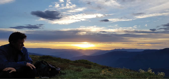
Day 4 – Speculation, Crosscut Saw, Mac SpringsRoutine dictated the 5 am start and so it was. Our luck with good weather afforded us a superb sunrise. It was now day four of the walk and we were well oiled. Striking camp
by 0700 hours had become easy. We drank our excess water and begin our descent of the steps of Mt Spec. Our first stop was the Horrible Gap at 0805 hours, a packs on five minute breather before taking on Buggery at spot height 1608 metres. At Buggary at 0850 we had photos and pushed on towards the ever-visible Crosscut Saw. Divine walking with conditioned legs and our head pointed to Mac Springs, views either side in excellent weather conditions. We met a chap on his way to Canberra. Brief chat, but I suppose he would be in a hurry to beat the serious summer issues of lack of water. We crossed paths with a small snake sunning himself on a ledge that I was pulling myself onto. Alert to my presence he was keen to exit. As I pulled myself up onto the ledge the other chaps were standing behind, not moving, just chatting and I was using my pole to make some vibrations. Unbeknownst to them until it had passed, the snake had gone right through the legs of Patrick and down the hill. He was only a baby. The snake I mean, not Patrick.
“The logging road may be 30 minutes longer but contours around the hill and has a locked gate at Speculation.
BWA June 2018 | 11


Up and over and around the teeth of the Crosscut we made the junction and turned for Mac Springs. This last 1.2 kilometres was tough. Conversation had dropped and the men strung out, going at their own pace. Goal orientated. Gantner Hut 1300 hours, spot height 1604 metres. Dropped packs, lulled about bootless. It was the earliest time we had made camp and we were loving it. Some lunch, coffee in the hut. Life was good.
The balance of the afternoon was spent lounging around reading the hut book, the odd banter and waiting for someone to call dinner. The evening meal was a rehydrated dahl and couscous which was prefaced with a light voluntary contribution happy hour that was designed to assist with “ration zero”. Ration zero, not exclusive to the society, is the policy of making it back to the car with no food in your Dilly bag. We are always trying.
Near the end of the walkAnthony Kost
Anthony Kost at dawn on day 4. The Terrible Hollow his focusMichael Johnson
12 | BWA June 2018


Anthony lives in Melbourne and walks Victoria when he is not working in IT. He has been walking with the Blisters and Chafers Society since 2005.
By 2000 hours we were done. The weather was changing. Dark skies over yonder from the west. We retired to tents by 2030. Come 2045 hours all hell broke loose in the form of lightning, thunder, gusting wind and good solid rain. When one has confidence in one’s single man quarters and you're buggered it is a joy just to lie back, watch and listen. Well, we did that for most of the night whilst this big storm rampaged through the lowlands and then up high. Listening to the wind come up the valley and through the trees was quite an experience.
Day 5 – Mac Springs, Howitt car parkA bit after 0500 hours and in calm conditions I came down to the hut. A new body was bunkered down. The sound of the door and the light streaming in awoke her. My apology was met with a calm admission of “I should be getting up anyway” With pleasantries out of the way I prepared the morning porridge and coffee. Marie came in from the car park last night and was set up on one of the top
camps on the way to Howitt. Seeing the weather rolling in she elected to retreat and seek shelter in the hut. She was heading out to Spec and back.
All the chaps joined me at the table for breakfast noting good sleep in the midst of the light show. No tent damage and a dry night for all. By 0700 hours we were bidding farewell to Gantner Hut in sloppy drizzle, the stuff that just requires a raincoat. Pace was good and we made the car by 0800 ish. Mission Complete.

Howitt Car Park, the party jubilant. Julian Nikadie, Patrick Platt, Michael Johnson, and Anthony KostPatrick Platt
Toilet at Mac Springs


BWA June 2018 | 13