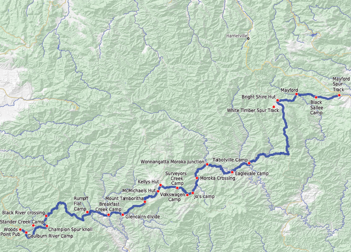


McMillans Track is a lesser known cousin of the Australian Alps Walking Track (AAWT). But combined with some spectacular scenery and the sheer remoteness of much of the track, McMillans may be less walked but it is a gem of a track in the Gippsland high country. More people should walk it.
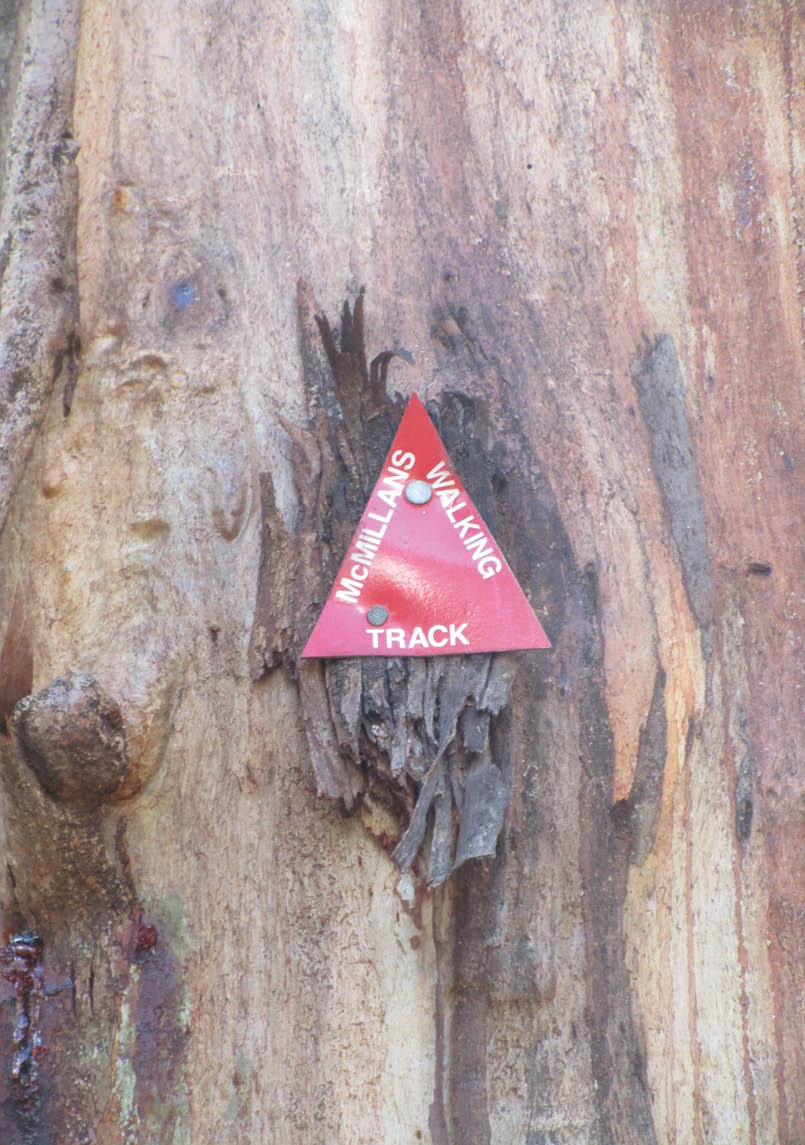
McMillans Track markerAll uncredited pictures by David Bell

McMillans Track
Victoria
David Bell

6 | BWA August 2019
So, who was McMillan?Angus McMillan was an explorer and pastoralist in the Gippsland region from the late 1830s. He has a controversial legacy due to his clashes with Aboriginal people. However, in 1864 he was called out of semi-retirement to cut a track linking various Gippsland goldfield settlements.
Once the gold ran out, the track fell into disuse and became overgrown. However, from the 1960s members of the Ben Cruachan Walking Club (BCWC) began to investigate, document and mark what they thought was an accurate alignment of the original McMillans Track and began maintaining it. With the assistance of the Victorian Government this track alignment was brought up to a standard where it was officially re-opened in 1988.
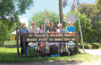
The present track runs for 220 kilometres from Woods Point, south-east of Mansfield, to Cobungra, west of Omeo. Thanks to the ongoing efforts of the BCWC and various land management agencies, the track remains walkable, although sections of it are hard to follow and require remote area navigation skills.
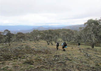
The big adventure beginsA party of six from Sydney Bush Walkers and The Bush Club left Cobungra on 16 November 2018 to undertake a 14 day walk to Woods Point. We had two food and water drops near Arbuckle Junction and Mount Shillinglaw.
The first day was a short and cruisy walk into Black Sallee campsite. The second day was more challenging involving a very steep descent along an old fire trail down the Mayford Spur, across the Dargo River and an equally steep ascent up Treasure Spur to reach our campsite next to Lankey Plain Hut (1550 metres) on the Dargo High Plains.
The original McMillans route took walkers along the Dargo High Plains Road for 25 kilometres or so but we avoided a road bash by following some more recent track
markers across country to meet up with the White Timber Track. This alternative route to the road is relatively easy to follow though navigational checks were required in places. This route took us down to the junction of Thirty Mile and Twenty-Five Mile Creeks. Here we set up camp at a really beautiful but rather cramped site. It also afforded the first of many opportunities to cool off in a creek.
The next section of the walk follows about 10 kilometres of what eventually becomes the Crooked River and had a reputation for being unwalkable due to the amount of regrowth on the track. However, recent work by volunteers has markedly improved the track and we encountered no difficulties. We eventually reached a campsite near the old gold mining settlement of Stonewall.
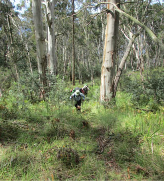
A steep climb up Treasure Spur
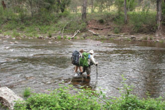
Crossing the fast flowing Macalister River in pairs
“... track runs for 220 kilometres from Woods Point, south-east of Mansfield, to Cobungra, west of Omeo.
BWA August 2019 | 7
The track then followed the Crooked River including over 25 river crossings as we meandered along a vehicle track. This took us to Talbotville, another old gold mining settlement of some note, and then onto the Wongungarra River for the next campsite.
Leaving the Wongungarra we had another steep ascent and descent over the Cynthia Range to reach the Wonnangatta River which we crossed on a suspension bridge. We then headed up the river with glimpses of Snowy Bluff to another terrific campsite just below the junction of the Wonnangatta and Moroka Rivers.
The next day was quite tough as we turned up the Moroka River and attempted to follow the track markers. After passing through the beautiful Moroka Glen the track took us away from the river. McMillans original line tended to keep high above the river and we followed some old track markers to a saddle about 500 metres up. Here another marker directed us to descend but the markers disappeared as did any semblance of a track. We decided to return to the river and stayed there criss-crossing it as we headed upstream. We also had one of several snake encounters, this time a red-bellied black curled up in the sun which declined to move away. So we did instead! Our camp was at the foot of an old fire trail and we settled in before rain arrived.
The following day was marked by a big ascent, initially up Playboy Creek and then to Beths Saddle. After a short side trip to Beths Peak (1125 metres) we reached the start of the old D4 track to our first food drop at “Volkswagen” camp just below the Moroka
Road. The weather began to deteriorate just in time for happy hour which rapidly became happy ten minutes as with shivering hands we gulped down the red wine and retired to our tents. We subsequently learnt that the weather was worse than we experienced, with snow and wind at higher elevations. We were lucky to be camped on a sheltered side of the range.
Leaving Volkswagen, we ascended Mount Arbuckle (1581 metres) and descended through some beautiful alpine meadows to Kellys Hut. Our next camp was on Shaw Creek, a tributary of the Macalister River, and where we were able to get a fire going. The track then ascended to Mount Tamboritha (1509 metres). There was a rare sighting of a kangaroo or wallaby on the ascent. Again, the wildflowers were spectacular. After the obligatory photos by the summit cairn we descended steeply along a long and narrow spur to Breakfast Creek, a tributary of the Wellington River.
After pausing by the plaque marking the 1988 reopening of the McMillans Track, the next day’s walking combined with the track to The Crinoline (Mount Ligar). However, we bypassed The Crinoline (leave for another day) to steeply descend along a faint footpad to the Macalister River. We lost any sign of track trackers near the river but crossed the river in the right place anyway. This was the deepest and widest of our crossings but we got across without incident. Some more ascending and descending through farmland took us to a gate marked “Private Property No Trespassing”. The sign is not obvious
Descending Mount Tamboritha

Taking a break on the Moroka River near the Playboy Creek junction
BWA August 2019 | 9
End of the walk at Woods Point Karen Darby
to those travelling west but will confuse walkers heading east. Some more climbing and descending took us to Rumpff Flat, an enormous camping area which we had to ourselves.
The following day took us up the notorious McMillan Spur which for steepness rivals the earlier Mayford Spur. This reaches the Jamieson-Licola Road and after a road bash and diversion past Mt Shillinglaw (1301 metres) we reached our second food and water drop just off the Jamieson-Licola Road, and near where McMillans joins the AAWT. This time the weather was kinder and we had a proper happy hour.
On the home run now and our next descent took us to the Black River. This also marked our departure from the catchments of the rivers flowing to the Gippsland coast to the catchments of rivers flowing into the Murray. Sections of the track down to the Black River were in poor condition, mainly fallen timber and regrowth, though re-marking by the volunteers helped a lot. The Black River campsite was too cramped for five tents so we set up a dry camp about 500 metres south of the river on a small saddle below a rocky knob. Not ideal but so be it. The Black River camp was also the only time we heard wild dogs (about an hour before dawn).
Leaving Black River took us over the ridge and down to Standen Creek (a tributary of the Goulburn and an old goldfield settlement) and our last camp. The track has been recently cleared and is well marked. We got
in early for a wash in the creek. We also met up with the only bushwalker we encountered in two weeks, aiming to complete McMillans solo in six days. Indeed, we found out later that he did. As far as can be determined this is the quickest completion of McMillans.
We reached Woods Point around lunch time the following day, 30 November, after another stiff climb, this time to Johnson Hill.
All in all, McMillans was in better shape than expected, largely due to the efforts of the maintenance teams. It is still a tough walk but well worth the effort.
Information Ben Cruachan Walking Club has track notes.
Biography of Angus McMillan.
David has been bushwalking most of his adult life. He loves the outdoors, in particular long-distance walks. There are places that are remote and wild and it is a privilege to be able to visit them. He recently decided to write more about these places, hopefully encouraging others to also visit them or, if not, to at least enjoy reading about these places. He is a member of three bushwalking clubs and is involved in several campaigns to protect our national parks.


Solving the world's problems at our second food and water drop


10 | BWA August 2019