

Climbing the highest peak in each Australian state or territory is a challenge many people take on. The peaks are listed on State 8 website. In May and September 2019 I climbed two of these peaks.
At the top of Mount WoodroffeAll pictures by Rob Collins

Two State 8 Peaks
Rob Collins

12 | BWA December 2019
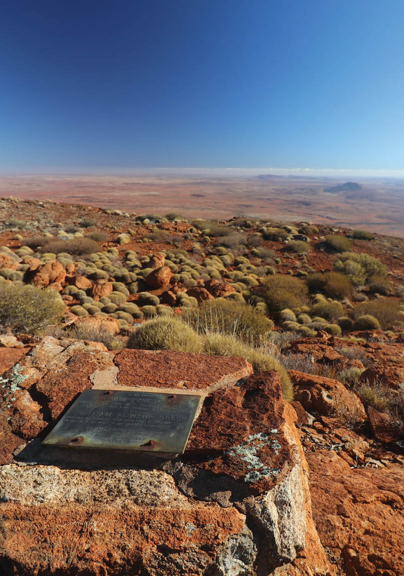
Mount Woodroffe
Mount Woodroffe, South AustraliaIn May 2019 I went on the annual SEIT trip to climb Mount Woodroffe, the highest peak in South Australia. There were 15 guests on the trip and everyone was on a State8 quest of some kind - why else would you climb such an obscure mountain? SEIT only run the trip once a year and cap it at 25 guests (or 15, as they use 10-seat offroad buses). You need to book well in advance through their travel agent Diverse Travel. I asked a few of the tour guides if the trip was an annual pain in the butt, or something they looked forward too - the answer was universal that it was a major highlight and something the SEIT team all tried hard to get on to.
We were picked up in a 4x4 Mercedes bus from Yulara on Friday morning and driven south on various unsignposted tracks over the border into SA where the APY permit-only lands begin. SEIT has an exclusive use of the area, being the only permit holding tour group. I learned that the owner of SEIT has spent many years touring the area and had gained the trust of the local land holders, and he works hard to maintain that trust.
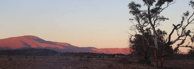
Our campsite was about 10 kilometres from the base of the mountain, and you can see the now-abandoned aboriginal community below, with the peak to the left.
Recent fires and then rain had changed things up since the 2018 tour. The toilet facilities had burned to the ground, but so had much of the spinifex on the mountain, which made climbing so much easier. SEIT
has a semi-permanent camp setup with a shipping container kitchen, rain water tank and even showers.
Camping was in provided swags with your own sleeping bag down in the river bed. Were were told there would be plenty of notification if it rained, since we could see the source!
Morning tea was provided en-route and lunch was had at the camp. In the afternoon, we were driven out to have a closer look at the mountain and plan our routes for the next day. There is no marked trail or even a commonly used “goat track” (except the ones used by the local wallabies, donkeys and camels) - it only gets climbed once a year by humans. Noting that the spinifex had burned away, the direct approach looked like a good option, so I checked around to the south anyway to see how that looked.
Next morning, we were up at 5 am to maximise the daylight. We were told that climbing times varied from just over four hours to 13 hours up and back (there are only 10 hours of daylight in May). UHF radios were part of the packing list, and most of us had one. Some small groups were formed and we all hit the mountain just as the sun came up. Myself, a fellow guest and one of the newer SEIT tour guides went up a little to the north for a mostly direct route up. The climb is only 750 metres, and the route we took was good - no real scrambling, hardly any spinifex and the top was generally in view most of the way with a few false peaks. Some climbers reached the top almost an hour before us as they called into base that the top was windy and covered in cloud. By the time we reached the top the cloud had cleared.
“There is no marked trail or even a commonly used “goat track” ...
BWA December 2019 | 13


Slippery boulders across the creek
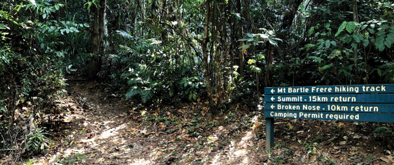
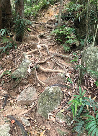
Start of the Mount Bartle Frere hiking track
One thing I learned coming down, is that it's best to use the same route. We didn't, and took the “scenic” route south, following a creek to keep away from the spinifex. It was a more arduous trek, but certainly more scenic. Almost at the bottom is a waterfall that is just that bit too high to negotiate, so backtracking was required to find another way down.
Everyone made it up and back safely, with only a few cuts and scratches and spinifex thorns. That night, we were fed BBQ corn, vegies, Northern Territory steak and stewed apples with custard and we all slept really well. The SEIT team were awesome and I would highly recommend the trip. The area is very typical remote, outback, red dust Australia, but there is 3G reception from the top of Woodroffe.
Mount Bartle Frere, Queensland Of the State 8 peaks, I was least looking forward to this one and didn't really have a plan to do it soon. However, an opportunity came up (via a work offsite in Port Douglas - tough days at the office!), it was the right season and it had been a dry, dry season so I figured low leech population and less chance of rain. I arrived in Cairns at 12.30 pm, picked up a rental car and a bottle of stove fuel from the local Anaconda, had lunch and drove down to Josephine Falls car park. Being a Sunday, the car park was full, but someone was leaving as I arrived. My original plan was to camp at Big Rock on Sunday night, then at the Eastern Summit camp on Monday night and walk out Tuesday. I headed off, everything packed into a Gossamer Gear Mariposa pack.
Day one – To Big Rock campI'd read somewhere about stinging trees and a sign at the start of the track talks about neurotoxins that cause pain for months - there were plenty around, but I avoided them all. The track to Big Rock camp (and the turnoff to Broken Nose lookout) is not too bad for a barely maintained earth track in an FNQ rainforest. It's not too steep during this part, with only a few steeper sections. There is a spot where two or three creeks come together and must be crossed via slippery boulders, which I expect would be just basically swimming across in a wet season.
14 | BWA December 2019
Its a magic spot, deep in the rainforest there. I hadn't seen any leeches, so didn't bother putting my gaiters on. I'd treated my clothes with pyrethrin. Last time I was bitten by a leech, I nearly passed out the next day as best man at a wedding. I have pretty thin blood and once they let go, I keep bleeding for hours.
I arrived at about 4 pm and set up camp. There are three lovely clear spots and one or two smaller ones, and the nearby creek provides plenty of white noise and is the last reliable water before going on.
At this point, I found out that my stove did not work - I think a small piece of wax or grit got into when I first attached the fuel canister. I also found out that not every Victorinox army knife includes the pin under the corkscrew - I couldn't get the stove to go no matter what. (At home I fixed it in a second.) So I changed my plans - up and back to the campsite the next day, leaving the tent set up. Walk out early Tuesday morning for a big brekky in Innisfail. I had salada with cheese and salami for dinner ... There were a few mice around, but my food was hung up in a tree.
Day two – The summitI took my Mike's Undercling sleeping bag and S2S Ultralight insulated mat in case I had to sleep in the emergency shelter. I also had four litres of water - three in a bladder with some electrolytes and a litre bottle of fresh water for the return trip. A fellow hiker (in jeans) startled me at 7 am as I was getting ready to head out. He was local and does the trip a couple of times a year, whenever the weather is “just right”. He'd started from the car park at 5.30 am. I passed him just a few minutes later. The hike from Big Rock to the first boulder field is steep, at times just ladders made of tree roots, often along a ridge with steep drop offs and no more water.
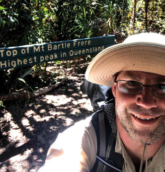
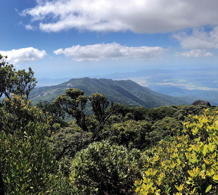
I met a couple of guys coming down who had camped up top. They did not have a good night - very windy and cold, and I was glad I decided to camp lower down. The first boulder field is over quickly and I reached the emergency shelter around 10.30 am and had some morning tea. There is a lot of rubbish around, which is a real shame - broken tents, a 3 kilogram gas bottle and lots of empty plastic water bottles. About 11 am I headed on up into the second boulder field - it was a little windy, but otherwise perfect. The scrambling required is pretty tricky and there are big drops where it would be hard to get back. There are steel bars in some of the harder spots. Before I knew it, I’d reached the summit about an hour later. A few metres away is a boulder affording a nice view.
Ladders made of tree roots. It's steeper than it looks.
Rob at the top of Mount Bartle Frere
BWA December 2019 | 15
A few selfies, then it was time to head back down. Again through the boulder field, I found a couple of easier routes this time and going down is always easier. Back at the emergency shelter I met up with Mr Jeans who was just about to head off to the summit, so he was about 90 minutes behind me. I also spotted someone in green shorts who had skipped the hut and was ambling up the track. With my hiking pole out, I headed back down to camp. I got back about 3 pm and Green Shorts came through about an hour later - a Swedish girl just smashing the mountain out. Mr Jeans came through at 6 pm - he had a torch, so he was good to finish in the dark, but it was a 14 hour day for him!
Back at the place where the creeks meet, I'd thrown my hiking pole across and the handle landed in a swampy area, which is probably how I got a leech on my little finger. I flicked it off before it got too settled and didn't see any more. Back at the car park on a Tuesday morning, and my car was the only one there. I changed in the toilet block and headed to Innisfail for one of the best big brekkys I've ever had.
In general, the track is reasonably well marked - if you can't make out the track, there is usually an orange marker somewhere. My legs hurt for the next three days, mostly lactic acid in the quads. I try and always use a hiking pole for descents to prevent knee soreness after learning the hard way on the Milford Track 20 years ago.


View from the top of Mount Bartle Frere
16 | BWA December 2019