
Back in July 2017, my wife Rachel and I did a five day bushwalk/packraft in Katherine Gorge. I thought I'd write up our experience, since there were lots of things that we found that would have been useful to us in planning the trip, and so may be useful to others.
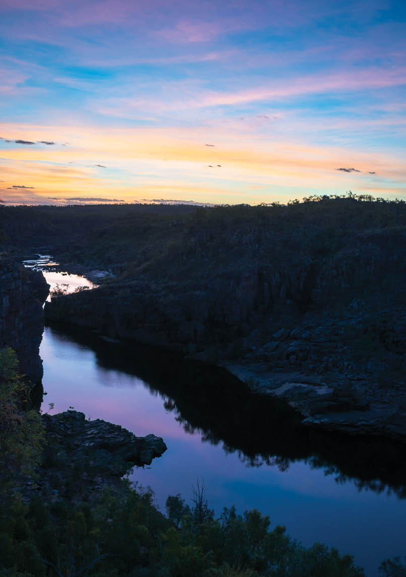
Sunset at Smitt RockAll pictures by Tom Brennan

Nitmiluk Gorge
Northern TerritoryTom Brennan

6 | BWA April 2021

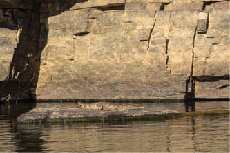
Upstream from ninth gorge
GeneralAny overnight walking in Nitmiluk NP requires a permit. You can book by phone, but you need to pay when you get there. The Visitor Centre opened at 7 am (even though the website says 8 am!), so we were able to get away reasonably early. You'll need exact money as you have to put it into an envelope, so bring some change. The cost is $3.30 per person per night as of March 2021.
The crows are very used to campers, so secure all of your food - and other items - if you are near any of the official campsites.
Daytime temperatures are very hot, so it's best to be walking early, and have most of the walking done by lunchtime. Walking on the tops is quite exposed to the sun, and the rocks heat up and then start radiating heat in the afternoon. It is cooler in the gorge, as there is often shade.
WalkingThere are two main routes to get to Smitt Rock and eighth gorge. The Yambi Walk (inland route), which mainly follows vehicle tracks, and the Waleka Walk/Windolf Walk (cliff route) which crosses rough country. We took the latter, so the only info I have on the Yambi Walk is what I've read elsewhere. See the guide.
In general, the Waleka Walk is pretty rough, and this is coming from someone who does a lot of off-track walking. By rough, I mainly mean rocky underfoot, and slow going (1-3 kilometres/hour). It is not technically difficult, just slow and rough.
The route is marked every 20-50 metres with green arrows. However, the further out you go, the less of a track there is and you are really just following arrows. The arrows are difficult to spot. Partially because they are green (on a white background), and mostly because they are in the shade. They usually hang from trees, and since you're walking generally north-east, the sun is behind them more often than not. They would probably be easier to spot in the opposite direction. We were wearing approach shoes, which we often wear for multi-day canyons in the Blue Mountains, but if I had my time again, I'd have worn my proper walking shoes, as my feet were killing me by eighth gorge. There are no significant elevation changes (50-100 metres tops).
All of the tracks are marked with arrows hanging from trees every 20-50 metres. Different coloured arrows mark the different tracks.
“... the further out you go, the less of a track there is ...
BWA April 2021 | 7
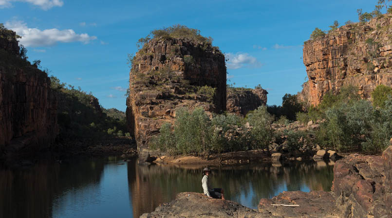

Smitt Rock
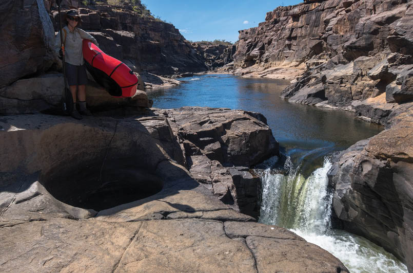
PaddlingThere are 13 gorges, separated by rapids. It's not always clear which rapids are gorge boundaries, and which are just rapids within a gorge.
No paddling is allowed in gorge one. From second to fourth gorge, it's pretty busy during the day, as all of the day trippers paddle upstream from second gorge. Few day trippers go upstream of fourth gorge, so it's much quieter, with typically only overnight paddlers. The portage at seventh gorge is a long one, so above seventh gorge you're likely to have things to yourself.
Packrafts make the paddling slower, but the portages easier, since you can tuck the rafts under an arm. Some of the portages involve scrambling over large boulders and can be pretty tricky even without a raft or canoe. It was quite windy when we were there, which made the portaging difficult - parkrafts are like an inflatable sail!
There are three main campsites for paddlers in the gorge - fourth gorge, on the opposite side of the river to the walkers' campsite, sixth gorge and ninth gorge. The last doesn't have a toilet.
Drinking waterThere was a lot more water available than we expected. Other than in Katherine Gorge itself, we found flowing water:
in Butterfly Gorge
in the creek above the Lily Ponds
at Smitt Rock Campsite
at the creek crossing before eighth gorge
at eighth gorge campsite
also higher up in the same creek, which is the one that drains Jawoyn Valley
at the back of the sixth gorge campsite
This was in the second week of July 2017. The 2016-17 period was a big wet in the Top End, so it's hard to say which of these would be flowing in drier years. I imagine Lily Ponds Creek would stop flowing, but there are pools above the falls that would retain water. Similar with eighth gorge/Jawoyn Valley - there are big pools upstream, and I don't imagine they would dry up. The creek crossing before eighth gorge flows through rainforest in a gorge, so may well flow year round. The sixth gorge campsite water is from below the falls, so may also flow in dier periods.
There are a number of tanks on the Yambi Walk, which are mostly fairly long detours from the Waleka Walk. Someone we spoke to said they were empty. We never used them. Presumably they are filled up regularly by vehicle, since they are all on the vehicle track section.
“... above seventh gorge you're likely to have things to yourself.
8 | BWA April 2021
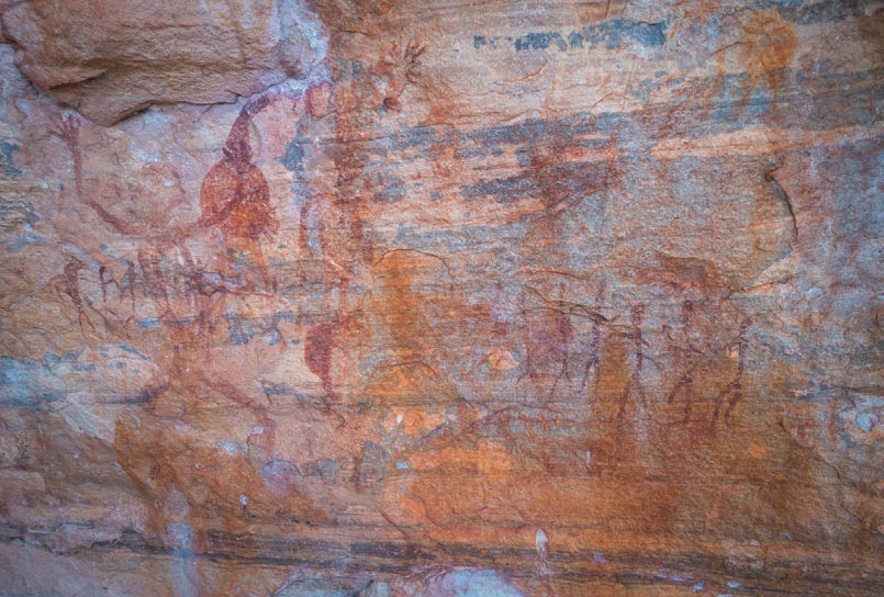
Rock art in Jawoyn Valley
Overview
We followed the Windolf and Waleka Walks to Smitt Rock, and then on to eighth gorge. From there we walked down to the river, inflated packrafts, and paddled up to ninth gorge. Leaving packs, we continued up to the top of the gorge system and then back to ninth gorge to camp. Next day we paddled down to sixth gorge, and on the last day, paddled to second gorge, and then walked out to the Visitor Centre.
Day 1 - Visitor Centre to Smitt RockThis is a fairly long day, so we took the easy half of the Baruwei Loop, and then the Windolf Walk to Pats Lookout and Jeddas Rock, and then back to the Butterfly Gorge turnoff.
The track out to Pats Lookout is easy. There are a couple of rough bits from Pats Lookout to get across to Jeddas Rock, but also mostly fairly easy to follow.
Apparently there is a route down to the river from the vicinity of Pats Lookout - some
people we met ended up at the river rather than Jeddas Rock. We climbed from the river back up to Pats Lookout later in the trip (see Day 5) but didn't seem to be following any existing route.
From Jeddas Rock there is a section of a few hundred metres where the track is difficult to follow, before it becomes obvious again to the head of Butterfly Gorge.
From there it is a fairly slow section to Lily Ponds Creek, which took 2.5 hours of walking (plus 30 minute break) to cover the six kilometres. It was worth the detour to the Lily Ponds waterhole for lunch, since it has shade til mid afternoon. A short rugged section across the grain of the country leads to the Smitt Rock track, which is pretty easy going.
The Smitt Rock campsite is above the gorge, and it's a 5-10 minute walk down to the river. The campsite has a number of small tent sites over a reasonably wide area, so even if there's other campers around, you might be able to get away a bit. There's a toilet nearby. There is also possible camping down in the gorge itself.
“It was worth the detour to the Lily Ponds waterhole for lunch ...
BWA April 2021 | 9

Gorge paddling
Day 2 - Smitt Rock to eighth gorgeFrom Smitt Rock it's about 20 minutes back to the main track, and then across country for a couple of hours. There is little to no track so it's a case of following the markers, and it's fairly rough walking up to a steep descent into a large valley. This had a flowing stream in it. There we met another party who said there was a "stagnant waterhole" at the eighth gorge campsite. Obviously other people have different ideas of stagnant, since when we got there, there was a small but delightful waterfall into a large pool, great for swimming and water collection!
We took a detour up Jawoyn Valley for a bit, and found a number of art sites, some of which were signposted, and others not. We then headed off track down to the creek, and followed it down until we hit water, and a swimming hole. Further down, a small waterfall tumbled into a rainforest gorge, so we returned to the track and headed for the campsite.
The campsite at eighth gorge is delightful, a small sandy camp next to a large (30 metre) pool and waterfall, and a short walk out to a big waterfall looking over the gorge. There is no way down to the river directly, but by walking up the valley to the east of the campsite for 100 metres or so, you can then climb over the low ridge, and back west
down a long ramp to the river. Allow about 20 minutes. There is reasonable shade at the campsite.
With multiple groups the campsite would be rather cosy. There would be options to move away, up the valley to the east, or down to the river. The toilet is a short way up the valley to the west.
Day 3 - Eighth gorge campsite to ninth gorgeIt was only half an hour or so of paddling up to the ninth gorge campsite. This is on a sandy beach, with limited shade. The campsite faces north west, so gets the afternoon sun. There is one large tree, so it would be a bit awkward if there was more than one group. There is no toilet (climb up on to the rocky plateau?), and no water options other than the river at ninth gorge.
From there we paddled upstream through a number of gorges, finally leaving our rafts at the bottom of a major blockup. A tricky scramble got us up to the plateau where we walked for a short distance to where we could see the gorge conditions ending. We had lunch in the major side tributary that enters from the north, since it had walls providing shade.
“A tricky scramble got us up to the plateau ...
10 | BWA April 2021


Tom is a Sydney-sider who has been bushwalking and canyoning around Sydney and the Blue Mountains for a bit over 20 years. When he's not out walking, he's probably dealing with photos from his walks, running bushwalking and canyoning websites, or making maps.
Day 4 - Ninth gorge to sixth gorgeThe paddling and portaging (with packrafts) was relatively straightforward. It took us around 1.5 hours to get from ninth gorge to the sixth gorge campsite, though for canoeists, the Parks and Wildlife suggest the portages alone will take 1.5 hours.
The sixth gorge campsite is on a beach in a small side gorge. It faces north-east, so there is shade for the afternoon. At the back of the gorge is a small waterfall and pool (not for swimming) in the rainforest. It was very windy down on the beach when we were there, so we spent a good deal of time up at the waterfall, which was more sheltered.
It's not that big a beach, so it's a fairly cosy campsite if you have to share it. There is a pit toilet in the gorge.
Day 5 - Sixth gorge to Visitor CentreFor the last day, we hadn't managed to organise a boat pickup through first gorge. Rachel had asked about this while booking, and been told that private paddlers weren't allowed. I suspect they thought we wanted to put our kayaks on the boat, and didn't understand that packrafters would just have packs! In any case, we would be walking out from second gorge.
Heading downstream, it was quiet for the first couple of gorges, and then we started meeting day paddlers at the fourth gorge
rapids, which are fairly substantial. By the time we got to the third gorge rapids, it was like Pitt Street!
Including a short walk up Butterfly Gorge, it took us 4.5 hours all up to reach the first gorge rapids. We packed up the rafts and set off walking, to the bemusement of everyone else who was coming and going on boats.
The lady at the Visitor Centre had pointed out the route, but I had obviously misinterpreted it. I thought we'd be able to walk along the river to the Southern Rockhole, but after a bit of narrow ledge walking, we ran out of ledge. Hmm. Not sure where the route/track was - probably further back nearer the rapids. We spotted a gully that looked like it would go, and scrambled up it, coming out pretty close to the main Waleka Walk track.
We had been told that the Southern Rockhole was dry, but after going down to check it out, it had a small pool, big enough for a quick dip. From there it was back to the fire trail, and then the other half of the Baruwei Loop back to the Visitor Centre.
Resources
Beware of crocs
Crocodylus johnstoni, colloquially called a freshie

Scrambling back up to the Waleka Walk from first gorge rapids

BWA April 2021 | 11