


Brad and Bathurst HarbourValérie Naslin
This report will give you a bit of an insight into what it is like hiking the Port Davey Track in Tasmania.

Hiking the Port Davey TrackBrad McCartney

6 | BWA February 2022
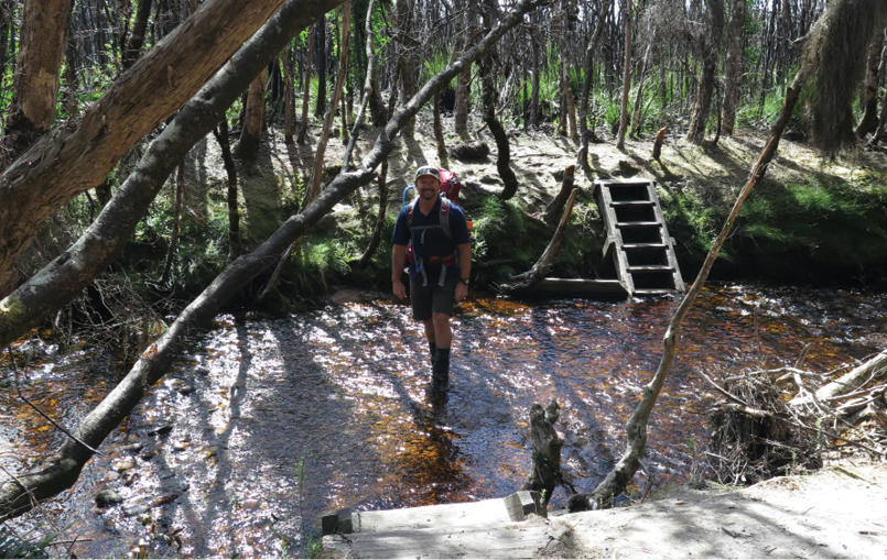

Day 1 Scotts Peak Dam to Crossing River19 km in 6.5 hours The hike started with light rain and drizzle which was only heavy enough to annoy rather than dampen anything. Within a couple of hours the drizzle ceased and the Western Arthur Range came into view. Most people stop at the campsite at Junction Creek but as it was early so we forded the creek and kept moving. In heavy rain this can be a very sketchy crossing so keep that in mind if the creek is running fast.
We continued through the glacial sculpted valleys of the Crossing Valley with the White Valley Mountains on the right and the Western Arthur Ranges on the left to our first campsite of the trip at Crossing River. At Crossing River we had a most interesting meeting with a German couple heading in the other direction.
They advised that they had been hiking for about 28 days from Lune River with lots of side trips. The guy started with a pack weight of 40 kilograms and the girls started with a pack weight of 30 kilograms, mostly cookies. They were in great spirits and very positive in their attitude, even if they looked like they needed a good feed and a week under a hot shower.
Day 2 Crossing River to Spring River26 km in 10.5 hoursFrom Crossing River there had been some recent fire damage that had made an obvious changes to the landscape. It meant that there was easy walking for us as most if not all of the trees and shrubs had been decimated by the fire.
The results meant uninhibited views of the surrounding White Monolith Range and its mountains such as Sculpted Mountain, Wombat Peak, Scrubby Peak and Stonehenge Peak. By lunch time we reached another campsite, Watershed Creek. We were somewhat surprised to find a German bloke, Sven. He was late in leaving camp, seems like he was taking his time. We took our time over lunch before heading off to the area known as the Lost World Plateau.
The track was in great condition with easy walking so we decided that we would try and make it to Spring River for our overnight camp. As we got closer the area scarred by the fire finished and the track took on a more muddy side. We passed Sven who camped at a small campsite near a flowing creek just
Crossing Junction CreekValérie Naslin
“The track was in great condition with easy walking ...
BWA February 2022 | 7

off the Lost World Plateau. It was getting late when we reached Spring River and we followed the obvious footpaths through the storm damaged area until the footpaths disappeared.
We backtracked and followed the next most obvious track, they too disappeared. Then a third time until we saw the error in our ways and found the track. The river crossing was damaged by a fallen tree. We made it across to find that the marked campsite had been destroyed by trees felled from the storm. Back across the river again to the less than favourable camp. With positive attitudes we laughed the day off as a long tiring day which made our minor but frustrating errors multiply.
Day 3 Spring River to Joan Point13 km in 8 hours Once again there was fine weather when we left Spring River again for the third time as we set our sites on camping at Bathurst Harbour by the end of the day. The walking was fine and we temporarily set our sites on climbing Mount Rugby, one of the highest mountains in the area which promised great views of the surrounds. As we approached we decided that it would be more prudent to give it a miss for now and continue to Farrell Point on the North Side of Bathurst Harbour.
The track up Mount Rugby looked non-existent; at least we couldn’t easily find it.
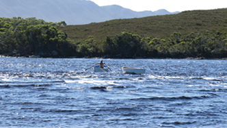
We were there in perfect weather. It was even warm enough for me to go for a swim and I hate cold water. Bathurst Harbour is huge. There is a narrow channel that needs to be crossed by row boat. National Parks provide the boats for hikers. The winds and tidal flow can make things interesting for some groups. We arrived to tides that appeared to be running out through the Bathurst Narrows at about 2 knots. We waited until late afternoon when the tide slowed to cross the 300 metre crossing. There are supplied row boats on either side of the narrow channel which required us
Boat trip across the channel
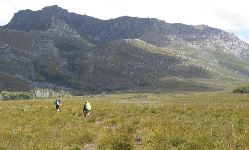
Port Davey Track looking at the Western Arthur Range Brad McCartney
“The winds and tidal flow can make things interesting for some groups.
8 | BWA February 2022
to make three trips to ensure there was a boat on either side. The campsite on Joan Point was stunning and the afternoon dinner spent watching the setting sun on one of the remotest harbours in Australia was magical.
Day 4 Joan Point to Melalauca Inlet17 km in 7.5 hoursWhen we set off the weather was grand, with low fog drifting outwards from the harbour onto the surrounding valleys and low lying country. After another brief geographical error we arrived near what appeared to be a track which indicated that it went to Mount Beattie. We checked with the map and decided to give it a crack. And I’m so glad we did.
The views from the climb and summit of Mount Beattie were stunning. Bathurst Harbour, Mount Rugby, the narrows and Port Davey were visible as was our ultimate destination for the day, Melaleuca. We lingered at the top for quite a while taking in the vista. We decided to take a short cut down to the remaining sections of the Port Davey track. It was shorter both in time and distance.
It was a very hot day and we ran out of water while at the top of Mount Beattie. Lucky the short cut took us to a small creek to quench the thirst. We sighted Sven again who was busy making a cup of coffee for the afternoon. He invited us to partake in the ritual. It provided the energy to make it to our destination.
Our campsite for the night Melaleuca has a free hut to stay in. Valerie, Sven and myself were the only one staying in the hut. There were posters in the hut of Lake Pedder before the dam was built. The old map showed the original Port Davey Track which crossed the now flooded dam area on route to the small town of Maydeena. It must have been quite a trek back in the sixties and earlier. Friendly and helpful volunteer rangers greeted us at the hut. Our food package had arrived so we opened the box of wine and fruitcake after dinner. Only a small amount of wine and I was somewhat tipsy; my tolerance when hiking was obviously non-existent. Suffice to say I slept well.
The Port Davey Track is often overlooked as one of the boring tracks of the South West. I enjoyed the whole thing from Scotts Peak Dam to Melaleuca. There is diversity and the
Point Joan with Mount Rugby behindBrad McCartney
“There is diversity and the region around Bathurst Harbour is stunning.
“It must have been quite a trek back in the sixties and earlier.
BWA February 2022 | 9

region around Bathurst Harbour is stunning. The great weather on the trip added to the pleasure. Highly recommended. Click on the link for Part II of the trip the South Coast Track.
InformationThe Port Davey Track is not hiked as often as it’s nearby neighbour The South Coast Track. Most people start at Scotts Peak Dam and hike to Melaleuca Airstrip. From there you can fly back to Hobart. A better option, if you have the time, is to continue on the South Coast Track to make a continuous 9-13 day hike about 160 kilometres in length. To facilitate an easier hike you can organise a food and fuel drop half-way at Melaleuca.
Food and fuel drop at Melaleuca AirstripOrganise to start or finish at Melaleuca Airstrip and fly with Par Avion. If choosing to hike the Port Davey Track and South Coast Track Par Avion can deliver a food drop to the Melaleuca airstrip. The freight price is $5.50 per kilogram, so the total is $60.50 + $6 for 1 litre of fuel, or $15 for a 230 gram gas canister. Flights cost $300.
They fly there on a regular basis with food drops and also sell fuel for all types of stoves. I organised a litre of fuel to be picked up. When I hiked the trail I flew in 11 kg of food which included 2 litres of wine and 1 kg of fruit cake along with other treats to keep my hiking group motivated.
Port Davey Track TransportThere are several transport options to and from the Port Davey Track. Getting to Scotts Peak Dam to access the hiking trails such as the Port Davey Track and Western Arthurs is not easy.
Public transport Tasmanian Wilderness Experience
Hitchhiking Not easy but that is how I got there
Driving Private transport or rent a car. There is a large carpark at the trailhead
The food and fuel are stored in a rodent-proof box near the airstrip and hut. Our cardboard box was undamaged when we arrived. After unpacking our food box a pilot arrived and kindly packed our box out for us, including our rubbish. That was not expected but greatly appreciated.
Brad grew up in Sydney but spent most of his life in the Northern Territory as a Tour Guide and Police Officer. Most recently he spent time managing a Macpac Store in the Sydney Region. He has been hiking since his early 20s and is a Hiking Triple Crowner, having thru hiked the Pacific Crest Trail, Continental Divide Trail and Appalachian Trail in the USA. He also spent a summer hiking the length of New Zealand on the Te Araroa Trail. When he is not hiking he can be seen drinking excessive amounts of coffee, cycling or writing on his website BikeHikeSafari.com

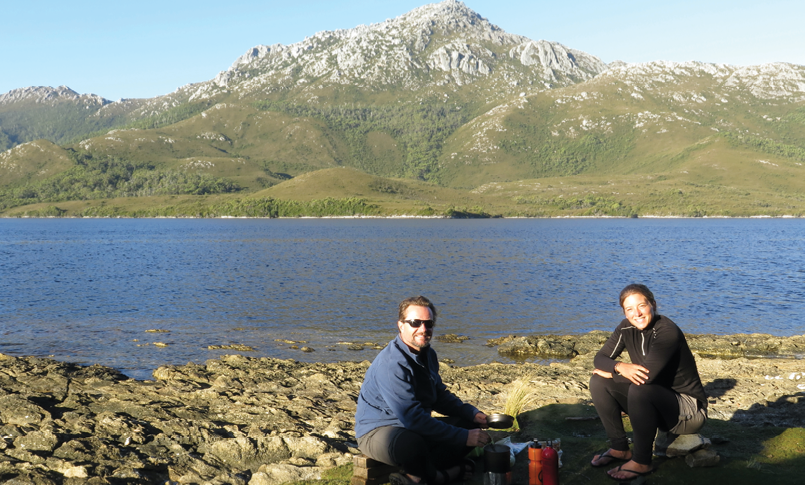
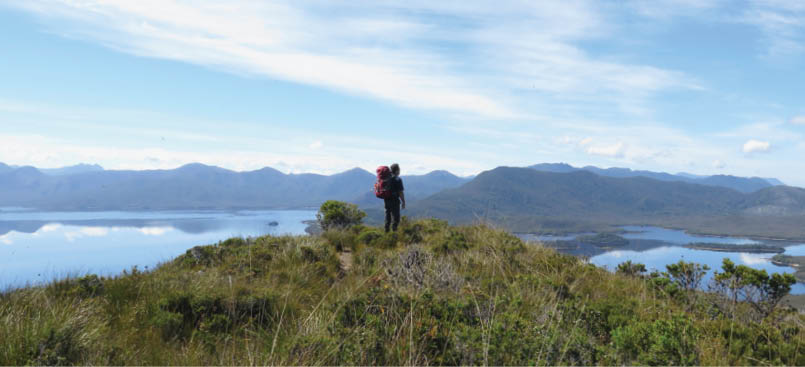
Brad overlooking Bathurst HarbourValérie Naslina


10 | BWA February 2022