


Two old fahrt Canadians in Kosciuszko NPPam Olson

In early January 2016, we flew into Canberra and after a few walks in Namadji National Park to acclimatise to the warm weather, we moved on to KNP. The weather had been a bit unsettled, with rain and thunder storms. Since we’d rather not be in the mountains in inclement weather, we had done some lower level walks. As it was getting close to our departure date, we figured we better get a move on if we wanted to get to Mt. Jagungal.
BWA April 2016 had part one of this story. Part two continues the journey from Vancouver Island to Jagungal.
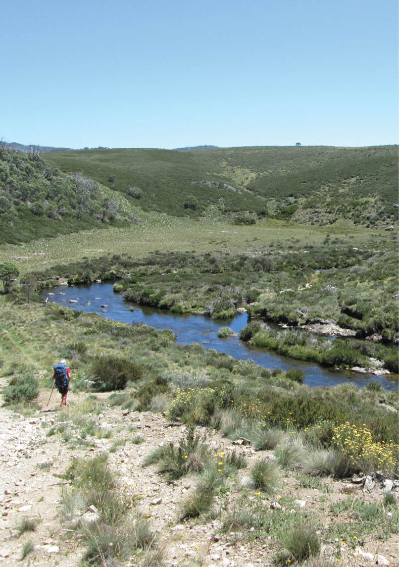
Dargals FT, descending to Tooma River crossing, February 2016. This is the same place as part one page 59 in BWA April 2016. Photo by Pam Olson
10 | BWA June 2016

Part two: a walk to Mt. Jagungal, February 2016
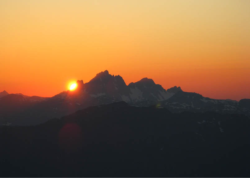
We chose the Round Mountain-Farm Ridge route for a couple of reasons. There are some huts along the route and while we prefer to camp, the huts are good temporary shelters from bad weather. Mountain weather can change suddenly and dramatically. The route is well established and there is no possibility of getting lost and even if a walker did get disoriented or lose all navigational equipment, walking a few hours in any direction would lead to a track or the highway. And the bonus was Mt. Jagungal (2061 metres). Earlier in our holiday, we had been to the tops of Mt. Twynam (2196 metres), Little Twynam (2120 metres) and Gungartan (2068 metres) but they seemed to be bumps on the ridge, some with a lop-sided trig marking the summit. Jagungal looked like a real mountain, impressive profile and rocks on the top.
Early on a sunny day in February 2016, we drove from Corryong to the Round Mountain car park. We hold a world record for taking the longest time to get packed up and about an hour after arriving at the car park, we were on our way. The weather was warm
and sunny and the track easy to follow. We gave Round Mountain Hut a brief inspection and continued along the track. It was mainly downhill and after a refreshing wade across the Tumut River, we started the uphill slog to Farm Ridge. The walk along the undulating ridge through recovering snow gums was very pleasant. As we walked along, we were treated to many views of Mt. Jagungal. Although it appeared that the silver daisies were finished flowering for the season, there were still patches of colourful flowers among the grasses, gentians, blue bells, eye bright. After dropping off the ridge to join the Grey Mare FT, we continued downhill to Bogong Creek. Very soon, O’Keefes Hut came into view. We tried several tent sites before settling on one with the fewest ants. All huts had the best camping spots, so it seemed reasonable to camp near them. On Vancouver Island where we hike there are hardly any huts, and the ants are not so populous nor so vicious.
“We hold a world record for taking the longest time to get packed up ...
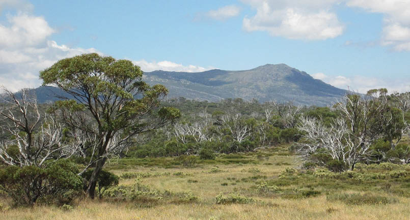
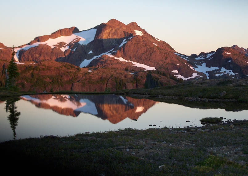
Mt Jagungal from Farm Ridge FT, February 2016Pam Olson
BWA June 2016 | 11
.png)

The next morning we got an early start as the weather forecast was for rain developing later. The plan was to walk up Jagungal then carry on to Dershkos Hut. It was easy walking along the fire trail. We did not see a cairn or any other marker near the meteorological station indicating a route so we continued on until we spotted the cairn near the upper Tumut. It was almost exactly where I had set my way point using the GRs I had determined from the topo map. I was pleased with myself! By this time, clouds were forming and rain was threatening. We had already pulled the covers over our packs and were dressed in our Gore-Tex jackets. At this point there was some discussion as whether we should go up the mountain since we would not be able to see anything anyway. There was some dissension and finally I said, “Well, when are we ever going to be back here?”
We thought about leaving our packs so we would be faster but then decided that if the weather got worse, we might have to put up
the tent on the ridge and sit out a rain storm. We headed off along the foot pad in clouds which got increasingly thicker the higher we went. Luckily there was little wind. It was obvious that the route gets enough visitors to make the foot pad easy to follow even in the clouds. Eventually the trig pillar loomed into view and my GPS indicated that we were at the summit. So much for the advertised magnificent views of the Main Range. The crows were nowhere to be seen. No time for summit photos, snacks or checking the phone for a signal. We turned around and charged back down to the Grey Mare FT, hopped across the upper Tumut River and set a hasty pace for Dershkos Hut, arriving there just after the rain started. We sat in the hut for a while letting our jackets and pack covers dry while we had tea and shortbread. By early evening the rain had let up enough for us to set up the tent. We chose the spot above the hut where we could get a view of Jagungal if the clouds ever lifted. Just before sunset, a hole opened in the clouds, revealing a patch of blue sky and a rainbow but Jagungal remained in the clouds.
Map of the walk
“Well, when are we ever going to be back here?
12 | BWA June 2016
A cold, fierce wind blew in overnight and we woke early in a wildly dancing tent. We had pegged it down well using all the guy lines. Since the previous two days had involved long walks, we decided we could do a shorter day as our plan was to walk out toward the car park, camping somewhere along the way. We retreated to the shelter of the hut to make coffee and have breakfast. The wind died down by late morning and we got on our way. At the Hell Hole Creek FT, we took a detour. The weather had turned sunny and we wanted to extend our trip. It was easy going to the confluence of Hell Hole Creek and the Tooma River where we found a level camping spot.
After our Earl Grey tea and shortbread treat, we had a rest then made soup for our evening meal, the only meal we cooked on the trip. When we were younger, we wondered how we could ever do week long trips because of all the food we would need. Now, we don’t eat much. Back home, we take a half dozen seed buns, sandwich meat, lettuce, mayonnaise and mustard. Our first three meals are sandwiches. Then we eat cheese and crackers, nuts, granola bars and dried fruit. Occasionally we make soup. For this trip, we had extra buns and sandwich meat which sustained us for the first three days. We were pleased that we could find Canadian-made Best Foods mayonnaise in most supermarkets, even though it cost about twice what we would pay in Canada. We also had cheese and crackers and a bag full of muesli bars, nuts and dry fruit.
What better way to start a day than a cool wade across a river? The morning was sunny and warm and after crossing the Tooma, we put on our boots and headed off. The track to the second Tooma crossing was circuitous, up, around and down a hillside, probably because the river floods. When the vehicle road was built, the river valley would have been impassible at high water. At the second crossing, we had a good look around, trying to remember if we really had been at that spot around Christmas 1999. It looked familiar and we thought we could identify the tree on the top of the hill where we carried our first load of bikes and packs. We debated retracing our route to Wheeler Hut but when we realized we’d have to wade the Tooma yet again to get back to Dargals FT, we decided two crossings a day was enough. We did see Wheelers in the distance as we walked along Dargals FT. We carried on to Patons Hut which had been nicely rebuilt after being destroyed in the 2003 fires. There were a number of nice ant-free camping spots near the hut.
Thiess Village FT, near Musical Hill, February 2016Pam Olson
Hell Hole FT, inspecting a wombat tunnel. Usually we wear gaiters to keep snow, not snakes, out of our boots. Photo: Pam Olson Collection
“What better way to start a day than a cool wade across a river?
BWA June 2016 | 13
After coffee and breakfast the next morning we reviewed our options: walk out to the highway then walk or hitch hike back to Round Mountain car park (boooring), retrace our route back to the Round Mountain FT (nope!) or see if we could find the old Thiess Village FT that was on our topo and GPS maps. “We’ll give it an hour and see if the road is still there.” Hah! I had won the “let’s go to the summit in the fog” so I had to endure the “let’s find the old road”. There was some grumbling. The area had been burned badly in the 2003 fires and there was a lot of new growth. We spent a few hours fighting through thick clumps of eucalyptus saplings, tall prickly grevillia shrubs and tall thick vegetation, possibly swamp or alpine heath. Finally we found the semblance of a road and it was just where we needed it to cross a deep, ugly stream gully. There was a culvert and an intact earth bridge leading to a road cut on the other side. After that, we saw no traces of a roadway until we came to another stream just east of Musical Hill, a feeder stream for Ogilvies Creek, where we could discern a faint road cut.
On the GPS, our route was a zig-zag crossing and recrossing the road line. We were crashing around trying to avoid the worst of the undergrowth. When we couldn’t see over the tops of the saplings, we moved up slope or down slope to see if we could get a better route through the tangled vegetation. There were no songs going through our heads, just a lot of bad language. We had to admit that we had not experienced such fierce bush anywhere on our hikes on Vancouver Island or other mountains in British Columbia.
It was late afternoon when we reached this stream which had lovely clear water and the area looked like an inviting camping place. We were exhausted as well as covered in scratches and cuts. Fortunately, we were past the badly burned area and into open forest with nice tall gum trees, maybe alpine gum or mountain ash, with little undergrowth. We found a level
“... we had not experienced such fierce bush anywhere on our hikes ... in British Columbia
Rees Ridge from Ralph Ridge, Vancouver IslandPam Olson
14 | BWA June 2016
spot and set up the tent. We had our tea and shortbread but were too tired to eat anything else but muesli bars and nuts. We really needed our bedtime Disprin Forte to ease the bush bashing aches. If you are not covered in scratches and bruises after a hike, obviously you did not have any fun. Was it the location of our camp site near Musical Hill or did I hear Lanie Lane singing “my feet are aching, don’t get a break” as I was falling asleep?
After a good sleep, a couple of cups of coffee and some breakfast, we were on our way. Walking through the open forest was easy and soon we came to Ogilvies Creek. While crossing the creek valley, we could see the remains of an old quarry and considered trying to get to it as a bail out route if we could not find the overgrown Thiess Village FT. However, as soon as we got to the other side of the creek valley, we found the old road. It was still very viable. Obviously the road had been closed deliberately as large trees had been dropped
across it to deter vehicles. We made good time to the remains of the Cool Plain Hut where we stopped for a rest. The hut was just a pile of metal sheets! Remarkable that some huts survive bush fires and and others are reduced to heaps of scrap.
The walk to the Round Mountain FT was easy and we reached the car park late in the afternoon. Quickly we changed our clothes and had a refreshing drink of lemonade mixed with soda water. Then we set off to find civilization. The Alpine Tourist Park in Adaminaby has a friendly manager and comfortable ensuite cabins. We checked in, parked the car at our cabin and walked over to the Snow Goose Hotel for cold beers and a pub meal. We got into an interesting conversation with a retired SMA employee who used to ski into the mountains to check on electrical installations; he knew where we had been. Adaminaby’s big trout sculpture had been repainted recently and looked quite stunning.
Before we left Australia, we sent a donation to the Kosciuszko Huts Association.
The Golden Hinde from Rees Ridge, Vancouver IslandPam Olson
“Before we left Australia, we sent a donation to the Kosciuszko Huts Association.
BWA June 2016 | 15