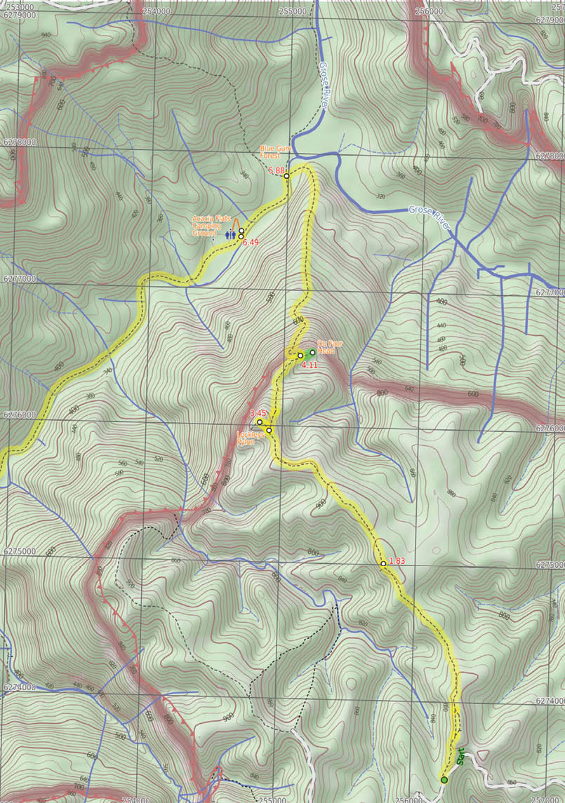
This walk starts in the low heath and with great cliff views of Lockley Pylon. The pylon, and other notable features, can be seen along the track, while the descent to the Blue Gum Forest provides plenty of photographic opportunities. After camping overnight at Acacia Flats, the walk heads out via Govetts Leap and Popes Glen, visiting many little cascades and the awesome Bridal Falls. A great overnight walk.
GPS at the start -33.651076, 150.37163GPS at the end -33.633876, 150.2844
Getting thereTrain: There are trains to Sydney about every hour.
Car: Practically you need to drive to the start of this walk. From Leura, drive north for 10 kilometres along Mount Hay Road, much of which is unsealed, fine for most 2WD cars. There is a car park at the signposted “Lockley Pylon” trackhead.
16.5 kilometres one way

Two days
1295 metres ascent 1107 metres descent
Hard(Very steep hills, section of faint track and no signage)


View from du Faur Head

Lockley Pylon to Blackheath Station
Matt McClelland
14 | BWA August 2016


Point Of Interest - Free Beacon Hire A Personal Locating Beacon (PLB) is a hand-held device that, when triggered, sends a message to the emergency services with your location. The emergency services staff can then look at your trip intention forms and decide how best to help you. In the Blue Mountains, you can borrow these for no charge, just complete this Trip intention form, and a borrowing form. The device can be picked up from:
NPWS Office - Govetts Leap Road Blackheath - 9am to 4pm 7 days Ph: 02 4787 8877
Katoomba Police Station - 217 Katoomba St Katoomba - Anytime Ph: 02 4782 8199
Springwood Police Station - 4 Jerseywold Avenue Springwood - Anytime Ph: 02 4751 0299
Lockley car park (0 km) From the car park, walk past the sign Lockley Pylon Track and another sign with a map on it. Follow the track which leads up a slight hill to tend right, along the edge of a spur. The track slowly climbs to the southern pinnacle (rocky outcrop) and then continues approximately 100 metres to the intersection below the middle pinnacle. Veer left keeping the pinnacles above to the right of the track, passing the most northern pinnacle before coming to an intersection. Veer left and walk up the hill away from the pinnacles. Then descend further 100 metres into a sandy and flat saddle, until the track rises out up the next hill. Ascend the hill to gently undulate across the plateau, through the trees. Follow the track as it then opens out onto a clearing where it continues up the hill for approximately 200 metres to the intersection on the next rise. The intersection is marked by a rocky outcrop to the left of the track.
Mt Stead Track (1.8 km) Continue straight towards the surrounding valleys, leaving the rock feature behind on the left of the track. Enter the tree line on the other side of the knoll and meander through the trees for approximately 400 metres to get out onto a clearing. Head down through the clearing to pass to the right of two knolls. Cross the saddle and
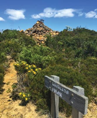
head up the stairs on Lockley Pylon to a sign marked intersection. Veer left following the sign to Lockley Pylon up the wooden stairs to the summit of Lockley Pylon. This is marked by a stone cairn.
Lockley Pylon (3.4 km) Lockley Pylon, Blue Mountains National Park, gives 360 degree views of the Mt Hay area with excellent scope over Fortress Creek Waterfall and into the Grose Valley.
Lockley Pylon (3.4 km) From the cairn on top of Lockley Pylon, walk down the wooden stairs away from the valley. Head down the stairs to a signposted intersection. Turn left and go up the stairs, towards the large grassy knoll, keeping the valley to the right, and soon arrive at an intersection signposted Lockley Pylon. Continue straight down the stairs to a creek, leaving Lockley Pylon behind on the left. Cross a creek and meander across a saddle and past a void in the rock before traversing several rocky knolls. Follow the track as it then drops down a rock step and very soon comes to an intersection in a rocky saddle (marked with white paint).
Lockley Pylon
BWA August 2016 | 15


Walk variation - Side Trip to Du Faur Head (4.1 km) Walk up the hill for approximately 20 metres to a rocky outcrop with stunning views down the Grose Valley. At the end of this side trip, retrace your steps back to the main walk then turn right.
Du Faur Head (4.1 km) Du Faur Head, Blue Mountains NP, is situated north of Lockley Pylon. The knoll gives spectacular views up and down the Grose Valley and River. Du Faur Head is worth a visit on your way up or down to Blue Gum Forest from Lockley Pylon.
Junction of Lockley Pylon and Du Faur Head Tracks (4.1 km) Veer left and walk down between a break in the rock, descending steeply left down the cliff line, keeping the cliffs on the left of the track. From the bottom of the cliffs, tend right, down the hill for a few hundred metres, then steeply descend a spur into the valley. Continue down to come to a fallen log and then turn right to descend off the spur. Meander from the hill across the grassy and ferny vegetation of the creek flat, then cross Govetts Creek. There is a fallen log
upstream which many walkers have used to cross the creek. Wind through more grass on the creek flat before coming to a signposted intersection.
Blue Gum Forest (5.9 km) Blue Gum Forest, Blue Mountains NP, is a large stand of Eucalyptus deanei trees on the junction of the Grose River and Govetts Creek. The magnificent trees stand tall on the flats with low vegetation beneath. The trees of Blue Gum Forest represent the protection efforts of Myles Dunphy, who led a group to raise the £130 required to buy the Blue Gum Forest - quite a sum in 1931 during The Depression - and save it from being cleared. The group were successful and the Blue Gum Forest is now protected within the Blue Mountains National Park.
Blue Gum Forest intersection (5.9 km) Follow the sign Camping only at Acacia Flats, heading downstream. Walk along the track as it tends right, away from the Grose River and towards the hills on the right. Head downhill and across a small creek, then meander for approximately 100 metres before arriving at Acacia Flats camping area.
Acacia Flats Camping Ground (6.5 km) Acacia Flats Camping Ground, Blue Mountains NP, is on the floor of the Grose Valley between Perrys Lookdown and Lockley Pylon. The camping ground is approximately 50 metres from Govetts Creek and approximately 500 metres upstream from Blue Gum Forest. Acacia Flats Camping Ground is appropriately named after the dense population of Acacias found in this area. Acacia Flats is a wonderful area to camp with tall shady Blue Gums and level grass clearings which make for a great place to pitch a tent. There is a pit toilet and sitting logs to make camping more comfortable, and plenty of room for large groups. Water is available from Govetts Creek (treat before drinking).
End of day 1 (6.5 km) This is the planned overnight stay for the end of day 1, happy camping.
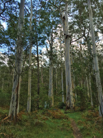
Blue Gum Forest
BWA August 2016 | 17


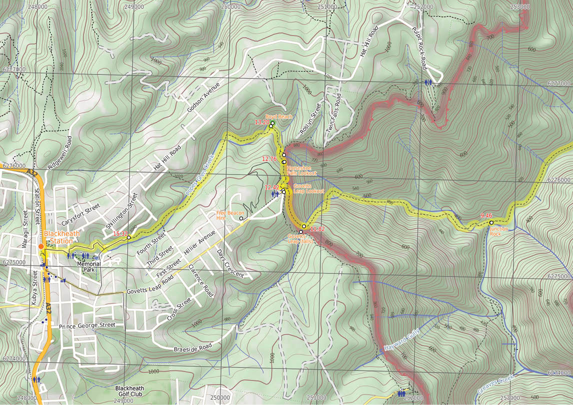
Acacia Flats Camping Ground (6.5 km) Leave the camping area with the Grose River far to the left and the majority of the camping areas to the right of the track. Pass a pit toilet on the right after approximately 100 metres. Continue along the creek flats before climbing up a small hill, then follow the track as it contours and undulates for approximately 600 metres to round a hill which gives views of Pulpit Rock above on the cliffs. Turn right to climb up the hill, and then left to contour for some time. As the slope lessens, the track descends to the creek bank, which is on the the right. The track continues to contour for approximately one kilometre just above the creek, on a steep bank which has minor undulations, until it comes across a clearing with a No Camping sign. Turn left here and descend to the creek bank at a signposted intersection of Junction Rock. Junction Rock intersection sits in the middle of the creek.
Junction Rock (9.5 km) ) Junction Rock, Blue Mountains NP, is a rock situated in the middle of the Govetts Leap Brook and Govetts Creek junction. The rock is signposted, giving directions to Evans Lookout, Neates Glen, Acacia Flats and the Blue Gum Forest. Junction Rock is a great place for lunch and a swim in summer.
Junction Rock (9.5 km) From Junction Rock, follow the Govetts Leap sign, soon crossing the brook. Follow the brook for approximately 150 metres, to another creek crossing. Walk along the track as it continues, with the creek now on its left, for approximately 60 metres, before crossing back to the other bank. Continue for approximately one kilometre with the creek to the right, and undulate steeply in sections between magnificent waterfalls. A section of track traverses a rock shelf for a short stretch, before continuing to wind up and down (with the creek to the right) to a few sets of steeply-cut stairs. From these, continue over hills to a creek crossing. Head up the spur, winding between views of waterfalls, before tending left further up the hill. Head up the meandering steps for some time, until crossing the creek at the bottom of a waterfall cascading off the large cliffs - Govetts Leap Falls.
Govetts Leap (Falls) (11.8 km) Govetts Leap is a waterfall in the Blue Mountains NP. The fall is fed by Govetts Leap Brook which runs over the cliff into the Grose Valley. The falls are best viewed from Govetts Leap and Barrow Lookouts. Leap is a Scots dialect word for cataract or waterfall.
Bottom of Govetts Leap Falls (11.8 km) ) From the bottom of Govetts Leap Falls, walk north-west, following the blue signs up the hill. Zigzags steeply up to a wall of rock covered by moss, ferns and grasses. Pass along the base of this cliff to a metal staircase, passing through the rock. Continue to wind steeply below the cliff, passing two lookouts before coming to the signposted intersection. Follow the sign to Govetts Leap carpark up the stairs. Zigzag up the hill before tending left to the signposted intersection. Turn left and walk across the grassed area towards a platform structure. Climb some stairs onto Govetts Leap Lookout, with its great views and sandstone monuments.
Govetts Leap Lookout (12.4 km) Govetts Leap Lookout is named after the first European man to have enjoyed this view, William Govett, as an assistant surveyor in June 1831. Govetts Leap Lookout offers wonderful views over the Grose Valley and the spectacular Bridal Falls. The word “leap” is an old Scottish word meaning waterfall. The lookout is easily accessed from the car park, there are also toilets and picnic shelters nearby.

View from Govetts Leap Lookout
18 | BWA August 2016


Govetts Leap Lookout (12.4 km) From Govetts Leap Lookout, walk down the stairs at the edge of the lookout, keeping the valley to the right. Then cross a grassed area to a well-signposted intersection on the edge of the tree line. Walk down some stairs, keeping the valley to the right. Turn right over a bridge, continuing around the hillside to drop down onto a viewing area and intersection. Walk down steep stairs, keeping the valley to the right. Follow the track as it winds along the cliff top until coming to an intersection, near Horseshoe Falls Lookout.
Point Of Interest - Horseshoe Falls Lookout (12.8 km) Horseshoe Falls Lookout, Blue Mountains NP, is a small fenced lookout. There are views down to Horseshoe Falls and across the Grose Valley.
Point Of Interest - Horseshoe Falls (12.8 km) Horseshoe Falls, Blue Mountains NP, are sourced by Popes Glen Creek which runs over the cliff into the Grose Valley. The Horseshoe Falls seem to be named after the shape of the valley into which they drop.
Horseshoe Falls Lookout (12.8 km) Walk along the cliff top towards Horseshoe Falls, with the valley below to the right. Follow the track as it winds for some time around the hillside, to a lookout on the right, before continuing around to a railing of some steep stairs. The stairs lead to Popes Glen Creek, where you continue through the ferns to a street sign. Follow the sign to Popes Glen keeping the creek below on the right. Continue for approximately 100 metres, rising to the left of a prominent rock feature. Pass another track on the right, then continue to rise past the rock feature (on the right - The rock feature has a trail to its top.) Continue from the rock feature, heading down the hill to a signposted intersection.
Walk variation - Side Trip to Boyd Beach (13.2 km) Walk down the hill following the Boyd Beach sign. Wind down the rocky steps for approximately 40 metres to Boyd Beach. At the end of this side trip, retrace your steps back to the main walk then continue straight.
Point Of Interest - Boyd Beach (13.2 km) Boyd Beach, Blue Mountains NP, is a small sandy bank on Popes Glen Creek. The beach is a quiet spot with nice ferns and shade. The beach is a short distance from the Popes Glen track.
Junction of Popes Glen and Boyd Beach Tracks (13.2 km) Walk up the hill, following the arrow on the sign pointing to Blackheath. Continue above the creek (on the right) for some time, then cross a bridge so that the creek is now on the left. Cross a second bridge, then continue for some time up a rocky hill to an intersection below power lines, with a bridge below on the right. Walk up the hill, keeping the creek below on the right. Soon cross the creek at a bridge, continuing along the other side to a small waterfall (on the left). Continue up the hill, passing an intersection (with access tracks to Clarence Road). Continue to head up the hill for approximately 300 metres to the intersection with Dell Street.
Junction of Popes Glen Track and Dell Street (15.3 km) Walk down Dell Street, keeping the bush to the left of the road and houses to the right. Soon pass Cleopatra Street on the right and continue along Dell Street to the intersection with Gipps Lane, on the right (where Dell Street changes name to Wills Street). Walk along Gipps Lane, passing a large wooden house to the right of the road. The road tends left onto Robertson Lane which then becomes Wills Street. Follow Wills Street then turn left onto Inconstant Street and then right onto Gardiner Crescent. Gardiner Crescent is followed to the Great Western Highway, where there is a petrol station on the left. From here, turn left to follow the Great Western Highway, keeping the petrol station on the left, as you head towards the Gardners Inn pub. Continue to the pedestrian crossing, opposite Blackheath Station steps. From the pedestrian crossing, cross the Great Western Highway to turn right up the covered station steps. Follow the railway bridge to the top of the station staircase.


20 | BWA August 2016