


In April 2016 I decided to head up to Little Desert National Park and revisit the Desert Discovery Walk (DDW), I did this walk around five years ago but started the walk with a flat camera battery ... greaaate! This time all gadgets were charged before leaving.
I'd walked for around thirty seconds before stopping to take this photo of the Yellow GumsKevin Moss

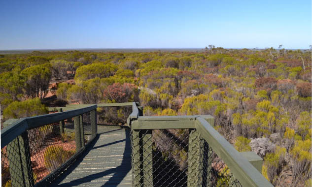
Desert Discovery Walk
Kevin Moss

6 | BWA December 2016


Little Desert National Park stretches from the Wimmera River to the South Australian border just to the south of the Western Highway. The park was gazetted in 1968 largely to preserve habitat for the endangered Malleefowl, which nests in the sandy soil among the scrubby Mallee Trees. The park comprises hundreds of low dunes interspersed with sandy heathlands, clay pans and the odd salt lake. As I'm not partial to crowds I decided to drive to Kiata on the Thursday night and start the walk on Friday morning, the theory being that I'd miss any long weekend crowds. So after having dinner with Sam I jumped into the ute and headed towards Adelaide, arriving at the large, almost deserted Kiata Campground just before 1am. I soon had the tent up and drifted off to sleep.
Day one - to Yellow Gums Camp 21.9 kilometres, 203 metres ascentI emerged from the tent blinking into the sharp light of a stunning morning. Before the walk started I had to stash water at Yellow Gums Camp - the tank is out of action due to an infestation of bees trapped inside and polluting the water.*
Now I suppose I could have carried water for two days and 45 kilometres but you know, I'm old and broken so I figured that the better option would be to drop some water. Yeah, what could go wrong with that plan?
After driving along Dahlenburghs Mill Track until Mt Arapiles was starting to tower above me I reluctantly admitted to myself that I may have missed the point where the DDW crossed the track, hmmm. A fifteen point turn later I headed back the way I'd come, keeping a close eye out for my intersecting walk. Arriving at Centre Track I'd overshot in the other direction - bugger me! Another fifteen point turn and I'm heading back in my original direction, with good news that as the rutted sandy track was now familiar I was able to scan the scrub looking for the elusive DDW. I managed to locate my walking track near the top of a small dune and headed into Yellow Gums Camp with my water and tent. The end result of all this faffing about though was that I didn't actually get back to Kiata Campground and start walking until 1pm.
So my cruisey first day was now not so cruisey; over 20 kilometres in five hours is a solid walk even in the flat desert landscape. The DDW leaves Kiata Campground on a soft sandy track and basically stays on it for the duration of the walk. The route soon forks to the right (the left hand track is my return route in a couple of days) and heads towards a long low ridge that heads south. The walking here alternates between red clay and the ubiquitous sand, and the low vegetation
*Parks Victoria advises that the bees have now gone, but could return. It would be useful to have a tank with mesh, like in the Barry Mountains on the AAWT. A tank that cannot be relied on is not much use. Parks Victoria suggests that walkers place their own water drops. Perhaps also check prior to the trip to see if the tanks have water. SL
It was around 1pm by the time I started walkingKevin Moss
BWA December 2016 | 7
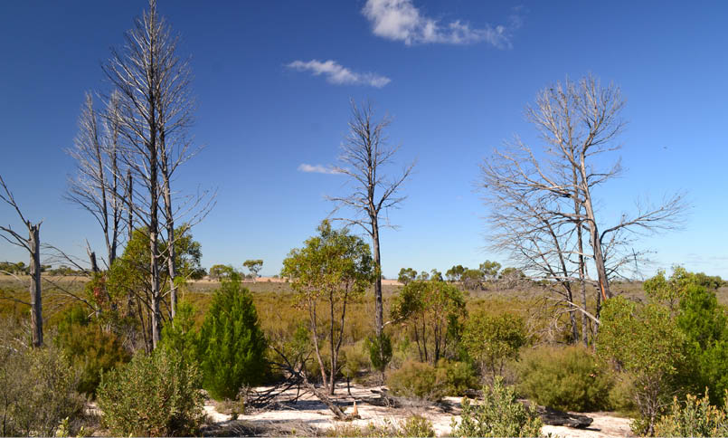
allows for some nice views over the surrounding country. I arrived at Trig Point for a late lunch and took in what is arguably the most expansive view on the DDW.
I left Trig Point close to 3pm, and with around 14 kilometres to go I kicked it up a gear as I made my way down to Salt Lake. All was going good until crossing Dahlenburghs Mill Track where progress suddenly got a lot harder. The walking track from here has been used by motorbikes and they had cut the soft sandy surface up - it was like walking along a soft beach. With the Yellow Gums on the dune on the eastern side of Salt Lake standing out like a beacon in the flat featureless terrain it was easy to measure progress along here. As well as helping with navigation they also looked beautiful in the late afternoon sun and I dropped the pack for a rest and to explore.
From Salt Lake the DDW heads south before curving around, heading due east. The late afternoon walking along here was probably as good as it would get. The DDW passes through heathland and dunes covered with Tea Tree, Broom and Mallee Trees, with the odd damper spot sometimes home to small copses of Yellow Gums. The motorbike churned up sand wasn't the only thing slowing me down now, with sun slowly
setting I was now stopping quite a lot to take another awesome (I thought) photo. With the sun slipping below the horizon I crossed Dahlenburghs Mill Track again at the point where I did my water drop so at least I knew exactly how far Yellow Gums Camp was. Arriving at the beautiful Yellow Gums Camp in the twilight I was glad that I'd put the tent up when I left the water. All that was left now was to settle down on the bench under the hut verandah and watch the bush change colour as twilight slipped into night and the full moon rose through the spindly trees like a spotlight. After my Thai green chicken and apple pie (relax its freeze dried) I was into the sleeping bag by 8:30pm on what was feeling as though it was going to be a cold night.

Yellowgum CampKevin Moss
Lookout at Trig PointKevin Moss
8 | BWA December 2016
Day 2 - to Mallee Camp 35.2 kilometres, 221 metres ascentToday was a solid day for an old bloke. Most people spend the night at Horseshoe Bend and complete the walk over four days but I wanted a day at home with Sam before going back to work, so I was doing the walk in three days again. Now I knew it was doable for me as I'd done it like this last time, only thing is last time I was a few years younger and I went light weight with just a bivvy. Anyway with all that in mind it was important that I got an early start so setting off at from Yellow Gum Camp at 9 am wasn't ideal, but hey it was early for me! To be fair (or make a piss poor excuse) I'd had to walk my water container back out towards Dahlenburghs Track, the couple of kilometres at least loosening up my stiff leg muscles. After returning from my morning's warm up I set off towards the Wimmera River, only to stop to take photos of the beautiful Yellow gums in the morning light.
From here the DDW heads east towards my next notable landmark, Eagle Swamp. Maybe I was grumpy or maybe it was because I knew I had a thirty plus kilometre day in front of me but the motorbike damage really did my head in this morning. I found myself constantly changing sides on the
track as I searched for some firmer ground that hadn't been churned up by my bogan brothers. Eventually Mt Arapiles came into view to the south and at around the same point open cleared farmland is less than a kilometre south of the DDW. I'd now crossed the park north to the south. After trudging over some slightly higher dunes, which gave me a bit more of a view of the surrounding country, I crossed McCabes Hut Track and arrived at Eagle Swamp. The good news is that my motorbiking mates seemed to have exited the walking track here. The bad news was that my responsible 4WD mates had obviously mistaken Eagle Swamp for a speedway track, and had cut the salt lake, leaving circular scars that will probably remain for 40-50 years.
Leaving Eagle Swamp the DDW crosses more dunes and starts to close on in some distant larger trees that signalled the flood plain of the Wimmera River. The other notable thing along this section is the amount of Banksia trees. Most of the trees were around head height and not mature, which gave the appearance of walking through an orchard. With no churned up sand the walking along here was easy and pleasant but the midday sun was hot and I was looking forward to reaching the river and its
Near Eagle SwampKevin Moss
BWA December 2016 | 9

larger trees that promised some more shade. I wasn't sure how much water would be in the river as the area has been in a severe drought for a while, but on arriving on its bank I was happy to see lots of slow moving brown water, good enough in fact for me to strip off, jump in and wash away the grime of the last couple of days.
Feeling a whole lot better after my short swim I slowly got dressed and headed up River Track towards Ackle Bend. The dry clay of the flood plain along here made walking a lot easier and the open Red Gum and Black Box forest made it easy for me to cut the meanderings of the river, although the now hard ground was playing havoc on my tender feet (One minute I'm crapping on about soft sand, now I'm complaining about hard clay, I'm turning into a cranky old bastard as I type this). Stopping at the Ackle Bend camp ground I enjoyed a late lunch and refilled my water containers. The large national park camping area was almost empty on this long weekend and I couldn't help but wonder if it was because of the exorbitant fees that are now charged for camping in some of Victoria's parks.
Eventually I had to leave the oasis-like surrounds of the Wimmera River and head into the heathlands, west. So not only was
I tired after already having walked around 25 kilometres but now I was walking into the slowly setting sun as well. After passing through another orchard of Banksia trees the DDW starts to cross some large flat heathland plains. Curiously, Mt Arapiles now appeared closer than it did this morning even though I was now at least six kilometres further away. The extensive flat plains allowed plenty of time for reflection as I trudged my way west. The only things to break my trance like state were the occasional kangaroo and odd noteworthy occasion that I'd get to a point of interest like the Dry Well or a larger dune.
With the sun now well and truly set I trudged on into the gathering gloom, stopping frequently to take more photos in diminishing light. After crossing one last dune that was a little higher than the rest I descended to Mallee Camp, suddenly bursting out of the thick cover of Mallee Trees at the dam near Mallee Camp. I had to put on my head torch to locate the hut inside the tree line. I didn't have the luxury of arriving at camp and having my tent already erected tonight so I didn't muck around finding a spot to camp. By the time I'd set up and had dinner (spag bol and apple pie), it was starting to get a little on the chilly side, with stars and satellites twinkling in the cold clear
I still had a couple of kilometres to go as the sun slipped below the western horizonKevin Moss
10 | BWA December 2016


skies. Eventually the cold drove me into my sleeping bag, my feet finally feeling some relief after a long day. It didn't take me long to drift off.
Day 3 - to Kiata Campground 20 kilometres, 104 metres ascentSomewhat surprisingly I pulled up pretty good after yesterday's epic. My leg and shoulder muscles weren't feeling too bad at all, and the only maintenance issue I had with my broken body was that my feet were a bit on the tender side. With only around twenty kilometres to go today I wasn't in a great hurry this morning so I lay in the tent for a while and waited for the sun to work its magic, before eventually pulling on some warm clothes and emerging to cook breakfast and pack. Mallee Camp isn't as scenic as Yellow Gums Camp, although it did have one thing going for it and that was it had a water tank with usable water in it, always a bonus when camping in the desert.
This morning I set off at around 9:30am but I was in a good mood, the sand was reasonably firm, the scenery was still great and I was heading for a hot shower and a cold drink. Life was good. After around an hour my mood deteroriated a little just after I'd crossed McCabes Hut Track I heard the sound of motorbikes approaching, initially I
hoped the responsible motorbike riders were on the 4WD drive track. However as the first one ripped over the dune behind me on the walking track I realised that my nice walking conditions were over for a while. Sure enough after the second one had gone past and I was able to resume my journey, now trudging along a soft rutted track.
It took me a while to get my mood back on track after my run in with the bikes but what do you do, you can't let a couple of tools ruin the experience and while they had tore up the track the scenery was still as good as ever. Passing the turn off to Wallaby Track (a short cut track to Yellow Gums Camp that bisects the park north-south) I trudged on to Pump Jack Dam, an old bore from the days when this area was grazed. I had some good news as well as it appears that my bogan mates had decided to leave the walking track here and head out along the 4WD track. Maybe they didn't wan't to run into any more extra-large pissed off bushwalkers ... who knows. I thought that I looked friendly enough!
With my mood now improved I headed west, the vegetation slowly getting sparser as I progressed. After crossing Centre Track the walking track started to cross a broad open plain, with the track heading towards
Mallee Camp in the new dayKevin Moss
BWA December 2016 | 11
a long north-south ridge, the same one that I climbed to the Trig Point on day one. I've walked here a few times before, joining the DDW after an off-track walk from Salt Lake Track on one occasion, so I was starting to get into familiar territory and that always seems to make things happen quickly. Arriving at Albrechts Mill I made use of the picnic table and finished off the last of my salami and cheese. Albrechts Mill is where early European settlers sunk a bore back when they tried to graze this area. The bore and dam are now used for fire fighting purposes. There's one thing I find a little odd at Little Desert: the number of mosquitoes. At both Yellow Gum and Mallee Camps the mozzies are ferocious, and at Albrechts Mill they were pretty full on as well, so after scoffing down a couple of salami and cheese wraps I was happy to be on my way again.
The last few kilometres back to the Kiata Campground is a fairly easy affair, with the tall Red Gums at Kiata seeming to guide me back to the ute. At Kiata I was surprised to see the huge camping area empty except for two caravans on this the Sunday of a long weekend. See my earlier comments about the Ackle Bend camp to maybe understand why people don't seem to be camping in national parks at the moment. Throwing all my gear in the back of the ute I now had to pick up my water container near Yellow
Gums Camp, but at least I knew exactly where to go. After picking up my left over water and using it for an impromptu bush shower I headed off on the long drive home, arriving home to my very understanding wife at 10:30pm after what had been another very solid day.
SummaryAlright, what's the dirt on the Desert Discovery Walk? Well I reckon its a great walk, there's plenty of native animals and birds, and the semi-arid scenery is not your typical bushwalking country. There are basic huts at Yellow Gums Camp and Mallee Camp with water tanks, although the Yellow Gum tank is out of action at the moment. You probably wouldn't want to stay in the huts but they provide shelter in bad conditions. Most people take four days to walk the Desert Discovery Walk, spending a night at Ackle Bend or Horseshoe Bend on the Wimmera River. If done over four days it's a medium grade walk, and over three days it's a hard walk. It appears that motorbikes on walking tracks are a bit of a problem. The start of each section of walking track has a sign banning motorbikes, but the temptation is obviously too much for these budding Paris-Dakar stars. With time the sandy tracks slowly return to their normal state and walking is good again, but it takes months and rain for that to happen. Tracks

Heading west again Kevin Moss
12 | BWA December 2016
Kevin and his wife Samantha live and work in the south-eastern suburbs of Melbourne. When Kevin isn’t at work or working on his Goinferal blog he is generally planning his next walk. Kevin has walked extensively in every state and territory of Australia over more than thirty years. He has also walked in Argentina, Chile, Peru, New Zealand, Papua New Guinea, France, America and the UK, but it is the arid climates of Australia where he feels most at home. When not walking, Kevin enjoys mountain biking and wild swimming, and drinking coffee while reading the papers with Samantha at their local cafe.


that have recently had motorbikes on them are substantially harder to walk on. It pays to contact the extremely helpful rangers at Wail on 5389 0200 to check on conditions before walking up here, at the moment with no water to be had at Yellow Gums you either need to carry enough for camp and over 40 kilometres walking or organise a water drop with a 4WD. If the full walk sounds like a bit much there is an option to shorten the walk by linking Yellow Gums Camp and Mallee Camp via the Wallaby Walking Track, making an easy three day walk.
I used the 1:50,000 Kiata and Natimuk Vicmaps on the walk, I also used an old Westprint Little Desert National Park map for my 4WD trip into the park to drop off my water. Unfortunately Yellow Gums Camp is incorrectly marked on this map, although I was using the 1993 edition! It would pay to carry a PLB. My Telstra mobile had service every time I checked it.
Albrechts MillKevin Moss


BWA December 2016 | 13