

Imagine walking across the ancient volcanic landscapes of the NSW Southern Tablelands past 160-year-old grand homesteads, plunging into a gorge 50 kilometres long, traversing a world heritage wilderness. Imagine walking the banks of a broadening river past some of the earliest farms established in Australia. Imagine entering a second wider gorge with the longest estuary on the east coast where seven national parks meet. This is a short description of the Great River Walk (GRW), a 450 kilometre long-distance track concept located on Sydney’s outskirts. The following article details the slow progress in getting this walk established.
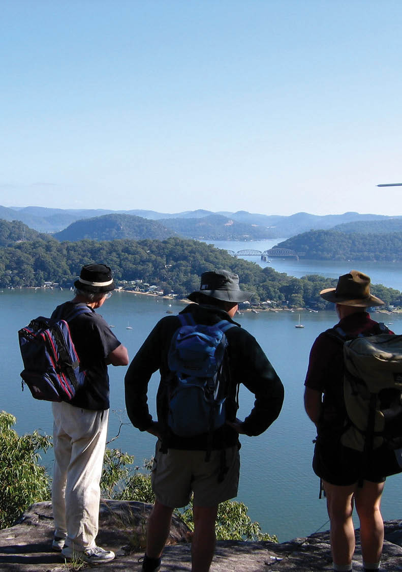
Lower Hawkesbury at Wobby

The Great River Walk
Roger Treagus

6 | BWA August 2017
Sunset over the Indian Ocean, Evans Creek, day four
The rise of international long-distance walks – Sydney’s responseLong-distance walks have raised the profile of bushwalking. Many of these walks are now internationally famous and are big tourist drawcards with names like the Milford Track, Appalachian Trail, Inca Trail and the Camino de Santiago. In NSW the peak bushwalking activity is adjacent to Sydney which can claim at least three such long-distance tracks, although not with the same international profile. These are the 44 kilometre Six Foot Track from Katoomba to the Jenolan Caves, the 130 kilometre Mittagong to Katoomba bushwalkers' corridor and of course the 250 kilometre Great North Walk from Sydney to Newcastle, which traverses a fantastic array of environments and poses a significant walking challenge. There is also the potential for a 150 kilometre Great South Walk from Bundeena to the Shoalhaven and a 300 kilometre Great West Walk from Sydney to Lithgow and on to Bathurst known as Coxs Road.
Born in 1999 the GRW Concept has still to find its legsHowever, even taking a casual look at a map of the Sydney region shows an obvious gap in this network. This gap has no established track on the course of Sydney’s major river, the Hawkesbury from the source to sea. Where the Great North Walk was conceived and built in just a few years and in time for the bicentennial, by contrast the GRW, the route down the Hawkesbury, has been stuck in the planning stage for 18 years. In 1999 a committee of government, local business and bushwalking interests was formed to develop the concept, design the route, negotiate with landowners and seek the necessary approvals and financial support. The resources of the NSW government were available for the Great North Walk in 1987 but not the GRW in 2000, a major reason for the difference in the rate of progress.
One of the early issues was to find out whether a feasible walking route existed all the way from source to mouth. The Sydney
Bush Walkers Club (SBW) offered to do all the on the ground route finding. This turned out to be quite a challenge and took over four years of walking from near Crookwell where the Wollondilly rises to Broken Bay, 450 kilometres away.
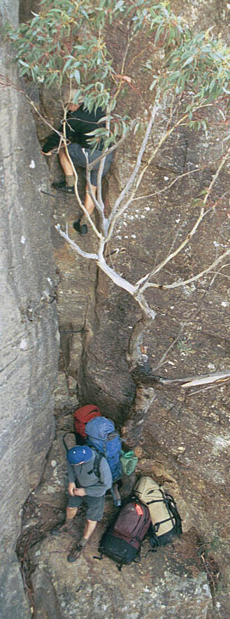
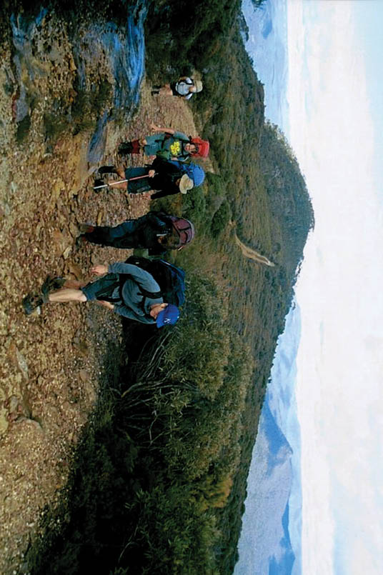
Ascending Narrow Neck at Tarros Ladders on the GRW
“There is no established track that follows the Hawkesbury River.
BWA August 2017 | 7
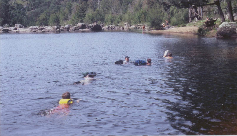

Underwater track in the Wollondilly Gorge
Finding a walkable route and meeting the enthusiastic river communitiesUnlike the Great North Walk, which mostly utilises public land corridors, the first 150 kilometres of the GRW crossed private property. So we in SBW negotiated one off access with over 80 property owners. This process was not just about seeking permission to cross private land. It was much more. It was about connecting with local people and communities and getting to understand property owners’ relationship with the land. It was also about gauging their support for the GRW concept. With only one exception they all embraced the idea with enthusiasm and gave our walking group a great deal of assistance. One landowner provided us with a Devonshire tea in china cups in one of his paddocks as we passed, one gave us unlimited beer at the end of a hot day and another gave us accommodation in his tin shed after an ebullient “pig on a spit” BBQ plus wine and a live bush band. It was one of the joys of our route finding project that we met such hospitable bush people. Their occupations were across the spectrum, from city stockbrokers to fifth generation farmers; from paintball skirmish operators to nuclear scientists; from hobby farmers to ancient bushmen who thought a nail through the foot was merely a flesh wound. Their stories added immeasurable depth to the walk experience.
The outcome of the route finding was confirmation of a walkable route all the way from the source to Mount White on the lower Hawkesbury. The route went via Goulburn, the Wollondilly Gorge, Goodmans Ford and on to Yerranderie and Katoomba west of the restricted catchment, the major storage for Sydney’s drinking water. The route then turned east through the Blue Labyrinth to rejoin the river near Glenbrook. Local roads provided access downstream to Wisemans Ferry. From there the convict-built Great North Road could be used through Dharug National Park connecting with Simpsons Track to Mangrove Creek. An easy section then accessed the Glenworth Valley, Wendorey Park, Neverfail, Marlow and on to Mount White. All the way from the source we utilised existing tracks or easily negotiable routes. These ended at Mount White and the way through Popran National Park was trackless. However, the bush along the dry ridges in the park was relatively thin and progress was possible. Eight hours walking from Mount White brought us to the Peats Ferry Bridge and on to Brooklyn. The final stage was by ferry to Little Wobby, the existing track system through Brisbane
“One of the early issues was to find out whether a feasible walking route existed all the way from source to mouth.
8 | BWA August 2017
Waters National Park to Patonga, a ferry to Palm Beach and then the final push up to Barrenjoey Lighthouse and the finish line.
What we found was a viable long-distance walk on existing tracks, negotiable routes and roads all the way except for 15 kilometres of new track construction. From a start just before the Sydney Olympics we finished on a Pittwater beach in 2004 having walked the route over 35 weekends. So what has happened in the last 13 years?
A need for political willThe Committee found that establishing a viable route was one thing but establishing the long-distance track as an existing physical entity was quite a separate issue. Unlike the development of the Great North Walk there has been a lack of political will to push this proposal even when it could be shown how such a track could be both a great educational and tourist resource for the river communities and for Sydney. A
major obstacle is that the route traverses quite remote and rough country in its upper reaches such as the Wollondilly Gorge, where access is difficult, and across private land. Negotiating a permanent right of way with so many landowners is a big challenge not yet attempted, and on a much bigger scale than similar negotiations would have been for the Six Foot Track. To open the top section will take time. It is a different story for the estuary section where the Hawkesbury makes its grand approach to the sea.

The spectacular Wollondilly Gorge
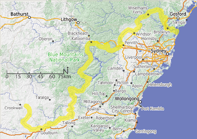
Map of the Great River Walk
“What we found was a viable long-distance walk on existing tracks ...
BWA August 2017 | 9

The GRW route on Narrow Neck in the Blue Mountains
Penrith Council shows the wayTo raise the current profile of the GRW it was important to actually have sections opened, with proper signs identifying the track as part of the GRW that people could walk. The easiest sections to develop were those where no private land was involved. About three years ago Penrith Council, an active member of the Committee, developed several kilometres of the Nepean’s river bank as part of the GRW. This first section immediately became popular indicating the pent-up demand for better access to the river.
The next stepThe next step, now in the advanced planning stage, is to open a 55 kilometre section from Lower Portland to Mangrove Creek along back roads and through the Dharug National Park, showcasing a very scenic and historic section of the Hawkesbury. This section can be walked now but official signs similar to those on the Great North Walk are vital to properly identify the GRW, plus a dedicated web site with a Google “track view” feature to promote it. These easy to implement measures would make the GRW much better known.
The long-suffering GRW Committee has been plugging away all these years trying to get the message through to our decision makers about all the benefits of having this walk. Its Chair is the Hon Kevin Rozzoli, previously the State MP for Hawkesbury and a long-time Speaker of the NSW Legislative Assembly. He has never wavered in his vision for the GRW and has been incredibly persistent in progressing the project. But 18 years in the one role is a long time when the aims of the Committee are still to be realised and he is hoping to hand the baton on. So right now the Committee is looking for a new and energetic Chairperson to take this project forward.
The economic benefits – a great return on investmentThe GRW will give a major economic boost to the local river communities and to Sydney. For example, the soon to be established 55 kilometre Lower Portland to Mangrove Creek Section has minimal establishment costs of about $30,000. These are just for the track
“ ... the Committee is looking for a new and energetic Chairperson to take this project forward.
10 | BWA August 2017
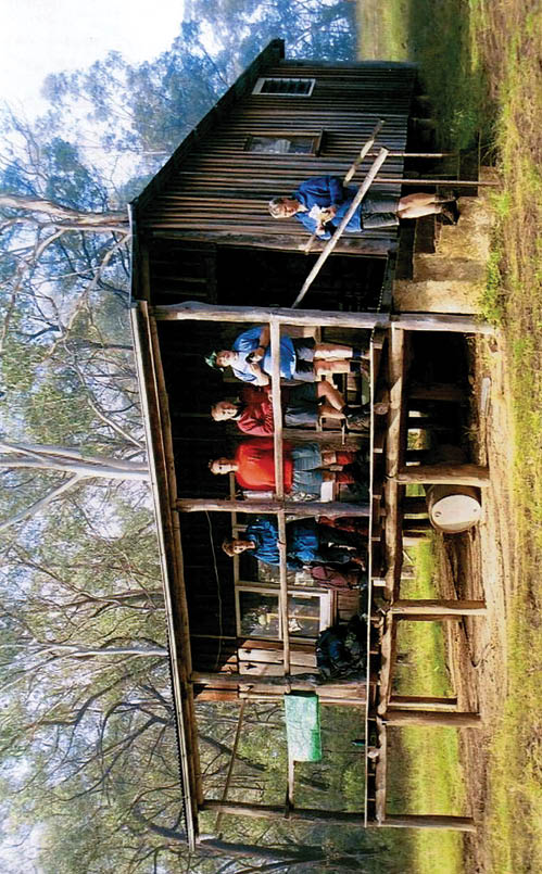

Catholic Bushwalkers hut offers emergency refuge on the GRW route
Roger is an active bushwalker and walk leader with both Sydney Bush Walkers and the NSW National Parks Association. He led the inaugural “route finding” GRW trek to confirm a walkable route existed from source to sea and is on the GRW Committee. He is a noise scientist by profession and lives on Sydney’s Northern Beaches with his wife and teenage son, close to Barrenjoey Lighthouse, the GRW’s finish line. He is currently writing a memoir which includes his experiences on the four year walk down the GRW and describes some of the fascinating people he met along the way.
signs and for promotion such as a web site, an app providing “on track” information triggered by GPS location, printed material, maps and a social media presence. The track and camping facilities already exist. Maintenance costs for tracks and facilities inside Dharug National Park are already in the national park budget.
Compared to this outlay the benefits are huge. Research into the tourist industry has revealed an average daily spend by a bushwalker in regional South Australia in 2015 was $96. In terms of visitation rates an example is Victoria’s Great Ocean Walk where 8000 people annually walk this long distance track or 22 walkers a day. If each of these walkers on the GRW spent $96 locally on supplies from shops, accommodation and transport it would mean an injection into the local economy of $7-800,000. When the Great River Walk is established and well known, and with its proximity to Sydney, 22 walkers a day may be a conservative figure. Regardless, this is a great return on investment, and that doesn’t even include the educational benefits.
When the Great River Walk is completed it will offer a world-class long-distance walk right on Sydney’s doorstep. The GRW just needs momentum with our decision makers to make it a reality. In 1987 the NSW Government started construction of the Great North Walk. Labourers from many Asian countries were brought in to boost the pace of work.
The entire project was completed only one year later. Can that ever happen again?


“When the Great River Walk is completed it will offer a world-class long-distance walk right on Sydney’s doorstep.

BWA August 2017 | 11