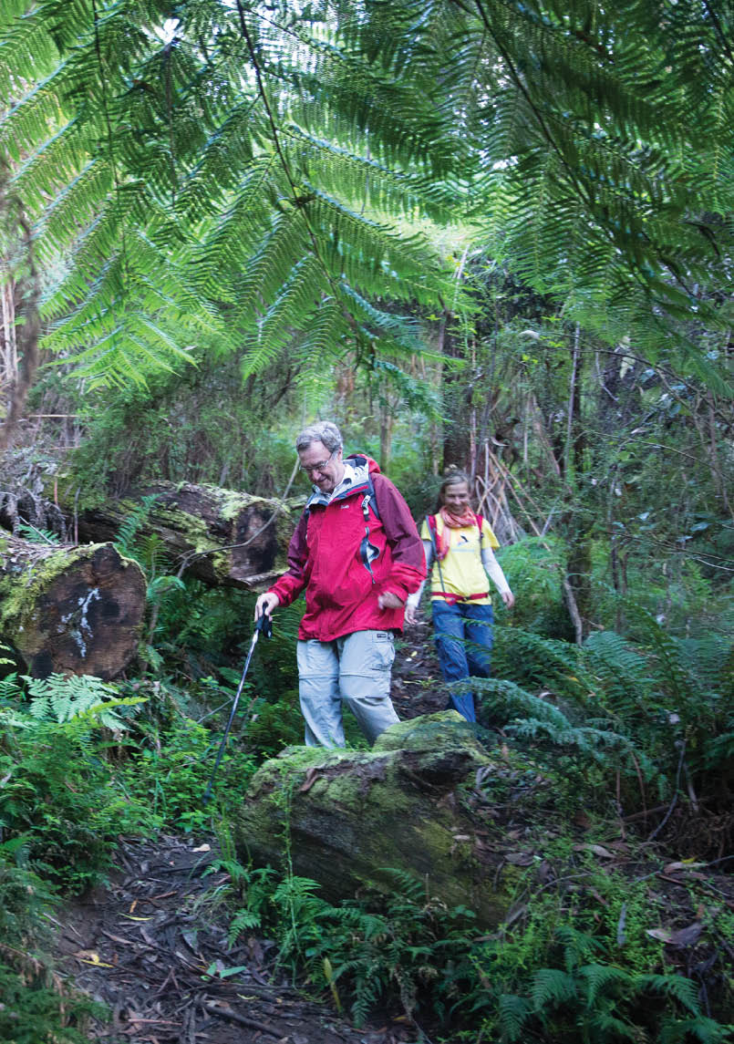

Warburton locals David Borton and Kim Linssen on the trackAll pictures by Warburton CEDA


Warburton to Mount Donna Buang
A Vertical Kilometre WalkDavid Borton

Warburton is 75 kilometres east of Melbourne in a deep valley in the Victorian Alps. The walk is in the Yarra Ranges National Park and goes from Warburton north up a major climb to Mount Donna Buang. This is an excellent training trip for bigger ventures, arguably the best vertical kilometre walk within 90 minutes of Melbourne.
24 | BWA February 2018

BackgroundAt 1250 metres, in winter, Mount Donna Buang is the closest snow to Melbourne, albeit not guaranteed. Donna Buang was a small ski resort with runs, a ski jump and lodges, with 12,000 spectators at 1935 ski races. Even then the snow was uncertain, and with climate change this is more so. The ruins of a ski lodge can be seen at the foot of an old ski run. Donna Buang's ash forests were harvested 120 years ago. The railway to Warburton boosted logging.
Getting there CarFrom Melbourne go on the Eastern Freeway and then to Lilydale. Take the Warburton Highway. Just before Warburton turn left at Mayer Bridge (Melways 289 J4) and then right at the Golf Course on Dammans Road. Drive 250 metres to the picnic area near the base of Martyr Road. The top of Martyr Road has limited parking, and there's a bridleway heading north to Mount Donna Buang, signposted.
Most parties seem to start from the top of Martyr Road, thus avoiding a very steep beginning. The start can also be at the
Aqueduct Trail where it comes close to Sussex Street on the west side of Warburton or where Yuonga Road crosses the Aqueduct Trail. Parking at these locations is limited.
Train and busThe closest railway station is Lilydale, from where a bus goes to Warburton, about 90 minutes total from Melbourne if the connections are good. From the Warburton bus stop in the main street go north approximately 100 metres down to the riverside track and head downstream to a white suspension bridge. Cross it and turn left on the north side of the river and walk a few hundred metres downstream to the picnic area at the base of Martyr Road.
FacilitiesInformation on the walk and the Warburton area is available from the Waterwheel Information Centre, directly opposite the Post Office and bus stop on the Warburton Highway. There are many cafés and restaurants on the highway in Warburton and there are public toilets in the Main Street playground and park between the highway and the river at 3385 Warburton Highway. The Dammans Road covered picnic area has
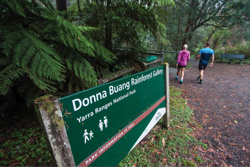
Donna Buang Rainforest Gallery sign
BWA February 2018 | 25


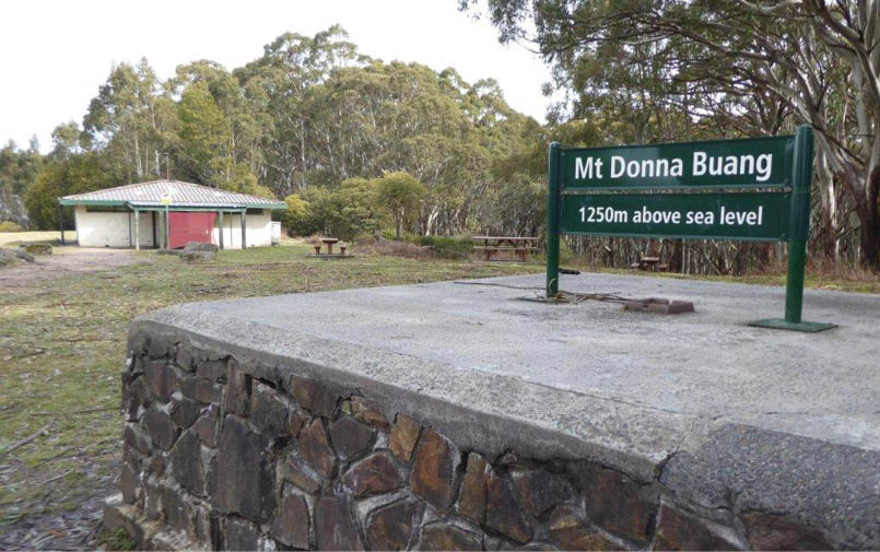
gas BBQs, tap water, parking and toilets. The 10 Mile car park has parking, spring water and toilets. The summit of Mount Donna Buang has a car park, a fire tower, a picnic shelter, water and toilets.
The walkStart between Martyr and St Johns Roads at the picnic shelter outside 25 Dammans Road, which is private property. Walk 100 metres west along Dammans Road to Martyr Road, turn right and walk uphill steeply beside the golf course to the top of Martyr Road where it turns east, sharp right. This is an alternative start point. You will see the Bridleway sign “Donna Buang Walking Track 12 KLM (sic) Return 7 hours” on the corner. Go 600 metres north down into a gully and then up beside a fence. The track bears sharp right at the top of the paddock.
The track then goes into the forest for a short distance to meet the Aqueduct Trail. Cross the disused aqueduct into the Yarra Ranges National Park and keep climbing. The track goes north and consistently up, mainly in a forest where Mountain Ash predominates on thickly timbered slopes. This section places a lot of stress on legs going up and knees going down, with slippery mud after
precipitation. The Donna Buang Road is four kilometres from the end of Martyr Road. This junction may be hard to find on the way down, so perhaps take a picture.
Go north (left) along the road for a short distance to a gated track on the right, which is followed south-east for 600 metres then north for about 600 metres to a pair of communication towers on Mount Victoria. Continue north and then north-west on a walking track for 2 kilometres to the next junction, a track to Ten Mile Turntable on the left. Ignore this track and continue more gently for 700 metres to the summit of Mount Donna Buang.
The 21 metre fire tower is well worth the climb to see views across to Cathedral Ranges to the north, Mount Buller to the north-east, Mount Baw Baw to the south-east, the Yarra and Little Yarra Valleys and the Dandenongs to the south-west. The picnic shelter has a wood fired BBQ and excellent posters of the forestry and tramway industry of the early 1900s, the early ski club and ski competitions, and the 1939 bushfires.
Return the same way, or arrange to be picked up at the summit.
View from the summit fire tower
26 | BWA February 2018


Grade
Medium to hard. The walk can be done in winter but it will probably be slippery, and very cold with snow at higher altitudes.
Climb
About 1100 metres.
Length
15.5 kilometres return from the top of Martyr Road.
16.5 kilometres return from Dammans Road.
17.5 kilometres return from the centre of Warburton.
Duration
Approximately 7 hours return.
Style
Out and back the same way, or arrange for a pick up at Mount Donna Buang car park.
Mobile phone
Coverage patchy.
Notes
The temperature drop from Warburton to Mount Donna Buang is approximately 10°C. It can snow on the peak at all times of the year but particularly in winter. It is essential to carry waterproof and warm clothing and wear sturdy boots. The track can be very slippery when wet, and walking poles are advisable. Leeches may be expected when wet, particularly if standing still for any period, so carry salt, saline or Aeroguard to remove them. Because the walk is in forest from start to finish, caution should be taken on windy days (falling branches). In summer when fire risk is very high (e.g. total fire ban or code red days) it is advisable not to do it.
Start of walk
Start of the walk, picnic shelter outside 25 Dammans Road, Warburton.
Maps
VicMap – McMahons Creek 8022 S 1:50,000
Walks and Riding Trails. Yarra Valley and the Dandenongs
Warburton, Yarra Valley. Visitor Information and Map. Yarra Ranges Council.
Website
Donna Buang summit picnic shelter
BWA February 2018 | 27