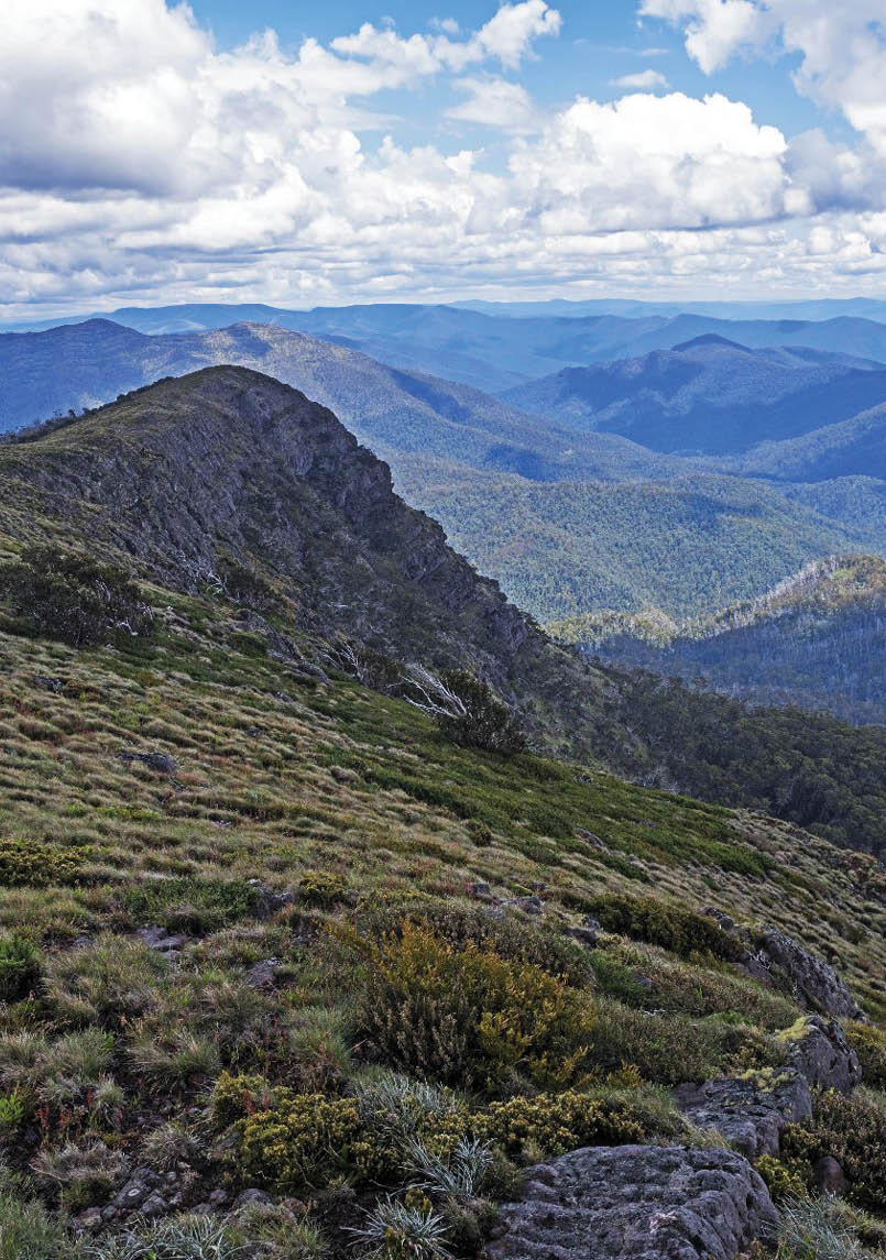


Mount Buffalo is a geographically isolated peak near Bright in the Victorian alps. About 65 kilometres south-west of Mount Buffalo is The Bluff, a short way across the Howqua valley from the ski resort Mount Buller, near Mansfield. There's a ring of mountain ridges in a clockwise direction from The Bluff to Mount McDonald, with the Australian Alps Walking Track traversing through this area. The following is a report of a November 2017 trip to these mountains.
The south-west peak of The Bluff with the main and western tops of Mount McDonald on the left and Mount Darling on the right

Buffalo, The Bluff and Mount McDonald
Brian Eglinton

6 | BWA October 2018
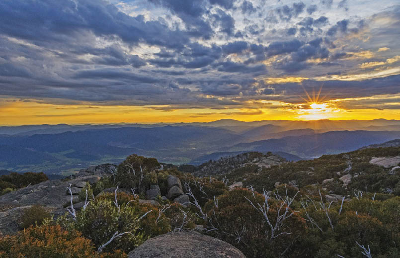
Sunrise on the Buffalo Plateau
Given the long drive from Adelaide to the Alpine National Park, I like to have some breaks to stretch the legs. I chose Mount Hope near Echuca on the way over and I dropped in on the Grampians for a quick walk after some heavy rain on the way back.
But once in the alps area it was back to Mount Buffalo to start. I find it is a delightful and easy place to get around and would like to bring the grandkids up there one day. The morning was spent checking out Mount Dunn, Eagle Point and the giant Og, Gog and Magog boulders. The afternoon saw me throwing on the pack and heading out to the Mount McLeod campsite.
That day set a pattern that was to be repeated throughout my time in the area. I had generally hot and clear mornings, with cloud building up to afternoon rain and thunderstorms.
So there was a little light rain on the way in and after settling in to the fantastic grassy area at the campsite, I did the quick walk to the top of Mount McLeod and watched storms to the north and south. Rising early the next day I was able to watch sunrise from a fair way up McLeod. There was enough cloud still around to add character to the sunrise, and the lighting up of the plateau did not disappoint.
This day was the worst on the BOM forecast and it proved to be that. There was steady rain on the walk out and the drive around to Mansfield was through heavy rain and lightning. I had pencilled in a car camp in the mountains that night, but due to the weather I piked out and stayed in a Mansfield motel.
The Bluff to McDonaldThe next day was another early start to drive over Eight Mile Gap to the Jamieson River where I parked my Yaris at the bottom of the Refrigerator Gap road in lovely clear weather.
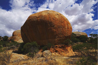
Exploring the granite boulders at Mount Hope
BWA October 2018 | 7
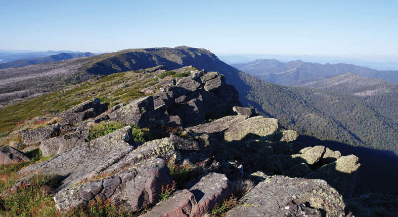

The view from Mount Eadley Stoney to The Bluff
It was a steady but sunny and humid climb of about 500 metres elevation along the road to Refrigerator Gap as the clouds were growing. The Refrigerator Gap Track looked okay to drive for 2WD at the time. I suspect the major threat would be tree fall, and don't know how often this road would be maintained.
I had a chat to a guy in a 4WD at the gap who was dropping water off. He informed me that there were about 260 school kids spread through the mountains at the time. I kept on the road the short distance to the Bluff Track junction and had lunch there.
Climbing the face of the Bluff involves a steep slope with a few scrambly bits - but I made good time and was thrilled to break out onto the tops. The clouds had been steadily building up and now it was apparent that there were a number of storms around.
I initially went to the south-west to check out the southern arm of the mountain before heading back to the top cairn. A few ranges to the north there were heavy rain showers and lightning.
I had hoped to camp somewhere on the back slope of Mount Eadley Stoney to get access to the top for sunset and sunrise. But proceeding north-east on the track it began to lightly hail. Foolishly I did not put on wet weather gear as I could not see anything
heavy headed my way and thought it would be short lived. But this weather was not like bands of rain sweeping through - they were like tropical storms where the weather is generated in situ.
So the light hail then turned to rain, and then heavy rain. I was getting soaked and gave up thoughts of setting up camp in these conditions with Bluff Hut so near. The track was turning into a river and water was streaming down the mountain side. Rain

The Bluff camping shelf had a magnificent view

On The Bluff it's about to get a lot wetter and more hail is coming
8 | BWA October 2018


On King Billy No. 1 looking towards King Billy No. 2
turned back to hail again and was getting heavier. I eventually got to Bluff Hut just as the hail got bigger again and came down in a heavy torrent. The hut was empty but a group of school boys turned up just after that.
I stripped down and got into dry clothes and we waited. As was typical of these days - the storms eventually blew over and exhausted their energy. Then a girls group also arrived and as they set up next to the hut, I put up the tent on a higher shelf about 50 metres from the hut in sunshine and tried to dry some things out.
From this platform Mount Buller and Mount Stirling were just across the valley. Mount Stirling appeared white - like it had snowed - but I was confident that I was looking at thick remnants of hail.
Bluff Hut to Mount ClearAs was the daily pattern, the next morning was clear skies - so I went back to Eadley Stoney to get the views I had missed in the rain. I was a bit concerned to keep one set of clothes dry - so I put my wet clothes back on again to start the day.
Packing up on the return it was then onwards in warm and humid conditions. I visited the top of Mount Lovick which consists of
a basalt cap. This basalt is apparent on a number of peaks in the ranges all the way to Mount Jim way to the north-east.
By lunchtime on King Billy No. 1 the clouds had built up again. I walked in shade and the odd light shower in the afternoon before a stiff climb up Mount Clear to camp for the night.
There was very big rain and lightning out to the east. Curiously, my photos indicate that 90 minutes after those storms were raging the skies had cleared right up.
Mount Clear to McDonaldNext morning was again a cloudless sky. This day was a shorter walk but the warm, sunny and humid conditions lasted later into

Approaching Mount Clear on its northern ridge is a nice example of a snow gum
BWA October 2018 | 9

The summit of High Cone with Mount Clear and Square Top behind

Descending the sharp nose on Square Top, with High Cone on the left, The Nobs in shadow and Mount McDonald on the skyline
the afternoon so it was very sapping. The small spring just after starting the descent off Mount Clear was amazing. The water was so cold and refreshing, just the thing for hot days.
I could not see where any bypass paths went for either Square Top or High Cone so I went over the top of both. About halfway across Square Top I lost the track completely, but realising I was diverging west, I fell back to using my Suunto Traverse that I had preloaded to get me back onto the AAWT.
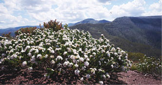
High Cone was a curious top, very open with no shade but lots of flowering bushes. But I loved The Nobs, particularly the far Nob which is such a great platform to survey the area, with a gorgeous ridge back to the first Nob. This was again a basalt cap like Lovick and the King Billies.
The storms were building up later that day so it had all been in bright sunshine to The Nobs, but storms were raging over Mount Buller to the north-west in the late afternoon. I struggled to muster the will power to get up onto the Mount McDonald ridge and was fortunate to stop on a nice saddle and set up camp. I had planned on getting to the top, but it would have been far too exposed with what was coming.
From my sheltered saddle campsite I was watching the storm and lightning over Buller
getting bigger when there was a crash of thunder from behind me. As light rain started I sheltered in the tent. For about an hour it was buffeted by heavy rain and short bursts of strong storm winds. At least three lightning strikes timed in at three seconds away, but with Mount Buller in line of sight I was able to chat over the phone to my wife during the storm.
Once again the storms cleared away to a calm night.
McDonald, Jamieson River and homeThe last morning was very special as I started early to get as high as I could for sunrise. It was a magnificent clear morning and the ridge of Mount McDonald is a great walk.
Getting back and having breakfast, anne3 happened to be walking past. My wife had heard her on ABC radio and wondered if
10 | BWA October 2018


Looking down McDonald's northern ridge, a common ascent route. Eagle Peaks are on the left, Buller is on the skyline and The Bluff is on the right
Brian (aka Eggs) is from Adelaide and enjoys walking and bush photography with his wife and friends and sometimes going solo. He has four children and with three married greatly enjoys time with them and his seven grandchildren.
we might cross paths. She was walking the whole Australian Alpine Walking Track from Canberra to Walhalla. We had a chat but after she left I was concerned for her due to the weather reports predicting significant flooding the next day. She did pull out the next day - and then went back a few days later to restart after the storms.
The return to my car involved a very steep and difficult walk down the 4WD Nobs Track. I have no idea how a 4WD could get up this road. I considered this the hardest part of my walk - and I was going down!
Back at the car it was time for lunch and I decided to freshen up by jumping in the Jamieson River. It was absolutely freezing and I could only submerge for about two seconds before getting out and drying off.
One lesson from my walk: I was very mindful of the weather reports, so my Bluff walk was revised from five days to four to avoid the heavy rain forecast on day five. However, the predicted 1-2 mm that the BOM forecast for Buller on a few of those days was a very inadequate description of what was going on. On each of the days out, there were thunderstorms, and depending on where you were, you could get drenchings and hail
or you could miss out altogether. I believe some locations in the mountains got 200 mm the next day, so I was glad to be on the way home.
I stretched the legs with a short stop in the Northern Grampians, where they had 25 mm of rain that morning, to see Beehive Falls with a reasonable flow in it.
I was very thankful to God for a number of kind providences over those days - throwing a dry set of clothes in the pack at the last minute rather than going super light, being near a hut for shelter when I got caught in the hail on the Bluff, cold spring water on Mount Clear and stopping early on Mount McDonald and getting the tent up before the storm hit.
All up, I was very happy to have covered a bit more of the Victorian Alps - including a substantial portion of the AAWT.


BWA October 2018 | 11