

The year before this trip I'd walked from Tharwa to Thredbo, finishing in cold disarray as quite bad weather hit the Main Range for three days. This year was Thredbo to Mount Bogong and Mountain Creek. The following describes the two days before the last day, when I descended Staircase. The report starts at Mount Wills.
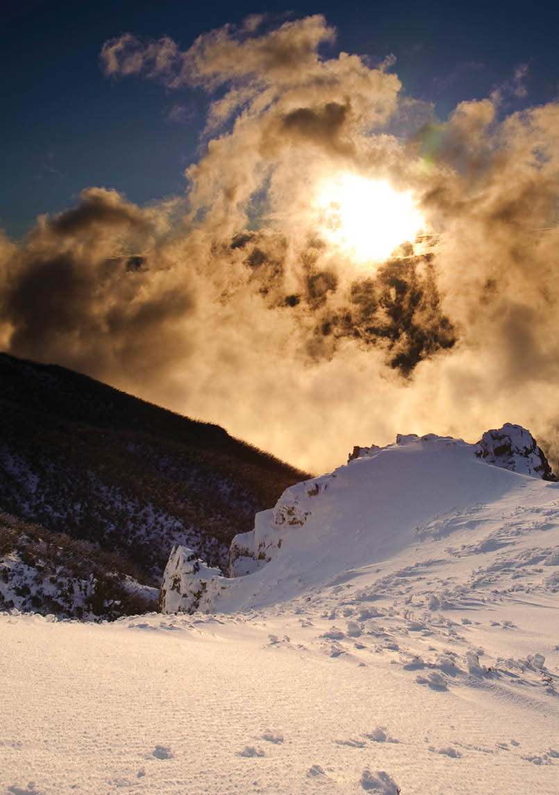
Bogong camp with Mount Wills on the left skylineAll pictures by Stephen Lake

Mount Wills to Mount Bogong
AAWT Completed
Stephen Lake

6 | BWA April 2019

Mount Wills to Cleve Cole HutOvernight the weather had deteriorated slightly. Foggy, no view, windy, light rain a bit stronger, cool. The joy of putting on wet socks!
In January 1974 I led the first walk on the Alpine Walking Track. The 1974 AWT started at in Victoria at Tom Groggin, west of Thredbo, and then went to Mount Wills. When the Dartmouth Dam was built a portion of the AWT was flooded, so a new route was found, the one I had just walked, from Cowombat Flat. The AWT was later extended north to Canberra to become the Australian Alps Walking Track. The 1974 AWT approached Mount Wills from the north, turning west a short way before the summit of Mount Wills to go to Big River Saddle and then climb Mount Bogong. I was on Mount Wills going north to meet the 1974 AWT route.
It wasn't much, just a marker on the 4WD track showing a foot track west to Big River Saddle. But I had been here before, just once, on or about 8 January 1974. At this point I had now walked all the AAWT, albeit some parts when the AAWT was called the AWT. I thought of the people who were with me on the AWT, Frank, Ray, Terry and Tim. This was nearly 43 years ago, a lifetime of bushwalking.
Onward and downward. The bushwalking Olympic motto was very true: Slower, Lower, Wetter. The foot track was steep and
slippery, unsuited for racing, and it took an hour to squelch 2.5 kilometres down to Big River Saddle. Water and fuel were ingested then I slogged up Big River Road.
Up, up, up. Try to set a good pace, thwarted by too many logs. Rest every now and again. This Long Spur is well named! More logs.
The end of the 4WD track was reached at 11.45am, and the fun began. For about five slow energy-sapping kilometres from the sign the foot track varied between acceptable and horrible. The latter was chest-high scrub, unable to see the track, which I had to feel with my boots. Trees across the track required time to cast around for where it went. Much energy was spent pushing scrub, and more time was needed as I went slower. This is the bottom line in funding cuts to Parks Victoria, with what should be the best long-distance alpine walk in Australia barricaded with logs and scrub. NSW and ACT maintain the AAWT brilliantly.
Then the weather really broke. In 50 years of bushwalking I could not recall such a heavy continual burst of rain while I was walking. The track had 30-100 mm depth of water rushing down. There was no shelter, no Mount Wills rocks to hide under. So I pushed on and on. The guide book said good views. I had none. There are no photos for this section - too wet. Like yesterday walking to the Mount Wills Hut I was in clouds, a cotton wool cocoon that softly shrouded me, denying me the hard-earned views that I was looking forward to but never saw. Ah well, I can return in 43 years. I'll be 106.
While it was up like a stairway to heaven, the continual climbing was closer to hell, a wet, cold, cloudy hell. I thought of No Name City from Paint your wagon.
Will you go to heaven? Will you go to hell? Go to hell!Either repent, or fare thee well.Fare the well!God will take care of No Name City.Comes the end, and it won't be pretty. Here it is! I mean, here it is!
And it was, too.
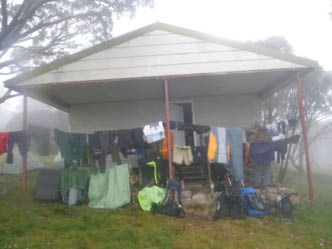
Mount Wills Hut drying
“At this point I had now walked all the AAWT ...
BWA April 2019 | 7

Camp Creek in flood
Finally, after many soul-destroying false summits, I reached the top of Bossiaea Hill and my heart rejoiced. I know this place! Down to the main pole line, flatness to Camp Creek, then up for 1.5 kilometres to Cleve Cole Hut. Can do! The rain stopped, as if to say we have not killed you, nearly there, we'll let you go - this time. As envisaged, Camp Creek was in spate, and I had to carefully negotiate a crossing.
Then the last stretch, a rocky if aquatic track up to Cleve Cole Hut. By this stage I was very low on energy. For more than an hour the jacket pocket with all my nibbles for today had a snagged zip, and it was too wet to take the pack off and delve for food. So now, close to the hut, I pushed on, regardless of the draining energy caused by climbing, distance, scrub, time, cold, lack of food and age-related decrepitude. Plod on, stopping at every snow pole or less. I reached the hut at 3.45pm, wrecked beyond belief. Too many hours of cold wet scrub and torrential rain. One walker at Mount Wills Hut described it as being in a car wash with no car.
I went in, took off my pack and knelt on the pack, unable to stand for a minute or two. This was very close! Too close. I later found out that the day before, Melbourne had wild weather, a one in 100 year storm, and the weather had moved east to make me suffer. A mate from near Glen Wills Retreat said that the rain gauges had about 100 mm of rain. Most of this went down my neck. This was one of the hardest days I’ve ever walked, a fair step and climb in often appalling conditions on a track that was hard to follow at times, no food for the last 90 minutes.
By the time that the weather cleared that evening I was too settled in the hut to move. It was a fine windy night, my tent was dry, and I could have camped. However, inertia ruled. Dinner, a cup of tea with the much-delayed choccy cake, and hide in the sleeping bag. Out like a light.
Half rest day at Cleve Cole Hut,Mount Bogong summitAfter the drenching going up Mount Wills and the pounding I took yesterday it was good to have a fine day. Gear was hung out to dry in the warm breeze and sun that graced
8 | BWA April 2019

the hut. The morning passed in a slow sloth of doing not much. A few people came by. I finished eating the cake I made the night before. Yum!
There was a log book entry, two people I knew 40 years earlier, Gordon and Terry, who had climbed Mount Cook the day before me. They left Cleve Cole Hut yesterday and descended Long Spur. We missed each other near Big Saddle in the murk. Bother. I would have loved to meet them again. We've since exchanged pictures and we have all got older. I doubt very much if we would have recognised each other at Big Saddle.
The log book had a number of interesting entries, like “Team smelly”. “Janice I'm 10 years old and this is the first time in this hut.” In November 2016 a party went from the Bogong High Plains then up and over the west ridges of Bogong. “Lots of dead fall on lower slopes of Quartz Ridge after crossing Big River. Although not a significant obstacle, the repeated over-and-unders are an embuggarance.” This is my new favourite word.
After lunch I left for the summit, a short stroll, three kilometres and 200 metres of easy climbing on the highest ridge in Victoria, with wide open slopes, gentle and steep, descending to the depths of the valleys over a kilometre below. The views were spectacular. To the north-east was Jagungal, about 120 kilometres distant, quite distinctive, even in the haze. The bumps to the right of the big jagged one must be the Main Range, above Thredbo, with Kosciuszko just another bump, indistinguishable. Pilot and Cobberas were a tad hard to spot, but I knew where they were. The Bogong High Plains were due south, with the Nelses closest, bare tops very obvious at 1880 metres. Feathertop was 25 kilometres south-west, standing tall and aloof, 1922 metres. West was Mount Buffalo, a very prominent mountain. Jagungal can be seen from about 200 kilometres of the AAWT, a much better bushwalking and ski touring mountain than many.
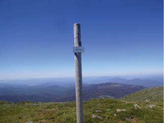
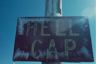
The signs used to have character, but have now been reduced to a common form. See the two Hells Gap signs from May 1980 and the current trip.
At the summit the sun was shining, the air was warm, the wind was pleasant, my proposed campsite was vacant, and I had a heap of water. I met a few walkers from Cleve Cole Hut, including volunteer rangers Michael and David who were keeping a tally of visitors and noting parts of tracks that needed attention. A large bird was riding the thermal surf, nearly motionless, soaring on invisible swirls of cascading air with ease, an enviable freedom to swoop deeply and rise into the clear blue sky. A song came to mind, Wings of an eagle.
On the wings of an eagle I find myself lifted through the skies,Lifted up above the world to sing.On the wings of an eagle I find myself lifted through the skies,Lifted up above the world to see,Can you see me? Can you see me?
“There was a log book entry, two people I knew 40 years earlier ...
“The signs used to have character ...
BWA April 2019 | 9


Sunset at Mount Bogong
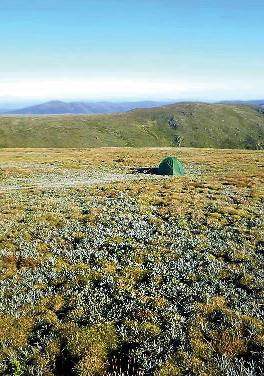
About 30 metres distant and 18 metres altitude from the summit, hopefully sheltered tonight, a series of hollows reside, just flat enough for camping. Sort out the kit, eat dinner, lie back and think about the last year, the last few weeks since Thredbo. A year ago on this evening I was on Gungartan. I thought of the people that had helped me, like NSW Trainlink, Michelle and Gordy. This was one of my toughest trips. Pilot scrub, heat and low water. Sundry portions of tracks that were not at all obvious. Long hard days, much distance and climbing. Hailed on twice, dreadful weather in a number of places, especially Long Spur. Relaxing at Glen Wills Retreat with Gordy for two nights, bliss. Mount Wills and Cleve Cole Huts that provided much-needed shelter after adverse weather. Happiness at being able to manage hard days at an age when many do far less. Any assertion that I'm barking mad is false. It's more of a growl.
As the light faded on the last day of the year I walked to the summit. Two people I met there earlier, Dean and Justin, were camped nearby and joined me as the year ended. We watched the Bogong Moths fly to their home in the summit cairn. Like them we were getting high on mountains. The setting sun threw a large shadow of Bogong to the east.
Two lights twinkled, probably the top of ski lifts at Falls Creek. Apart from that the hills were dark, not a glimmer to be seen. There were people at Cleve Cole and on the Bogong High Plains, but there was no sign of them. The Kiewa Valley lights were hidden by the whale back of Bogong's ridges. We were alone on the top of Victoria as the sun farewelled 2016. Millions saw fireworks this
night at thousands of places; I did not envy them. Three people saw the sun set from Mount Bogong. It was a privilege to be here. I first overnighted on the summit 44 years ago, within a week of tonight.
The Carpenters' Top of the world was apt.
I'm on the top of the world lookin' down on creationAnd the only explanation I can find,Is the love that I've found ever since you've been around.Your love's put me at the top of the world.
This is not about a person and me. It’s about the mountains and me. So much happiness, so many wonderful people sharing these times, people I walked, skied and climbed with or just met on the track or in camp, people to trust with your life, occasional hard or bad times. Some who died in the mountains, or just died: TH, VG, CJ, MC, FM, WM, others. Some I will never forget.
I thought of Cilla Black's You're my world that describes the mountains and me:
You're my world, you are my night and day.You're my world, you're every prayer I pray.If our love ceases to be,Then it's the end of my world, end of my world, End of my world for me.
After all the trials getting here, it was good to see the year out on top of the world in Victoria in fine weather, cool fresh air softly blowing, stars shining increasingly brighter as darkness gently embraced the mountains and my small insignificant home.


10 | BWA April 2019