

A love of moving fast through mountainous wilderness, an attraction to any endurance challenge and a fascination with the Australian Alps Walking Track (AAWT), are the common interests that brought the three of us together to attempt the self-supported fastest known time (FKT) for the AAWT. Such like-mindedness and a significant amount of planning and preparation, culminated in Kylie Salm, Phil Robinson and me setting out on Friday 16 November 2019, each thinking that while obtaining the AAWT FKT of anything less than the record of 11 days and 18 hours was possible, it really was not probable.
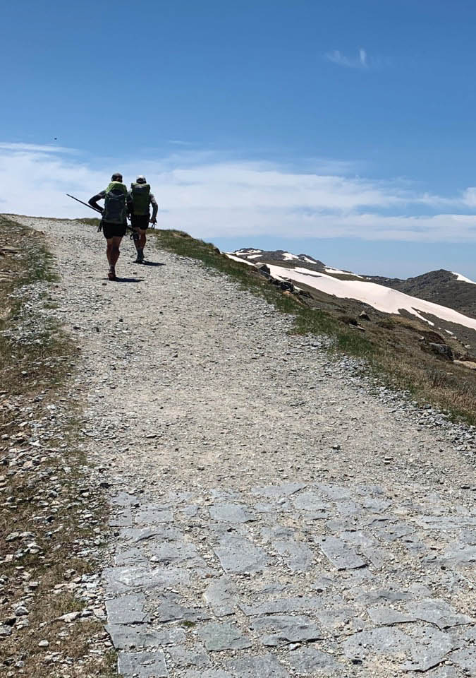
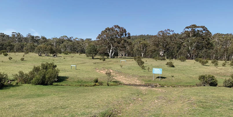
Day 9 - Just above Rawson PassAll uncredited pictures by John Riley

Australian Alps Walking Track
Fastest Known Time
John Riley

10 | BWA February 2020
For those not aware of its attributes, in simple terms the AAWT is a 660 kilometre traverse across the roof top of Australia, passing through some of the most remote and scenic areas in the country. Starting in Walhalla in Gippsland, Victoria and ending in Tharwa near Canberra, the AAWT demands over 27,600 metres of ascents (more than three Everests) and a similar amount of descents.
The record self-supported FKT for the AAWT was set by Paul Cuthbert in March 2016. In fact it was the fastest anyone has done the full AAWT period - supported or otherwise. He was at the time, and still is, a very well-known and accomplished ultra-runner/athlete. He was clearly someone that could move over mountainous terrain much faster than us. It was therefore obvious that to get anywhere near his time we would have to be at our physical best, have luck on our side and make very few mistakes on the track. Perhaps the edge we needed was a combination of good weather and a good knowledge of how to navigate through the less defined areas of the track.
We had varying degrees of experience with the AAWT, however each of us had previously been defeated by its many forms of defence. For the AAWT, the well-known saying "to succeed you must first fail" is truly apt. Attempting the AAWT, no matter what form that attempt takes, is certainly a humbling experience.
In our 2018 attempt, after five days I had my feet stripped of a substantial amount of skin resulting in me hobbling off Mount Bogong at the 280 kilometre mark to be rescued at Mountain Creek. That year Kylie and Phil with another experienced ultra-runner, Simon Turnbull, had made it 447 kilometres to Dead Horse Gap only to retreat to Thredbo due to illness and storms on the Kosciuszko Main Range.
Phil also had a couple of failed FKT attempts in earlier years. Again a combination of poor weather, navigation issues, injury or illness, were to blame for abandoning the track or falling behind record pace.
Given these experiences we certainly had an appreciation of the challenges and risks we faced. We also had a love/hate relationship with the track. Overwhelmingly though we had an inability to put the AAWT FKT at the back of our minds. To use mountaineering terminology, we were "prisoners" of the AAWT. Our only escape from a life sentence was to complete the track in less than the record time.
Preparing for the FKT attemptA goal without a plan is merely a wish and wishes rarely come true.
We were travelling super-light, carrying little in the way of food and water. This meant many well-placed food drops and a good knowledge of where water could be found.
On water, we were lucky with some good falls of rain and even snow in Victoria the week before our departure. With the exception of the 37 degree day when we went over Johnnies Top, water never needed to be rationed. Nor did we have to leave the track far to find it.
For food we had 10 food drops, each placed at our intended bivvy/sleep stop. Our wishful thinking was that for most days we would never have to carry dinner or breakfast. As it turned out, we only made two of these drops by the designated night, Low Saddle and Mount Speculation. So in the end for the majority of the time we were carrying 2-3 kilograms in food.
Putting in food drops took many weekends through October and November, of driving 2WD and 4WD vehicles, mountain biking and long hikes. Most of the national park roads in Victoria remain closed until Melbourne Cup weekend, so with the exception of Low Saddle Road and Kiandra, it was never a case of placing a food drop straight out of the car.
Obviously there was also the need to prepare our bodies for 12 days of continuous running and walking up and down mountains. I started in August with mostly long runs in Melbourne, which ultimately led into full fastpacking days around Wilsons Prom
“... each of us had previously been defeated by its many forms of defence.
“Putting in food drops took many weekends ...
BWA February 2020 | 11
This summary shows very clearly how long and hard the days were.
and the Grampians during September and October. My Melbourne runs reached 32 kilometres on most Sunday mornings, while my day long fastpacks were up to 70 kilometres. I supplemented this with heaps of fast road cycling through the weekday mornings and a long ride in the hills on Saturdays. Some weekdays I would ride in the early morning and then run up to 12 kilometres at night after getting home from work.
In the end, while I was pretty happy with my fitness level at the start line, how my body would be after four or five days of long continuous running and walking up mountains remained an unknown, and is perhaps something that cannot be addressed through any specific training approach.
One area I was found lacking by comparison to my AAWT companions was hill speed, both up and down. They trained over hilly terrain around Port Macquarie while I mostly stuck to pancake flat bayside Melbourne. My thinking that quad strength through cycling would address this was just plain wrong. Phil and Kylie absolutely smoked me in the mountains, particularly running down anything steep. The clear message being, if you want to play in the mountains then you need to train in the mountains.
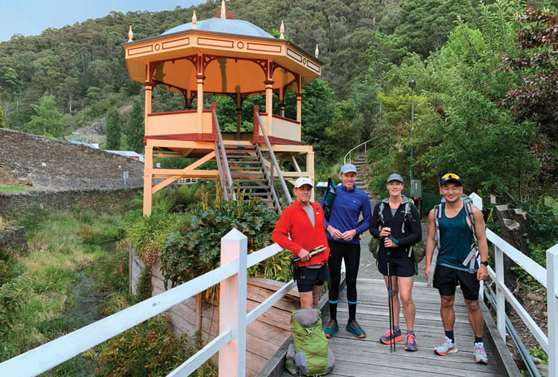
Our AAWT journeyDay 1 – Walhalla to Red Jacket 70.3 kmAfter a great counter meal the night before at the Wally Pub, a good night's sleep at the very comfortable Star Hotel, and a big breakfast there, we set off from the Mountaineers Brass Band rotunda at 6.02 am on Friday 15 November. Once up and on to the old tramway it was a very fast start for the first 7 kilometres to the Poverty Point Bridge. We did this in a little over an hour and then after crossing the Thomson River we launched into the long climb up to and onto the Baw Baw Plateau. Apparently this is the longest continuous climb on the AAWT, ascending some 1125 metres to Mount Erica.
On the climb, our first of only three snake encounters was a sleepy tiger snake near Mushroom Rocks. It was enjoying the sunny conditions as much as us and at first refused to move off the path. Prodded lightly with a long stick, it eventually slowly moved to the side of the track, signifying we could now pass through its territory.
With such perfect weather and a few remaining snow drifts, the Baw Baw Plateau was at its picturesque best and good speed was enjoyed to make Mount Whitelaw Hut site at 1 pm. After a quick lunch and a water refill it was an easy jog down to Stronachs
Day
Date
Description
Time
Km
1
15
6 am, Walhalla, Baw Baw Plateau Red Jacket, 8.30 pm
14.5
70
2
16
5.45 am, Black River, Mount Sunday, Low Saddle, 9 pm
15.3
57
3
17
6.25 am, McDonald, Clear, Magdala, Speculation, 10.20 pm
16
44
4
18
7 am, Razor, Viking, South Selwyn, 7.45 pm
12.8
32
5
19
5.55 am, The Twins, Hotham, Cope Hut, 8 pm
14
53
6
20
5.20 am, Ropers Hut, Long Spur, Wills, Wombat Divide Track, 11 pm
17.7
55
7
21
5 am, Mitta Mitta, Johnnies Top, Buckwong Hut, 9.30 pm
16.5
57
8
22
5 am, Cowombat Flat, Tin Huts, 8.30 pm
15.5
53
9
23
5 am, Dead Horse Gap, Main Range, Rolling Ground, Whites River Hut, 8.15 pm
15.3
52
10
24
6 am, Valentine Hut, O'Keefes Hut, Nine Mile Creek, 7.45 pm
13.8
64
11
25
5 am, Kiandra, Murrumbidgee River, Dairymans Gap, Oldfields Hut, 8.45 pm
15.8
67
12
26
4 am, Murray Gap, Cotter Gap, Honeysuckle Creek, Tharwa, 3 pm
11
50
“... our first of only three snake encounters ...
12 | BWA February 2020

Camp before our first real AAWT obstacle was encountered, a two kilometre gym session going under, over and around a maze of fallen trees while trying to stay on a vague foot pad. It's a difficult but thankfully short lived section of the track. Small and light packs also help.
Once through the pick-up-sticks section, the AAWT popped out on to Thomson Road which runs north-east into a very ugly logging coupe, a stark contrast to the beauty of the Baw Baw Plateau. From there it was a quick descent into the mass of mossies that rule the Thomson River. Crossing the river is now very simple thanks to a new log bridge complete with handrail. What is not simple though is the 600 metre climb up Mount Eaton that follows. Tired legs, ridiculously steep terrain and many false summits, make this climb late in the day torturous. Still we grovelled our way to the top in fading light and increasing rain, only to almost immediately lose our hard earned altitude descending steeply into the Jordan River. It was 8.30 pm and nearly dark by the time we made Red Jacket but thankfully the rain had stopped.
Too tired to head up Victor Spur Road we made the decision to tackle the Victor Spur track at first light in the morning. I found a relatively flat spot under a tree and after a quick Back Country dinner, I climbed into the bivvy. Despite being tired, the constricted space of the bivvy and sore legs and hips made for a restless night.
Day 2 – Red Jacket to Low Saddle 57.4 kmThis day was mostly roads so navigation was going to be easy, perhaps with the exception of descending off Mount Sunday at the end of the day in the dark.
An early start of 5.45 am and a speedy climb up Victor Spur, meant a well-earned breakfast at our first food drop on Mount Victor. From there the 19 kilometre road bash to Black River commenced. Rather than contend with numerous river crossings we took the longer route down the Champion Spur Link Track and hit the Black River log crossing for an earlier lunch. This really is a pretty spot and I was a bit disappointed that we could not set up camp and spend the afternoon bathing in the crystal clear shallow waters of Black River.
Day 1 - Departing Walhalla. Phil, John, Kylie and our first day companion Kohby PoolePicture by Michael of the Star Hotel
BWA February 2020 | 13

We kept moving and next on the menu was the 700 metre climb up Mount Shillinglaw. The track was easy to follow at first but then got a bit sketchy as it changed direction in a saddle near the top. Still, we found the linking jeep track and powered up to the Jamieson Licola Road and then on to Middle Ridge Road. While it was a road walk, I always found Middle Ridge Road enjoyable. There are many heavily ferned gullies with waterfalls and streams that run into or under the road. Expansive views to the north-east are also to be enjoyed.
We stopped for a quick late afternoon break at Rumpff Saddle and then made the 14 kilometres to the top of Mount Sunday by sunset. We knew coming off Mount Sunday into Low Saddle would be difficult in the dark, however we were surprised at how overgrown and difficult the track was for the last two kilometre; it seemed much worse than in 2018. We finally made Low Saddle at 9 pm. Too tired to eat, it was straight into the bivvy for another restless night with sore legs and hips. I began to wonder whether my body will adapt or whether the long days plus little sleep will ultimately get the better of me. I also started to worry about my feet, with blistering similar to the previous year starting to develop. I even contemplated my AAWT exit routes for the next day, thinking a retreat down the Howqua Feeder Track may be an option. These negative thoughts and the cold night, -1 °C, also helped to keep me awake. Recollecting the 2018 feeling of AAWT failure began to fill my weakening mind.
Day 3 – Low Saddle to Mount Speculation 44.2 kmI climbed out of the bivvy bag early so that I could bandage my blistered feet and place gel toe caps on the two toes that were now red raw, although unlike 2018 the skin was still on. A quick breakfast and then we headed up Mount Sunday Road to the Mount MacDonald turn-off at 6.25 am. My feet were painful at first but somehow they warmed up, allowing me to move at normal speed and keep up with my faster companions. We made good time once high and passed through The Nobs, (where we ran into two completely camouflaged deer hunters with high-powered bows), High Cone and Mount Clear. We then stopped for a late lunch next to the Chesters Yard spring.
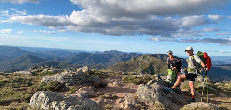
In the early evening the scenery was spectacular as we moved past Mount Magdala, Big Hill and Mount Howitt. We arrived at the start of the Crosscut Saw as the light began to fade. This meant the last two-thirds of the Crosscut Saw and up and on to Mount Speculation summit was under torchlight in near complete darkness. Half-way across I thought the top of Mount Buggery would be the end of a big day, however Kylie powered on and led us over Mount Speculation to our third food drop near the Camp Creek campsite. It was another late finish at 10.20 pm and another cold and uncomfortable night in the bivvy.
Day 3 - On Howitt with the Crosscut Saw and Speculation in the background
“My feet are painful at first but somehow they warm up ...
14 | BWA February 2020

Day 4 – Mount Speculation to South Selwyn 32 kmThis day was always going to be our slowest. There is no quick way through The Viking. Navigating its faint pads and confusing multi-direction track takes time, and so does climbing up and over and then descending its steep rocky slopes. Despite a late start of 7 am and a stop for water in Viking Saddle, we made Barry Saddle for a late lunch. From there we only managed a 17 kilometre afternoon to South Selwyn. We decided to finish early and enjoy a relatively early and relaxing dinner. Compared to the previous three days this seemed like a bit of a rest day.
The easier day and with my body adapting to the daily pounding, a great sleep in warm and windy conditions was enjoyed near the water tank on the top of South Selwyn. My feet bandaging and gel toe caps also seemed to be working. The blistering had stabilised and the morning pain remained temporary as my feet warmed up after the first hour.
Despite the easier day we also remained ahead of record pace. By our calculations at the end of day four we were holding a 17 kilometre buffer on the record.
Day 5 – South Selwyn to Cope Hut 52.7 kmRevitalised from the easy day four, we set off at 5.55 am and ambitiously agreed to an end of day target of Ropers Hut. We ended up 16 kilometres short of that, but enjoyed perfect conditions running down Swindlers Spur and then across the very scenic Bogong High Plains. Another highlight of the day was our fourth food drop at The Twins which, after 30 minutes of failed searching by me, was eventually found by Phil despite me placing it there only three weeks earlier.
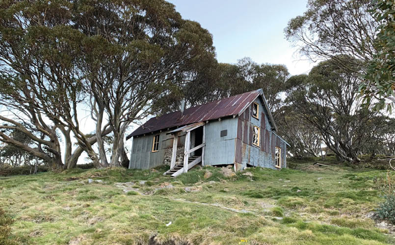
Another earlyish finish (8 pm) at Cope Hut meant a full body wash in the creek and a three course dinner could be enjoyed. The hut also provided comfortable lodgings after four nights in the bivvy. Our spirits were high, although Kylie had begun to develop some Achilles problems; both her ankles and feet were now completely bandaged and some bad blistering to her toes and the bottom of her feet had also started to become painful. By contrast, Phil remained completely blister free, jokingly commenting that one of his feet felt slightly wrinkled.
Pleasingly, our lead on the record had also increased. We estimated that at the end of day five we were 26 kilometres ahead of record pace.
Day 5 - Cope Hut
BWA February 2020 | 15

Day 6 – Cope Hut to Wombat Divide Track 55.4 kmA 5.20 am departure and flat terrain along the Langford West Aqueduct and Big River Track made for a very fast start in the early morning. We ran most of the way to Ropers Hut and then dived quickly down Duane Spur to the Big River crossing. The crossing was no more than thigh deep, although for myself and Kylie it meant getting our heavily blistered feet wet, inevitable. Avoiding my mistake of 2018, we stopped and dried everything out and rebandaged where necessary. I also swapped to my completely dry second pair of Armaskin inner socks and DexShell waterproof outer socks.
It seemed that our bodies were starting to adapt to the demands of the AAWT as we maintained a good pace up T Spur to Maddisons Hut site. After a quick water collection we immediately hit Long Spur for the 13 kilometres descent to Big River Saddle. I have now passed my 2018 exit point and I started to feel some slight achievement from going further than the previous year.
Big River Saddle looked like a nice campsite and perhaps a good place to spend an afternoon in the sun recovering, however that was really not an option for us. Our only option was the long and steep climb up to Mount Wills Hut where our fifth food drop awaited. The climb reduced us to our slowest pace for the day, however increasing hunger drove us to the top of Mount Wills.
The Mount Wills Hut area really is a special spot. Beautiful snow gums sit amongst huge granite boulders, with large expanses of alpine grass providing ample tent sites. The rocky outcrop that is the summit of Mount Wills provided 360 degree views of where we have been and where we are headed. This included our future objective of the snow-capped Kosciuszko Main Range.
We had an extended rest in the sunshine outside the hut, ate a late lunch and chatted with a friendly party of three fellow AAWT trekkers, who I previously ran into a few weeks earlier doing our Low Saddle food drop. One of the friendly party happened to be a doctor who provided great advice and even examined and re-strapped Kylie's feet.
The temptation was to stay put and enjoy a star-filled night on Mount Wills, however it was too early in the day for that and we gave in to the ever present feeling of the need to keep moving. So down Mount Wills and along the Omeo Highway we went, turning off at the Gill Spur Track. By the time we crossed Gill Creek it was dark which in the end was fortuitous as we were unable to see the gradient of the climb coming out of Gill Creek. This is a seriously steep and tough section of the AAWT, which I was not aware of. My calves were burning and my Achilles were stretched to their limit as I tried to keep Phil and Kylie within sight. I was thankful that my pack was only circa eight kilograms
Day 7 - Taylors Crossing over the Mitta Mitta River
“By the time we cross Gill Creek it's dark ...
16 | BWA February 2020

Day 8 - Cowombat Flat, crossing the infant Murray River into NSW
and I thought of those much tougher AAWT adventurers who must have somehow climbed up this with 15+ kilogram packs. We all eventually got to the top and, in the dark, crashed on the side of the road which was the Wombat Divide Track. It was nearly 11 pm so it was straight into the bivvy, hoping that no vehicle traffic would be on the track as a lack of cleared level ground forced us to set up on the very narrow shoulder of the road.
A check of our comparison with record pace suggested that despite our big day, our lead had reduce to a little over 19 kilometres. Paul's bigger engine was starting to eat into our slender lead!
Day 7 – Gill Creek to Buckwong Hut 57 kmThis would be our hottest day with temperatures reaching 38 °C. Accordingly, an early start was in order. We hit the track a bit before 5 am. The morning quickly warmed up and we stopped at Taylors Crossing for a leisurely breakfast and water collection. The Mitta Mitta River felt unusually warm and I filtered my water for the first time.
From Taylors Crossing, the AAWT offered a refreshing change of scenery as the harsh scrub gave way to pleasant pastoral land through the Fraser Tableland. Such pleasantries were short lived as navigation became tricky and the very swampy Morass Creek must be crossed. We avoided wet feet but not the bush bash to find our way back onto the track, which we lost soon after
crossing the creek. Eventually we popped out onto Benambra-Corryong Road and commenced the drawn out very hot climb to Johnnies Top. By this time it was the middle of the day and we were suffering in the heat and a little worried about the very hazy smoke-filled air that surrounded us. What was comforting though was the lack of any scent of burning bush.
In the heat and with limited water, I rationed myself to a sip of water per kilometre. Consequently I was extremely relieved to reach the water tank at Johnnies Top, where I quickly mixed up and guzzled down a litre of Gatorade. We had lunch and then got on the move again to quickly reach the hot gully within which the Buenba Creek gently flowed. Following the creek we made it to Buenba Hut site and then crossed Buenba Road to begin the climb up to Mount Hope Road. To me this was another one of the AAWT's "ghost climbs" – easily missed when looking at the map but certainly not something un-noticed at the end of a long hot day.
Our goal was Buckwong Hut and we still had seven kilometres to go once on Mount Hope Road. Thankfully it was mostly downhill, initially allowing for a slow jog until darkness set in. We arrived at Buckwong Hut around 9.30 pm and forced ourselves to eat a late dinner from our sixth food drop near the hut. We had the company of a large and noisy school group which delayed the onset of much needed sleep.
BWA February 2020 | 17

Day 8 – Buckwong Hut to Tin Mine Huts 53 kmI was woken early by two feral horses who were sniffing around, and were uncomfortably close to my bivvy. Sleep was impossible after that so breakfast was at 4.15 am and after filtering water we were on our way under torchlight by 5 am. Although the track was a little undefined in places the terrain was flat which allowed us to travel quickly up and on to Misery Trail, from where we enjoyed our first views of The Pilot and the Cobberas.
After leaving Misery Trail the confusion of the many feral horse tracks continued and we lost some time trying to stay on, or at least near, the official track. Things got easier upon reaching the Limestone Creek Track, from where it was a case of following the western bank of Stony Creek in a southerly direction until the Cowombat Flat Track was met.
While easy to traverse, I found the country up to Cowombat Flat the least interesting of the whole AAWT. There were only limited views from the shallow gullies that the track followed and the vegetation seemed to be very dry and monotonous. It was therefore with some relief that we arrived at the open expanses of Cowombat Flat and enjoyed the achievement of passing into NSW where an easier AAWT was promised.
At this point I also noticed that feral horse damage was becoming increasingly obvious. Protecting these animals in an ecosystem in which they do not belong is completely wrong. This is clearly evident from the polluted waterways and the trampled vegetation in areas that would otherwise be untouched wilderness. The sight of a young feral horse hobbling aimlessly with an obviously badly broken leg also signified that their proliferation was perhaps a fate cruel to them as well.
Back onto our AAWT journey, we pushed ahead, keen to make our goal of Tin Mine Huts by nightfall. We eventually got there at 8.30 pm and we were welcomed in from the cold night by a roaring fire and a friendly mountain biker who has ridden up from Dead Horse Gap.
We set up our bivvies on the dirt floor of the hut and after dinner it was time to calculate where we sat compared with record pace. We thought that perhaps we were about 25 kilometres ahead of Paul at the end of day eight.
It was also time to assess injuries. Kylie's blistering has developed into large patches of skin missing from the bottom of her feet. Essentially they appeared heavily sandpapered. It was hard to look at and evidently extremely painful. I wondered how she could walk, let alone run. Kylie talked about exiting at Dead Horse Gap but Phil
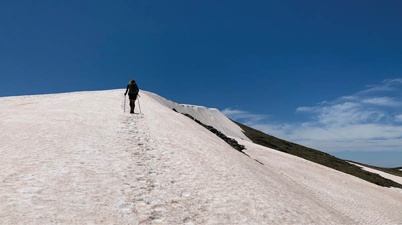
Day 9 - Ascending the shoulder of Muellers Peak
“I'm woken early by two feral horses ...
18 | BWA February 2020


quickly shut that down, correctly pointing out that she was not slowing us down and to date she has managed the pain. After Phil's friendly chat, there was a degree of acceptance by Kylie that more Ibuprofen, Panadol, blister pads and Fixomull tape was the only way forward.
Day 9 – Tin Mine Huts to Whites River Hut 52 kmToday more than ever we needed the weather gods on our side. Thankfully they did not disappoint. We left Tin Mine Huts at 5 am under clear skies, making the 25 kilometres to Dead Horse Gap in 5.5 hours. We had a late morning tea at our seventh food drop and after confronting the stark reality of human civilisation at the Dead Horse Gap car park we quickly moved on to the climb up to the Kosciuszko Main Range.
Being near perfect weekend weather and the middle of the day, there was a constant stream of people moving between the express chairlift and Rawson Pass. We managed our way through the crowds and were relieved to reach the quieter trails after Muellers Pass. For me, this quickly became one of the most memorable parts of the
AAWT. The scenery was eye-watering. It brought on that feeling of how lucky I was to be in this place. Looking down into Albina Lake and Blue Lake and crossing Carruthers Peak and Mount Twynam were all highlights. There were a few lengthy snow drifts to negotiate in our trail runners, but this was made slightly easier by the soft snow in which we kicked small steps and footholds.
We stopped for a late lunch at a small stream, near the Anton Anderson saddle on Pounds Creek, laying in warm sunshine and sheltered from the chilling breeze by large granite rocks. It was hard to move on but our preference was to traverse The Rolling Ground in daylight. Phil took the lead and although we initially aimed for Schlink Pass and then onto Schlink Hut, we settled on Whites River Hut as darkness and fatigue set in. It was also quickly becoming very cold and the warmth and comfort of the hut was embracing.
After dinner it was time for a quick AAWT record check. Our calculations suggested we remained around 24 kilometres ahead of record pace.
Day 9 - Albina Lake and snow drifts on the Kosciuszko Main Range
BWA February 2020 | 19


Day 10 – Whites River Hut to Nine Mile Creek 64.2 kmIn our minds this was to be the start of the speedy part of the AAWT. Our expectation was to increase our speed and daily kilometres from here on. Personally I also felt that my body and feet were finally co-operating. My blistering had stabilised and I no longer felt fatigue in the legs until the late afternoons.
Kylie was still suffering, with little skin left on the soles of her feet. There was still some talk of her finishing at Kiandra, however Phil quickly silenced this again. He now had the added armoury of pointing out how close we were to finishing.
We made a late start, leaving Whites River Hut just after 6 am. The flat roads that led us into the Jagungal wilderness area allowed for some easy running early in the day. Despite the quick pace, we seemed to travel forever towards and then around Mount Jagungal.
Our first stop was an early lunch at our eighth food drop near the Round Mountain Trail-Grey Mare Trail intersection. After loading the day's food we continued at a fast pace, eventually passing the very prominent Mount Jagungal and soon after O'Keefes Hut and then Mackays Hut. Our next stop was near Tolbar Road where we had a late afternoon tea and reassessed the likelihood of meeting our initial objective of
Kiandra by the end of the day. We decided Nine Mile Creek was more likely which was still 14 kilometres away. We arrived at Nine Mile Creek in fading light and set up for what would be our coldest night. Under clear skies and at 1600 metres the temperature quickly dropped to below freezing. I had every piece of clothing on but I was still too cold to get any meaningful sleep.
Day 11 – Nine Mile Creek to Oldfields Hut 67 kmThe cold got us up early. Better to be moving than laying in a frozen bivvy. A quick breakfast and after collecting water we were on the move to Kiandra under torchlight and still with puffer jackets and gloves on. We quickly covered the 12 kilometres down to the Kiandra bridge for our second-last food drop where we enjoyed morning tea in the sunshine, drying out wet bivvies, sleeping bags and mats.
Today was about river crossings and, for Kylie and me, trying to keep our blistered feet dry. I had one foot that was only mildly blistered so I took to hopping across the rivers and creeks that could not be passed with dry feet, keeping my bad foot in the air and out of the water. In the end Kylie just ploughed through and rebandaged (plus more Ibuprofen and Panadol) where necessary. This was difficult as for her looking at her feet just confirmed why her mind was telling her to stop.
Day 9 - Near Northcote Pass looking over Lady Northcotes Canyon and Alice Rawson ridge
20 | BWA February 2020
We continued to move at a good pace and crossed Tantangara Creek and the Murrumbidgee in the late morning. From here we moved up a narrow gully following Dairymans Creek, hoping that some new AAWT track markers would lead us to the old telephone line which eventually runs into the Port Phillip Trail. For some reason the old telephone line never appeared and I felt we have gone too far east. I could not check the GPS as my phone was out of battery, but a compass check did confirm that since the last AAWT marker perhaps we had been following feral horse tracks that have led us in a easterly direction away from the AAWT. Decision time. I wished to return to the last marker or even bash in a NW direction back to the trail. Phil wanted to push on and cut across to the Mosquito Creek Trial once we hit open ground. We did the latter and, after scaring a large herd of wild pigs, we eventually linked up with a track that runs directly north along the Tantangara Reservoir and up to the Old Currango Homestead. From the homestead we continued north for two kilometres to re-join the AAWT at Morris Creek.
In the end we had probably wasted an hour of time, but overall travelled the same or slightly more in distance. Anyway it was a good feeling to be back on the AAWT and we then powered ahead to our final food drop a few kilometres past Pocket Saddle. We loaded up the additional food and completed the day's journey with a short two kilometre walk in the dark to Oldfields Hut.
It was a late dinner in Oldfields Hut, but our tiredness was kept at bay by the exciting prospect of finishing the AAWT the following day. We also completed our final check against record pace and worked out we were around 35 kilometres ahead on distance. Surely, bar storms or injury, we could make the final 50 kilometres before midnight the next day?
Day 12 – Oldfields Hut to Tharwa 49.6kmThe night before we were told by a school group that the forecast was for afternoon storms, so we made the decision to leave very early. It was up at 3 am and then on the track by 4 am. We went over Murray Gap as daylight first began to show. The wind was already up and, in the increasing light, storm clouds became visible on the horizon. We pushed on as showers developed. It was still warm though and we had our first break at the top of Cotter Gap. After that it was down into the beautiful roo-filled Orroral Valley and then on to the very steep Link Track that led up to Orroral Ridge Road. This brought back memories of grovelling up Mount Eaton way back on day one. It was just as steep and it was also peppered with many false summits. We eventually got to Orroral Ridge Road and from there we jogged down to the Honeysuckle Creek Space Station site for an early lunch.
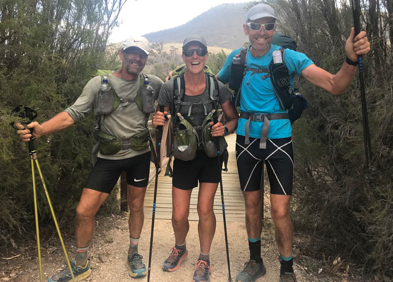
A little over 16 kilometres to go, which we thought we could cover in three hours. This would give us a finishing time of a little after 3 pm and a total time of 11 days and 9 hours. With that timing in mind we kept a fast pace to the base of Mount Tennent, from where we were slowed to a walk until we reached the Mount Tennent summit turn-off. We got our first glimpse of the Namadgi Visitors Centre but kept our eyes fixed on the descending rock-filled trail as we ran past Cypress Pine Lookout and down to the flat lands upon which the Visitors Centre sits. We crossed the road and arrived at the Namadgi Visitors Centre at 3.08 pm on Tuesday 26 November, completing the AAWT in 11 days, 9 hours and 6 minutes.
The feeling was perhaps more one of relief than joy. For me that relief also came with a realisation of tiredness. It was like I could finally relax after 12 days of continually feeling that I needed to keep moving and also thinking and addressing what could stop me in my tracks - literally. So overall, I have to admit, perhaps not the most enjoyable way to do the AAWT. However, I was no longer a prisoner of the AAWT and that release had to come at a cost. A cost well worth it in the end.
“... our tiredness is kept at bay by the exciting prospect of finishing ...
“... completing the AAWT in 11 days, 9 hours and 6 minutes.
“I cannot check the GPS as my phone is out of battery ...
BWA February 2020 | 21

More reflectionsNo matter how you tackle it, end-to-end the AAWT is very tough. It requires endurance, good navigation skills, mental toughness and generally the knowledge and ability to keep yourself healthy in remote wilderness for lengthy periods of time.
As for our trip, I felt our AAWT success came from good team work. Despite my weaknesses on descents early on in the mountains, generally we moved at a similar pace. Fortuitously, we also seemed to be on the same wave length on appropriate start and finish times for each day. Overall I can honestly say there was never any real disagreement (perhaps we were too tired to argue) and in different ways we each made valuable contributions to the team effort.
For me the physical impact of the AAWT was significant. I lost five kilograms (about 7% of my total body weight) and my immense
tiredness at Tharwa only gradually dissipated over the next fortnight. It has taken a similar period of time for my feet to heal. For Kylie, things were a little more serious with a need for crutches and antibiotics as part of her recovery.
As to AAWT tips, number one is look after your feet. Have a blister prevention and management plan and practice it before your departure. Know what to use and how to use it. This was the sole reason for my failure in 2018. Second to feet is navigation. Read up on the difficult parts of the track, study the maps and read the track notes for these parts. Have a GPS as back-up. Number three tip is take a water filter and use it, particularly in feral horse country. Getting sick on the track is really not an option.
Would I do the AAWT again? Yes, but perhaps I would take a different approach. I would also only accompany someone who has a strong personal goal to complete it. The AAWT is certainly not something that you can force on another. The desire to tackle the AAWT must come from within.
Arriving at Namadgi Visitors Centre - Phil, Kylie and JohnPicture by Alison Riley
“As to AAWT tips, number one is look after your feet.
22 | BWA February 2020
GEAR LIST
Weight grams
Ultimate Direction Fastpack 35 litres
710
Outdoor Research Helium Bivvy
510
Exped SynMat Hyperlite mat
360
Sea to Summit Spark 3 Sleeping Bag
610
Sea to Summit Silk Liner
145
Sea to Summit Aeros pillow
105
Jetboil Zip Stove
345
Fuel
100
Sea to Summit collapsible mug and titanium spork
80
Mobile phone + Solar Powerbank
320
Spot Messenger & GPS tracker
114
Compass, relevant sections of John Chapman's AAWT track notes
MSR Dromlite water bladder 2 litres
100
Sawyer mini water filter
70
Petzl Tikka head torch
Snake bandage, Elastoplast & Fixomull tape, blister kit & toe caps, Ibuprofen, Panadol, Body Glide, hand sanitiser, tooth paste, tooth brush, sunscreen, waterproof matches & 2 x lighter, spare AAA batteries
Total base weight: 4 kg (approx.)
CLOTHING
Short sleeve running top, cap & sunglasses
Long sleeve running top
Running/compression shorts
Long running tights/compression
Macpac lightweight merino thermals (1 set)
Lightweight merino gloves, buff and beanie
Montane anti-freeze down pertex jacket
Polar fleece
2 pairs DexShell waterproof socks 2 pairs Armaskin socks
Mountain Hardwear Plasmic Ion Jacketwaterproof outer shell
Altra Olympus 3.5 trail runners
FOOD DROP CONTENTS
Dinner: Soup packet, Back Country/Outdoor Gourmet Company freeze dried (2 serve), rice or steam pudding, hot chocolate
Breakfast: Oats, milk powder and raw sugar mix
Lunch: Wholemeal wraps with jam and cheese
Long life flavoured milk - coffee/chocolate
Gatorade powder
Cliff bars, muesli bars and gels
Large block of chocolate
Soy crisps
John is a Melbourne-based lawyer who likes being out of the office enjoying the more remote and wild parts of Australia. He has hiked and climbed extensively throughout Tasmania and Victoria and in more recent years has taken to fastpacking solo over mountainous terrain. Travelling light and fast has brought together his two passions of long distance running and spending time in the wilderness. Other pursuits that keep him fit include road cycling, mountain biking, rock climbing and mountaineering.
Phil is a pecan farmer on the Camden Haven River near Port Macquarie NSW. He is a former high school physical education teacher and exercise physiologist. He is a keen tennis player and has coached a former Australian number one wheelchair athlete. Phil has been an ultra runner for around 10 years but now prefers to fastpack wild places alone or in select company.
Kylie is mum of two, a Pool Aquatic manager and also has a fish farm in the Hastings Valley near Port Macquaire. Kylie has always had a love for sport growing up she represented NSW in swimming and running. When Kylie has some spare time she loves to run, hike and swim. In her local area she can explore the hidden trails and beyond. Over the past few years she has gained a love for ultra-running and now taken up fastpacking treks and plans to go on a Breca race in New Zealand in the next few months.


BWA February 2020 | 23