

The mysterious severed wallaby tail was lying on the track not far from our first campsite in Lerderderg State Park. We hadn’t noticed it on the way to set up camp and so we assumed it had been left there during the night. Who or what had left it there? A dog, a hunter, a mad axe murderer? The explanations became more sensationalist and lurid as the morning went on. Maybe someone was watching us from the scrub! However, we put all that aside, finished breakfast, packed up and continued our walk along the Lerderderg Track.
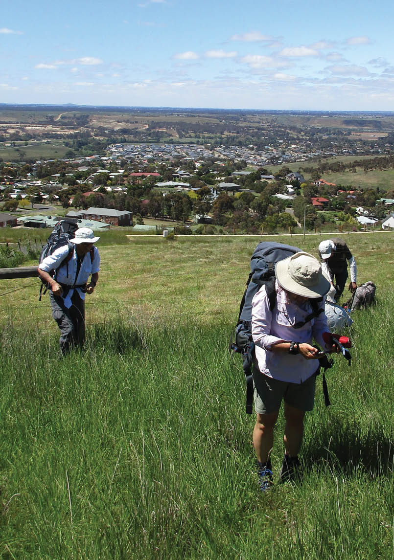
Day 1 - Ascending a hill outside Bacchus MarshAll pictures by David Bell

The Great Dividing Trail, Victoria
Bacchus Marsh to Castlemaine
David Bell

6 | BWA February 2020


Day 2 - Lerderderg Gorge
The Great Dividing Trail (GDT) is a network of over 200 kilometres of tracks in Central Victoria stretching from Ballarat in the south to Bendigo in the north. The GDT covers some wild and remote country as well as striking reminders of the gold rush days. It isn’t an area any of us were much familiar with so what we came across during our walk would be a pleasant surprise.
The walk would take us from Bacchus Marsh to Daylesford along the Lerderderg Track and then the Dry Diggings Track from Daylesford to Castlemaine. The total length is about 150 kilometres and we took eight days. There were five in the party.
Getting away from Bacchus Marsh was a little tricky as the southern end of the Lerderderg Track has now disappeared under housing development. This is one of Australia’s fastest growing locations and the housing expansion around here is relentless.
We eventually found the edge of Bacchus Marsh but with no track markers we proceeded over a fence and up a grassy hill where we stopped to look back at the Melbourne skyline 40 kilometres away. Once over the hill we found a track marker and took a road up to the edge of Lerderderg State Park where Karen had left a water drop. This was extremely useful as the first two days of the Lerderderg Track stays on high ridges and water would have been hard to find.
Incidentally, the word “Lerderderg” is an Anglicised amalgamation of two Aboriginal words which was given to the name of a nearby pastoral station.
After the encounter with the wallaby tail, we continued along a high ridge with great views of the Lerderderg Gorge below us and more views of the region from Mount Blackwood.
BWA February 2020 | 7
Late on day two, and after a close encounter with a tiger snake, we reached the Lerderderg River and set up camp at Amblers Crossing for our second night. There was plenty of water here and enough for a wash.
Day three saw us stick with the river and head upstream along an old gold mining water race to the village of Blackwood where we stayed at the local campground. Water was crucial to the type of gold mining carried out here and water races were an ingenious method for moving water to the mine sites.
Blackwood also afforded us our first opportunity to “take the waters” from the mineral springs that occur throughout this part of Victoria. This is not to everyone’s taste but it's claimed that the water from these springs is good for one’s health. Later we saw visitors filling up bottles of the stuff.
Day four took us through some beautiful ferny gullies on the edge of Blackwood before we re-joined the water race to continue along the Lerderderg River. The gorge has a remote feel to it even though we were not that far from Melbourne. We reached Nolans Creek in good time to set
up camp, though we were later distracted by a dog that appeared out of the bush. The colouring was un-dingo-like so we assumed it was a town dog which had gone feral. Needless to say, no one left their food bags or shoes outside the tents that night.
Day five took us away from the river to ascend a long spur to eventually reach Balt Camp, our highest point of the walk at nearly 900 metres. Balt Camp is an old forestry workers’ camp. All that is left are some chimneys and building foundations. By now we had left Lerderderg State Park and had entered Wombat State Forest. Formerly nice forest to walk through has tracks that have been badly cut up by trail bikes.
Before we reached Daylesford for our next camp, we had crossed the Great Dividing Range at a mighty 726 metres and were now in country where all the rivers flowed to the Murray. There was another snake encounter, this time a black one – red-bellied or copperhead. A windy camp at Daylesford proved a challenge of tent assembling and after some resupplying from a local supermarket we commenced our next leg: the Dry Diggings Track to Castlemaine.
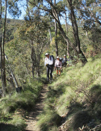
Day 3 - Following a water race along the Lerderderg Track
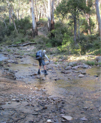
Day 2 - Crossing the Lerderderg River at Amblers Crossing
8 | BWA February 2020
As is commonly encountered, exiting an urban area to find the right track head proved a challenge of navigation but we eventually found the Dry Diggings Track and headed north along Sailors Creek. Once again, we followed an old water race. Here the water race clung to a steep hillside and the drop to the creek bed was quite significant, so this required concentration on not slipping or tripping.
We found a camp in the bush adjacent to the Hepburn Springs Reserve. There was no time here to enjoy the luxurious (and expensive) spa facilities. Save up the money for another time.
Leaving Hepburn Springs, we followed more water races through regenerating bushland and skirted the edge of the one-million old Mount Franklin volcano. This is now extinct, though a local we met said it is a popular place for strange goings on at Halloween. We now entered the Castlemaine National Heritage Park. This forms part of the Central Victorian Goldfields and in the mid to late 1800s it was the richest goldfield in the world. Tens of thousands of people lived and worked here and small villages like Fryerstown and Vaughan Springs once housed thousands of people. Mining still goes on but the area is rich in buildings, mine shafts and artefacts from the 1800s. It is also a story of environmental recovery as much of the forest and woodland was destroyed for mining and settlement. However, in recent decades the woodland and forest has
started to regenerate. We were impressed by the wildflower displays, in particular the profusion of ground orchids in places. We had come at the right time.
Our last camp was near Vaughan Springs on the banks of the Lodden River, another mineral springs location. Following Vaughan Springs, it was a gallop into Castlemaine for a late lunch and dinner at the pub for those who stayed on. We saw few other people on the track over eight days – a couple of day walkers and some mountain bikers.
Gary still had some energy so he continued walking the next day on the Leanganook Track to Bendigo. He walked the 60 kilometre to Bendigo in under three days. As far as I know he stopped there.
Thanks to Karen, Gary, Don and Gordon for making this an enjoyable walk in a part of Australia rarely visited by our bushwalking club (Sydney Bush Walkers). There is more walking to do there.
For those who want to sample the walking in this part of Victoria, there is an excellent website, The Great Dividing Trail Network.

Day 8 - Mechanics Institute at Fryerstown
David has been bushwalking most of his adult life. He loves the outdoors, in particular long-distance walks. There are places that are remote and wild and it is a privilege to be able to visit them. He recently decided to write more about these places, hopefully encouraging others to also visit them or, if not, to at least enjoy reading about these places. He is a member of three bushwalking clubs and is involved in several campaigns to protect our national parks.

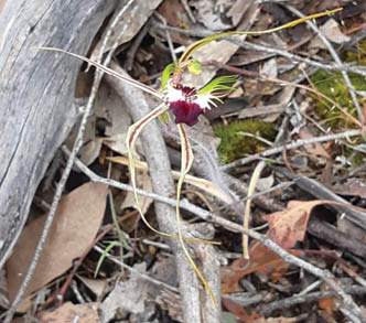
Day 7 - Spider Orchid


BWA February 2020 | 9