
Canyon Calamity
Text and photosDamian McDermott
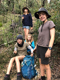
Mary, Chris, Rory, Ava, Daisy and Damian - the Crazy Danger Crew
Wayfinding in Wollemi National ParkDharug Country
It’s autumn, and the “Crazy Danger Crew” are back in the wonderful Wollemi National Park with our sights set on a canyon adventure. The Crew include Ava (14), Mary (8), Rory and Daisy (both 11), Crazy Chris and myself (mid forties, but who’s counting). For the last few years we’ve been taking our kids on a multi-day adventure in every season and I’ve been writing about it on my page Random Footprints to help other parents find backpacking adventures for kids and families.


16 | Bushwalk December 2022
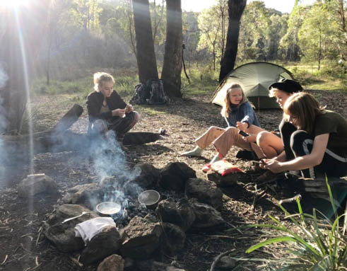
Ava, Mary, Rory and Daisy at Deep Pass campsite
After going off track in Namadgi National Park last spring we packed the compass and topographic maps and headed to the Newnes Plateau and a remote camping area among the sandstone escarpments. The geography couldn’t be any more different to last spring. With a labyrinth of deep canyons, gullies, rocky pagodas and forest, this is a stark contrast to Namadgi’s open country and easy navigation. Navigating Newnes Plateau is not for the inexperienced or underprepared.
Day 1 - Base Camp at Deep PassJust like our last Wollemi trip we opted for a base camp adventure. Our base camp is Deep Pass campground, accessed by a steep but short 500 metre hike from the carpark. We had a few extra luxuries like a small esky with some fresh food (and a few cold cans of beer).
We took the unsealed Glowworm Tunnel Road which begins at the Zig Zag Railway and then followed a series of 4WD tracks to the carpark. From there it was fairly
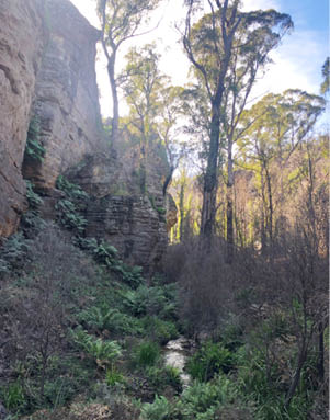
Nayook Creek near Deep Pass campsite
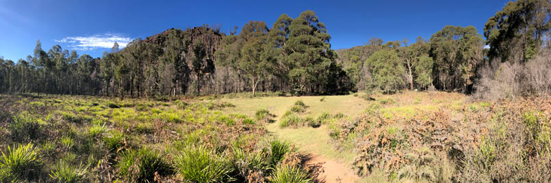
Campground panorama

17
intuitive and somehow we got there without too many wrong turns, or maybe because I was following Chris, oblivious to any navigational conniptions. The walk down to the campground is on a steep, overgrown and uneven service trail. Though short, it’s not a walk we want to do multiple times, so we carried everything down in one go, deciding to leave the climbing gear in the car.
Deep Pass campground is a sunny clearing surrounded by trees, rocky pagodas and canyons, with green grass and a crystal clear creek running through the area. There are multiple options for tents and as we arrived a group was just leaving a nice shady spot with a campfire and sitting logs close to the creek, so we claimed it as our home for the next two nights.
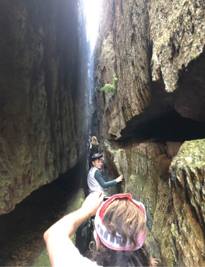
We spent the afternoon exploring the gullies and nearby T Slot canyon, scrambling over
the various rock formations. The T Slot canyon is particularly fun and worth seeking out if you visit Deep Pass. Don't let the squeeze at the start put you off!
Later, two other walkers returned from their day exploring River Caves Canyon - an off track route to a dry canyon about 5 kilometres north of the campground. This was our plan for tomorrow, but I forgot to download the maps to my device, so we gathered some intel, photographing their maps and marking the route onto our own maps. This information will put it back on the agenda for tomorrow's adventure.
After some more exploration and fun, we settled in for a relaxing evening, dining on Chris's fresh spaghetti bolognese under the stars, ready for our big adventure in the morning.
Day 2 - A canyon adventureThe night was cool but not too cold and there hasn’t been a drop of dew. We lit the fire and enjoyed breakfast and a show from the local lyrebirds. The kids dressed in their hiking clothes as Chris and I loaded our packs with water bottles, a nice lunch, snacks and cooking gear, then embarked on our journey north to find the hidden canyon.
We crossed the creek and headed upstream to the north following the bottom of the cliff. After a few hundred metres there was a break in the cliffs and we scrambled up to a ridge, heading north-east. Eventually this ridge opened up to a wooded area and we continued to climb, finding a footpad heading north-west following the contour.
After about 1.5 kilometres we hit a very well graded dirt track, the road to Natural Bridge. We followed it east, passing an impressive valley of pagodas and amazing rock features, and River Caves Canyon hidden somewhere among it all. After following this track for a few hundred metres we realised it's going the
T Slot canyon
"
Don't let the squeeze at the start put you off!


18 | Bushwalk December 2022

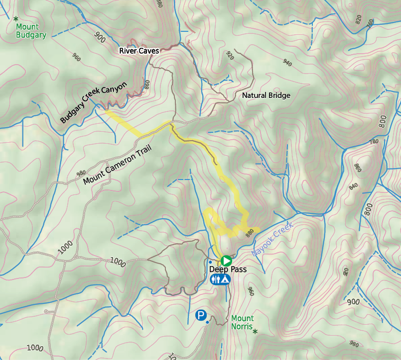
This map is © Bushwalk.com and is created using data © OpenStreetMap contributors
Getting lost on day 2
Road, four-wheel drive track, walking track (treed)
Main track, side trip, alternate route
Cliff, major contour line, minor contour line (20 metre interval)
Lake, river, waterfall or creek


0 km 0.5 1 2 km

Start of the walk
Hut
Campsite
Toilet
Parking


19
wrong direction and backtrack to where we originally met the road. Then we head north to find an entry point to the canyon.
Lost! (the first time) We don’t have much information and there are no digital maps in the GPS app, an oversight on my part. We just have a printed topographic map with the track scrawled on it (copied from the other campers maps) and are heading in a north-westerly direction searching for the canyon.
By midday, the kids have been scrub-bashing through regrowth, getting scratched and scraped by ashen stumps, having expected a
lovely cooked lunch in a beautiful dry canyon by now. There is an impressive canyon ahead but we can't find a way in, just deadly drops. The kids eat dry wraps with dodgy cheddar cheese on the dusty banks of a dry creek while Chris and I continue to traverse the clifftops with walkie talkies, looking for an entry point.
Eventually I found a way down, somewhat convinced that it will lead to River Caves Canyon. It was a precarious scramble with a sheer 15 metre drop on one side and after some coaxing, we guided the kids safely down to the shady canyon.
Rory at the top of a scramble near Deep Pass campground

Mary and canyon tops
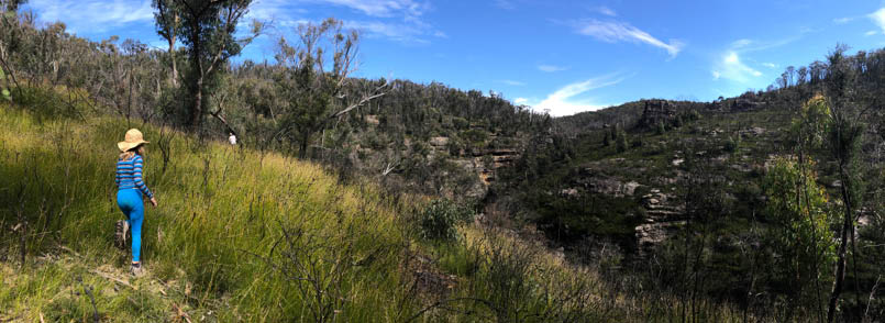


Ava, Mary, Rory and Daisy, and Chris approaching canyons but before getting lost

20 | Bushwalk December 2022
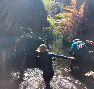
The rock features are impressive and the creek is crystal clear, so we began exploring downstream and are almost immediately stopped by a 2 metre drop into a deep pool. This is not exactly the dry canyon we were expecting.
We had no ropes or climbing gear (beer was deemed more valuable to carry into camp at the start of the walk) so we decided against continuing downstream. Instead we headed upstream. The canyon meandered beneath ledges and rock fissures, turning at right
angles and opening up as we approached a series of cascades that looked like natural waterslides.
We were able to climb the sides of the cascades and follow a pool until we were stopped again by another 2-3 metre waterfall. At this point we were convinced that we aren’t anywhere near River Caves Canyon. Chris found an easy scramble out of the canyon and we rested in the sun, wrung out our socks and ate some sweets before heading back south to the comfort of our campsite.
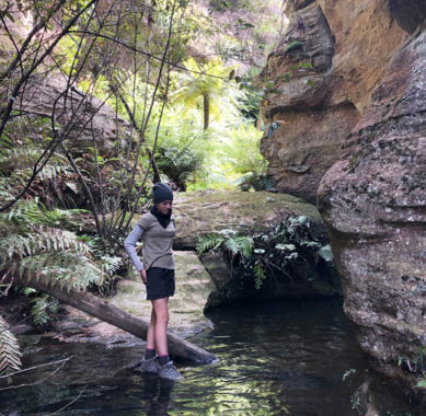
Ava in the canyon
Lost! (the second time)By now it's about 2.15 pm and all we need to do is walk back - for an hour or so - the way we came ... easy! And it is easy for the first few kilometres. We make it back to the road quicker than expected and followed the same footpad back towards the south. We moved quickly along the ridge, knowing we will be back soon for a relaxing afternoon in camp.
But we aren't ... we haven't focused on the point where we need to leave the ridge to scramble back to our valley and have walked way too far and are now on the escarpment,
far above where we want to be, with nothing but vertical drops ahead of us. What's more the kids find it all really exciting and scatter off frantically to climb all the pagodas and peaks, evoking mild panic in Chris and me.
After another hour trying to escape to the lower ground we traverse west and find a scramble down. It's unfamiliar but eventually we recognise features and make it back to the campsite by about 5 pm, relieved that we won't need to huddle together for a night sheltered beneath an overhang somewhere on the escarpment.
Kids in the canyon
21
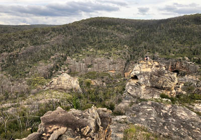
Escarpment pagodas with the kids
Back to base campWe returned to camp exhausted but relieved and instantly consumed the soup with noodles intended for our canyon picnic. Later we clean up and eat a hearty shepherd's pie, with lamb mince I'd prepared earlier and trusty old Deb powdered mash. The kids fall asleep easily and Chris and I enjoy a drink by the campfire, reflecting on the misadventures of the day. It may not have been the canyon we were looking for, but it didn't really matter in the end. Plus it's always satisfying to take the road less travelled. Chris and I have history of accidental canyons - but that's another story.
Day 3 - The journey endsWe woke to another cool but dry morning and enjoy a slow start to the day. Happy in the knowledge that the hardest thing today is walking 500 metres uphill to the car and deciding what to eat at the pub for lunch. After packing up camp we visit the nearby T Slot canyon again. On the way we saw a rare spiny crayfish in the creek where we got our water. It's a large prehistoric looking creature with bright orange spiky claws that look like they could cut your finger off. We look but don't touch.
The walk back to the cars is an uphill slog, but after yesterday the kids barely notice it. We load up and hit the road to the Gardeners Inn at Blackheath for a good pub feed. Burgers, nuggets, chicken parmas and cold drinks cap off an amazing adventure.
SummaryChris and I are experienced bushwalkers and our kids are used to the challenges of exploring the Australian bush (even with us). But our canyon adventure could have been a lot easier if we hadn't made some basic mistakes. If I had managed to download the maps before the trip everything would have been a lot smoother - next time I won't forget.
But there was another lesson here, about the value of knowing how to navigate with maps and compass. Navigating with GPS and digital maps can make you complacent and cause you to take less notice of the features you travel through. Which can be a fun challenge, but when the kids are there, the stakes are raised. And if we weren't experienced in navigating and didn't have the maps we would have been really stuffed.
I tracked some of our return route and downloaded the maps later to see where we had been - I'm pretty sure the canyon we were in was Budgary Creek Canyon - formerly known as "buggary creek" just west of River Caves. The map shows the detail and the scrambling around trying to get back to camp.
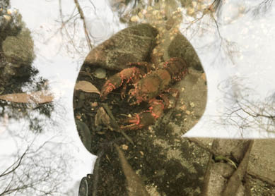
Spiny crayfish
"
It may not have been the canyon we were looking for, but it didn't really matter in the end.

22 | Bushwalk December 2022
Damian is a Canberra-born bushwalking and mountain sports enthusiast who lives in Sydney. Since 2017 he’s been taking his two young daughters out every season on a multi-day adventure and has (so far) managed to nurture their love of the outdoors without crushing their spirits. He writes about the adventures on his blog at randomfootprints.com with the hope of helping other parents find overnight adventures for kids.
The Author wishes to acknowledge the Wiradjuri people who are the traditional custodians of the land featured in this article.
"

Our canyon caper was fun, but if you're travelling to Deep Pass with small kids you may want to keep it local. The campground is stunning and there is a loop trail that goes to Nayook Creek and a fun canyon a lot closer to home. If you go in warmer weather there is a swimming hole to cool off.
Water was abundant, but be sure to treat it if you intend to drink it. The campground has toilets, but they were out of action while we
were there - so be prepared with plenty of toilet paper and something to dig a hole with. The ground in the Newnes Plateau is hard, but not as hard as our kids.
For an easier car camping option in the area check out our 2019 Newnes Campground blog. For information on River Caves Canyon check out Bushwalking NSW. And for information about the Aboriginal cultural significance check out Storylines.
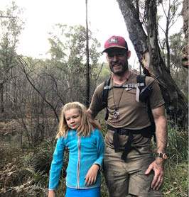
Mary and Damian
Day 2: Kids after hike
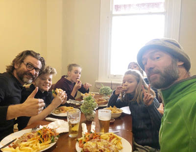
Pub feed


Climbing out
23