"

Meditation and Memories on the Thorsborne Trail
TextHelen McKerral
Photos Helen McKerral and Geoff Fisher
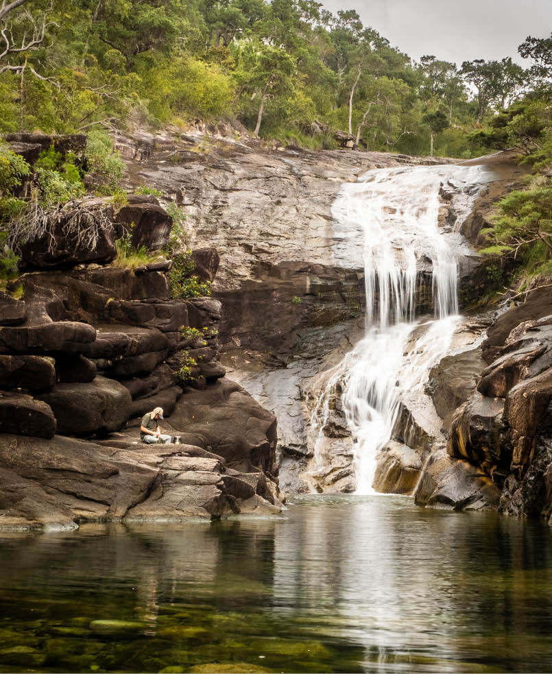
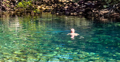
Infinity pools at Zoe Falls
Why do we hike? The reasons are many but, for Geoff and me, two trump all others. It’s not speed and distance – in our sixth decade, any distance is satisfying! It’s not social media likes, though we aim to inspire other leisurely folk with our website. It’s not for mental health per se, although being outdoors is undoubtedly beneficial.

6 | Bushwalk February 2023
For Geoff, multiday hiking is about immersion in landscapes that you can reach no other way. After decades of meditating, he also practises walking meditation, being wholly present in landscape. For me, although photography and botany are passions, hiking is about creating lifetime memories so, when friends invited us to join them on the Thorsborne Trail, we jumped at the chance.
The trail is an exceptional 32 kilometre hike on Hinchinbrook Island (Bandjin country) in tropical north Queensland. The entire island is an uninhabited national park, with hiker numbers capped to preserve its serenity.
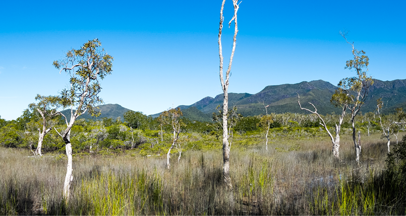
Because Hinchinbrook is mountainous, we not only experienced empty beaches and rocky headlands, but also lush swamps, rainforest and estuaries. We rested on heathland peaks and saddles, and crossed rocky streams. We swam in clear pools with jungle perch nibbling our toes, while glorious waterfalls thundered down nearby. At night we camped amongst trees, usually within a stone’s throw of the beach.
This trail is unique – in its wildlife, vegetation, variety and beauty.
Tips Our friends had successfully booked the competitive peak April-September season: summer/monsoon bookings are discouraged because people often can’t complete the hike and require rescue due to flooded creeks or heat exhaustion. The track is short, but humid heat, rough terrain and lack of mobile coverage mean a PLB/Inreach, map, tide table and first aid kit are essential (see Planning and Tips for details). In poor weather, the trail is demanding at best, impassable at worst.
The recommended six day itinerary seems excessive, but this hike is more than walking: bring togs and goggles!
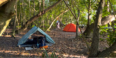
Swamp between Little Ramsay Bay and Zoe Bay
"
The entire island is uninhabited national park ...


7


Bushwalk.com notes and maps on webpage, GPX and PDF
This map is © Bushwalk.com and is created using data © OpenStreetMap contributors
The Thorsborne Trail
Road, four-wheel drive track, walking track (treed)
Main track, side trip, alternate route
Cliff, major contour line, minor contour line (50 metre interval)
Lake, river, waterfall or creek


0 0.5 1 2 3 4 5km

Start of the walk
Campsite
Toilet


8 | Bushwalk February 2023
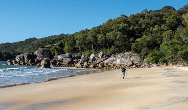
Day 1: Trail Head to Nina Bay, 5.4 km We left early from mainland Cardwell to catch the tide with Hinchinbrook Island Cruises. Brad provided printed tide charts to correctly time estuarine creek crossings (saltwater crocodiles) and also clarified the (few) cell reception areas; he was pleased we were carrying Inreaches because he’d rescued numerous hikers.
The boat ride flashed by with island tales; we spotted a turtle and the splash of dugites. Finally, we motored up an inlet, disembarked via a steamy mangrove boardwalk, and began our hike.
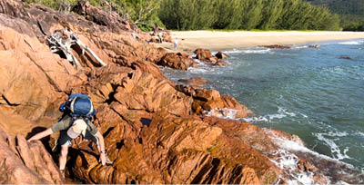
Almost immediately we traversed a shell-scattered beach, followed by lush jungle soft underfoot and alive with birdcalls and small scuttling things. Leaving our packs at a junction, we took day packs up the rocky scramble to Nina Peak. The humid heat made everything more challenging for southerners like us, but the spectacular views were worth our sweat.
Down we went and on to Nina Bay campsite. We were following the eastern/seaward coastline with no civilisation in sight, walking north to south so spectacular waterfalls were the climax of our journey.

Views from Nina Peak over inlets and mangroves

Nearing the end of the beach
Climbing Nina Peak

9
The campground is right beside the beach but, contrary to the Nim’s Island movie filmed here, crocodiles preclude any swimming in that inviting aqua sea!
There is plenty to see around camp; arriving early means you’ll have time to explore the rocky headland or find rockpools up the creek. However, because we were in the company of friends, we continued to Little Ramsay Campground where they were staying two nights. We’ve structured this article to reflect our recommended leisurely itinerary for days 1 and 2.
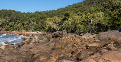
Day 2: Nina Bay to Little Ramsay Bay, 2.7 kmThis short distance comprises more beach and forest, as well as fun but slow rock-hop Boulder Beach; high tide would be tricky. Much of the Thorsborne is tide-dependent: occasionally we had to wait to cross estuaries safely, another reason to schedule conservatively.
Once we arrived at the campground – yes, beside the beach! – we explored the lagoon with its stunning Mount Bowen backdrop. Again, this estuarine lagoon is unsafe for swimming. However, it is a photographer’s dream and I took a million shots to capture sunrise on the mountain.
We considered the unmarked route to the summit of Mount Bowen, but prior research suggested the terrain would be too demanding for two old farts unaccustomed to tropical heat. Due to numerous accidents, a Parks permit/induction is mandatory: secateurs are recommended!
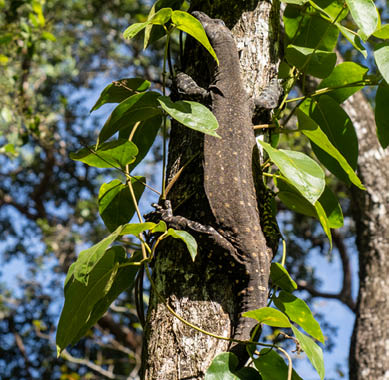
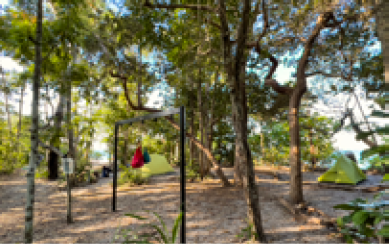
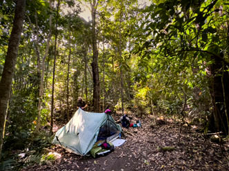
Instead, we filled water bottles from the lagoon inlet and enjoyed wildlife in camp. Birds flit in treetops and a Spotted Tree Monitor glided between tents. The campsites are fantastic: flat, sheltered, and with “pack racks” to prevent hungry critters reaching our food.
We searched the headland for caves and watched fish in the lagoon. At night, we were lulled to sleep by hushing waves on the shore. It was surprisingly cool; we had our summer-weight down quilt and needed it.

Little Ramsay campsite with pack rack
Tree monitor at Little Ramsay campground
Collecting water from the lagoon inlet at Little Ramsay campground
10 | Bushwalk February 2023

Mount Bowen early morning
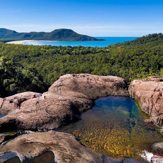
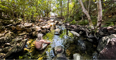
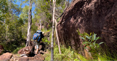
Day 3: Little Ramsay Bay to Zoe Bay, 10.5 kmA beach start today, detouring for a cooling dip in a tiny pool, followed by rocky headland scrambling, more lagoons, and beaches. After a steep, exhausting climb, we diverted to Banksia Bay campground for a peek, then headed inland, crossing rocky streams that were easy now but treacherous after rain. The multi-textured emerald forest was marvellous, so different from South Australia’s olive-green eucalypt. We swam at Blue Lagoon before continuing across soggy floodplain to reach Zoe Bay campground. The tent sites were shady and the beach sunset, complete with silhouettes of palm trees and mountains, was magnificent.

Hidden lagoons
11
A cooling dip in a rockpool
Scrambling over rocky headlands
Crossing a creek at low tide
Boulder Beach requires rock hopping

Steep climbs between Ramsay and Zoe
This would be demanding or impossible in the wet season
Swimming in the Blue Lagoon
Zoe Bay campground
12 | Bushwalk February 2023
Day 4: Indulgence Day at Zoe FallsMost descriptions recommended two nights at Zoe Falls. It’s a short hike to the falls from the campground and we swam in the rock pool at the base, then climbed the trail to the top to enjoy the famous infinity pool and views. We were on an (almost) deserted tropical island and we wanted to savour every wonderful moment.


Zoe Bay sunset
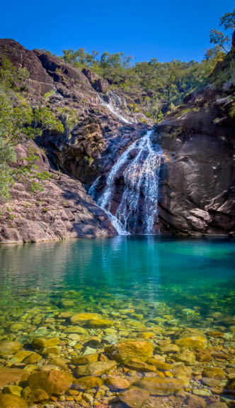
Zoe Falls

A rope climb beside Zoe Falls
13
Day 5: Zoe Falls to Mulligan Falls, 6.7 kmToday’s hike is relatively short but surprisingly tough with an elevation gain of 300 metres over short sections; the track stays inland. Because distances are modest, leisurely hikers like us have time for a final swim at Zoe Falls either in the pool or at the top. We then climbed to a saddle with expansive views, followed by a long descent along a spine, across the boulders in Diamantina Creek (yet another place to cool down) and through rainforest into Mulligan Falls campsite. The falls were unbelievably photogenic, the rock pool perfect for swimming. Electric blue Ulysses butterflies flitted overhead. It was insanely beautiful.
Mulligan campground

Descending the long spine to Mulligan

The track can be impassable in heavy rain
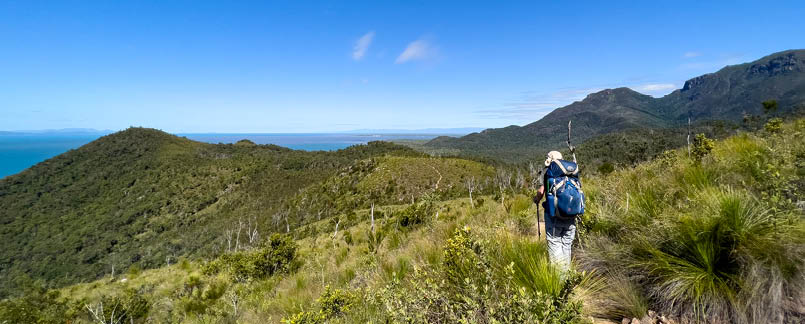
View from the saddle to Zoe Bay
14 | Bushwalk February 2023
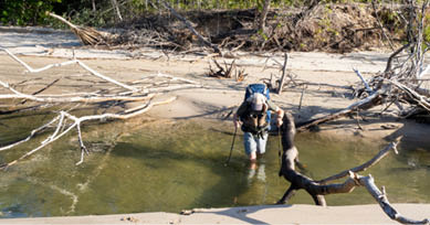
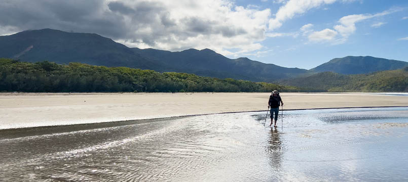
Day 6: Mulligans Falls to George Point,6.3 kmThis easy day provides a delightfully relaxing finish, primarily downhill through different rainforest, then along the beach. We had chosen to be collected late so we could enjoy another swim at Mulligan, but timing also depended on tides as there was another estuary to cross.
It was shallow when we arrived, but high tide would make it waist deep – we were glad we were not late.
It has been an extraordinary journey, one of the most unique, varied and spectacularly beautiful hikes we’ve done anywhere in the world: banner days to immerse yourself in, with memories to last a lifetime.
Based in South Australia, Helen and Geoff play on the water in their kayak, in the air in their hang gliders and on the earth in their hiking boots. Neither are athletes but they enjoy numerous fantastic trails – including long distance ones – at their own pace, which is more relaxed and with shorter daily distances than usually promoted online. Their non-profit website Slowerhiking.com aims to inspire and empower other leisurely hikers with examples of relaxed multiday itineraries adapted from more traditional schedules. See their website for more Thorsborne Trail Planning and Tips plus maps, elevation graphs and other useful daily details.
"

Last estuary crossing at low tide - high tide reaches the vegetation
16 | Bushwalk February 2023