

WILDERNESS WALK
Pete Jessup (aka Mutley)
2 COASTAL WALKS
Australia’s magnificent coastal walks

6 | BWA December 2013

Eastern Victoria / Southern New South Wales is a special place for me. My wife and I have spent many weeks in the area of Croajingalong National Park through to Eden. It is a remote and beautiful part of the eastern Australian coastline.
The Nadgee Howe Wilderness Walk spans two states, starting at the quaint coastal town of Mallaco-ota in Victoria and finishing in the Wonboyn area, NSW. The length of the walk varies but I covered about 80 kilometres in five days.
Walkers need to register with the NSW parks service, stating their intentions and returning the form
with payment of a small fee. Walkers should call the Merrimbula NPWS office for more information. There is a maximum group size of eight and a maximum of 30 people on the walk at any one time.
I started the walk from Mallacoota, but it can be done in either direction. The trail begins from the eastern side of the Mallacoota Inlet mouth, and with the mouth open to the ocean at present, it can be dangerous to get there by boat, and wading the mouth is an absolute no-no, unless you also plan to visit New Zealand. The best option is to catch a boat to “Lake-view”, a jetty near the old settlement, on the Eastern
When: November 2012Length: 80 kilometresTime: Five daysGrade: MediumMaps used: Vicmap Nadgee 8823-S and Mallacoota 8822-N 1:50,000. I also used a one page map and information publication from Parks Victoria, called “Nadgee Howe Wilderness & Nadgee Nature Reserve. Oh, and of course, the trusty Garmin GPS (Garmin City Navigator Australian Topo V3), which showed some parts of the walk
I am fairly new to the world of bushwalking. I have completed the Overland Track in Tasmania a few times and have done the Great Ocean Walk, from Apollo Bay in Victoria. A new adventure was needed, after a typical Melbourne winter and I was looking for something more challenging than the Great Ocean Walk and maybe more remote.
WILDERNESS WALK
Pete Jessup (aka Mutley)
2 COASTAL WALKS
Australia’s magnificent coastal walks
BWA December 2013 | 7
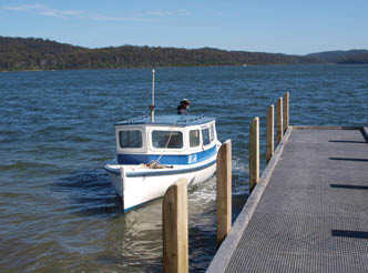
shore of the lower lake. I used Simon Buckley, who has a quaint old lake boat. It’s not the flashest thing on the water, but it will get you there safely. Simon’s minimum charge is $80 for the 30 minute boat ride. His vessel would probably hold up to four passengers, but check with Simon for larger groups.
I left my car at Wonboyn, at the caravan park, (I asked permission from the owners beforehand), and organised a lift back to Mallacoota. There is a mini bus service available out of Mallacoota, but for one person, the price was exorbitant. So I called the Mallacoota pub a few weeks prior, offering $100 for a ride back to town. A publican’s mate was all too happy to help out, picking me up right on time, with a great trip back into town. This was much cheaper than the $200 for the mini bus, but it wouldn’t be an issue with large groups.
There is plenty of accommodation in Mallacoota. I chose the pub, which has motel-style rooms attached. Clean and reasonably priced ($80 per / night) and a very short walk back to the room after some pre-walk drinks the night before. This little town is very friendly,
although the whole town knew my plans by the time I started the walk, calling me the Wonboyn Walker - what do you expect making your plans known to the public!
On the morning of the walk, Simon (the boat man) picked me up from the pub and soon I was standing on Lakeview Jetty, watching as his little vessel returned to town.
The walk begins by skirting the lake, through euca-lypt, tea tree and open grassland, weaving it’s way to the coast. Walkers pass the old Mallacoota settlement, now just a weathered shack shaded by somewhat out of place European trees.
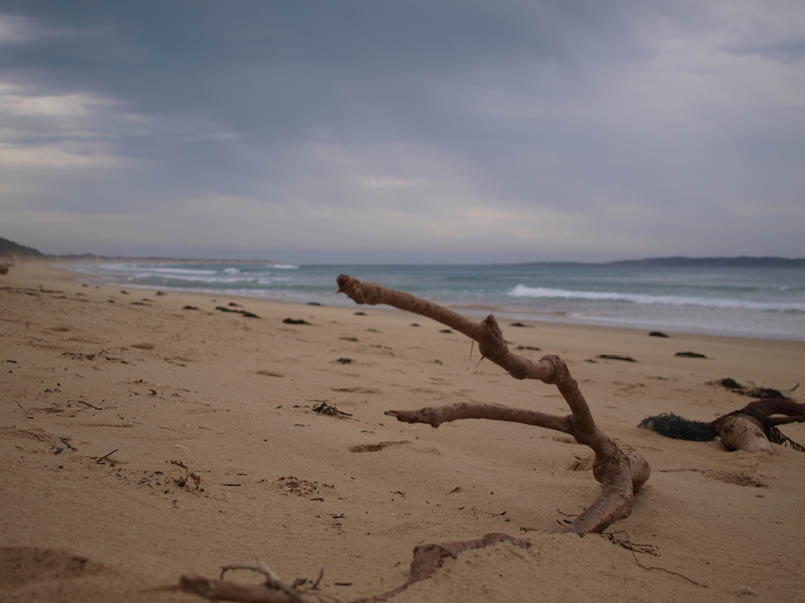
Soon the beach appeared, where the walking became harder. Beach walking can be challenging, forever trying to follow the thin strip of firm sand, just above the waterline. Before attempting this, or any beach walk, make sure your boots and pack are as light as they can be. Every extra kilogram of weight is felt, as your foot endlessly sinks into the soft white sand, sapping strength to take the next step. It’s like walking through glue and on this trip, I promised my-
8 | BWA December 2013
self to get my pack weight down for the next adven-ture. The coastline was stunning, and very remote. You follow the ocean for a couple of hours, then turn hard left, over the dunes, to Lake Barracoota. I almost missed the turn - a small blue bucket is the only track marker. It’s a good idea to use a GPS here, as the sandy trail to the lake is easily missed.
Lake Barracoota is the largest natural freshwater lake in Victoria and, bordered by truly impressive sand dunes. I spent a peaceful night on the shore of the lake, sheltered from the prevailing wind by the dunes. The water is fine to drink but reed beds need to be negotiated for a swim.
The next morning I set off for my second campsite, Lake Wau Wauka, via the beach. Passing the wreck of the SS Riverina (I originally thought it was a beached whale, with wave-generated water spurting through a rusty blow hole), and rounding Telegraph Point gave me a good view of Gabo Island. You can book ac-commodation here, but it didn’t look too hospitable on this day, with a raging sea smashing its coastline. And its certainly not reachable from the coast, unless you
have a 50 horse power half cab pack raft.
It took about four hours of slogging through the sand to reach Lake Wau Wauka (did I really need to bring that coffee machine and why is my pack so heavy?). Approaching the western side of the lake, I followed it’s shores around to a great little campsite, under some shady trees. A couple of marine buoys hang from a limb to mark the spot. The water is drink-able from the lake, but tastes a bit brackish. I used sterilising tablets as a precaution, as I did throughout the trip.
The view from the campsite looks over the lake and out to sea. It was well protected from the south-erly wind. It’s a pity the weather wasn’t kinder, with a thick cloud cover and rain by late afternoon.
Day three - Off to Nadgee Lake, via Cape Howe. Another tough day of beach walking to Iron Prince Point, then I traversed sand dunes, which extended right down to the rocky shoreline. There were plenty of dog tracks and some tracks I think belonged to an emu or a giant flesh eating devil bird (vivid imagination after a few days by myself).
BWA December 2013 | 9

There is a need to be very careful here. The sand has obscured a coastline of large boulders and there are many open voids under the sand. My leg disap-peared up to my groin on one occasion and there may be deeper holes out there. This area is just so remote. If you do hurt yourself, you had better hope the PLB’s (Personal Locator Beacons) working. The only access apart from walking is by helicopter or a very risky boat ride.
Conference Point marks the border of Victoria and NSW. I stopped for the obligatory photo, then over more dunes to Cape Howe. After the cape there is a short beach walk, to a track leading away from the water. This track is not really obvious and looks like it goes nowhere. Just walk to the end of the beach and turn hard left and keep walking. Soon you will climb up over the dunes and down to Bunyip Hole. This was shown on the map as a water source but it looked ordinary - algal growth and very black. Drink at your own peril.
Turning north, I crossed Endeavor Moor. With stunning and amazingly varied coastal vegetation, the track was quite overgrown and hard going. In places and I had to literally force my way through narrow, green tunnels. The low cloud and sea fog added to the mystery and sense of stillness of the moor. I liked this place.
By lunchtime I had reached the thin spit which separates the ocean from Nadgee Lake. Still foggy, I made my way around the north - east edge of the lake, to a well defined and grassy campsite. Like the previous campsite, there was some bush furniture set up - makeshift bench seats from planks of timber and rocks. There was supposed to be a small water source near this camp, but I couldn’t locate it. In the warmer months water may be a real challenge here and the camp would benefit from a small shelter and water tank. But the whole point of this walk is self-reliance, through an unspoiled wilderness area.
I decided to push onto Little Creek for the night. The track climbed up and away from Nadgee Lake and onto a heavily overgrown old vehicle access track. Called Nadgee Moor, it is an easy walk through coast-al woodland. I happened to prove that a walking pole is not as strong as my forehead, as I tripped on a tree root and fell forward, head butting the now horizontal pole and snapping the aluminium right through. Would have made a great YouTube clip.
Just before reaching Nadgee Beach, I passed a
large tea tree-lined soak, which had sweet, clean but discolored water. I filled up here for the night at Little Creek.
From Nadgee Beach the track traverses Impressa Moor, much easier walking. At the point where the track enters the thicker eucalypt forest there is a very small track to the right. This is very easy to miss but is a good short-cut through to the four wheel drive track leading to Little Creek.
By mid-afternoon, I reached Little Creek and camped on a flat grassy section on the southern coast of the inlet. A really beautiful spot with great swimming and probably the best campsite of the trip. I later discovered the official campsite was on the other side of the inlet. The fish were rising and jumping as the light receded behind a thick cloud cover. Rain began to gently fall, increasing to a downpour, which lasted most of the night.
The next morning the rain had stopped and I waded the shallow inlet, heading for Merrica River. There was supposed to be a track leading up above the rock ledge but it was hard to find. Instead I headed upstream and scrambled around the base of the rocky point, to the official Little Creek campsite, which also featured timber bench seats. A 4 wheel drive track left the Western edge of the campsite, heading up the hill and towards Newtons Beach.
This section of the walk was quite diverse, with coastal scrub, tea tree stands, morphing to lush vine draped and heavily overgrown forest. Really beautiful.
Walkers are supposed to turn right, to Newtons Beach and a water source. Instead I continued along the dirt road and had to negotiate a 200 metre climb. Next time turn right. There was a good alternative water source at a creek crossing, however.
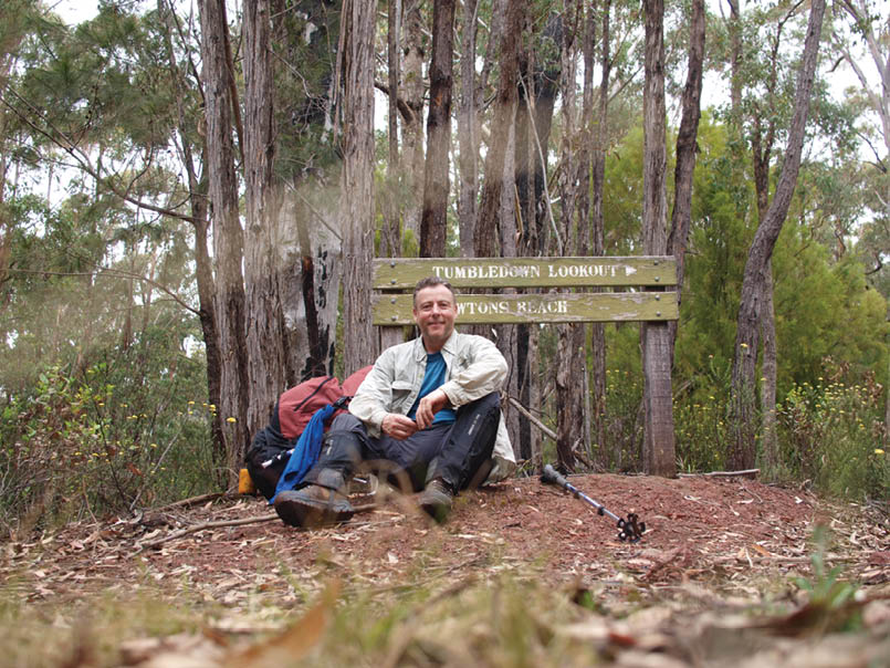
From Newtons Beach, the track climbs steeply up to Tumbledown Lookout. Lyrebirds were darting across the track everywhere, until I found the camera, then, nowhere to be seen. Typical of celebrities.
10 | BWA December 2013
Reaching the Merrica Walking trail, I detoured downhill to a stream, for water. This took about 40 minutes return, but is an essential detour, as there is no fresh water at Merrica River.
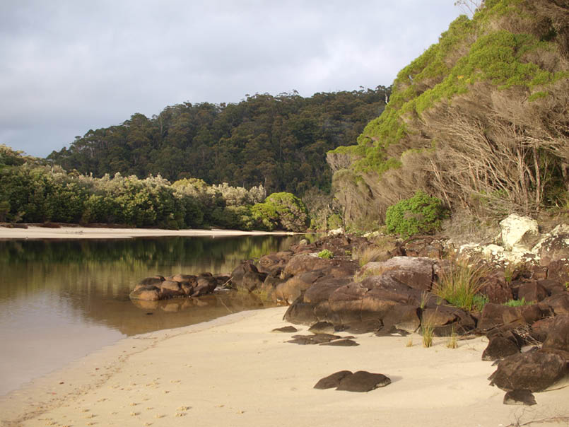
Merrica River is a beautiful place. You can camp on the southern side in tea tree or across the river, where another furnished camp is located, complete with bush swing.
It rained all night. Very hard. I later learnt the area had 50 mm overnight. By morning though, the rain cleared long enough to pack up and start the climb back to the Merrica trail, which leads out to the ranger station.
This was, in my limited experience, one of the best walks I have done. The amazing range of flora and topography compressed into a five day walk is a wonderful experience and possibly unique in Australia. The dunes near Cape Howe have to be seen to be believed, tumbling right into the ocean.
Bonus tips:
An alternative route back to Wonboyn is to traverse the range north of Merrica River, up to the 161 metre crest, then NNW down to the Green-Glades Trail.
Ticks can be a problem in this area and I later discovered I had picked up three of the little vampires. The few mozzies and flies weren’t really a problem. In late summer water may be a real issue on this walk. If you are not a fan of beach walking, don’t even consid-er this trip. But if you can keep your pack light and are not in a rush, the experience is one you will not quickly forget. The trip could be compressed into three nights, by missing Merrica River if time is tight. A GPS is a good idea for some of the trickier turnoffs and a PLB is essential. You are entering a wilderness area. Open fires are not permitted from December till March.
For the more adventurous, this walk can be combined with the Wilderness Coast walk from Cape Conran, near Marlo in Victoria, to Mallacoota.
More information can be found at:
http://www.nationalparks.nsw.gov.au/nadgee-na-ture-reserve/nadgee-wilderness-walk/walking
Merrimbula NPWS office (02) 6495 5000
Simon Buckley, the boat man (0408408094),
Pete Jessup, November 2012
This avoids having to backtrack and saves a few kilometres back to Wonboyn. I decided to take the long way back, by way of the ranger station and Newtons Road. In hindsight, I should have left the car at the ranger station and avoided eight kilometres of fairly boring dirt road walking.
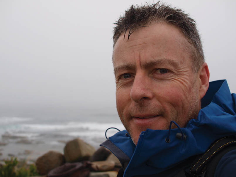
Peter Jessup is from Eltham, Victoria and is an avid bushwalker, who spends his time plan-ning trips and his limited annual leave living them. He shares his life with his wife, Amanda and a very spoilt Brittany Spaniel, Bonnie.
BWA December 2013 | 11