
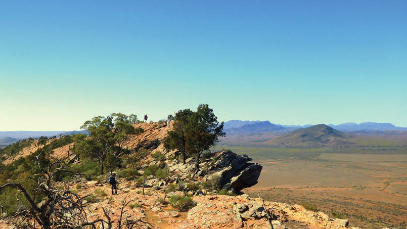
I was standing on the ridge top along the Yourambulla Range looking out to the town of Hawker far below out on the plains. Turning north, the far-off ragged peaks of the Elder Range curved around, and beyond, in the distant haze, was the rugged rim of Wilpena Pound. This 4.5 kilometre trek along the Yourambulla Range was on our group’s fifty-third day of walking the 1200 kilometre adventure hike known as the Heysen Trail.
From Bridal Gap - Black Gap and Elder RangeRobert Alcock

The Friends of the Heysen TrailRobert Alcock, President

40 | BWA October 2015

We are members of The Friends of the Heysen Trail (the Friends), hiking with one of the End to End groups that facilitate the members to complete this 1200 kilometre hiking Trail. The Friends provide the leaders and logistics making it an easy and convenient way, over a number of walk seasons, to become an “End to Ender”. Although originally set up to develop and maintain the Heysen Trail, The Friends have developed a comprehensive program of walks. The End to End walks are very popular, with seven separate groups walking through the 2015 walk season. The South Australian walk season is from April to November, avoiding the heat and high fire risk of summer. Each weekend of the walk season the Friends also provide day walks, Trailwalker of 5 to 6 hours and the less demanding Trailstarter, 3 to 4 hours,. These walks are planned by the walk leader and can be anywhere, usually within about an hour’s drive from Adelaide.
My group had started our hike of the Heysen Trail along the coastal path from Cape Jervis, where the ferry was about to depart for Kangaroo Island. From this southern trail head the trail follows the coast south and west to Victor Harbor. Lunch was on the white sand of Blowhole Beach where a beached bottle was found covered in marine shells. The high hills here run down
to very jagged rocky ridges jutting out into the Southern Ocean. Kangaroo Island is across the sea with the white pillar of Cape Willoughby Lighthouse glowing in the sunlight. We then had a long climb up through the scrub passing tall yakkas (grass trees) and stands of black oak until we reached the Cobbler Hill campground. There were kangaroos aplenty as we traversed west through the Deep Creek Conservation Park.
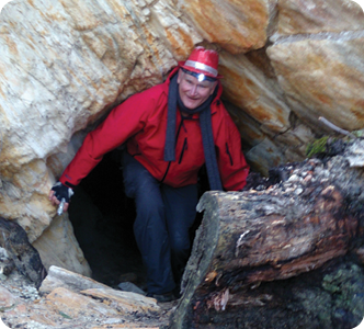
Many ask, “What’s the best section to walk?” This is a very subjective question as it’s usually the section I walked yesterday, as each hiking day on the Heysen Trail is so different. The country keeps changing - walking in dense bush or forest, then up to a peak with magnificent vistas stretching out all around. Pushing through bracken amongst mallee trees and flowering wattles, past vineyards, through historic towns, across cropping and grazing paddocks and through conservation reserves. At Jupiter Creek gold mine reserve we went underground, through an old mine shaft. In wet weather the soft wet clay from the walls of the narrow shaft stuck to my pack and clothes.
The foot track varies greatly. It may be a nicely made path or track, then onto a rocky kangaroo track, a soft sandy beach, a scramble uphill, a rocky creek-bed with
Aroona Valley - Flinders RangesRobert Alcock
BWA October 2015 | 41
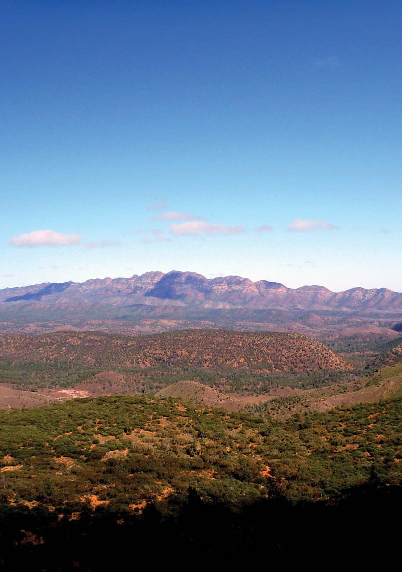
clambering up or down waterfalls (almost always dry), or on a wet winter’s day, a muddy trek. Towards the north the trail traversed the rugged Flinders Ranges with its sparse vegetation and distinctive red rocky strata showing the twisted folds from the pressure that pushed and shoved this ancient seabed way up into the sky. The rugged hills, gullies and ranges we walked through are what remains after the millions of years of weathering that has reduced what was once a very tall mountain range to its present form.
Back down south, at Newland Conservation Park west of Victor Harbor, we walked above the Waitpinga cliffs where the whales or seals can be viewed on a good day. Here the unique stunted coastal flora is full of wattle blossom and colourful flowers in springtime. I delayed the group because there were such a variety of flowers to photograph.
We then hiked up the Mount Lofty Ranges, passing above Adelaide and on through the Barossa Valley vineyards. Local wineries tempted us as we walked on by. We hiked
through historic copper mining towns of Kapunda and Burra, then way out east to touch the remote saltbush plains, which stretch northward up from the Murray River. This is home to succulent “saltbush lamb”, a unique flavour of the sheep which graze on this saltbush. We followed the Trail through Tourilie Gorge, a delightful walk along the creek bed between spinifex-dotted hillsides and rocky cuttings.
From here we followed the trail west across the productive agricultural mid-north to the Flinders Ranges where our walk again headed north through many ups, downs and rocky creek-beds to the northern trail head at Parachilna Gorge. On the way we walked up and through the world famous Wilpena Pound, and through the valleys and peaks seen in the Flinders Ranges vistas painted by Sir Hans Heysen, the artist from whom the Heysen Trail gets it’s name. Note that in the north there are some rugged remote areas where good planning before walking is recommended. There are also many wonderful accessible walking trails around

St Marys Peak - WipenaPoundRobert Alcock
42 | BWA October 2015
Robert joined the Friends of the Heysen Trail in 1998. A long-term member of the Friends management Council, Robert become President in 2011. He completed the Heysen Trail in 2011, and is now close to completing the Trail for the third time. He has trekked the Trail in all weather, from searing heat, frosty mornings, pouring rain, and through a white wonderland of snow on Mount Bryan. He enjoys photographing the beauty and diversity found along the Trail.
Yourambulla RangeRobert Alcock
the Wilpena Pound area. Just book into one of the accommodation options and spend a week exploring.
I completed my End to End in August 2011. In October this year I will complete the Trail again, this time from north to south. It has been a wonderful adventure, not only walking the country, it’s very much about meeting people, sharing adventures, and the friendships that have developed.
The Friends of the Heysen Trail
Formed in 1986, the Friends of the Heysen Trail are the voluntary support group which, in cooperation with the Department of Environment, Water & Natural Resources, develops and maintains the Heysen Trail. The Friends also provide a comprehensive walk programme, and promote the 1200 kilometre adventure hike – the Heysen Trail. See heysentrail.asn.au
The Friends also support other walking trails and walk activities in South Australia, to encourage more people get out and enjoy the outdoors.
The Friends are fortunate to have a large group of volunteers (we are all volunteers) running the office, administration, trail development works, promotions, greening and walk program. The large range of
activities ensures a place for all those who would like to help support South Australia’s iconic Heysen Trail.


BWA October 2015 | 43