


Best walks of South Australia
Jeremy Carter, Walking SA

Adelaide can often be found on lists of the most liveable cities, and in no small part because not only is the city itself wrapped in parklands, but the greater metropolitan area is bounded by the Adelaide Hills on one side, and the coast on the other. This provides plenty of easily accessed walking trails within a short distance of the CBD, whether they be in the Hills, along the coast, or following the creeks and rivers flowing from the Hills to the sea.
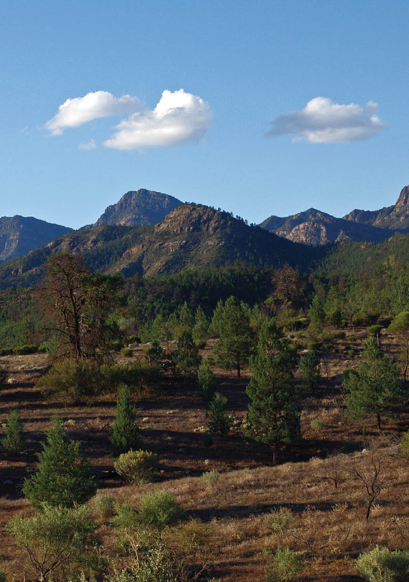
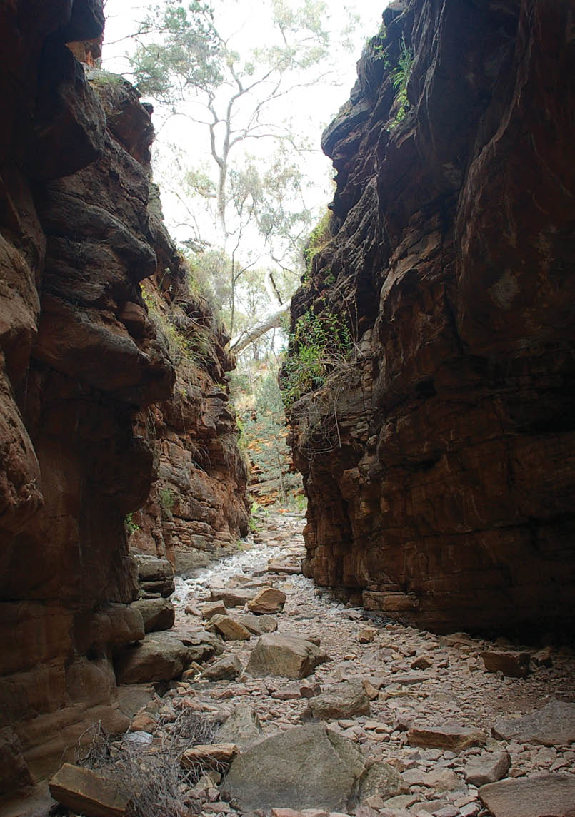
Twisted rocks of Flinders Ranges National ParkTed White
6 | BWA October 2015
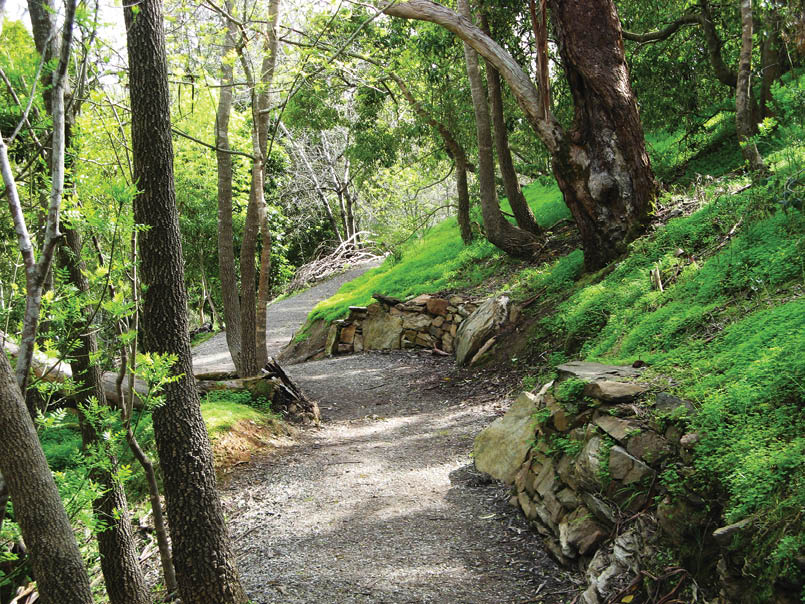
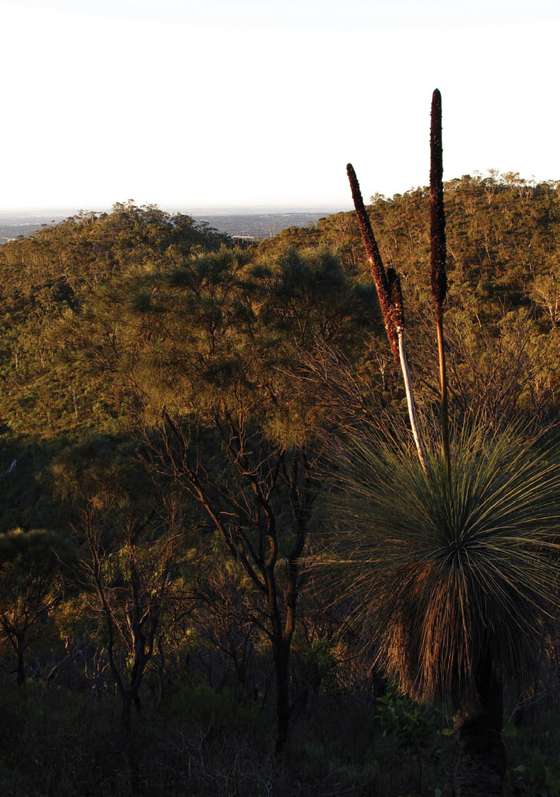
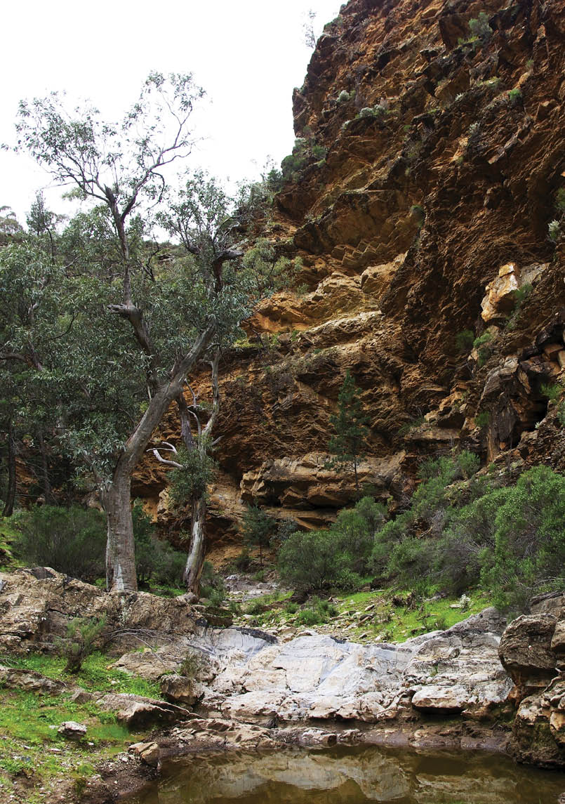
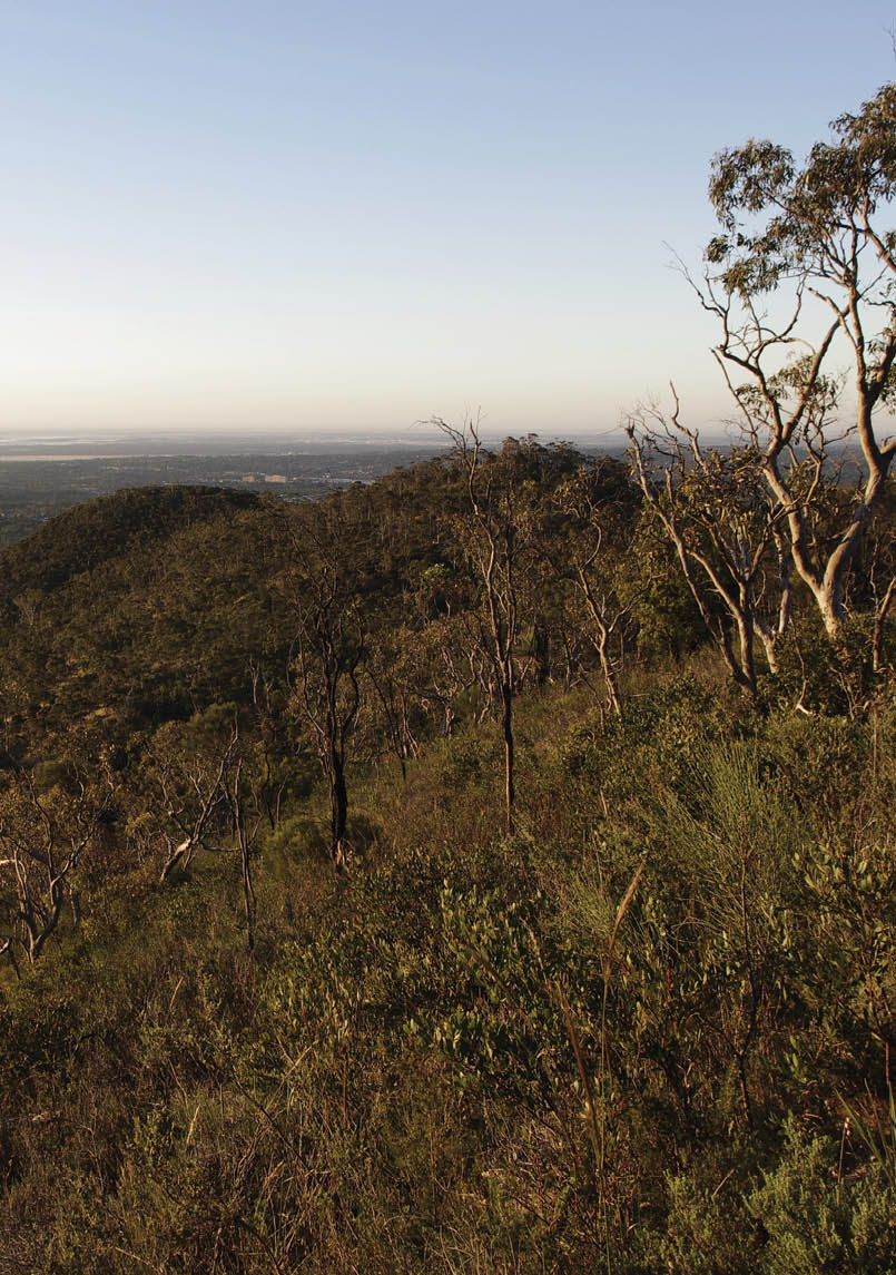
Valley Loop Hike, Belair National ParkJeremy Carter, Walking SA
Scattered up and down the Adelaide Hills there are many conservation parks offering a vast number of walking choices. The ever-popular and well known Waterfall Gully to Mt Lofty Summit Hike is short and sweet, rising quickly from the Adelaide Plains to the summit of Mt Lofty, the highest peak in the southern Mt Lofty Ranges. Step off the busy trail on to any of the numerous side trails, and you will often see considerably less people. Nevertheless, the trail opportunities here in Cleland Conservation Park and nearby are rewarding, including some highlight trails:
Wine Shanty Hike, 10 kilometres, 4 hour circuit - a circuit bushwalk through stringybark forest, some steep climbs with gentler sections.
Measday Hike, 4.8 kilometres, 2 hour circuit Venture into the southern-most parts of the park, along this secluded track, exploring the gully.
Sugarloaf Circuit5.8 kilometres, 3 hour circuit The Sugarloaf Circuit hike explores the cool sanctuary of Chambers Gully and Woolshed Gully, with splendid views of the city and coast. Watch out for koalas and kangaroos.
Chambers Hike9.6 kilometres, 3 hour circuitEnjoy the Chambers Gully Track, fringed with ferns, as it meanders up towards Mt Lofty through Chambers Gully.
Heysen Trail Mt Lofty Circuit7.5 kilometres, 3-5 hours Experience a Heysen Trail highlight looping around Mt Lofty, including the summit, quaint cottages and small-scale farming in Piccadilly Valley, a walk through the Mt Lofty Botanical Gardens, and the stringybark forests.
Another popular national park for walking is Belair National Park, with eight walking
BWA October 2015 | 7
trails ranging from short gentle hikes through native and planted forests, to more adventurous hikes further out from the centre of the park. Highlights include walking trails that pass the Adventure Playground, Old Government House – complete with its plunge pool dating from the 1890s, the national park nursery, and walking through Echo Tunnel. All trails are well marked, so are easily explored.
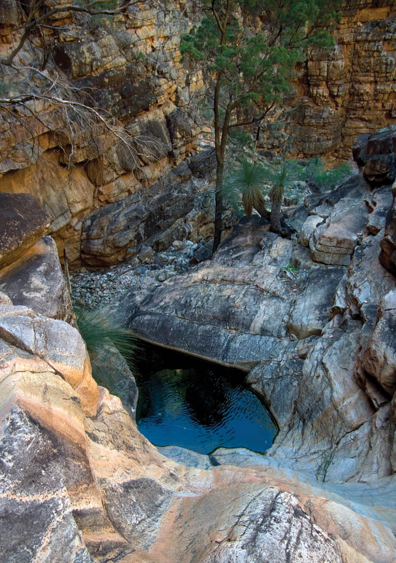
Further north, but still close to Adelaide’s suburbs, lie Morialta and Black Hill Conservation Parks. With its deep rugged gorge with nearly-permanent waterfall, there are four key hikes that skirt around and through the gorge. The hikes here are generally more challenging than those found in Belair National Park. Again, the trails are all well marked so easily explored. Highlights include visiting the two falls above the main fall, Giants Cave and Deep View Lookout. Black Hill Conservation Park includes two excellent shorter trails, to explore the tougher hills, with no shortage of koala and echidna spotting opportunities.
Linking Belair National Park, Cleland Conservation Park, Morialta and Black Hill Conservation Parks is the Yurrebilla Trail. At 56 kilometres in length it can be walked in three to five days, although trail runners or walkers can be found completing the entire length in a single day on several popular annual walking and running events. The trail includes plenty of steep hills, secluded gullies and opportunities to spot wildlife, including the quiet Horsnell Gully with its old nursery ruins and prolific koala life.
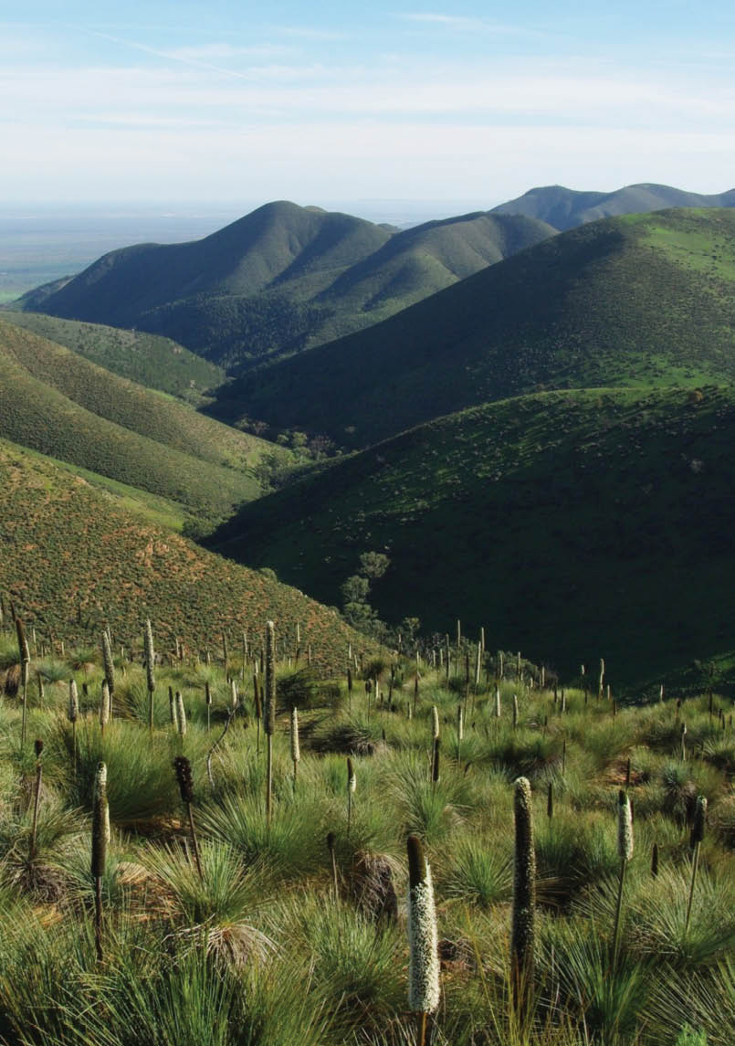
Spanning the entire Adelaide Hills and beyond is the Heysen Trail. At 1200 kilometres, it takes between 50 and 60 days to walk. Starting in the south at Cape Jervis, the trail extends through the Mount Lofty Ranges and Flinders Ranges, before ending at Parachilna Gorge. Highlight sections include the three to five walking days from Cape Jervis to Victor Harbor, the walks through the Adelaide Hills, and the ten-days to two-weeks of walking through the Flinders Ranges north of Quorn, beside the majestic Elder Range and stunning natural crater-like

Heysen Trail spur from the Bluff to Kings Beach, Victor HarborJeremy Carter, Walking SA
8 | BWA October 2015
Wilpena Pound. Campsites are scattered along the trail, which makes many sections very walkable for either day walkers or overnight walkers.
Another popular walking destination is Deep Creek Conservation Park, just 90 minutes from the city centre with over 10 accessible walks. Highlights include the Deep Creek Cove Circuit, which takes in the Deep Creek Waterfall, a permanent waterhole but intermittent waterfall, the sub tropical gullies nearby, coastal views and the rugged Deep Creek Cove.
Further afield is the Mount Remarkable National Park in the southern Flinders Ranges. With plenty of hike options for both day walkers or overnight walkers, the park includes highlights such as the Wirra Wirra Loop, Hidden Gorge and Alligator Gorge.
In the northern Flinders Ranges is Flinders Ranges National Park offering 18 different hikes. Combine with a camping trip, and enjoy the spectacular and ancient Flinders Ranges. Best visited from April to October, the park offers options for day walkers or overnight walkers.
On the Yorke Peninsula there are numerous shorter walks in Innes National Park, which is a great way to explore the history, coastline, headlands and lighthouses.
Many South Australians find it more comfortable to undertake their longer bushwalking activities during the cooler months of autumn, winter and spring. During summer, shorter, earlier morning walks are ideal and the linear parks on the Adelaide Plains offer an abundance of choice. There are the linear parks that follow rivers, criss-crossing the Plains, offering an array of choice to walk smaller sections, and explore local parks and playgrounds. The most well known is the River Torrens Linear Trail, a 35 kilometre trail linking Athelstone at the edge of the Adelaide Hills to the coast at West Beach. Other trails include the Little Para River Trail (16 kilometres), Dry Creek Linear Trail and Sturt River Linear Park (7 kilometres). The coast paths are also ideal for summer walking, the most popular being the Hallett Cove Boardwalk/Marion Coastal
Walking Trail, a seven kilometre clifftop boardwalk along the rocky coastline between Marino and Hallett Cove. For walkers, the 70 kilometre Coast Path is functionality complete, a decades old vision to create a connected multi-use path along Adelaide’s coastline from North Haven through to Sellicks Beach. Some sections near Port Stanvac remain inaccessible, and between Moana and Port Willunga some areas are just a rough path, but still easy enough for walkers to follow.
Find inspiration for hikes and places to explore in Walking SA’s Find a Place to Walk directory, a selection of 130 walks and trails. The Friends of the Heysen Trail have an excellent Walk Selector to choose which of the 60 trail sections you might like to hike. Several bloggers share their best South Australia hikes, and can also be a good source for ideas.
The following pages are a compilation of best walks based on a survey by readers from the last edition of BWA.
Since rediscovering hiking ten years ago, Jeremy has been an avid hiker, exploring many of South Australia’s walking trails including the 1200 kilometre Heysen Trail. With a history of blogging about places to hike, he has combined his marketing and web development professional background to undertake volunteer and professional work with numerous South Australian hiking and walking bodies, including Walking SA, Friends of the Heysen Trail and Adelaide Bushwalkers. Walking SA is the not-for-profit peak body for all forms of walking in South Australia. Their vision is to see more people walking more often.


BWA October 2015 | 9


South Australia


Heysen Trail sections
varies, heysentrail.asn.auVictor Harbor Heritage Trail: Coast walk including the Bluff at Victor Harbor - a landmark with views in to Encounter Bay and town, and out west along expanse of cliff coastline. Trail follows the coast, it is a spur trail of the Heysen Trail, and connects to the Heysen Trail at Kings Beach. Coast takes in pathways and beaches. See whales, seals, dolphins, birdlife. In winter coastline looks like a Cornish coastline. Walking along wild sea shores in the first half and along the sea cliff top with spectacular views in the second half.Cape Jervois to Victor Harbor: The most spectacular scenery in this world, bar none!Bridgewater to Hahndorf: This is a spur of the Heysen Trail and takes the walker from one lovely Adelaide Hills town to another through lovely quiet backstreets and paths and through the wonderful Cedars property where Hans Heysen lived and worked. Great coffee at the end of the trail.Wilpena to Yanyanna: Views of the outer rim of Wilpena pound.Mount Falkland: From Parachilna Gorge take the Heysen Trail south. After approximately 2 kilometres on left see Mount Falkland. Climb one of the spurs to summit and camp. Second day descend go through Wild Dog Creek to Blinman Pools and camp. Then out to Angnorichna or back to Parachilna.
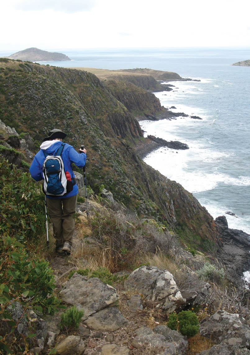
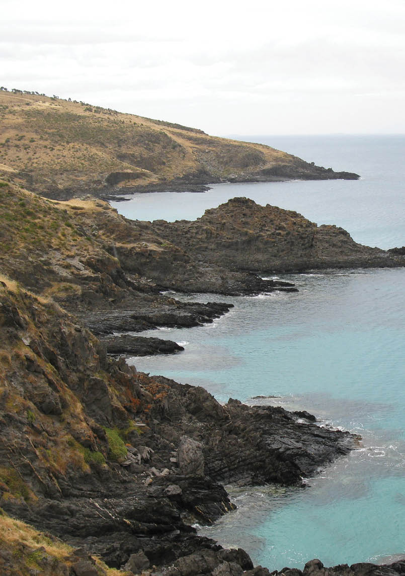
Waitpinga CliffsRobert Alcock
Deep Creek Circuit
12 km circuit, 1 day, walkingsa.org.au/Combines four elements: waterfall gorge (permanent water), coastal views, subtropical forest, hills as well as birdlife. Plenty of animals including echidnas, kangaroos, birds.This walk is reasonably close to Adelaide. Can be walked year round. Deep Creek is a hidden gem in SA. A challenging walk through native bushland, views to Kangaroo Island and lots of Kangaroos.
10 | BWA October 2015


Deep Creek Circuit
12 km circuit, 1 day, walkingsa.org.au/Combines four elements: waterfall gorge (permanent water), coastal views, subtropical forest, hills as well as birdlife. Plenty of animals including echidnas, kangaroos, birds.This walk is reasonably close to Adelaide. Can be walked year round. Deep Creek is a hidden gem in SA. A challenging walk through native bushland, views to Kangaroo Island and lots of Kangaroos.
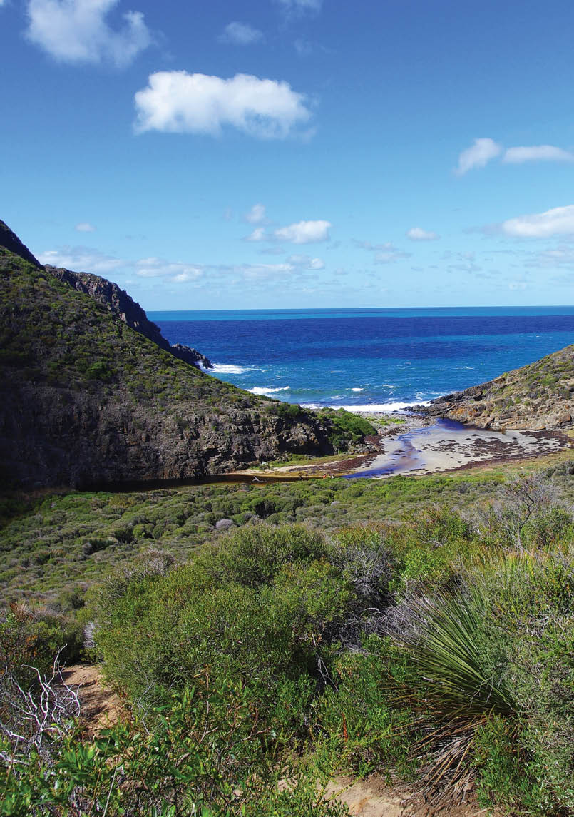
Deep Creek CoveBrian Eglinton

South Australia
BWA October 2015 | 11

Gum Gully Rockleigh, Lavender Federation TrailSouth Australian Recreation trails incorporated (SARTI)


South Australia

Lavender Federation
Walking Trail sections
varies, lavenderfederationtrail.org.auInteresting inland trail which stretches 212 kilometres inland in SA from Murray Bridge (have a swim in the river) to Eudunda. Lots of spur trails in and out of towns make this accessible along its length. Murray Bridge to Monarto: The latter stretch from Monarto to Murray Bridge goes through a picturesque gorge. This can be best described as a mini Flinders Ranges close to Adelaide. It leaves from the banks of the Murray but avoids urban areas around wetlands, through Rocky Gully Gorge, past Monarto Zoo with views of exotic animals like giraffe & Mongolian wild horses to the Monarto Recreation Reserve. All off road apart from a 200 metre stretch. The trail head at Murray Bridge is 1 hour from Adelaide CBD on the SE Freeway.Eden Valley Loop Trail: Starts from the mainstreet at Eden Valley in the Barossa. Mainly off road or minor unpaved back roads. Distance 18 kilometres. There’s a large cross at the top of a nearby lookout, views over the Barossa vineyards and Keynes Gap. One of many loop & spur trails joining the Lavender Federation Trail.Mount Beevor: Starting from Ramms Road at Rockleigh, the trail passes abandoned ruins before going into Gum Gully following a creek and with prolific wildlife. The final ascent to Mount Beevor is steep however the effort is well worthwhile. At the summit are communication towers but the 360 degreee views are amazing. A sign at the summit provides information but include the Murray River to the east, sandhills of the Coorong and Southern Ocean to the south, Mount Lofty & Mount Barker to the SW & west & the back of the Barossa Range north. A short walk to Diggers Rest completes the 16 kilometres walk.
Yurebilla Trail sections
varies, southaustraliantrails.comI just love that you get to walk across the hills from one side of Adelaide to the other. Great views. This walk traverses the face of the Adelaide hills. It can be easily split up into day walks. because it is so close to city there is great phone coverage.
12 | BWA October 2015
Yurebilla Trail at the Ambers Gully endBrian Eglinton


Yurebilla Trail sections
varies, southaustraliantrails.comI just love that you get to walk across the hills from one side of Adelaide to the other. Great views. This walk traverses the face of the Adelaide hills. It can be easily split up into day walks. because it is so close to city there is great phone coverage.
South Australia
BWA October 2015 | 13

South Australia

St Marys Peak, Wilpena Pound
21.5 km circuit, 9 hours, walkingsa.org.au/This is a long day walk to the highest peak in the Flinders Ranges with extensive views in every direction. It can be done as a loop back through the basin of Wilpena Pound. To be done in cooler months. The round walk goes through multiple different types of environment - beautiful dark forests, open grassland full of emus and kangaroos, challenging sandstone climbing and hopping, spectacular views and really gives the walker a good sense of what the Flinders has to offer. Best walk in South Australia by far. You can either walk up the outside of Wilpena Pound which is shorter but involves some rock hopping and steep climbs or you can walk through the spectacular Pound floor. St Marys Peak on a clear day has the most stunning views of Wilpena Pound and the ABC Ranges, You are rewarded for your efforts at the Peak and feel on top of the world.
Hidden Gorge Loop
18 km circuit, 7 hours, southaustraliantrails.comWalk from Mambray Creek (walk clockwise not anti-clockwise as in the brochure). Flinders gorges and wet creeks, “hidden” location, good variety in trail type with nature, gorges, views. Good trail with good markings. Loop walk. The Gorge has great scenery, and on the return along Mambray Creek in the late afternoon there is the chance of seeing the yellow-footed rock wallabies on the rock screes.

Belair National Park
varies, environment.sa.gov.auLarge enough to be lost, small enough to explore in a whole day. Combination of short sharp climbs, long meardering descents, watefalls crekk crossings. Located within 15 minutes of city yet feels like a world away.Belair Waterfall Hike: gababouthiking.com, close to city.
Morialta Conservation Parks
varies, environment.sa.gov.auDiferents grades of dificulties. So close to the city yet a paradise to walk. Short or medium with enough to make you puff and feel you have had a walk or a stroll, if that is your thing. Great scenery, views, fauna (sometimes) and flora, depending on the season.
From the Heysen Trail as it heads north towards the wall of Wilpena PoundBrian Eglinton
14 | BWA October 2015


Hidden Gorge Loop
18 km circuit, 7 hours, southaustraliantrails.comWalk from Mambray Creek (walk clockwise not anti-clockwise as in the brochure). Flinders gorges and wet creeks, “hidden” location, good variety in trail type with nature, gorges, views. Good trail with good markings. Loop walk. The Gorge has great scenery, and on the return along Mambray Creek in the late afternoon there is the chance of seeing the yellow-footed rock wallabies on the rock screes.
South Australia

Morialta Conservation Parks
varies, environment.sa.gov.auDiferents grades of dificulties. So close to the city yet a paradise to walk. Short or medium with enough to make you puff and feel you have had a walk or a stroll, if that is your thing. Great scenery, views, fauna (sometimes) and flora, depending on the season.
Hidden Gorge in Mambray Creek section of Mt Remarkable NPBrian Eglinton
BWA October 2015 | 15

South Australia

Onkaparinga River Gorge
8 km, 7 hours, environment.sa.gov.auThere are many trails with sightings of wildlife, undulating tracks, views of the river and only 50 minutes from Adelaide. Spectacular views from above the gorge. Great experience walking through the gorge. Opportunity for a swim at appropriate times of the year.
Warren Tower Walk
9 km circuit, 4.5 hours, environment.sa.gov.auGreat views from near the tower as well as from other parts of the trail. A variety of different vegetation along the way, it feels quite different in the valley compared to the ridges. Wildflowers, orchids, kangaroos and great views.
River Torrens Linear Trail
35 km circuit, 1 day, walkingsa.org.auThe trail can be accessed at multiple points and can be as long or short as you please. It takes the walker through some lovely parks alongside the Torrens River in the suburbs of Adelaide, right from the foothills to the sea. You can access great coffee and food in multiple places along the trail as well.
Mt Remarkable, Mount Remarkable NP
23 km return, 10 hours, Heysen Book 2Melrose Map 3,1 367644 to Alligator Gorge Road Map 3.3 278760.Challenging start with lovely views from the top. Walk continues across rolling country side with a lovely gorge to finish.
Alligator Gorge Hike
Mount Remarkable NP
9 km circuit, 4 hours, southaustraliantrails.comA pleasant walk through a constricted gorge in the Southern Flinders Ranges.
Black Hill Conservation Park
varies, environment.sa.gov.auDifferent grades of difficulties. Enjoy spectacular scenery of rugged ridges and a wide variety of native plants and animals along Black Hill Conservation Park’s extensive network of walking trails.
Bunyeroo Gorge, Flinders Ranges
7.2 km, 3 hours, walkingtrailssupportgroup.org.auGeological history, vegetation.
Bunyip
Vulkathunha-Gammon Ranges NP
1.2 km, 45 minutes, Vulkathunha-Gammon Ranges National ParkMagnificent gorges, creek walk, vegetation, remoteness. Not safe to go into the further reaches of this walk.
Onkaparinga GorgeAdelaide Bushwalkers
16 | BWA October 2015

Warren Tower Walk
9 km circuit, 4.5 hours, environment.sa.gov.auGreat views from near the tower as well as from other parts of the trail. A variety of different vegetation along the way, it feels quite different in the valley compared to the ridges. Wildflowers, orchids, kangaroos and great views.
South Australia

Mt Remarkable, Mount Remarkable NP
23 km return, 10 hours, Heysen Book 2Melrose Map 3,1 367644 to Alligator Gorge Road Map 3.3 278760.Challenging start with lovely views from the top. Walk continues across rolling country side with a lovely gorge to finish.

Alligator Gorge Hike
Mount Remarkable NP
9 km circuit, 4 hours, southaustraliantrails.comA pleasant walk through a constricted gorge in the Southern Flinders Ranges.

Black Hill Conservation Park
varies, environment.sa.gov.auDifferent grades of difficulties. Enjoy spectacular scenery of rugged ridges and a wide variety of native plants and animals along Black Hill Conservation Park’s extensive network of walking trails.

Bunyeroo Gorge, Flinders Ranges
7.2 km, 3 hours, walkingtrailssupportgroup.org.auGeological history, vegetation.

Bunyip
Vulkathunha-Gammon Ranges NP
1.2 km, 45 minutes, Vulkathunha-Gammon Ranges National ParkMagnificent gorges, creek walk, vegetation, remoteness. Not safe to go into the further reaches of this walk.
Alligator GorgeBrian Eglinton
BWA October 2015 | 17

Devils Nose Hike
2.2 km return, 1.5 hours, environment.sa.gov.auGreat views from the Devils Nose and along the ridge without having to work hard as the trail head is at one end of the ridge. Loop option extends the walk and gives the option of a greater workout if you do in the reverse direction from normal.
South Australia
Mt Arden
21 km return, 1 day, Heysen Book 2“Mt Arden Map 4.5 809389 to Buckaringa Gorge Map 4.6 210430.Great views from the top (very windy and exciting). Most of the walk is high and across bare ridges before dropping into Buckaringa Gorge and the opportunity to see yellow footed rock wallabys.

Mount Lofty
10 km return, 3 hoursShort, sharp accessible. Great views and facilities at the top as well as at the bottom. A first-class heart beater and beautiful all year round ...

Pioneer Women’s Trail
22-28 km, 7-10 hours, walkingsa.org.auVery historic walk which showcases the Adelaide Hills and great views.
Sea to Summit, Kingston Park
32 km, 1 day, walkingsa.org.auVariety of environment. Bush, park, creeks, gorge, coast.

Sturt Gorge
varies30 minutes from Adelaide, views to the sea, and a lovely walk along the creek. Many parrots.
Terrapinna Tors
7.1 km circuit, walkingtrailssupportgroup.org.auRemoteness, variation of vegetation and terrain, creekbeds, gorge, wildlife.
Mt ArdenBrian Eglinton
18 | BWA October 2015


Heysen Trail, Flinder Ranges
1200 km one way, 60 days, heysentrail.asn.auClassic, iconic long distance walking trail which takes the hiker from the southern coast to the centre of South Australia. It skirts Adelaide through the beautiful Adelaide Hills and shows the hiker all the types of environment South Australia has to offer. Needs a huge commitment, but is unbeatable in SA. 1200km long, can be split up to be lots of day walks or some overnighters, or do it all in one go! Spectacular ocean views at the start at Cape Jervis through scrub land and farm land all the way to the Flinders Ranges. Such differing terrain along the whole track.


South Australia
Blowhole Beach CoastRobert Alcock
BWA October 2015 | 19


Lavender Federation Walking Trail
212 km one way, 10 days, lavenderfederationtrail.org.auInteresting inland trail which stretches 212 kilometres inland in SA from Murray Bridge (have a swim in the river) to Eudunda. Lots of spur trails in and out of towns make this accessible along its length. There are currently six spur and loop trails connected to the main trail making a total of 278 kilometres of trail (covered in four maps). A further extension from Eudunda to Clare is currently under construction. By early next year the main trail will reach Manoora on the Barrier Highway (+ 49 kilometres) and link with the Heysen Trail at Web Gap. A spur trail of 7 kilometres and a loop trail of 8 kilometres are also a part of the first year’s extension. The following year Clare (+ 57 km) will be reached and also link the Riesling and Rattler Trails with the Heysen and Lavender Federation Trails creating over 1700 kilometres of interlinked trails in the next two years. The proposed River Trail from Cadell in the Riverland to Salt Creek on the Coorong (450 kilometres) will connect with the Lavender Federation Trail at Murray Bridge.In addition to work currently underway extending the main trail, a spur trail extending from the Springton Loop Trail is being constructed into Sanders Gorge (11 kilometres), a spur trail from Rocky Gully called the Jailbreak trail (yes, it is right next to the Mobilong Prison on Murray Bridge outskirts) of 5 kilometres is almost complete (multipurpose) and a loop trail of 8 kilometres called the Frahns Farm Loop Trail is shortly to commence. These are both cooperative trail building exercises between walkers & mountain bikers. You may not be aware that the Lavender Federation Trail and all associated spur & loop trails are a project of South Australian Recreation trails incorporated (SARTI) and have all been constructed and are maintained entirely by volunteers.For an overnight walk, start from the Sturt Highway near Truro in the Barossa and travel towards Eudunda. The Gap, a magnificent gorge east of Dutton has permanent water, several waterfalls, hand build stone walls and views east over the Murray Mallee. Dutton is a quiet town full of old historic buildings. Leake Lookout on day two has amazing views. Almost entirely off road using road reserves and private property.

South Australia
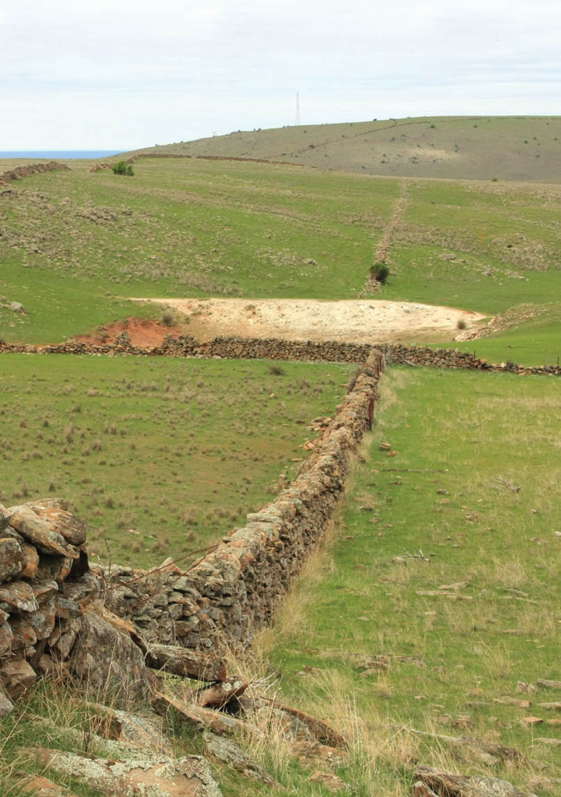
Stone fencing - a common sight east of DuttonSouth Australian Recreation trails incorporated
20 | BWA October 2015


Yurebilla Trail
54 km one way, 3 days, southaustraliantrails.comRanging from narrow single-person tracks to vehicle fire tracks, the Yurrebilla Trail passes many of the Adelaide Hills’ top tourist attractions, including Waterfall Gully, the Mount Lofty Botanic Gardens, Mount Lofty Summit and Cleland Wildlife Park. It also visits or has connection to picturesque Hills’ towns such as Summertown, Crafers and Norton Summit, as well as wineries, pubs and other attractions.
South Australia
Yurebilla Trail at the Ambers Gully endBrian Eglinton
BWA October 2015 | 21


Mount Remarkable National Park
2 to 4 days, environment.sa.gov.auThere are a variety of options from two to four days including some of the best features of the park including: Hidden Gorge, Alligator Gorge, The Battery, Mount Cavern, The Black Range and Mount Remarkable. Great views, pretty creeks, spectacular gorges and lots of wildlife make this a great walk. Remarkable rocky outcrops, waterfalls, easy gentle walking with challenging streches, gorges, creek crossings, wildlife, good distances between campsites, water available, easy to do loop walks located within 300 kilometres of Adelaide.
South Australia

Arkaba Station Walk
45 km one way, 4 days, Heysen Book 2Mayo Hut Map 5.3 545838 to Moralana Drive Map 5.6 639010This walk goes through beautiful recovered pastoral land. Easy walking but quite a distance.

Cape Gantheaume Coastal Trek
34 km one way, 2 days, environment.sa.gov.auThis two day walk can easily be extended to many days although water drops would need to be arranged. It’s quite easy to extend to three days by walking through Seal Bay conservation park to Vivonne Bay. Feels like a real wilderness walk. Great coastal scenery, cliffs and beaches. A lot of wildlife and large seal colony at the cape.

Flinders Chase Coastal Trek
58 km one way, 3 days, environment.sa.gov.auTakes in the wild coast of Kangaroo Island. Stay at campsites along the way. Historic lighthouses and shipwrecks. Somewhat being replaced with Kangaroo Island Wilderness Trail.

Gammon Ranges
5 days circuit, bushwalk.comOff the main tracks and roads in the Gammons NP, people need to forge their own routes and be competent in map and compass. But the remote gorge and cliff face scenery is fantastic and the waterholes are delightful. This is a desert park and varies from open plains to bouldery creek beds, forests of gnarled old sheok/pine and thick unforgiving scrub. The variety of colours in the ever present rocks gives the feel of walking through the bones of the earth.
Scalloped second Fall, Gammon RangesBrian Eglinton
22 | BWA October 2015

Mawson Trail
900 km, 45 days, southaustraliantrails.comIconic long distance trail in SA which covers some beautiful forests, hills and towns. Very walkable - shared trail so good for cyclists as well.

South Australia
Mount Brown Conservation Park
(near Quorn)
2 days circuit, environment.sa.gov.auThis walk goes from Wool Shed Flat following the Heysen Trail to top of Mount Brown via Waukarie Falls. Finding campsite along trail to summit after saddle. The second day follows Summit Trail to turn off and instead of going to summit the other trail we descended back to Wool Shed Flat. This walk goes through beautiful recovered pastoral land. Easy walking but quite a distance.
Mount Falkland, Flinders Ranges
14 km return, 2 days, peakclimbs.comMount Falkland can be done as part of an overnight walk by doing it as a side trip while walking the Heysen Trail from the Parachilna trail head down the Aroona Valley or other multi day options in the area such as via Blinman Pools from Angorichina. It is most spectacular if you camp on top. Great sunrise and sunset views over the surrounding ranges to the east and plains to the west.

St Marys Peak, Wilpena Pound
19 km circuit, 2 days, walkingsa.org.auYou can camp overnight at Cooinda Campsite and make it a two or three day event. You can walk in through Wilpena Pund, camp overnight, do Mulloga Falls on the second day, which is a spectacular gorge on the edge of Wilpena Pound (on accessible on foot). Then stay overnight again and on the last day hike out via St Marys Peak.
Horrocks Pass to Mt Brown section of the southern FlindersBrian Eglinton
BWA October 2015 | 23