


Presented with a myriad of GPS gadgetry, it's often difficult to decide what option is appropriate for a bushwalker. Do you need a GPS? How do you decide on what models to get? Why are the prices so varied? What comes with the GPS?
Keith in Iceland Keith Tan
Choosing a GPS
Keith Tan

46 | BWA October 2016
Global Positioning System (GPS) is one of the satellite systems in the Global Navigation Satellite System (GNSS) umbrella. GPS use has become ubiquitous. GPSs are expected in mobile phones and tablets. They're used in radio controlled toys, security tracking, farming applications, safety beacons and autonomous vehicles. GPSs are important for timing standards, with mobile phone towers synchronising their time with GPS time.
Outdoor GPS use has expanded from traditional activities like bushwalking, skiing, cycling, paragliding and skydiving to geotagging photography, social networking activities, geocaching and games.
I'm comfortable with a map and compass - do I need a GPS?A GPS may be invaluable when bushwalking in unfamiliar places, or when there's no sightlines. There may be reduced visibility in fog or a whiteout, or you've walked off the intended track and under the canopy be unable to see landmarks to triangulate your position. The faint pad may have petered out in scrub. At dusk or night you might be walking in low light. In these scenarios a GPS is highly useful.
A GPS can easily log walks and mark changed track conditions for later use or to share with others. The track log record is automatic, and marking waypoints is relatively simple. When used with paper maps, a GPS can confirm the location quickly.
Term
Description
ANT+
A wireless technology that allows monitoring devices to connect with each other.
GNSS
Global Navigation Satellite System. Currently the United States GPS and Russian GLONASS are the only fully functioning GNSS. Others include China’s Compass/BeiDou, European Unions’ Galileo.
GPS
Global Positioning System is the GNSS launched and operated by the United States. Operational globally since 1994, it uses up to 32 satellites and is currently the world’s most utilised satellite navigation system.
GPSr
Global Positioning System Receiver - a handheld GPS receiver designed for outdoor recreational use
Almanac data
Almanac data allows the GPS receiver to rapidly acquire satellites shortly after it is turned on. It consists of the coarse orbit and status information for all satellites in the constellation, an ionospheric model, and timing information. It is used by GPSr to identify the visible satellites overhead based on the time/location stored in the GPSr.
Ephemeris data
The precise satellite orbit data. Each satellite transmits its own ephemeris data which allows the GPSr to calculate the satellite’s position, and in turn with trilateration (a more complex version of triangulation) to determine the receiver’s location.
Route
A group of waypoints entered into the GPSr in the sequence you desire to navigate them.
Track/ Breadcrumb trail
A record of your current direction of travel relative to a ground position. A GPSr will record a set of waypoints at a set interval, and joined together, they form the track log, also known as a breadcrumb trail.
Waypoint
Waypoints are location positions recorded and stored on the GPSr.
“... GPS chipsets and antenna combinations in smart phones and tablets are not equal; some are more accurate than others.
BWA October 2016 | 47

Of course, a GPS should not replace good navigation skills with maps and compass. GPSs may fail, be damaged, or have a flat battery, and GPS signals may be blocked or spoofed in extreme circumstances. Maps and a good compass should always be carried as a backup, or better still, use the GPS as a backup to maps and compass when bushwalking.
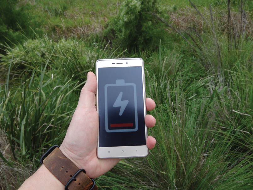
I want a GPS - where do I start?Smart phones and tablets with GPSImprovements in GPS chipsets in smart phones means that they are becoming a viable navigation option. With the right smart phone, appropriate software, a durable protective case, and a battery charger, some newer devices may work well outdoors fully offline with no mobile signal required. When used offline, smart phone battery life with GPS only may compare favourably with hand-held GPSs.
It's important to understand that GPS chipsets and antenna combinations in smart phones and tablets are not equal; some are more accurate than others. Similarly, not all GPS applications are created equal. It may be complicated for beginners dipping their toes into GPS use, and this article focuses on available consumer GPSs.
Dedicated hand-held GPS models still have the advantages of durability and battery life.
Categories of GPS consumer devicesAutomotive navigation models – Most people will be familiar with these. Some models can display topographical maps, but are inappropriate for bushwalking due to the short battery life, durability and software limitations. However, there are a few hand-held GPS models that can be used as an automotive GPS. These include the Garmin Montana, Monterra and the Magellan 510/610/710.
Marine GPS models - Some hand-held marine GPSs like the Garmin GPSMap 78 or the GPS72/GPS73 can be used for bushwalking, but have been primarily designed for marine use with the ability to float if dropped overboard.
Aviation GPS - Portable aviation GPSs are usually unsuited for bushwalking, as the software is geared towards aviation use.
Cycling GPS - Some cycling GPSs can display topographical maps and be used for bushwalking, but the software is typically geared towards cycling, such as the Garmin Edge and Magellan Cyclo.
Wrist-based GPS and watches - The main considerations are the small screen size, the battery life, and most models cannot incorporate maps.
Hand-held GPS receiver (GPSr) - This article primarily focuses on these dedicated hand-held models. The Australian market for hand-held GPSrs is dominated by just two brands, Garmin and Magellan. There were other brands, however they either no longer produce hand-held devices or their products are generally unavailable in Australia.
Categories of Hand-held GPSrsHand-held GPSrs broadly come in two formats: non-mapping capable, and mapping capable.
Basic non-mapping models – These include the Garmin Foretrex 401, the basic Magellan Explorist models like GC and 110, and Garmin eTrex 10. These might have a basic world base map, but
Garmin Oregon 650 near Mt RufusWeiyun Yu
“Some cycling GPSs can display topographical maps and be used for bushwalking ...
48 | BWA October 2016
the devices usually don't support more detailed topographical maps. You can use them to leave a breadcrumb trail and mark waypoints on the device, but these are best used in conjunction with paper maps. Basic non-mapping GPSrs also include some watch-based GPSs, GPS watches, and some cycling GPSs.
A basic non-mapping GPSr would suit if:
The GPSr is a backup to derive your location to check on paper maps, and/or
You intend to log your tracks and mark waypoints to reference on paper maps.
GPSrs have a setting to adjust the datum used. When using a different datum setting on the GPSr compared with the datum on the paper maps, the GPS co-ordinates will result in incorrect grid references. Therefore, it is important when using a non-mapping GPSr, that the datum setting matches the paper maps being used.
Note that some GPS watches and bicycle GPSs have datums that cannot be changed, and cannot display familiar grid formats. These models might only report a longitude and latitude and the user must convert these manually to a grid reference.
Mapping capable models – These come in two basic styles - button-based, or touch screen. The touch screen models are typically more expensive. One advantage of mapping GPSrs is that if you have a topo map installed your position will be displayed the map. This makes it easier to compare with your position on paper maps, and
helps minimise the issue of having set an incorrect datum on the GPSr. If you set an incorrect datum and enter a grid reference, the mapping GPSr displays the location on the map and it will be easier to see if this is correct.
Button input mapping models - These include the Garmin Etrex 20/30/20x/30x, Garmin GPS Map series (64, 78s etc), Magellan Explorist 310. They have mapping capabilities and utilise buttons for screen navigation and interaction. Button inputs are slower than using a touch screen, however, these models will typically have a longer battery life than the equivalent touch screen models.
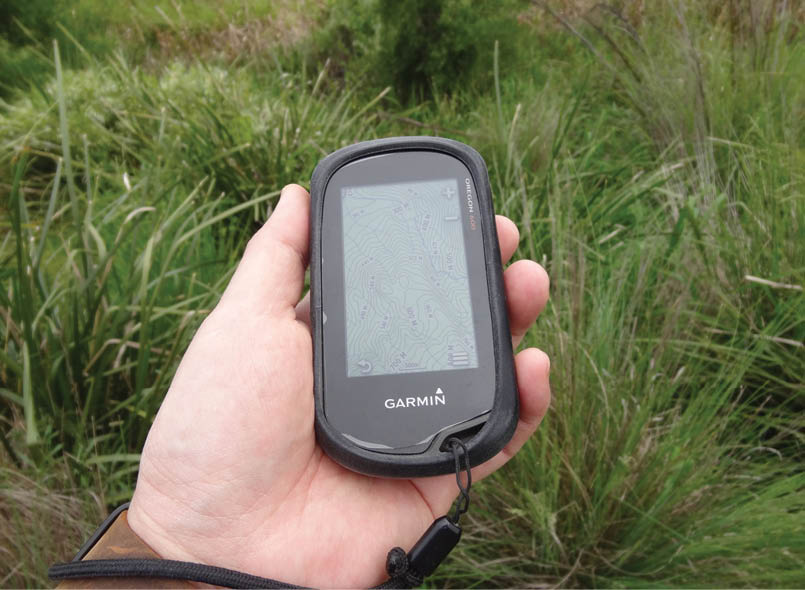
Touch screen input mapping models – these include the Garmin Oregon, Garmin Montana, Monterra, and Garmin Etrex touch series or Magellan Explorist 510, 610, 710. They have the ability to include topographical maps and the advantage of screen navigation using the touch screen. GPS touch screens are well behind smart phone touch screens, but they make screen navigation and data input significantly easier. I've used gloves with newer touch screen models like the Oregon 600 and found them to be acceptable, but see below.
Choosing between button or touch screen modelsButton-based models use a combination of buttons on the GPS for data input and screen navigation. This is a slower than using a touch screen. A touted benefit of button-based models was that they could be operated when wearing gloves. This has been somewhat negated by the newer touch screen models which are glove-friendly. However, the touch screen the author has used (Garmin Oregon 600) did not fare so well when the screen is wet. While gloves

“... a wet screen tends to make touch screen use frustrating.
“... I find the trip computer handy to determine my walking pace and distance already covered.
BWA October 2016 | 49
can be used on the screen, a wet screen tends to make touch screen use frustrating. The wet screen can lead to unintended screen touches. Button models work best in wet conditions.
Both options should have a keylock to prevent accidental button presses when the GPS is stowed. I've experienced accidental button presses that have either added unintended waypoints, or worse, deleted routes and tracks by mistake.
Common basic features of hand-held GPSr models
Display current location coordinates, in a variety of datums and position formats. If you have a map capable model, it will display your location on the map.
Record a track log. All GPSrs record track logs of your bushwalks, and can display the "breadcrumb" trail on the screen for later reference. The number of track logs and waypoints each model can record depends on the memory on the device.
Navigation. All GPSrs can navigate "as the crow flies" to a specific location or follow a pre-set route with given coordinates.
Other basic standard features include a trip computer, compass, geocache options, a photo viewer, sunrise/sunset information, area calculator, calculator, alarm, calendar,
stopwatch, satellite information, ideal fishing days, man overboard, proximity alarm when approaching a saved waypoint, tides information. The majority of these standard features are rarely used in bushwalking.
Of these additional features I find the trip computer handy to determine my walking pace and distance already covered. Combined with the sunset time and a graphical representation of the route elevation I can easily see if I need to pick up the pace or look for a camp site before darkness descends.
Durability, weight and sizeGPSrs are designed with durability and water resistance in mind. Typically, a GPSr will have a waterproof rating of at least IPX7. It should work after immersion in one metre of water for 30 minutes, in rain or after river crossings, but not for swimming or snorkelling.
While GPSs are more rugged than most smart phones, they are still electronic devices with screens, albeit with thicker plastic casing and waterproof seals. Optional cases suitable for most GPSrs give extra protection.
GPSs with batteries usually weigh 150-200 grams. Garmin Montana (290 grams) and Monterra (330 grams) are exceptions. Smaller models might fit more easily in the hand, but have smaller screens.
GPS ChipsetsMost modern GPSrs use high-sensitivity GPS chipsets, including ones that are able to track multiple channels simultaneously. Newer chipsets have improved the initial GPS acquisition time, increased the GPS signal stability, and have improved reception of multiple satellites in adverse conditions such as under tree canopy, in heavy weather, or partially indoors. If you are on a budget and looking at second-hand GPSr, this might be an important consideration. The SiRFStar III chipset was used almost exclusively by manufacturers a decade ago in high-end GPSrs, seting something of a gold standard. Since then, new chipsets


Garmin Oregon 600Keith Tan
“If you are on a budget and looking at second-hand GPSr, this might be an important consideration.
50 | BWA October 2016
from other manufacturers like MediaTek and STMicroelectronics have emerged, and have been adopted by GPSr brands. These newer high-performance GPS chipsets use low energy and can receive additional GNSS signals like the Russian GLONASS.
MemoryAs with smart phones, hand-held GPSrs use onboard memory to store information such as maps, routes, tracks, waypoints, points of interest, and on more advanced models, photos and videos. The memory you require depends on the type of maps and other data (like photos or other media) that you intend to store on the device. While the GPSr onboard memory is usually not upgradeable, on most models it can be supplemented with a memory card slot. The Magellan and Garmin basic eTrex models store 2000 waypoints, 200 routes, and 200 tracks (comprising 10,000 waypoints per
track). More advanced Garmin models increase the number of waypoints storage to 4000 (Garmin eTrex Touch, Orgeon 600/650, Montana), or 10,000 for the newer Garmin Oregon 700/750.
AntennasHand-held GPSs have two sorts of antennas. Internal is typically a flat ceramic patch antenna, and external is a quad helix antenna. I would not get hung up on the external vs internal antenna. It may have been an issue in the past, but the quality of the ceramic patch antennas in new internal antenna models is significantly better than the older ones. I've found that there is little real difference in time to first fix with the newer models with internal antennas compared with the protruding quad helix antenna.
“Button models tend to use less power and will last longer
Android smartphone low batteryKeith Tan
“Fortunately, tracks and waypoints are usually in a standard format, and can be shared between different GPS brands ...
BWA October 2016 | 51

Battery considerationsMost GPSrs take replaceable AA batteries, however there are some that come with built-in lithium batteries. Some brands like Holux have models that use rechargeable lithium ion batteries, which can last as long as rechargeable NiMH AAs or Lithium AAs. I've found that the built-in internal lithium batteries in such models are similar to those in smart phones. Over time the internal battery degrades, and tends not to last as long as replaceable batteries (especially if not used for a while), and it can be difficult to source replacements when the lithium battery finally dies. These models need to go to a specialist for replacing. Replacing can be difficult when the model is discontinued. By comparison, a 15-year-old GPSr that uses AA or AAA batteries might still work today.
For example, the Garmin Foretrex 201 had an internal lithium battery that was not user replaceable. When the original batteries were depleted, commonly within 3-5 years, it proved more difficult to replace than the AAA
batteries used for the Foretrex 101. You can find a 10-year-old Foretrex 101, insert AAA batteries and still have it working.
Typically, touch screen GPSrs using AA batteries will run for 10-12 hours while logging tracks continuously. Button models tend to use less power and will last longer - the Garmin eTrex 20x/30x is advertised at around 25 hours. Note that the manufacturer’s specified battery life tends to be on the optimistic side, and depending on the type of batteries used, actual battery life might be shorter.
Mapping considerationsMost newer GPSs have colour screens; older and basic models might still sport monochrome screens. Maps are easier to read on colour screens. Some mapping capable GPSrs include topographical maps, however most do not, and will require a separate map purchase. Manufacturers occasionally have promotions to include topographical maps with your purchase or by redemption with your receipt.
Garmin Oregon 600Keith Tan
52 | BWA October 2016
All models include a basic world basemap. The Magellan World Edition basemap is more detailed than the very basic Garmin basemap, but both are sparse on detail. Mapping is an important consideration as if it is not pre-bundled with the GPSr, it can be a significant additional cost.
The Magellan Explorist 710 comes with turn by turn Australian street maps and GeoScience topographic map and the Magellan Explorist 610 comes with Summit Series Topo Maps pre-bundled. The lower models like the Explorist 510 and 310 are not bundled with topo maps as standard, but these can be purchased separately - the current price is around $A50 per state, or $A150 for Australia and New Zealand. New Zealand Magellan topo maps are around $A100.
For Garmin, only the models that have a “t” designation at the end of their model numbers are sold with topo maps, For example, Garmin Oregon 600t has maps while the Oregon 600 does not. Garmin topo maps can be purchased either on microSD card maps, DVD, or download them from the
website. Depending on the maps chosen, the maps range from an additional $1-200. There are third party digital map providers that also create maps for Garmin. Oztopo has been making Garmin-compatible topographical maps for Australia since 2006 and their current version is priced from $229.
Additionally, Open Street Maps (OSM) are community-based mapping and is free. OSM maps can be installed on Garmin models easily. OSM maps can also be used in Magellan models, but the process is a little more complex.
Newer Garmin GPSs can also display scanned and georeferenced maps. The process to create these maps involves some technical knowledge and use of a number of free/paid PC programs and the process can be quite complex. Garmin have instructions on georeferencing scanned maps on their website.
Note that purchased maps downloaded or on DVD will be licensed to the serial number on the specific device. This prevents you sharing the map with someone who has the same GPS. However, if maps are purchased on a memory card, you will be able to use that memory card in any compatible GPSr.
GPSs available in Australia suitable for bushwalking** Note that only certain models include pre-installed maps
Model
Garmin eTrex 10
Garmin eTrex 20x/30x
Garmin eTrex 25/35
Garmin Oregon600/650/700/750t
Garmin Montana 610/680t
Magellan 310
Magellan510/610/710
Screen size
5.6 cm
5.6 cm
6.6 cm
7.6 cm
10.2 cm
5.6 cm
7.6 cm
Weight
142 g
142 g
159 g
210 g
289 g
147 g
195 g
Battery life
25 hours
25 hours
16 hours
16 hours
16-22 hrs
18 hours
15-16 hours
Mapping **
No
Capable
Capable
Cap./Incl.
Cap./Incl.
Capable
Cap./Incl.
Buttons/ Touch
Buttons
Buttons
Touch
Touch
Touch
Buttons
Touch
ECompass
No
30x only
35 only
Yes
Yes
No
Yes
Alti/Baro
No
30x only
35 only
Yes
Yes
No
Yes
Spoken Street Navigation
No
No
No
No
Yes
No
Yes
Price*
$120-150
$275-375
$350-430
$500-675
$680-880
$170-190
$270-550
“Be wary of over-investing in advanced models with features that you may never or rarely use
BWA October 2016 | 53
Other considerationsA major source when researching GPSs is internet forums, where users discuss their experiences of various models, including software bugs. Also, other users might share maps they created for that device. There's no standard map format between the two main GPS brands so maps created for use for Garmin models cannot be used in Magellan models.
Fortunately, tracks and waypoints are usually in a standard format, and can be shared between different GPS brands, although some tweaking might be required between different brands. There are a number of websites where GPS users upload their tracks for walks. These can be downloaded and used as routes when installed on your GPSr.
Additional featuresThe differences in the more advanced model include things like electronic compass, barometer, other sensors like ANT+ for connectivity, etc. These are some of the additional features you might find on more advanced models.
Other satellite systems - GPS is not the only satellite navigation system. Some models can also track the Russian GLONASS, and there are other systems like the Chinese BeiDou or European Gallileo. Currently, some consumer GPSrs can access GLONASS satellites, however smart phones and tablets have GPS chipsets that can receive the other satellite navigation signals. Including these other systems in a GPSr increases the speed and accuracy of the reported position.
GPS Augmentation systems - These can be ground based (GBAS) or space based (SBAS). These augmentation systems work to improve the horizontal accuracy of the GPS position. In Garmin and some Magellan models they use the European SBAS European Geostationary Navigation Overlay Service (EGNOS) system, and in the US the FAA's GBAS Wide Area Augmentation System (WAAS). However,
these augmentation systems do not reach Australia, so they will only benefit those hiking in the US or Europe.
Electronic compass - All GPSrs have a directional compass. This means that when in motion, the GPSr compares your current position with your previous position, it can determine which direction is north. However, when you are stationary, only GPSr with a built-in electronic compass will be able to provide an accurate bearing.
In addition, some models have a two axis electronic compass,meaning the GPSr has to be held horizontally to get an accurate bearing. Others have a three axis electronic compass so that the reading will be accurate even if you hold the GPSr vertically. If you have a magnetic compass, this may seem like an unnecessary addition as you could manually orientate the GPSr with your magnetic compass.
Barometer - Used for elevation correction and weather tracking. While a GPS is great for horizontal accuracy, it's less so for vertical accuracy. This is primarily the reason for the barometer, a tool to compensate for the GPS elevation. The GPS elevation is derived from a the ellipsoid model of the earth rather than the actual elevation. Alternatively, map elevations, are usually based on a vertical datum tied to the geoid.
The Garmin website says that “it is common for GPS satellite heights to be off from map elevations by ± 400 feet.” The use of properly calibrated barometric altimeter can reduce this vertical error to ± 10 feet.
Mountain weather is rarely constant, so to maintain vertical accuracy the barometer needs to be regularly calibrated against a known height or pressure. Again, if you are carrying paper maps or have digital maps installed, with knowledge of your position, you could determine the elevation from the maps themselves.
“GPSr require a minimum of three satellites to determine the horizontal position.
“Understand the grid reference system on your paper maps, and make sure it matches the datum used on the GPS.
54 | BWA October 2016
Another advantage of the barometer is that it can also log a trend of barometric and ambient pressure readings which can be used to predict forthcoming weather.
Camera - Digital cameras to take automatically geo-tagged photos and videos.
Wireless connectivity – This is for data transfer to another GPSr or with a computer. This could be used on a track to share waypoints or camp locations. Newer models have Bluetooth, Wifi or ANT+ connectivity.
What will it cost?Finally, it comes down to price. Models with more features, are more expensive, often substantially. For example, a Garmin eTrex 30x has an electronic compass, barometric altimeter and wireless connectivity, which the eTrex 20x does not have, for an extra $100. The eTrex 20x has buttons and the the eTrex 25 has a touch screen, $75 more.
If you are a novice GPS user, these additions are nice to have but are not absolutely necessary. As mentioned above, if not included with the GPSr, mapping may be another additional cost. There may be
free alternatives, which may require some technical jiggery-pokery.
If you decide you don’t need mapping capabilities, the basic models are good value. Be wary of over-investing in advanced models with features that you may never or rarely use.
If considering a second-hand or discontinued GPSr, be aware that they may have inferior GPS chipsets, or may have non-user replaceable built-in batteries, or not have simple computer connectivity.
Once you have have your GPSr, it is important to understand the basics
Understand the screen icons to know the accuracy of the displayed positional fix. The GPSr might have poor satellite reception and report a poorer accuracy than with a good signal.
Know how to select the co-ordinate system, and when to use LAT/LON for nautical maps, and UTM (Universal Transverse Mercator), military grid reference system (MGRS), DMS (Degrees Minutes Seconds), or Decimal Degrees for land topographical maps.

“A “hot start” is the quickest GPS lock ...
BWA October 2016 | 55
Understand the grid reference system on your paper maps, and make sure it matches the datum used on the GPS. The incorrect setting of a AGD66 datum on the GPSr when you are using a GDA94 datum physical map will result in a horizontal error of some 200m.
Know how to set a point on the GPS to a point on the paper map or vice versa.
As with any tools, practise using with a physical map in a known location before setting out bush
GPS accuracy concernsGPSr require a minimum of three satellites to determine the horizontal position. This is known as a two-dimensional (2D) GPS position fix, which does not include elevation. To determine elevation and achieve a 3D fix, the GPSr will require a minimum of four visible satellites.
Recreational grade GPSrs like those discussed in this article typically have a horizontal accuracy of around 10 metres.
With a GNSS argumentation system like the US WAAS or European EGNOS, the accuracy can be increased to around three metres. Australia currently does not have a similar system that can be accessed by consumer GPSrs.
The 10 metre accuracy does not mean that the GPS derived position is 10 metres from the actual absolute location. It is instead an estimate of position error, a representation of the probability of your position being within radius of the actual location. Further, there is no standard for the calculation of this error, so the "accuracy" shown between brands cannot be directly compared.
In ideal scenarios, the accuracy of GPSrs can be significantly better, displaying three metre accuracy.
Unfavourable situations that may negatively impact GPS accuracy include being under dense canopy, in canyons or steep valleys where the satellite signal is obstructed, reflected, or refracted.

A Garmin eTrex 10
56 | BWA October 2016
Keith is a freelance project manager from Melbourne. His first GPS receiver some 15 years ago was a clip-on attachment to a PalmPilot PDA that set him on his journey into the world of GPS navigation. After a hiatus from outdoor pursuits, he rediscovered his love of bushwalking while working overseas. Since then he has taken to walking adventures in Borneo, Nepal, Romania, Croatia, Norway and Iceland. When not tinkering with gadgetry and geocaching, he is planning his next walk.

.png)
Why your GPSr might take a while to display a positionWhen first turning on the GPS, known as a cold start, it does not know your location, and does not know what satellites are overhead. Once it locates the first satellite, it downloads the almanac data, the information on the other satellites, which can take up to 15 minutes. It then downloads the ephemeris data (the information on that particular satellite and its orbit), and this can take a while depending on your signal quality. Newer models have brought this down to a minute or two, while older GPSs could take longer in challenging conditions .
The next type of start is the “warm start”. This occurs when the GPSr has a valid almanac (the almanac data is valid for 180 days), you are within 100 kilometres radius of the last time the GPSr acquired a fix, and the GPSr has been turned on within the past three days. The GPSr will then seek out at least four satellites overhead to download the ephemeris data, which takes 30 seconds to around five minutes.
A “hot start” is the quickest GPS lock and is achieved when the GPS is effectively in the same location that it was last turned on and has valid ephemeris data for at least five satellites and had a fix within the past two hours. The GPS remembers its last calculated position and the satellites in view, the almanac used, the time, and attempts
to lock on to the same satellites used in the previous start. A hot start is usually under 30 seconds.
If you don’t use the GPS for a long time or travel to a new location, the GPS will typically have to dump the previous information, and begin on a cold start again.
SummaryBack country GPS use is anathema to some bushwalkers who prefer the traditional map and compass, but for others it is a welcome tool.
When bushwalking, as long as you are aware of the limitations of GPS and own skills and knowledge, a GPSr can provide more confidence in navigation. In situations where there's no visible landmarks for orientation or where the trails have eroded or subtle route markers missed, the GPSr can lead less confident navigators back on track.
More expensive models are not necessarily better, and an entry level model may meet the bushwalker’s needs. As long as the bushwalker has the requisite base navigation skills and adopts common sense, the GPSr can be used as a tool to enhance your enjoyment of the bush.


“If you don’t use the GPS for a long time or travel to a new location, the GPS will typically have to dump the previous information, and begin on a cold start again.
BWA October 2016 | 57