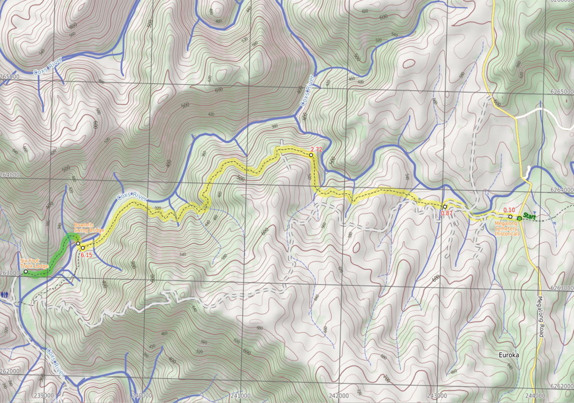


Starting from Megalong Road, this walk will take you past the historic Megalong Cemetery and then through some farmland as you wander along private dirt roads on part of the Six Foot Track. Just shy of 1 kilometre into the walk, you will then follow a track as it crosses the Guyvey Bridge and meanders through the pleasant open farmland with views of the distant escarpment. In time, the walk leaves the farms and explores the more dense forest and granite boulders before coming to the granite-carved Coxs River. There is a chance to explore the river up close or take a bird's-eye view from the swing bridge. The track notes also describe a side trip to the Six Foot Track Eco Lodge, great if you want to stay and explore the area for longer.
GPS at the start and end -33.7356, 150.2346Getting thereCar: From the Great Western Highway turn on Bundarra Street. After about 70m turn left on Kubya Street. After 350m turn right onto Shipley Road and then after 750m turn left onto Megalong Road. Follow the sealed road for about 14.1km. There's a car park on your right at the intersection with Aspinall Road. Park and start walking on Aspinall Road.
12.6 kilometres return

5 hours 30 minutes
772 metresascent/descent
Hard(Very steep hills, section of faint track and no signage)


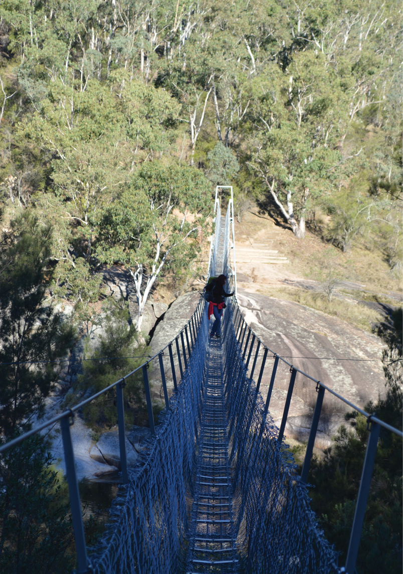
Bowtells Swing Bridge

Six Foot Track
From Megalong Road to Bowtells Swing BridgeMatt McClelland
6 | BWA October 2016

Intersection of Six Foot Track and Megalong Road(0 km) From the car park on Megalong Road (about 400 metres south of Megalong Creek), follow the Six Foot Track sign over the cattle grate or stile and walk beside the large sheltered Six Foot Track information sign. Here head gently downhill along the dirt road for about 80 metres to come beside a stone memorial, marking Megalong Cemetery (on your left).
Megalong Cemetery (historical) (0.1 km) The Megalong Cemetery became the final resting place for at least 14 people who died between 1894 and 1931. Many of the grave sites are in poor repair or can no longer be easily found - please take care in the area to avoid any further damage. A tall stone monument marks the edge of the cemetery on the Six Foot Track, about 100 metres west of Megalong Road. This cemetery is currently under the management of the Blue Mountains City Council, and is recognised by the National Trust.
Megalong Cemetery(0.1 km) Continue straight beside Megalong Cemetery, walk gently downhill along the dirt road for about 80 metres to pass through gate with a No Through Road sign. Just shy of 300 metres later, pass a few driveways beside the farmland to cross another cattle grate. Then about 150 metres later, the road leads close to Megalong Creek, where a sign reminds visitors this is private land. About 30 metres further on, the main dirt road veers right at a Y-intersection then cross a cattle
grate. Here head uphill along the dirt road for just over 200 metres (with views of the escarpment behind) to cross another grate and come to an intersection marked with a Six Foot Track sign pointing right into the valley.
Intersection near Guyver Bridge(0.9 km) Turn right and follow the Six Foot Track sign downhill along the narrow track into the valley. Now cross a small creek on the timber Guyver Bridge, named in honour of Jon Guyver who worked hard to redevelop the 6FT as the track coordinator/administrator until 2010. Here head up the timber steps and over a rise. Follow a wire fence down through the farmland and across a valley (above a dam) for almost 100 metres to a metal stile just before a dirt trail. Here turn right and cross the fence using the stile, then follow a Six Foot Track sign along the track as it undulates over a series of hills for about 300 metres before crossing another fence using another metal stile beside a large tree. Follow the track that now leads uphill for 200 metres to pass a Private Land - No Camping before Coxs River Reserve sign, then winds along the side of the hill for a further 150 metres before heading into a wooded forest and down some timber steps. Then cross a steep gully and walk along the side of the hill for just over 100 metres to pass a 35 kilometres 6FT arrow post, then 150 metres later, cross another fence using a metal stile. Here continue for another 600 metres through a mix of farmland and open forest, crossing a few more steep gullies with timber steps to head through a closed gate, marked with a few Private Property signs.
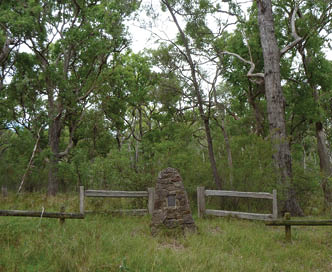
Megalong Cemetery
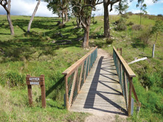
Guyver Bridge on the Six Foot Track
BWA October 2016 | 7


Private gate(2.7 km) Continue straight downhill along the narrowing track, keeping the valley to your right. After about 120 metres, cross a timber fence on a metal stile, then continue down the track over a few large rocks for just over 200 metres, to an intersection with a wide trail. Here turn right then immediately left, to continue along the track as it narrows again. Follow the track which then leads down along the side of the valley for about 600 metres and passes through another usually closed gate, then about 250 metres later, the track passes a few granite boulders and head down a few timber steps. About 400 metres after this, walk down 100 metres of timber steps to cross a gully and find a series of large granite boulders. One of the small overhangs is home to a wild bee hive. Follow the track out of the valley and gently down along the side of the hill for about a kilometre, where the valley opens up with wider views down to the Coxs River, then head down some more timber steps. About 250 metres later, head down another set of timber steps to then walk through a pleasant lush gully with views close to the river. Then head along the hillside for another 150 metres to an intersection (just above the swing bridge, to your right), marked with a Six Foot Track and Alternative Bridge signs.
Bowtells Swing Bridge(6.1 km) This suspension footbridge spans the Coxs River and provides an alternate route for the Six Foot Track when the river is in flood. Regardless of weather, this route is now becoming more popular with many walkers, wanting to avoid the river crossing. The bridge was built and opened in 1992 by the Royal Australian Engineers. The bridge is named after a fellow soldier of the builders, Corporal Bob Bowtell, who suffocated and died in foul air whilst attempting to clear a Viet Cong tunnel during the Vietnam war. Bowtell grew up in Katoomba and is buried in West Malaysia.
Bowtells Swing Bridge(6.1 km) Turn right following the Alternative Bridge When River High sign down the timber steps to the southern end of the Bowtells Bridge. Here climb the ramp and cross the Coxs River on the suspension bridge, observing the Only one Person at a time sign. This crossing can take some time
with a large group; the bridge swings a fair bit and people concerned by heights may find this challenging. The bridge spans 100 metres, giving great views of the river below. On the far side there's a large rock platform.
Walk variation - Side trip to clearing east of lodge (marked in green on the map)(6.3 km) From the north side of the bridge, walk up the timber steps through the dense forest to soon pass the Bowtells Bridge sign. At the top of these steps, follow the track that bends left then leads along the side of the hill for 500 metres, crossing a few gullies and undulating up and down a series of timber steps to then pass between a couple of fences posts. Here continue down a series of timber steps to a clearing and intersection marked with a Private Land - No Camping sign.
Turn sharp right at the intersection and clearing, following the Camping Ground-500 metres sign north up the timber steps. Follow the track that soon bends left and follows the side of the hill for about 130 metres to then head through a gate with a Welcome sign. Continue along the clear track for another 70 metres to the intersection with the timber path just below the Six Foot Track Eco Lodge. At the end of this side trip, retrace your steps back to the main walk then turn left.
Six Foot Track Eco Lodge (6.3 km) The Six Foot Track Eco Lodge is on the Six Foot Track Alternative Route, above the Coxs River flats, just north of the Coxs River Campsite. Read more about the lodge and its lovely owners on the following pages.
Return the way you came.
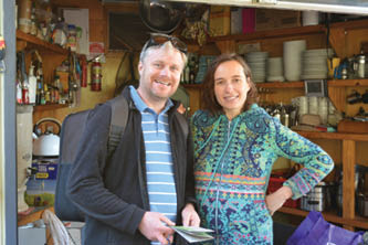
Matt with the new owner of the Six Foot Track Eco Lodge - Lucie Novak


BWA October 2016 | 9