

In March 2016 I completed a traverse of south-west Tasmania, one of the wildest, most pristine wilderness areas on the planet. The trip took 24 days to complete and combined the rugged, untracked coastline south of Strahan, with the Arthur Range, arguably Australia's most spectacular mountain chain.
Cape Sorrell Lighthouse

South West Tasmania Traverse
Cam Honan

6 | BWA February 2017
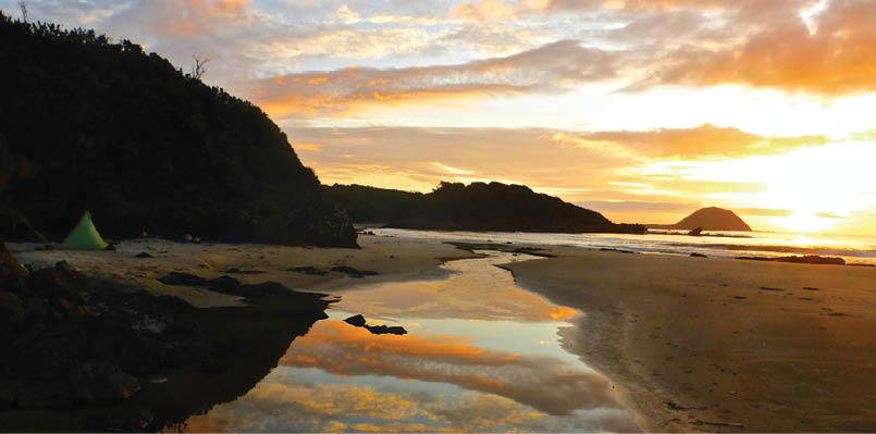
Sunset over the Indian Ocean, Evans Creek, day four
Distance About 300 kilometresStart Cape Sorrell Finish Farmhouse Creek Trailhead Time 24 daysDaily average 12.5 kilometres
DifficultyExtreme. A combination of hiking, scrambling, climbing, bushbashing, paddling, swimming and crawling on all fours.
Maps and general informationI used a combination of the brief notes in John Chapman's South West Tasmania guide and the TASMAP 125,000 Topographic map series (20 maps total).
Resupply Just one. I sent provisions by post to the small town of Maydena. I hitched there and back from Scotts Peak Dam on the eighteenth day of my journey.
WildlifeAmazing variety. Tasmanian Devils, wombats, seals, tiger snakes, starfish, sea anemones and yellow-tailed black-cockatoos. Not so great was the fact that there were also leeches, ticks and plenty of mosquitos on the coastal stretch.
Stage 1 - The West Coast
The first two weeks of the traverse were spent making my way down the remote coastline south of Strahan. The terrain was a combination of rocky shoreline, pristine beaches, buttongrass plains and dense bands of inland scrub.
In more than a quarter of a century of hiking all around the world, this section represented some of the most challenging conditions I have encountered. It was difficult for two primary reasons: bushbashing and coastal gulches.
In regards to the former, there were a handful of days when I hiked for twelve hours straight only to cover a total of five or six kilometres. The vegetation was incredibly dense and fighting through it was an exercise in both patience and perseverance.
Food bags for the seventeen day first stage.There was another smaller bag just out of shot

“... this section represented some of the most challenging conditions I have encountered.
BWA February 2017 | 7


As for the gulches, they constituted the most dangerous and technically difficult aspect of the entire walk. Timing was key in negotiating these jagged and slippery ravines, which are regularly pounded by three to five metre high waves. Before attempting the more difficult gulches, I would often sit and watch the surf coming in for ten to fifteen minutes before
I was satisfied that it was safe to go (note: waves come in sets). The potential price of making an error in judgement, was getting smashed into the rocks, washed out into the Indian Ocean, or both.
Thankfully, the arduous bushbashing and gulches were broken up by some far easier stretches of beach walking. Indeed, every time I emerged from the rocks or scrub onto a long expanse of golden sand, I’d break out into a big smile. This was partly because it was a welcome respite, but mostly due to the fact that the beaches were beautiful and there was not a footprint to be seen. This was a tangible reminder that it was just me, the coast and the ocean.
Indeed, during the first fourteen days of the traverse I only saw one person; a fisherman just north of Endeavour Bay on day five. For someone that has always enjoyed spending long periods of time by himself in nature, the solitude afforded by the south-west wilderness was one of my favourite aspects of the trip.
On the morning of day fifteen, after negotiating the rugged coastline I headed inland for the final time. It was a cold, rainy and foggy farewell. The inclement conditions
I took this photo not more than a minute after making it out of this gulch

Tasmanian west coast
8 | BWA February 2017
continued until late afternoon, when the weather finally broke and the sun emerged. The timing could not have been better, for I was just about to attempt what would be final significant challenge of stage one - a crossing of the 150 metre wide Davey River.
The waters of the Davey are both very cold and deep and hypothermia was a distinct possibility. However, in planning the trip I decided against carrying a packraft or wetsuit, and instead opted to negotiate this and other lengthy crossings on my inflatable sleeping mat. With my backpack floating behind tied off with a two metre piece of guyline, the system worked like a dream. Nonetheless, I was more than a little happy when I eventually reached the other side of the channel!
Almost two days after the crossing I made it to Scotts Peak Dam, the finishing point of the West Coast stage.
Before beginning the second part of my trip, I needed to pickup some supplies in the tiny town of Maydena, population 245. In order to do so I would have to hitchhike there and back. Which begged the question - would anyone give me a ride looking like this?
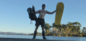
Celebrating after crossing the Davey River on my Thermarest NeoAir

No, Sir, I wasn’t mauled by a Bengal Tiger. I just finished hiking down Tasmania’s west coast

BWA February 2017 | 9
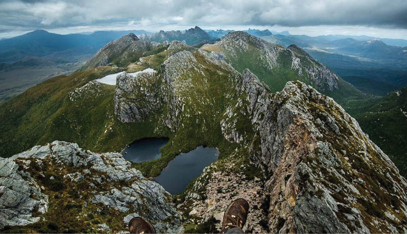

Arthur Range Photo by Viktor Posnov, whom I met during the second stage of the traverse
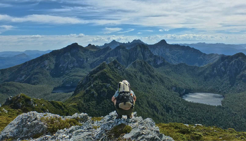
Stage 2 - The Arthur Range
Despite my less than presentable appearance, I did manage to procure rides out and back to Maydena. The following morning (day 19) I began the second stage of my journey; a six day crossing of the Arthur Range from Scotts Peak Dam to Farmhouse Creek.
Arguably Australia’s most spectacular mountain chain, in fine weather the Arthurs are a bushwalker’s dream. Jagged quartzite peaks, hanging valleys and glacier carved lakes. Stunning views from one end to the other. Unfortunately there’s a rather large caveat when it comes to bushwalking in this area: the weather.
Thanks in no small part to the Roaring Forties (i.e. gale-force westerly winds found in the southern hemisphere, generally between between 40° and 50° latitude) the Arthurs receive some of the most extreme conditions on the planet. The winds are often accompanied by horizontal rain and snow, and when coupled with the fact that much of the walking is done on exposed rocky ridges, it is not a place you want to be without good backcountry skills, the right equipment and an ironic sense of humour.
During two previous trips to the area, I had experienced more than my share of inclement conditions. In 2016 I was much more fortunate on the meteorological front. Out of the six days it took to reach Farmhouse Creek, I encountered heavy rain and wind for only a day and a half. Not too bad for a place that averages 250 days of precipitation per year.
Despite the relatively mild conditions, walking in the Arthurs is never easy. The vast majority of the track is either steeply up or precipitously down. Lots of scrambling, climbing, mud, roots and rocks. Indeed, if you are looking for a walk in which you can stretch out and cover big distances
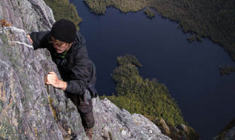
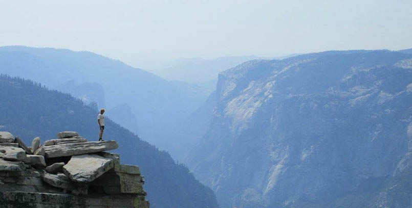
The Direct Ascent Route, Lake Geeves below Photo by Jason Macqueen
“... a place that averages 250 days of precipitation per year.
“We’re talking six hundred metres pretty much straight down to Lake Geeves ...
10 | BWA February 2017

on a daily basis, it may be best to look elsewhere. In the Arthurs, one kilometre per hour is usually considered to be very speedy progress!
One of the highlights of the second stage was ascending Federation Peak. While this is a holy grail of sorts for many Australian bushwalkers, more than half that attempt to summit are turned back due to foul weather.
Fortunately, on Day 22 the conditions were relatively fine and I managed to make a successful climb to the top. I took the direct ascent route; not technically difficult, but extremely exposed. How exposed? We’re talking six hundred metres pretty much straight down to Lake Geeves; definitely not for those with a fear of heights!
Upon reaching the summit I broke out into a huge smile and let out an ebullient exclamation. If memory serves, it may have been something along the lines of, “You #*!* little beauty!”
I had the mountain all to myself, and spent the next hour soaking in the amazing 360° panorama. Eventually the clouds started rolling in and I knew that it was time to head back down. Federation Peak is no cake walk in dry conditions; in wet weather it can be treacherous.
The final day and a half of the traverse was relatively uneventful. After Federation I descended from the Arthur Range via the Bechervaise Plateau and Moss Ridge. The “track” was steep and more of a hand over foot scramble than a walk. Ducking and weaving my way through fallen trees and overgrown vegetation, I eventually bottomed out at Cherry Creek.
From that point on, the terrain was relatively flat and not-so-relatively muddy. The highlight was some early morning rays piercing through the forest canopy just a few kilometres from the end.
At 11am on the twenty-fourth day of my journey, I reached the Farmhouse Creek trailhead, the finishing point of the south-west Tasmania Traverse. The sun was shining. I broke out into a wee jig. I then put down my pack and went for a ten minute swim in the creek.
Looking back at the Western Arthurs from Mt Taurus
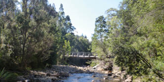
Farmhouse Creek
BWA February 2017 | 11

Approaching Federation Peak ... the tall one
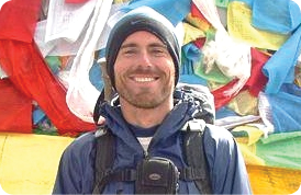
One of the world’s most prolific hikers, Cam Honan has trekked more than 90,000 kilometres in some 56 countries since the early 1990s. In 2015, Backpacker Magazine called him “the most travelled hiker on earth.” In recent years he has pioneered traverses of Mexico's Copper Canyon region, Peru's Cordillera Blanca range and South Dakota's Badlands National Park. When not out in the wilderness, Cam runs The Hiking Life website, and can be found splitting his time between Australia and his adopted homeland of Mexico.
You can reach him atthehikinglife.comfacebook.com/thehikinglifetwitter.com/TheHikingLifeinstagram.com/thehikinglife/

Soaking in the pleasantly warm water, I floated on my back and looked up at the pale blue sky. I thought about the last three and a half weeks. There was no way around it; there had been some very challenging moments.
Scrambling in and out of the wave smashed gulches, coming within centimetres of stepping on a Tiger snake and even a malfunctioning Personal Locator Beacon, which starting going off when it was inadvertently submerged in seawater on the morning of day five!
I began to chuckle.
If truth be told, I’ve never been one for dwelling or second guessing. Stuff happens out in the wilderness, and my preferred method of dealing with it has always been to shrug my shoulders, learn from the experience and get on with things.
I think that’s one of the most important lessons I’ve derived from spending so much time in the woods over the past three decades. Not to over-analyse. There are no “what ifs” in the natural world. Everything just is what it is.
And that very simply is a big part of what keeps drawing me back.


“There are no “what ifs” in the natural world. Everything just is what it is.
12 | BWA February 2017
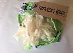
Your proven natural solution for blister and hot spot prevention.
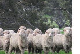
100% pure Australian Merino lambs’ wool, unprocessed to retain all its natural lanolin. The wool provides soft cushioning and the lanolin wicks away moisture, reduces friction and promotes healing.
A burning feeling on your ankles, heels or toes is a a sign that a blister is imminent and your feet are the last place you want pain with kilometres to trek or run. A change in terrain can quickly result in hot spots, no matter how well worn in your shoes or how many layers of socks you wear.
At the slightest feeling of friction, place or tape Trekker’s Wool over the area, the cushioning and lanolin immediately ease discomfort.
Do your feet a favour. Only $22.00 (including postage) for a 30 gram bag, sufficient for a five day trek.
Online orders at trekkerswool.com.au

BWA February 2017 | 13