
This article describes two walks in the Megalong Valley in the Blue Mountains. The first walk was in winter 2017, and the second one was in winter 1957.

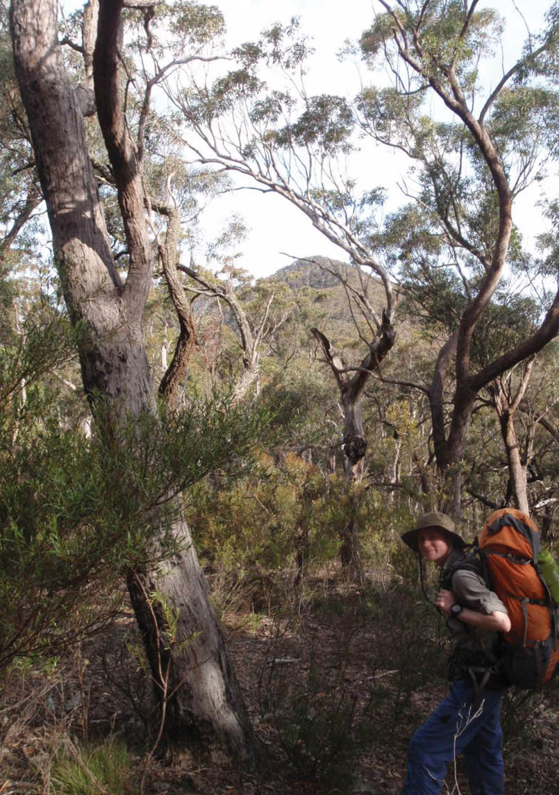
Ben on Krungle Bungle Ranges just past Mount McAviney with Mount Jenolan behindAndy Mathers

Conquering the Giant
Andy Mathers

12 | BWA December 2017

I was talking to my father in early 2017 and he showed me a 1957 trip report he had written for the monthly magazine of the Coast and Mountain Walkers (CMW) of which he was a member. He's still active with CMW. He had at times also been the editor and club president. His walk was in winter 1957, which gave me the idea of redoing it in winter of 2017.
The walk started at Carlons Farm in the Megalong Valley, goes down Breakfast Creek, crosses the Coxs River and then up to Scrubbers Saddle. It then followed the ridge over a number of mountains including Mount O’Reilley and Mount Jenolan to Mount Guouogang.
We planned/hoped to do the walk in two days like my father did, but we allowed for three. (We actually finished about 10am on day three instead of 6pm on day two.) We took extra food and allowed an extra day. This is a good lesson because, as it turned out we needed the extra day and so allowing for it meant we weren’t tempted to take risks to finish on day two. I had a few friends lined up, but by the time the walk came around all but one had
pulled out, Ben Whiting, a TAFE friend. This is ironic because as it happened there were only two on the 1957 walk, my father and fellow CMW member Peter Reis.
By doing this walk I proved to myself that, although I wasn’t an experienced bushwalker like my father and somewhat older than he was at the time, with basic skills and proper planning it is possible to do walks such as this one.
We left the cars at Carlons Farm at around 9am and headed off down Breakfast Creek. We were familiar with this section as a number of our TAFE walks started and ended at Carlons Farm. The report we used didn’t mention the stinging nettles in what has become known as Nettle Gully, the lower section of Carlons Track beside Breakfast Creek. Prior to the walk, I checked with my father about the presence of nettles in the gully and sure enough they were there in 1957, but didn’t rate a mention as it went without saying that there were nettles in that part of Carlons Gully. I imagine they wouldn’t have been as bad back then. Despite hacking at any protruding on the track and doing our best to keep arms and hands well above them, we both fell victim to stinging nettle attacks.
The Coxs River crossing just after Breakfast CreekAndy Mathers
“... we both fell victim to stinging nettle attacks.
BWA December 2017 | 13
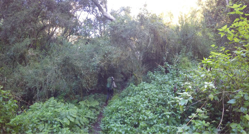

Andy dodging the thin, outstretched branches of stinging nettles on the descent to Breakfast Creek Ben Whiting
Breakfast Creek was slow going with the track continually disappearing from one side and appearing on the other. We were aware that our progress was slower than our target. How did the 1957 party get to the Coxs in an hour and a half we pondered? They must have been running we concluded.
We missed the short-cut track across a spur which Breakfast Creek snakes around, giving us some unintended scrambling to do to get back down to the creek. On our return trip we found the short-cut track a little further down the creek.
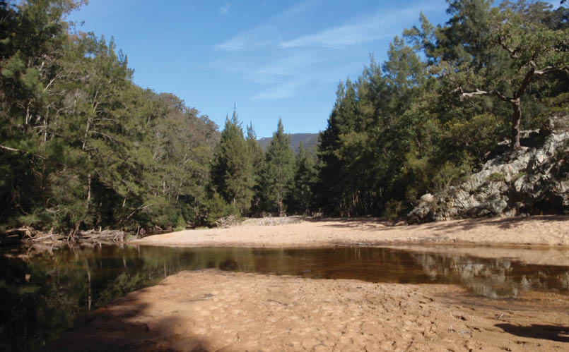
At about noon we reached the Coxs, almost an hour and a half after our target time. At this point I began to wonder if we would reach our goal before having to turn back. Luckily we had allowed an extra day, I thought to myself.
We wandered a short way downstream and found a place where the river was shallow and wide enough to be crossed without getting much more than our calves wet. The policy we learned at TAFE is that if you can see the bottom and it is sand or small river pebbles with no risk of cuts or sprained ankles than it is okay to remove shoes. The section we found met the criteria and so we removed shoes as neither of us had river crossing shoes. The upside of this method is that the shoes are dry for the remainder of the walk, and the downside is that it takes
some time to dry feet and remove sand from the feet and between the toes. The water was extremely cold and painful, however not as cold as in 1957 when the Coxs was frozen. The warmth of the sun soon relieved the painful feet as we dried them.
After a quick bite to eat we were ready to take on the ascent to Scrubbers Saddle, a 250 metre rise over 450 metre distance. It was pretty tough going up to the saddle, with trees and scrub often blocking our view of our objective so at times we weren’t sure if we were still aiming at the middle of the saddle. There was no clear track to follow and the tracks that were there were possibly animal tracks and not necessarily going where we wanted to go. At times I was questioning my fitness level and wondering if this was too much; after all, the 1957 group were about 30 years younger than I was. How much more difficult it must have been for them to have to contend with the cold wind and snow as well! We were pleased to see a stone cairn right in front of us as we arrived at the top of the slope confirming that we were exactly where we were aiming for, the middle of the saddle. We stopped and had a well-earned, belated lunch. I had
“... if you can see the bottom and it is sand or small river pebbles with no risk of cuts or sprained ankles than it is okay to remove shoes.
14 | BWA December 2017
.png)


2km
0
1
planned to have wraps with salami, salad and cheese but all I could get my head around was the old staple of crackers, cheese and vegemite. As it happened, Ben had the same thing.
After lunch we set off along the ridge with Mount O’Reily as our next objective. We couldn’t have asked for better weather to walk in and before long we were on the summit of Mount O’Reily looking along the Krungle Bungle Ranges toward Mount Jenolan. Ben and I had a special reason for getting to the summit of Mount Jenolan as it had been the objective of one of our TAFE walks that was cut short due to a classmate spraining an ankle.
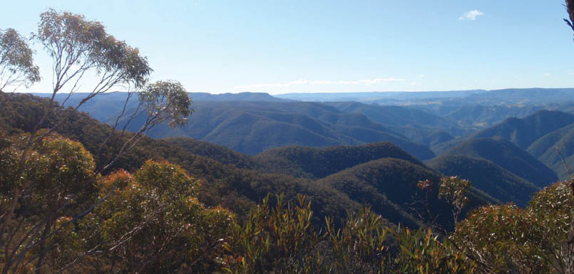
The Krungle Bungle Ranges are like nothing I’ve seen anywhere. The ridge is quite narrow and is made up of varying sized chunks of granite. Vegetation is quite sparse and so we made good time along the ridge despite the trip hazards due to loose rocks and fallen trees. We felt quite satisfied when we reached the summit of Mount Jenolan, an achievement we had been denied last year on our TAFE walk.
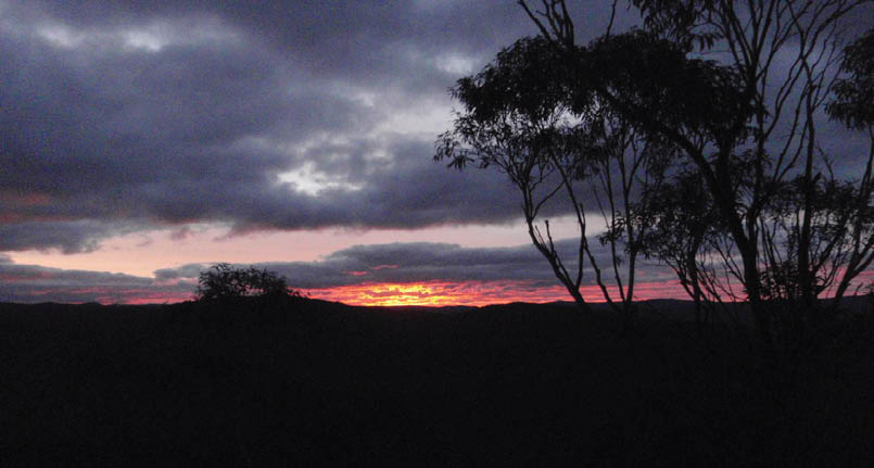
The sun was setting as we reached Mt Queahgong, our last big climb for the day, approximately 1000 metres higher than we were at the Breakfast Creek junction.
We spent what was probably a bit too long taking photos and admiring the view as we ended up making our way to Hawk Fell Saddle by head torch. At about 6pm we found a suitable place to camp on the saddle at the base of the spur leading up Mount Gouougang and settled for the night. We were still about an hour and a half behind our target time. Not bad, I thought to myself.
We weren’t in too much of hurry to set off the next morning, still feeling the strain of all the climbing the previous day. We had decided to leave the tents set up to dry and headed off with just food, water and the essential emergency equipment at about 9am.
The summit of Mount Guouogang was as we expected from the trip report, with small saplings making it difficult to move and visibility of the summit obscured and not very
Map of the walk
“The Krungle Bungle Ranges are like nothing I’ve seen anywhere.
BWA December 2017 | 15
Moorara Mountain at sunset from the Mount Queahgong to Mount Guouogang ridgeAndy Mathers
obvious due to its domed top. We were quite pleased to come into a clearing and see a huge stone cairn marking the summit of Mount Guouogang.
After taking the compulsory photographs and signing the log book we returned to our camp around 11am to pack up and commence the downward journey home.
We took longer than anticipated getting back to Mount Jenolan due to some navigational errors, largely because we were making better time than expected and went over Mount Queahgong without realising it. From Mount Jenolan we ran and skated down the scree slope of Gasper Buttress. The northerly sun was beating down on us as it moved to the western horizon in a race against us making our way back to the Coxs River and ultimately our cars.
The Coxs River was a welcome sight as the sun began to drop below the mountain range we had walked along the previous day. This section of the river was deeper than the section we crossed the day before but was still easily crossed with shoes off, however we ended up wet almost to our hips which was even more painful. The walk back along the Coxs was hindered in parts where we chose to do some scrambling, almost rock climbing, to avoid sections where the track end and the only other option was getting back in the river.
The last of the light was fading as we arrived back at Breakfast Creek. Before long we were finding our way along Breakfast Creek by head torch light which made it nearly impossible to find the track when it appeared to disappear and reappear on the other side. Progress was slow and we still had the tricky short cut to negotiate, which we had trouble with in broad daylight, so when we came across a suitable reasonably flat area we decided to call it a night and make camp. We treated ourselves to a camp fire as compensation for spending the extra night.
The next day we continued to make our way up Breakfast Creek. We found the short cut track quite easily and saw where we went wrong the previous day. We had headed up what looked like the track too soon, the track we wanted was further down the creek.
From Breakfast Creek we headed back up Carlons Gully to the cars. It seemed to take ages, so close and yet so far, more uphill, again and then, at last, the car park was in sight. Back at the cars we were feeling quite pleased with our efforts. We congratulated each other on our achievements, reaching not one but two objectives, Mount Jenolan and Mt Guouogang.
North from Mt Jenolan towards the Jenolan River, Kanangra Boyd National Park on day 2Andy Mathers
“... we ended up wet almost to our hips which was even more painful.
16 | BWA December 2017


The following is the report that inspired me to do the walk. It was written by my father, Kevin Mathers, in 1957. He did the walk with fellow Coast and Mountain Walkers member Peter Reis. As it turned out, due to the weather conditions it was quite a different walk to the one I did in 2017.
Conquering the Giant in 1957It was indeed an ominous sign, thick ice on a puddle in Carlons yard at 9am With hands in pockets, woollen berets pulled over our ears and a frozen nose a piece we were on the move to conquer the giant of the Mountains - Mount Guouogang. Overseer of the Wild Dog Mountains it soars to 4300 feet and commands an unsurpassed view over much of the area.
The route was by way of Breakfast Creek Coxs River, Scrubber's Hump and the Krungle Bungle Range including Mount Jenolan and Mount Queahgong. The journey down Breakfast Creek was highlighted by fantastic patches of frost, with spindly ice crystals up to half an inch long crowded on logs and stones.
The day frowned miserably with overcast skies and valiant attempts by Hughie to send down rain. All of these ended in showers of “sago snow”, the temperature being far too low for puny rain to survive its long journey without freezing. There was, however, no suggestion that the climb be abandoned due to the inclement weather, because climbing was the only alternative to freezing.
The Coxs was crossed at 10.45am accompanied by the usual “Tail down, feet up in the air draining ritual” before which Piere shot off into the scrub like a rocket with legs flailing the ground in an effort to recover his "lost" feet.
A little further downstream, the surface of a backwater attracted our attention. “That’s ice” saith I. “Rats and other things” saith he, “anyone knows the Coxs doesn’t freeze”. However, after bouncing numerous small stones off the surface, the point was conceded. The ice was about as thick as a dinner plate and covered an area about the size of the clubroom floor and this was almost mid-day!
Leaving the Coxs we headed up the side of the “Long Ridge”, the warmth generated by the steep climb to Scrubbers Saddle being quickly dissipated by the icy blast blowing across the ridge from the west.
Lunch, in the lee of a groundsheet, was quickly removed from the agenda and the climb resumed up the easy and comparatively open ridge.
The grade steepened as the rocky slopes of Mount Jenolan fell underfoot, and the patched of mountain holly and springy saplings made progress even more painful than before. The broken, rock strewn peak was reached at 3 o’clock and after a hurriedly eaten orange we turned to face Queahgong, linked with Jenolan by a saddle 500 feet below.
North from Mt Jenolan towards the Jenolan River, Kanangra Boyd National Park on day 2Andy Mathers
BWA December 2017 | 17
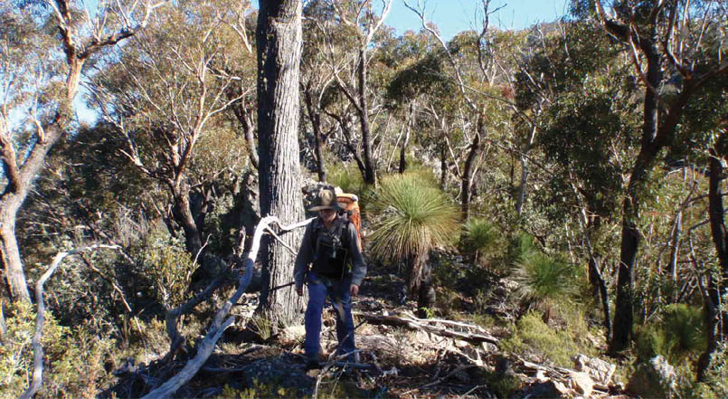

Ben walking through head-high grass trees on the ridge near Mount JenolanAndy Mathers
As we pushed our way through the stinging scrub on the side of QUEAHGONG, light snow began to fall “you beaut and wacho” I said, little knowing that I’d wish the stuff to blazes before the weekend was over.
At about 4.30pm with a gale blowing across the ridge, we decided to call it a day. Camp was made in the lee of a clump of trees on Hawkfell Saddle over a thousand feet below our goal.
As time was running out, it was decided that an early rising on the morrow was necessary or we must surely turn back – only an hour away from the summit.
Like true C.M.W.s, the improbability of this early rising was the cause of a fitful sleep highlighted by yours truly announcing with great gusto “arise, it’s 6.15am and we must away”. A sleep-soddened face with a bristling leer scornfully replied “Silly clot; It’s half past three, the hour hand is the shorter of the two.”
A fire was painfully coaxed alight at 6.30am in the gloom of a frosty dawn and daylight made it apparent that the snow was starting to fall heavily. Breakfast was finished with a steaming cup of tea, the last of our precious quart of water from 3000 feet below.
We moved off without packs just after eight o’clock in the face of a howling westerly blowing snow across our bows like vast squadrons of miniature jets.
The snow was quite thick on the saddle below the peak, covering the ground with a thick white carpet and at the risk of being called uncomplimentary names I would like to clearly state that snowmen, although not quite the size usually encountered were built on the slopes of Mount Guouogang in the winter of 1957.
The summit of this particular mountain is characterised by the interminable forest of saplings planted six inches apart. After being showered with snow from these saplings, the trig was mounted in clear sunshine, a few snow splashed comments made in the visitors book and our leave taken from this frozen and forsaken spot.
The ridge between Guouogang and Queahgong was quickly being covered with heavy snow and likewise the two unfortunate bods stumbling along it as we made our way back to the Cox via Mount Jenolan and the Gasper Buttress.
While slithering down the endless scree slope of the Gasper, visions of great pots of tea loomed in front of us and the thirst so effectually suppressed for the last two days took complete charge.
“After being showered with snow from these saplings, the trig was mounted in clear sunshine ...
18 | BWA December 2017
In 2013 Andy took a voluntary redundancy from his corporate job and began his journey to work in outdoor recreation, which got him into bushwalking. He now has qualifications as an outdoor guide, in abseiling and in canyoning. He works as an outdoor guide and outdoor education instructor. Andy has always enjoyed the outdoors and was encouraged by his father’s passion. Through his father he was introduced to skiing, camping and the beach. He is a member of a ski club that his father established. In the late 2000s he got into kayaking, the highlight of which was a crossing of West Bass Strait in 2010.

Kevin Mathers was the editor of the CMW magazine Into The Blue. In the late 1950s, probably 1959, he wrote an editorial Why is a Bushwalker below.

We loafed for an hour or so by the Coxs, drinking numerous cups of tea and basking in the warmth of the glorious winter sunshine. This was obviously turned on either as reparation for the constant buffeting dealt out to us or to engender kind thoughts of this country in our friend who would be leaving it for some time.
As we staggered up Carlons Gully by torch light, it was apparent that we had tarried too long over our delayed lunch by the banks of old Father Cox.
Spurred on by the incentive under the front seat of the car, we raced past Carlons Farm and collapsed in a smouldering heap, the journey finished.
This was truly a "Swan song" in more ways than one I thought, as two pairs of boots were thrown into the car never to be used again.
Into The Blue magazine editorialKevin Mathers


BWA December 2017 | 19