

The 2003 fires in Kosciuszko National Park (KNP) destroyed 23 huts and did enormous damage to ecosystems, but it’s an ill wind that blows no good.
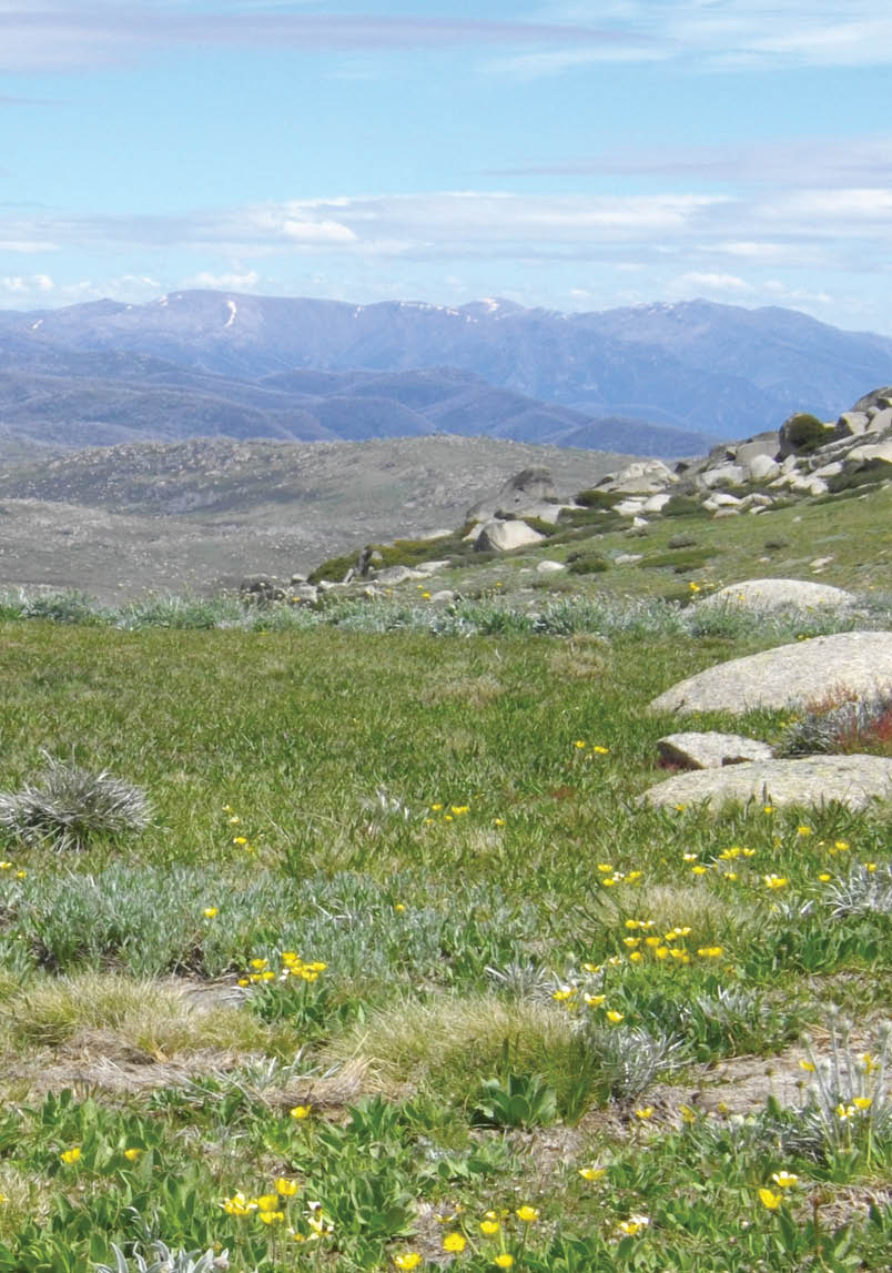
Main Range from Jagungal Robl

Heritage Tracks
Robert Green

20 | BWA December 2017
There were some beneficial side effects. One of these was to bring about a general recognition, by the National Parks and Wildlife Service and others, that the high country huts had a real heritage value which was in danger of being lost, and that greater efforts had to be made to protect that heritage.
A second benefit arose out of the nature of the fires themselves. Because they were so destructive, a substantial amount of regrowth was removed which revealed geographical features, such as tracks, which had become overgrown. This meant that, for a whole generation of bushwalkers, tracks were revealed which, although not forgotten, had largely disappeared. This gave an opportunity for the old tracks to be rediscovered and recorded by GPS, so as to know precisely where they went.
Separately at first, but, later, together, a number of bushwalkers worked with Graham Scully of the Huts and Heritage Section of Kosciuszko Huts Association to search for and record the old huts, other ruins, graves and mine sites which had been exposed by the fires.
This led to an effort to “ground truth”, i.e., verify the precise location of many of the old sites in KNP. Several hundred sites have been located and recorded but there is more work to be done. The work so far has led to the rediscovery of old tracks, lost huts and other features. It was assisted by the work of David Scott, a conservation architect who had amassed thousands of records about the park and its people, including many old maps.
That work led to the publication of Exploring the Jagungal Wilderness which aimed to fill a gap in the literature by identifying routes, tracks and places of interest in this part of KNP. It was hoped that by putting these old maps in front of the bushwalking public and including precise GPS positions for the tracks shown on them that this would open the park up to long and short walks, many of which are off the beaten track.
One thing which became clear was that the old routes chosen by the stockmen made perfect sense. They had the benefit of seeing a countryside which had been cleared by stock. Their bridle tracks followed logical and reasonably direct routes to their destination. Even if the tracks fade away, as many have, we at least now know where they went. That makes it a lot easier for us to traverse the same country. The book recorded those routes.
It was hoped that the book would encourage walkers to make use of them, but it was also acknowledged that the omission from modern maps of the old tracks might result in their disuse with the result that regrowth would reclaim them and they would disappear again.
As mentioned above one of the beneficial results of the fires was the recognition by NPWS of the heritage value of the huts. This has led to NPWS now taking an active role in preserving that heritage. What is now clear is that the huts never existed in isolation and that the tracks which joined them are part of our heritage too.
As John Blay’s book on The Bundian Way shows, the tracks used by later European settlers often followed the routes used for thousands of years by Aboriginal people. His book dealt with the routes between Twofold Bay and Dead Horse Gap, but other, more northern, Aboriginal people undoubtedly used other routes to access the more northern parts of the park.
Of these the routes along the Burrungubugge River and the Gungarlin River were logical accesses to the Jagungal area, which like the Main Range further south were used by seasonal moth hunters. The names Dicky Cooper Bogong, the Big Bogong and Jackys Lookout are evidence of this.
Later, these routes were used by the graziers. The Snowy Plains Fire Trail and the route through Kidmans to Mawsons both follow such logical routes that it seems likely that they were used by Aborigines long before Europeans arrived.
“Several hundred sites have been located and recorded but there is more work to be done.
BWA December 2017 | 21
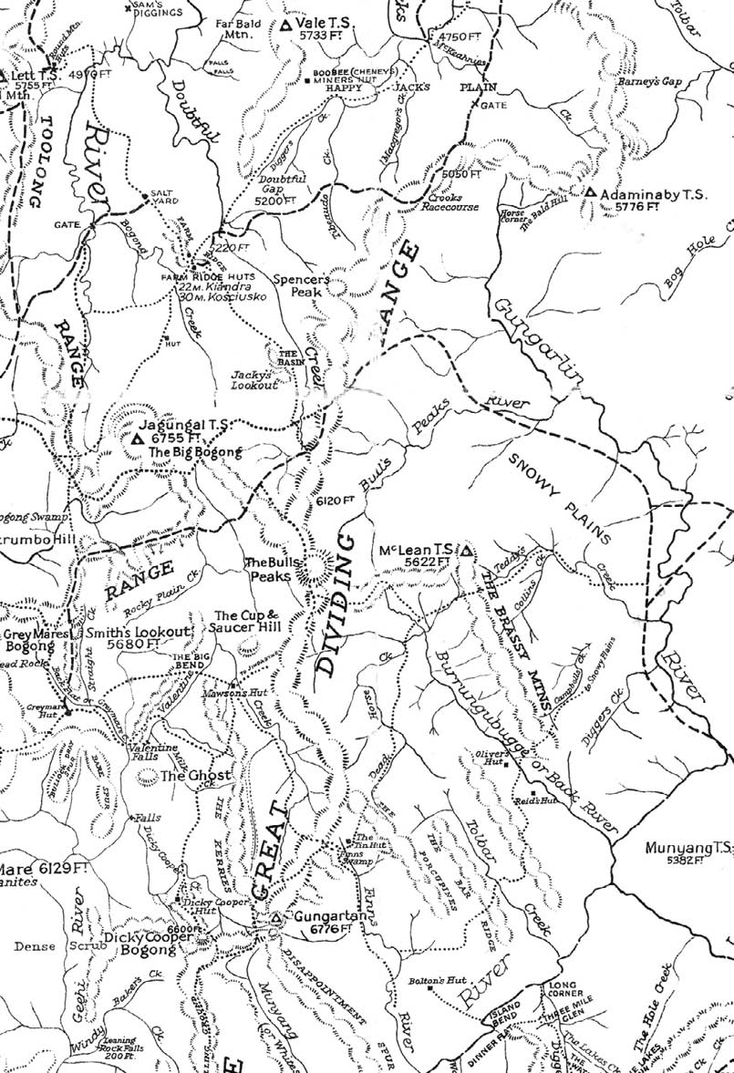

Tracks east of the Grey Mare Fire Trail with the ancient route through Snowy Plains to the Mt Jagungal area used by Aborigines, graziers, miners and the Snowy Mountains Authority, 1934.
22 | BWA December 2017

Other tracks were connected with the mining heritage of the area. Equipment was taken to the Grey Mare Mine by way of Snowy Plains and then by a route south of Mt Jagungal, which was later used by the Snowy Mountains Authority becoming, in the process, the Strawberry Hill Fire Trail.
Early prospectors, going to Kiandra, used tracks from the south which led through Doubtful Gap, along Diggers Creek and up Arsenic Ridge.
The NPWS website explains the role of national parks in the following way. "NSW national parks not only provide areas for social and recreational use, they also preserve biodiversity, heritage sites and Aboriginal culture." In line with this policy, at some sites in the park, like Boltons and Napthalis homesteads near Diggers Creek, NPWS has erected boards with photographs and an explanation of the site. In much the same way, the tracks also need to be marked and, where appropriate, explained.
The position today is that walking pressure alone will not be enough to keep these old routes open. What is needed is for some minor work to be done on strategic tracks to keep them open for walkers. What is being
suggested is that for a few tracks and for relatively short distances work be done to clear regrowth so as to maintain walking tracks just wide enough to enable walkers to follow the tracks in single file.
This map shows many of the old tracks but not all of them. There were also tracks from the Pretty Plain area through Ryries Parlour to the Grey Mare Fire Trail.
The benefits will be that this part of our heritage will be preserved and access will be given to part of the national park which is likely to become inaccessible for all but a hardy few. If the following tracks were given minimal attention, several circuit routes would be opened up which would give access to parts of the park which are now receiving fewer visitors than is warranted. In the case of Pretty Plain Hut a large amount of time, effort and money was spent on rebuilding it. However, without access from Grey Mare Hut and the creation of a circular route passing through Pretty Plain, it is likely that an interesting part of the park is likely to be under used.
Pretty Plain HutStephen Lake
“What is needed is for some minor work to be done on strategic tracks to keep them open for walkers.
BWA December 2017 | 23
.png)


The following tracks, a good number of which are shown on the map, which need attention are:
Strumbo Hill, east of the Grey Mare Fire Trail, for about 700 metres along the alignment of the overgrown, but still visible, Strawberry Hill Fire Trail.
The track from Grey Mare Hut west along the old Strumbo Fire Trail (to give access to the Pretty Plain area).
The Bulls Peaks Fire Trail south of Cesjacks Hut up Smiths Perisher for about 500 metres.
The track up a specific ridge west of Kidmans Hut from the Burrungubugge Gorge to the plateau above for a distance of about 500 metres. The benefit is to improve access to the Mawsons Hut-Tin Hut-Valentine Hut areas. The route leads past an old stockman’s camp found by Greg Hutchison after the 2003 fire.
Arsenic Ridge.
This work which needs to be done is relatively minor. It would not require machinery other than hand-held tools. If NPWS agreed, there would doubtless be enough volunteers to do much of the work under NPWS supervision. The cost would be low and fund raising would no doubt be available to minimise cost to government.
The 2003 fires made it possible for the old tracks to be recorded and it is now time to take some small steps to prevent the loss of that heritage.
Snowy Mountains Authority map, showing the old bridle tracks linking Mawsons, Kidmans and Tin Huts, 1961
Robert has written a book Exploring the Jagungal Wilderness. Klaus Hueneke described this book as "The most detailed coverage of track and hut sites in the Jagungal Wilderness ever compiled. Chapter after chapter, map after map, reveal numerous routes and sites between Snowy Plain in the east and the Grey Mare Range to the west, and between Island Bend in the south and Happy Jacks Plain to the north."
24 | BWA December 2017
