

The Pennine Way is a 407 kilometre track in the United Kingdom running from Edale, just outside Manchester, to Kirk Yetholm just across the Scottish border. It had been in use for several decades before 1965 when it was established as an official path, and so is the oldest long-distance walk in the UK.
Looking back to Edale, day 1All photos by Digby and Alison Gotts

The Pennine Way
Digby Gotts

6 | BWA April 2018
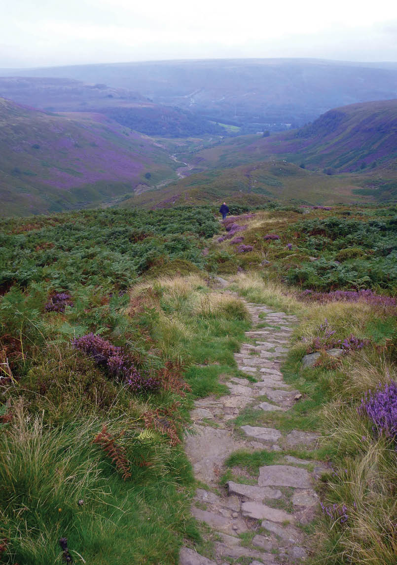
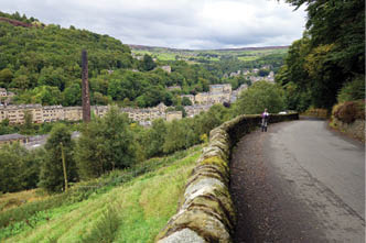
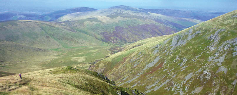
Looking down to Edale, day 1
Planning the hikeThe through hike is regarded as difficult, although the walking itself is relatively easy with few steep sections and is well marked. The difficulties arise from the state of the track and the English weather. The track runs for many kilometres through wet peatbog, and has been much damaged and widened by generations of walkers and sheep, all trying to dodge the mud. Some of the worst sections have been paved with recycled stone slabs, but while these contribute to impact bruising, at least you can stay clean. Waterproof boots and knee high gaiters are essential, but are unlikely to keep your feet dry.
English autumn weather is the epitome of unreliable, with four seasons in one day the norm. We were often tempted by blue sunny skies in the morning to don shorts and t-shirts for walking, but by the time breakfast was completed, clouds had rolled in with a 30 km/h wind off an ice floe somewhere. We normally walked in long pants, a merino top and a windproof parka, with overpants in reserve for the afternoon showers. The walking is mostly at an altitude of 100-300 metres, with half a dozen climbs up onto the fells at 600-800 metres. Typically we would be in cloud on the high points, with restricted visibility leaving us reliant on occasional cairns, compass and a GPS.
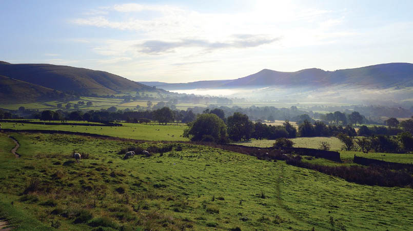
We decided early on that we would do this walk slowly and in autumn, avoiding the crowds of summer, and cope with the weather by doing it as a slack pack, staying in B&B accommodation throughout. This meant we could enjoy the track, absorb home and village culture, and carry less than 10 kilograms for the duration so did not need a carry service. Most fit young hikers take around 17 days for the through hike, so we planned for 23 days, with a few zero (non-walking) days and a few nero (nearly zero) days, but otherwise averaging around 20 kilometres each day.
Days 1-3, Edale to Hebden BridgeEdale was our first of many stone villages, spread out along a river valley, where the water flow was used for running mills of various types. It is a hub for walking tracks heading off in all directions, including the start of the Pennine Way.
After five months of planning and dreaming, we finally started walking on Saturday 2 September 2017, with three days planned to reach Hebden Bridge for our first zero. We knew we would need the break as we were not track fit and these three days are all over 20 kilometres.
“English autumn weather is the epitome of unreliable, with four seasons in one day the norm.
BWA April 2018 | 7

Alison at Stoodley Pike, day 3
Terry gave us an early breakfast and we were walking up the valley by 8am. An hour or so of gentle climbing has us at the foot of Jacob’s ladder, a stone stairway climbing steeply 300 metres up to the main ridge and the high point of Kinder Low (I have no idea why it would be called that) at 633 metres.
Flagstones are laid for some of the boggy bits, but the dry areas are very rocky, so the walking is slow, stepping from rock to rock to the waterfall called Kinder Downfall and then Jacob’s Ladder – the Reckoning, where the track drops steeply on stairs again, then flagstones for three kilometres to Snake Pass. Much of the track here had been eroded two metres down through the bog to the hard clay beneath.
As we came down off Bleaklow Head, the track was again rocky and difficult and Ali was tiring, taking several falls but without damage. We’re both exhausted and very grateful to reach the road next to the Torside Reservoir, but now have to cope with traffic and no verge for the last kilometre or so up to The Old House. We tottered in to be greeted by another dozen walkers and a cup of tea almost before the boots come off. A bath was welcome, fortunately, as there was insufficient headroom to stand up for a shower.
The climb for the next morning is up and over Black Hill, no longer black thanks to a massive regeneration and recovery program. Tonne bags of lime fertiliser are scattered over the plateau and sheep have been fenced out. The track followed a sharp edge, and we were grateful for the wind blowing us away from it as it’s a long way down. From near the top of Black Hill, we saw our lunch target, another major road across the moor where we have been assured that as it is a Sunday, there will be a hot food van parked in a layby. As we got closer, the tension rose as although we can see the food van, there is no movement and the sidewalls are shut. We’ve resigned ourselves to biscuits and
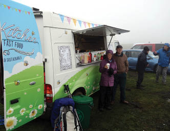
Motocross food van with hot chocolate
8 | BWA April 2018

Fingerboards near Tan Hill, day 9
cheese when we realise that because of the wind the van is operating out the back door. Several cups of tea with egg and bacon butties later, while we huddle up against a stone wall out of the wind, and we are revitalised for the afternoon.
Our feet were feeling the pain as it had been gravel tracks and flagstones for the entire way to Redbank Reservoir where we could see our hotel across the moor. It was very tempting to take a short cut across the southern edge of the dam, but we could see sedge and sphagnum, so we decided to stay on the safer track for the extra two kilometres despite our blisters.
By morning the weather had finally shut down after the last few days of cool and dry, and we were greeted by low cloud and drizzle for the kilometre back up the main road to the track. We were following Blackstone Edge, a famous climbing cliff,
but there was nothing to see from above except vague grey rocks and cloud. Some of the track had been cobbled with stones in Roman times, and for contrast we cross a six lane freeway on a bridge made for hikers.
Hebden Bridge is a town of weavers, originally with hand looms, then powered by water wheels then steam engines burning coal. Chimneys are everywhere. The black satanic mills could have been right here, and the town still looks the part. We spent our day off wandering quietly, doing coffee and lunch while Ali managed a few sketches.
Dropping into Hebden Bridge, day 3
“Some of the track had been cobbled with stones in Roman times ...
BWA April 2018 | 9
Flagstones on the way to Top Withins, day 5

Days 4-8, Hebden Bridge to Pen Y GhentWith our clothes washed and dried, dry clean boots and socks, our batteries were fully charged and we were raring to go the next morning. Especially as our host, Sharon, offered to drive us five kilometres up to Colden, neatly avoiding a 200 metre steep climb up out of the valley. The moorland was exposed and open to a freezing wind, gladly in our back. It was hats and gloves with parkas and long pants for the whole day, walking past another three reservoirs before a solid 150 metre climb to Top Withins and some ruins said to be the inspiration for Wuthering Heights. Whether it was or not, it was a spectacular location on the edge of high moorland and overlooking Haworth, the home of the Bronte sisters.
The descent for the afternoon was to Ponden reservoir, with our B&B set on a peninsula overlooking the valley and the lake. We were met by Brenda with tea and pikelets with jam and cream ready by the time our boots were
off. As we were the first arrival she gave us our choice of rooms, so we had to have the purple one! After some recovery time she drove us two kilometres down to the pub for dinner, but had forgotten to mention that we had to make our own way back until we were there. As we hadn’t brought parkas or a torch we were a little miffed, but made it back okay before the rain and dark set in.
An early breakfast and we’re off by 8am, fine by us as the day looked to be a hard one, with three climbs, each of 200 metres. A pub
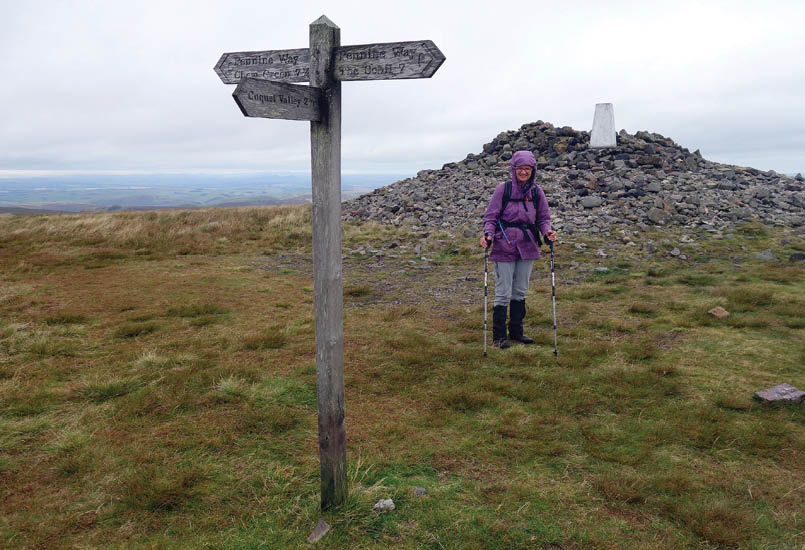
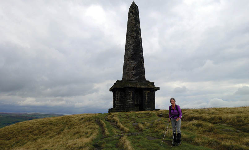
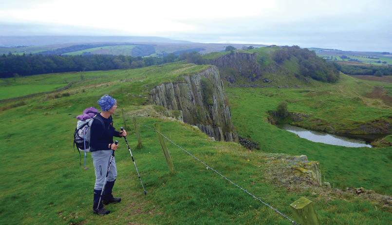
Alison at Windy Gyle, day 21
“ ... it was a spectacular location on the edge of high moorland and overlooking Haworth ...
10 | BWA April 2018
after hill two looked promising for lunch until we arrived and discovered it to be under renovation, so we found shelter against a wall under some blackberries and settled down to our cheese and bikkies. The last hill was over before we expected and from there it is all downhill to Earby.
Our host was able to show us a disused railway line which led back to the main Way avoiding about five kilometres of busy road. Then we had wet paddocks and a canal crowded with boats and moorings. A couple even had “lounge rooms” built into their docks.
That saw us into Gargrave and The Dalesman a track café famed for coffee, cake and lollies. We followed the Aire River for several kilometres, admiring the continuous grade two water with timber screens and barbed wire fencing making life entertaining for the intrepid kayaker.
Another Saturday dawned, so we’ve been on the track a full week and seem to have arrived at a comfortable level of walking fitness. We certainly hoped so, as today is one of our hardest days on the Way. 450 metres of climbing to get out of the valley and up to Fountain Fell, then down 300 metres and back up again to get over Pen Y Ghent before the 500 metre drop to Horton in Ribblesdale.
The day started with climbing 420 steps up the side of Malham Cove, a limestone amphitheatre formed by a waterfall 50,000 years ago, then another four hours of steady climbing before we reached the double cairn marking the top of Fountain Fell. Mine shafts were scattered about, some with fences and some with dire warning signs. We didn’t leave the path. The afternoon light made Pen Y Ghent glow as if the grass was backlit. The stepped path wound through two cliffs before easing off for the gently rounded summit where there was a queue for shelter in the lee of a wall. The track down is hardened, with lots of steps to make it easy for track runners, for whom this is the first of three peaks in the aptly named Three Peak Challenge.
Dry river valley above Malham Cove, day 8
Stone way-marker, day 8
BWA April 2018 | 11
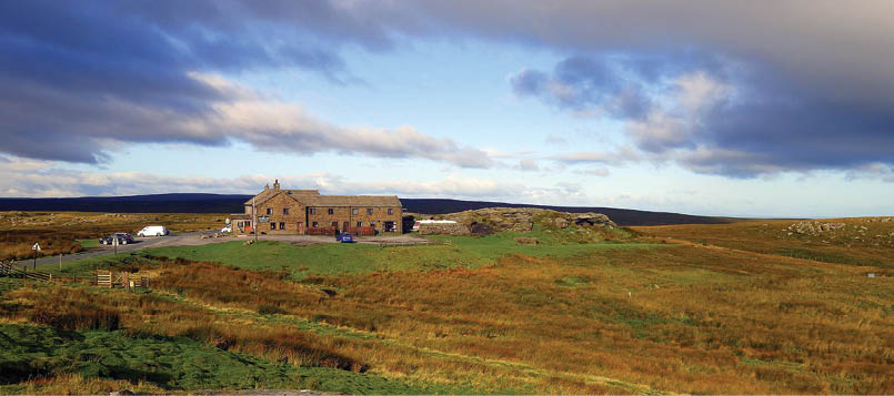

Days 9-11, Pen Y Ghent to BowesSunday greeted us with miserable weather, drizzling rain again with that biting wind. There was a 400 metre climb for the morning, but it was all on rough roads so route finding in the cloud wasn’t a problem. As we got closer to the top, it became apparent that there was a serious mountain bike competition using our path. Bikes whizzed past in both directions, appearing out of the cloud with little to no warning, so we had to stay on full alert. We started across the summit plateau to find a motocross competition in full swing around us as well. This was at the end of a sealed road, so there were several hundred people with cars and trailers parked in all directions. We were boggling at all this activity, when two of the organisers pointed the hot food van out to us. Hamburgers and hot chocolate with marshmallow for lunch on the summit was a wonderful compensation for our invaded feeling. Motocross bikes and mountain bikes continued past us, very politely, for another kilometre until we turned off their path at Ten End and started down towards Hawes and Laburnum House.
The burst of foul weather was expected to continue for a few days, so with a major climb over Great Shunner Fell looming, we didn’t hesitate to book a taxi to skip 10 kilometres and stay low down for the day.
After the lift, we climbed gradually up a valley, with another obvious path at the same height on the other side, and we eventually realised that we are looking at Wainwright’s Coast to Coast path where we walked 12
years ago. After saying hello and goodbye to the C2C, we climbed on through very wet and boggy moorland and even though I had wrapped my feet in Tesco bags inside the boots they still got wet. The pub for the night was the Tan Hill Inn, almost on top of all this moorland, and a major search and rescue centre as well as being the highest pub in the UK at 572 metres. The clouds were scudding by just over our head, and Shunner Fell a good 300 metres above that, so the decision to skip was a good one.
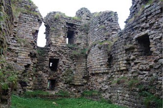
The five kilometres of track north from Tan Hill Inn had the worst reputation of any bog along the Way, so we opted to follow the road around it, covering six kilometres instead. This allowed us to complete the day’s walk with dry socks, the only day where that occurred. Bowes Castle came into view from several kilometres away and it dominated the valley. It was built in 1170, replacing a Roman fort, and by the sixteenth century it was ruined.
Tan Hill Inn at 572 metres, day 12
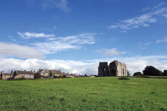
Bowes Castle still dominates the valley, even as a ruin, day 10
12 | BWA April 2018


Days 12-16, Bowes to GarrigalWe were in Horton in Ribblesdale a few days ago and next we’re on our way to Middleton In Teesdale. Even the locals use the whole name as there are several other Middletons in the area. Aussies get laughed at about the longish names we use, but I can’t see any difference.
The lane we were following had a warning sign every 50 metres or so gently suggesting that we stay on the road as there was unexploded ordnance in the neighbouring fields. It seemed to be okay to go in there as long as you didn’t touch or disturb anything. Up over another 200 metre ridge and the valley of the Tees is on display before us.
The next day the Way followed gently along the Tees River for the whole day, passing Low Force and High Force waterfalls where the river crashed over bluestone edges. A 150 year old suspension bridge crossed the river to some recommended tea rooms for a good coffee and poor cakes for morning tea. We learned that the word force for waterfall came from the old Nordic word foss.
Low Force is a series of one to two metre drops over a kilometre or so, probably canoeable but at about grade four with manoeuvring inside white water. High Force is a near vertical drop of about 10 metres, crashing off rocks on its way down.
At Langdon Beck we woke to brilliant lighting on the range outside our window, with the hillsides glowing green and grey in the low sun. A bouquet of pheasants was running around in the paddock below us, but they disappeared as the pub started to wake up. They had apparently heard about the shooting party which had started to assemble at the pub as we left. We were back on the Way after about 30 minutes, again following up the river to where it emerged from a dam. This gave us an exposed and frightening climb up wet and slippery rock beside Cauldron Snout before reaching the dam wall and a farm track again.
Middleton in the valley of the Tees River, day 13
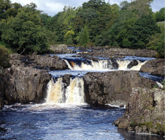
Low Force, day 14
BWA April 2018 | 13

By then, gunfire was echoing around the valley, hopefully from gun butts a kilometre or so off to one side, while appropriately there are more warning signs of unexploded ordnance in the moors around us. We kept moving and appeared to get out of range of threats as we approached High Cup Nick, a spectacular glacial landform with a semicircle of cliffs around a closed valley.
We managed an early dinner of coffee and panini at a Dufton café before our host arrived to collect us, so we didn't have to go out again that night. The Hollies is very walker friendly and comfy with plenty of power points, Wi-Fi and a hard bed. Jan was also happy to give us a 7am breakfast and drive us back to Dufton to get us back on the track early for the 25 kilometres and a 600 metre climb over Cross Fell and its friends.
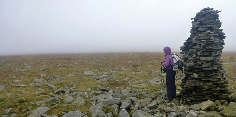
All went to plan and we’re slipping and sliding up cow shit-covered lanes out of Dufton by 8am. It was a steady uphill grind for a few kilometres before a small bridge and the main climb started. This was steep with steps, then a plateau before steep again for about six steep bits before topping out on Knock Fell at 670 metres. The Way then bobs along, with 200 metres down and 200 metres up to Dun Fell and its radar station, then a repeat for Little Dun Fell before the final climb up onto Cross Fell at 900 metres, our highest point for the walk.
By then the cloud had rolled in, so visibility on the trackless main plateau was down to
25 metres and we had to use the GPS to find our way from cairn to cairn. The summit cairn is in the shape of a cross, with arms about 10 metres long providing some shelter regardless of the wind direction. We had a snack there but decided to press on down to Greg’s Hut for lunch. With muddy tracks going in all directions the GPS was worth it’s weight in gold for this tricky bit of navigation. Greg’s Hut dates from a lead mining era, so for several kilometres we’re on a rough and rocky track in a wasteland of spoil heaps.
The road way improved, but it was still a long way down on a hard surface to reach Garrigal and the Post Office B&B. We received a warm welcome and were happy to hear that the pub next door had just reopened and would be able to cope with feeding us, even if just a cheese toastie. That went well with Guinness and cider before going back next door and crashing.
Alison at a trail marker near Cross Fell, day 15. The summit cairn was bigger.
Greg’s Hut just off to one side of Cross Fell, day 15
14 | BWA April 2018
Another couple of walkers arrived at 7:30pm, taking even longer than us for the crossing after being unable to start before 10am. We commiserated but patted ourselves on the back for coping well with the hardest day so far, and what would be the the hardest day of the entire walk.
This B&B was also memorable for all the signs and instructions posted on every available surface. I counted 10 in the shared bathroom, and several more in the bedrooms. She has obviously had problems with some people, but I boggled at the one which said “please take off your cycling shoes before entering the shower”.
Days 16-19, Garrigal to Twice Brewed InnOur first frost was making the grass glow white in the early morning as we breakfasted. From Alston the Way goes up and down through many farms and bogs, but there was an easier option for about six kilometres following the South Tyne railway to where it crosses the Pennine Way.
We were making five kilometres an hour along the rail-trail, so it was a bit sad to head back into the boggy ground and a climb over
another Black Hill. Bog was over the boot tops this time, so we were very grateful for more hard track for the last few kilometres to Greenhead pub and Hadrian’s Wall.
Thirlwall Castle was our first stop, built from Roman stone taken from Hadrian's Wall, then a ruin itself by 1700. There was nothing to see of Hadrian's Wall, so we were feeling a bit let down, but as we gained some height it was possible to look down on Greenhead and see the double ditch where the wall had been, and along which we were actually walking.
Thirlwall Castle, day 19

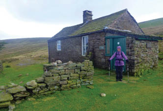
Catholic Bushwalkers hut offers emergency refuge on the GRW route
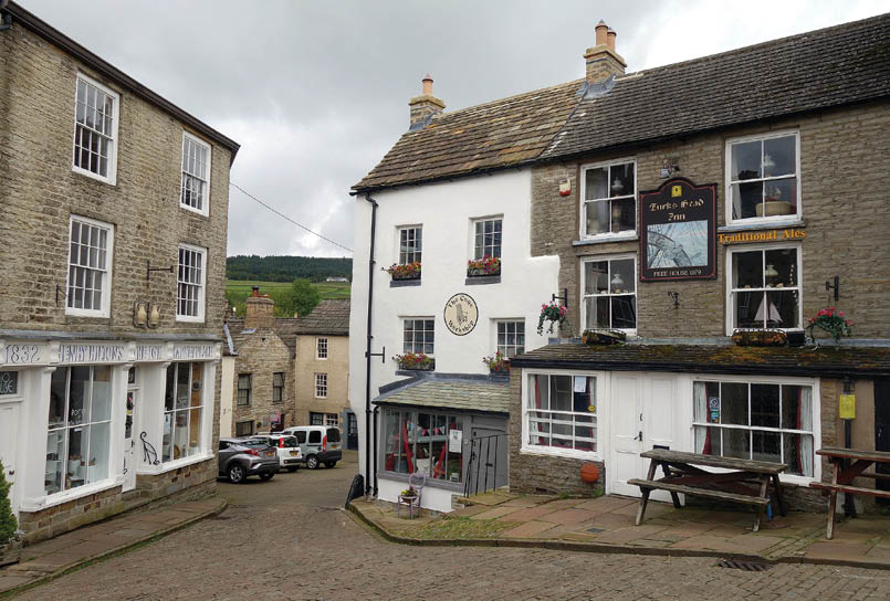
Alston streetscape, day 17
BWA April 2018 | 15
As we walked on, it became more obvious that much of the wall is a natural landform, with north facing cliffs, that the Romans were able to develop and extend. After we passed Walltown quarry, sections of wall and remains of watchtowers became evident, with what’s left of the wall being about 1.5 metre thick and 2 metres high in places, some mortared and some not, with an infill of rubble and soil.
The wall follows the top of the cliff, so it was constantly undulating, and we were on the lookout for sidling sections where we could skip the climbs. Today was another nero of 12 kilometres to give us time to explore the possibilities of Hadrian’s Wall, so after arriving early at Twice Brewed, we were able to take a bus to Vindelandia, three kilometres away, to spend the afternoon.
Vindelandia is a Roman fort and an ongoing excavation that has been in progress for over 100 years, with 400 years of work left. The original fort, built of timber around 100 AD is about five metres below current ground level, but the fort is known to have been rebuilt at least nine times on top of that. As well as a town of exposed building structures and foundations, there is a museum collection of items recovered from the outside ditch and preserved by the anaerobic peat conditions.
Days 20-23, Twice Brewed Inn to Kirk YetholmThe next day it was back up to Hadrian's Wall and its undulations for another hour before reaching Rapishaw Gap and heading off north again away from Hadrian's Wall. The Way was composed of boggy pastures and hard roads through pine plantations and a climb over Shitlington Crags - I kid you not - but I do wonder how it is pronounced as we are headed for Bellingham, pronounced Bellingen.
For our last section of trail we had booked to stay in Byrness for two nights as they also offer a pick up and return service from half way through this last section of 36 kilometres to Kirk Yetholm and the end of the Pennine Way.
Next day, for the first couple of hundred metres out of Byrness, the track climbed out of the valley on the steepest and slipperiest path we’d encountered. This was really exhausting work and made us reflect on the overall lack of maintenance we had seen and the amount of repair work needed to keep it as an iconic track, particularly after seeing all the volunteer work put into the Appalachian and Pacific Crest Trails.
Hadrian's natural on day 19. Big drop!
“... and made us reflect on the overall lack of maintenance we had seen and the amount of repair work needed to keep it as an iconic track ...
16 | BWA April 2018

I must have been losing concentration on the path as I managed a knee-deep plunge into a bog I thought was dry, then a full face plant, fortunately onto sphagnum, not mud, when both feet lost traction. We topped out on Windy Gyle after 7½ hours, then took 45 minutes to drop 300 metres over two kilometres to the farm where we were to be collected at 4:30pm.
Our last day on the Way and we started walking from Trow’s Farm at 9:30am with the climb back to Windy Gyle looming over us. It only took an hour to get back to the Way, then slabs and bogs in equal measure up onto West Cheviot. A detour out to the main peak didn’t attract us, so we continued onto a bothy for lunch. We climbed over The Shill, then started the eight kilometre descent to Kirk Yetholm. As it was a Sunday, there were people everywhere, dog walkers, fell runners, day hikers and a few like us just trying to finish. The path gently descended on farm tracks to a road and car park. Then there is a last ridge to cross on two kilometres of sealed road. Just as we started this bit, Ali stuck out her thumb and a lovely couple picked us up and took us to the front door of our B&B. That made for a great finish after a strenuous and foot pounding day. Claire at Mill House took us in, got our washing done and booked us for dinner at the Border Hotel where we can get our free pint and certificates signed.
We settled into the pub and WiFi to discover a reminder from Facebook that today, 24 September, is our anniversary for completion of the Appalachian Trail in 2010. So how’s that for serendipity?
Follow Digby and Alison at iamfootlooseandfree.com
Pennine Way information can be found at nationaltrail.co.uk/pennine-waythepennineway.co.uk/pennineway.co/
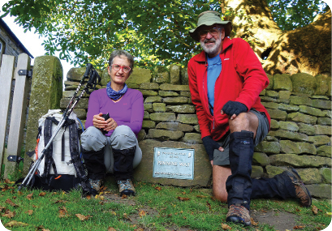
Digby Gotts and his hiking partner, Alison, are life-long walkers after becoming addicted while at Monash Bushwalking Club back in the 1960s. After a varied career in education they have now retired to Mossman, Queensland from their permaculture fruit farm at Cape Tribulation. They are spending their retirement either hiking or planning to hike where the hills are flat and the weather is perfect, catching up on all those trips where the career got in the way of the lifestyle.

Miles down to Trow's Farm, day 22


“... I managed a knee-deep plunge into a bog I thought was dry, then a full face plant, fortunately onto sphagnum, not mud, when both feet lost traction.
BWA April 2018 | 17