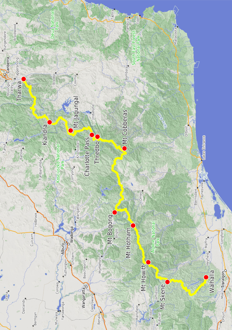


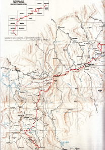
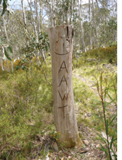
The AAWT is a major long-distance track from Walhalla in Gippsland, Victoria to Tharwa in the ACT, 660 kilometres. While Tasmania's Overland Track has many more visitors and is much more well known, the AAWT is much longer and much harder. The AAWT is the only long-distance walking track that goes through alpine Australia.
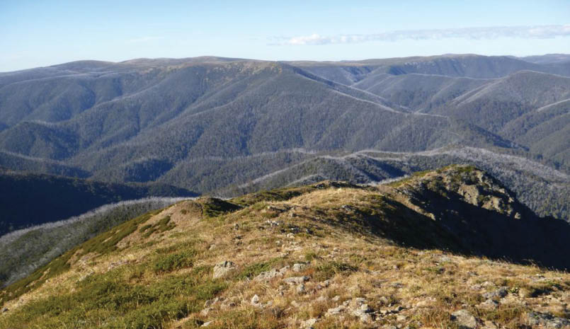
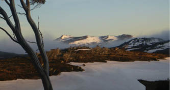
Mount Anton and Mount TwynamStefan De Montis

Australian Alps Walking TrackPast, Present and Future
Stephen Lake

6 | BWA February 2019
Why walk the AAWT?The year before George Mallory died on Mount Everest in 1924 he was asked why he wanted to climb it. He said, "Because it is there". The same reason applies to the AAWT.
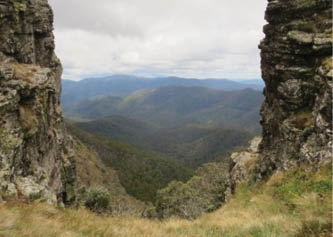
This is not an easy walk. Unlike a number of other Australian long-distance walks, the AAWT passes through wild and remote places. Many days have moderate to significant climbs. The entire track has over 27 kilometres of ascents and descents. Unlike the Overland Track, except for a short Main Range section there are no boardwalks. Signs and track markers are often minimal. There are long sections with no huts. Snow falls in every month.
Everyone has their own reasons for walking the AAWT. Reasons include the challenge, the sense of achievement, the wonderful scenery, the ability to look at a map that shows Canberra to west Gippsland, see the AAWT, and then think, I did that.
The AAWT is a walk that all people with suitable experience, endurance, planning skills and time should walk.
How long does it take to complete the AAWT?Some parties do sections at a time, perhaps 7-14 days each year. Others do the walk in one trip, with a huge variation in the time. Witzes Hut has log book entries for north-bound AAWT walkers taking 34, 38, 43 and an amazing 70 days, Cascade Hut has an entry from a walker who went from Bulley Creek over The Pilot to Cascade Hut in a day, 47 kilometres. Another north-bound
walker at Cascade Hut was on day 13. A hut near Jagungal had an entry "Day 55 of 70 walking the AAWT south to north. (We're taking it more leisurely than most hikers … the Kennedys, Diane, Alena, Oliver and Kevin.)" Most people will take 4-8 weeks. Paul Cuthbert took 11 days and 18 hours, very light pack, 14 hours of running most days. Wow!
I set a record of sorts. The Alpine Walking Track (AWT) was a long-distance Victorian track and is the predecessor of the AAWT, which follows a lot of the 1974 AWT. In January 1974 I finished the AWT, which was recognised as the first party to do so. In December 2016 I had walked the AAWT starting at Tharwa. From Mount Wills Hut I went north, reaching the point where the 1974 AWT came from the north. I had been there nearly 43 years before, an average speed of 15.4 kilometres a year. This falls into the walk by section method, and is unlikely to be beaten. One does one's best. A well-known walker said "You beat me there. My first walk on the AAWT was in January 1981, the last in November 2013 - a measly 32 years and 10 months."
Food drops and accommodationIf you move fast it's possible to have just two food drops – Hotham Heights and Thredbo. There are usually 4-8 food drops for parties that walk the AAWT in one trip. Putting in food drops involves a huge amount of planning, time and effort, maybe 1000 kilometres of driving and two days. After the trip the empty containers need to be collected, another two days of driving.
Howitt Car Park, 26 December. It was cold!Stephen Lake
Cascade HutStephen Lake
BWA February 2019 | 7
Most people seem to collect a food drop and stop overnight at Hotham Heights and Thredbo. Apart from builders, Hotham is very quiet in green season, and accommodation is limited – most places are closed. Two that are open are The General and Asgaard. Both are opposite the Police Station.
On the Omeo Highway about 40 minutes south of the AAWT where it goes north to Gill Creek is Glen Wills Retreat, lovely accommodation.
Thredbo is a big contrast to Hotham, with many people and a selection of open accommodation. The Youth Hostel is clean, warm and does not cost much. Non-members can stay there.
History part oneEarly days and backgroundIn 1778 Thomas West published a very popular walking guide to the Lake District in England. In 1876 Robert Louis Stevenson wrote Walking Tour, and in 1879 Travels with a donkey in the Cevennes. Rambling and walking clubs proliferated.
The word bushwalking is based on the Sydney Bush Walkers, formed in 1927, the first mixed gender bushwalking club in NSW. This era gave us such notables as Myles Dunphy and Paddy Pallin, and was the basis of the Australian environmental movement. Bushwalking took off in the 1920s.
This excerpt is from Chief Guardian by Allen Fox.
“During January 1954, Allen Strom, then Secretary of the Caloola Club, led a trip into Victoria to follow the Great Divide from
Mt Baw Baw via Matlock to Mt Kosciuszko and ultimately to Mt Franklin in the ACT. His Proposal for a Tri-State Trail in March 1954, used the 3,000 kilometre Appalachian Trail in the United States as a model and is an example of the way in which his imagination was fired by field work coupled with his extensive knowledge of activity in other parts of the globe (hand written edited note that says “particularly by the Club’s US counterpart, the Sierra Club”).”
History part twoThe Alpine Walking TrackFrom the AAWT Strategic Plan:
"In the mid 1930’s, conservationists dreamt and advocated for creation of a continuous protected area of national parks to across the Victorian high country. This interest became even stronger with the dedication of the Kosciuszko National Park in New South Wales and its proximity to the mountain areas in Victoria. In the early 1970’s, bushwalkers began establishing a long-distance walking track from near Melbourne to the New South Wales border at Tom Groggin."
The prime mover of the track to Tom Groggin was the Federation of Victorian Walking Clubs, now called Bushwalking Victoria. This walk was the Alpine Track, which became known as the Alpine Walking Track, AWT.
The AWT started at Tom Groggin station on the Murray River west of Thredbo on the Alpine Way, which at that time was unsealed from near Murray One Power Station to near Dead Horse Gap. The AWT went west and
Glen Wills RetreatStephen Lake
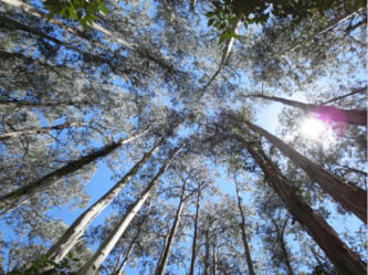
Baw Baw TreesTerry Cornall
BWA February 2019 | 9
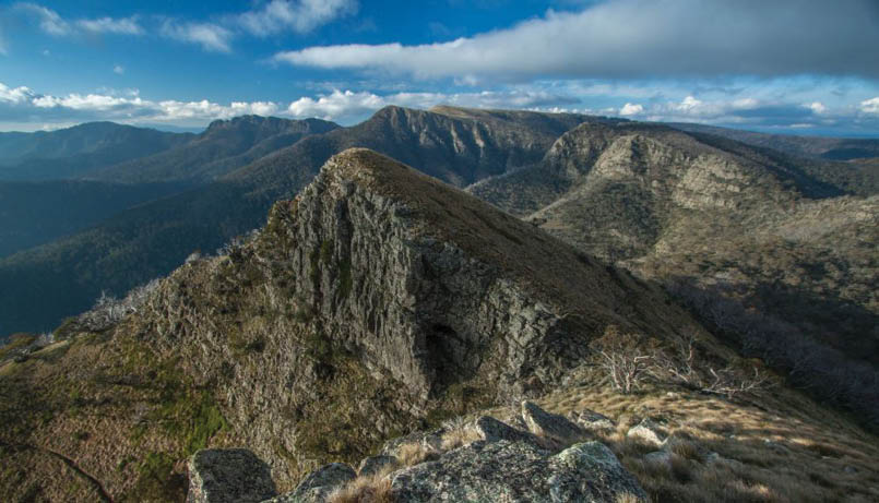

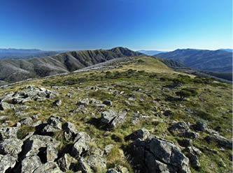
Magdala with Howitt and the Crosscut Saw behindNorth-north-west
south over Mount Gibbo to the Mitta Mitta River at Soldiers Point, a wide thigh-deep crossing in swift water. The next section bypassed the summit of Mount Wills to ascend Long Spur, with an interesting option, splitting at the top of T Spur. One part went over Mount Bogong to Quartz Ridge, Big River and Timms Lookout. The other way was T Spur, joining the Timms Lookout track near Ropers Hut.
From the top of T Spur the next two weeks are well known to bushwalkers: across the Bogong High Plains, the Barry Mountains, Mount Speculation, Mount Howitt and Mount
Magdala. The Barries had a reputation for there being no water, and were known as the Dry Barries, a name that is still justified and used. About half way on the Barries a water tank was put in, now no longer working. There was a track from Barry Saddle – another tank – over The Viking to Viking Saddle. Many consider the section from Barry Saddle to Mount Magdala to be the best on the AWT, and the best on the Victorian part of the AAWT. It's nearly all foot tracks, with spectacular scenery in wild locations.
A short distance after Mount Magdala there's a ring of mountains culminating in Mount McDonald, nice walking when away from the open 4WD tracks. From Mount McDonald
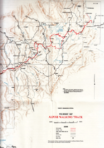
Preliminary Alpine Walking Track Map
Hells Window, Mount MagdalaTerry Cornall
10 | BWA February 2019
the AWT went south, never quite regaining the brilliance of the Viking-Magdala section. Walking is often on 4WD tracks, generally at a lower altitude.
The last few AWT days were over the Baw Baw Plateau to Erica Car Park, an easy end to a good walk.
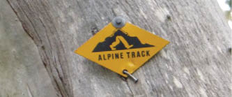
The AWT had a very distinctive track marker, a yellow diamond with baggy legs. These are still visible in many places, some battered by 45 years of weather to just a silver diamond, maybe buried deep in the outer layer of trees. These markers are an important link to the past.
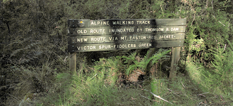
History part three Dartmouth River & Thomson River Dams
In 1972 the Dartmouth Dam on the Mitta Mitta River was approved, with construction completed in 1979. This meant that the AWT would need to be changed; Soldiers Point would soon be under water. The end of the AWT was moved south from Tom Groggin to Cowombat Flat on the NSW border at the infant Murray River. The Cowombat Flat route is generally west over Johnnies Top to reach the Mitta Mitta upstream of the dam, with a bridge making it easier to cross. The bridge here was washed away a few times and rebuilt. The AWT then went west to the Omeo Highway and Mount Wills, meeting the original route a short way north of the summit.
In 1984 the Thomson River Dam north of the Baw Baw Plateau was completed, and the AWT was moved around the dam.
History part four The Australian Alps Walking TrackThe Tom Groggin start was isolated, with no easy way to walk there from NSW. However, Cowombat Flat has good walking access from Dead Horse Gap, which is on the Alpine Way and is an hour's walk from Thredbo. From this region the Main Range, Jagungal and points north beckon.
An excerpt from AAWT Strategic Plan:"The formation of the Australian Alps Co-operative Program in 1986 (cross-border co-operative management program between the national parks managers within Victoria, New South Wales, the Australian Capital Territory and the Federal Government) saw interest develop in finding a symbol of the unification of the mountain protected areas. Agreement was reached on a route for the Australian Alps Walking Track to divert and extend the Alpine Walking Track through the new links of the Alpine National Park, into and through Kosciuszko National Park and subsequently through Namadgi National Park in the ACT. The track was uniformly marked according to guidelines drafted by all the land managers along the route from Walhalla in the south to the Namadgi Visitor Centre in the ACT. In 1989, a month-long trek through the Australian Alps National Parks closely followed the Australian Alps Walking Track and celebrated the dedication of Victoria’s Alpine National Park and the unification of a contiguous protected area from near Canberra to Mt MacDonald in Victoria."
The AAWT had 254 kilometres of extra track added to the AWT in the north from Cowombat Flat to Tharwa, and 20 kilometres extra in the south from Erica Car Park to Walhalla, making it 660 kilometres in total. Like the AWT, most of the new AAWT tracks existed previously. The AAWT opened in 1995.
Thomson Dam signpostNorth-north-west
An AWT markerStephen Lake
An AAWT markerStephen Lake
BWA February 2019 | 11
AAWT new tracks Walhalla to Erica Car Park and ThredboThe start at Walhalla is gentle, along mining tracks, followed by a 1300 metre climb to Mount Erica, somewhat surprisingly the biggest ascent on the AAWT. From Mount Erica there are 365 kilometres on the AWT to Cowombat Flat. A short way north of here The Pilot is a worthwhile side-trip, an imposing mountain. The AAWT meets the Alpine Way just below Dead Horse Gap, and goes up to the Eagles Nest at the top of the chairlift. Most bushwalkers go to Thredbo, a food drop, hot showers, a beer and a bed. After a rest, it's probable that most north-bound AAWT bushwalkers make a fast ascent to the Eagles Nest – on the chairlift.
AAWT new tracks Main Range to Schlink Pass The most populous part of the entire walk is Eagles Nest to Rawson Pass. Instead of taking the obvious way from Rawson Pass over the spectacular Main Range to Twynam, the Rolling Ground and Schlink Pass, the AAWT is on 40 kilometres of roads from Rawson Pass to Guthega Power Station, with vehicular traffic often very busy and dangerous after the locked gate at Charlotte Pass. It's not very tranquil, and it's most certainly not a walking track or bushwalking.
Point 8.6 of the 2006 KNP Plan of Management says: “Retain the route of the Australian Alps Walking Track (AAWT) along the Dead Horse Gap Track, Kosciuszko Walk and Summit Walk from Rawson Pass to Charlotte Pass. In order to protect the outstanding values of the area and retain the current range of alpine walking experiences, the AAWT will not be re-routed to traverse any other part of the Main Range.”
I estimate that about 2000 people a year walk the Main Range Circuit. The 2000 figure could well be low, and numbers have been much higher in recent years. The NSW National Parks and Wildlife Service (NPWS) advise that 100,000 people a year summit Kosciuszko. I have been unable to determine how many people walk from Schlink Pass and Whites River to Mount Twynam. However, it's a major route from the Schlink side to the Main Range which I have skied
and walked in both directions many times. My research shows that there are about 60 AAWT parties a year, about 150-200 people. It's highly likely that AAWT walkers go on the 40 kilometres of road on the official route to Charlotte Pass and Guthega Power Station only in bad weather. Having navigated for a few weeks from Tharwa or a month from Walhalla, a short trackless Main Range and Rolling Ground section will not stop parties in fine weather. These parties follow the tracks if they exist, and meander through sensitive habitat where tracks are not defined. Would it not be better to keep all walkers in one track, away from sensitive areas? The AAWT and other parties going from Mount Twynam to Schlink Pass or the other way cannot be stopped, so why not manage them to protect the environment? There would be minimal extra walkers due to a track, and even if the track led to more walkers, the impact would arguably be less as the walkers would be on one track.It seems that the NPWS has a track from Mount Twynam to Schlink Pass as a low priority. Funding is limited. However, most of this route will not require much works, and follows tracks that have gone into disrepair. There was a vehicular track north from the Mount Twynam turnoff for a few kilometres, a most amazing serpentine path through big rocks. It stopped at or near the saddle before Mount Anderson, and a foot track went from there to Mount Tate. One section here had or has a big eroded washout. There are many tracks contouring on the east side of Mount Tate, and one over the summit. They come together west of Consett Stephen Pass, which has a track across it that fades as it ascends the Rolling Ground side.
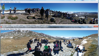
Crowds on the summit of Kosciuszko and at Rawson PassNPWS
12 | BWA February 2019

Another possible reason that NPWS oppose a Main Range track is to protect wet areas. The only one I've seen is on the east side of Consett Stephen Pass; on the ridge it's dry walking all the way to Whites River Hut or Dicky Cooper Bogong and Schlink Pass. This has been confirmed by a very experienced walker. A track around this wet area would protect it.
I am simply unable to see how a track would compromise protecting "the outstanding values of the area" or "the current range of alpine walking experiences". It has been suggested that the opposition to a track is to avoid infrastructure spending.
Much of the Twynam-Rolling Ground section will not need work. There could be markers for most of it to keep people in existing pads and tracks, erosion control for the washout and multiple Tate tracks, and some new works on the east side of Consett Stephen Pass. The latter may involve going south-east around the wet areas instead of east or north-east.
NPWS is in the early planning stages of a new track from Charlotte Pass to Guthega, so the AAWT may end up following that route, and if so, at Guthega most walkers
will cross the Snowy River to Mount Tate or the Rolling Ground. Like the current official road route from Rawson Pass, except in bad weather I cannot see AAWT or any experienced walkers taking this new route in good weather. It's longer, involves more climbing, and the views are inferior to those on the Main Range-Dicky Cooper Bogong route.
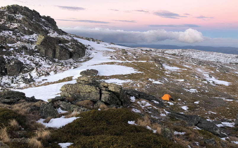
Main range campingCamping between Eagles Nest and Dicky Cooper Bogong is limited. The first spots are on Rams Heads overlooking either the Snowy River or Lake Cootapatamba. The next campsites are in Wilkinson Valley, although due to lack of toilets the water may be compromised. Dispersed overnight camping is permitted except within the catchments of Lake Albina, Blue Lake, Club Lake, Lake Cootapatamba and Hedley Tarn. There is no camping within 200 metres of the Eagles Nest to Kosciuszko track, Kosciuszko's summit and Rawson Pass. There are a number of good places to camp on the Main Range, and I'm not going to say where. Find them.
Let's follow the Main Range. A short way below the summit of Kosciuszko is the turnoff to the Main Range Circuit where the
Main Range campsiteStefan De Montis
BWA February 2019 | 13
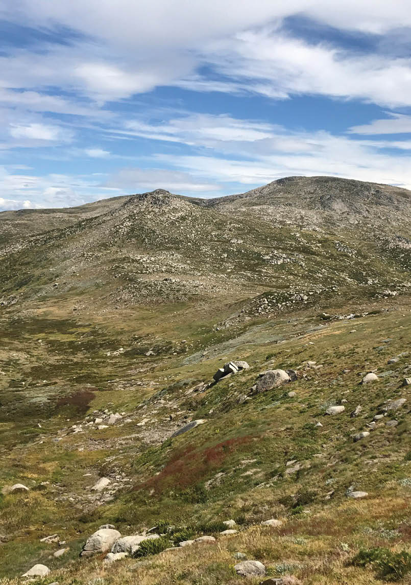
steel boardwalks, vehicular management track and most of the masses that summit Mount Kosciuszko are left. There are a number of brilliant side trips on this section – Mount Townsend, Lake Albina, Blue Lake, The Sentinel, Watsons Crags, Mount Twynam and other places. The foot track follows the spine of the Main Range to the Twynam turnoff, where nearly all day trippers are left. On my last three summer visits between Schlink Pass and Mount Twynam, I saw just two people on a day trip from Guthega Pondage, and only a few people on Mount Twynam.
From Mount Tywnam the walking is brilliant – high ridges, windswept plains, no scrub, excellent views, clear water in small creeks, and minimal people, with plenty of camping options, albeit often in exposed positions. There are patchy tracks from Mount Twynam for the next four hours to Consett Stephen Pass, and after here tracks are mainly absent for about four hours over the Rolling Ground. There are two ways down, Whites River or continue north to Dicky Cooper Bogong and Schlink Pass. Dicky Cooper appeals to me more as there's a high open plateau, fantastic views, no need to walk on the management vehicle track from Whites River, less descending and less climbing.
AAWT new tracks Jagungal regionFrom Schlink Pass the AAWT goes on management vehicle tracks to Grey Mare Hut and Mackays Hut. There's a consensus among experienced bushwalkers that any route near here is considered to be walking the AAWT. For those that can navigate off-track, perhaps the best option is Gungartan, Mawsons Hut and Mount Jagungal, from where there are a number of ways north to O'Keefes Hut or east to Cesjacks Hut, then to Mackays Hut or nearby. Another option
is to go east to Tin Hut, Bulls Peaks and Cesjacks Hut. This eastern route avoids river crossings, notable the Geehi, and may be best in spring as snow melts. This also keeps with the spirit of the walk which is to stick to the higher ridges and the alps.
AAWT new tracks Mackays Hut to TharwaAfter Mackays Hut the rest of the AAWT is mainly 4WD tracks - some management and closed to the public, some open - pleasant enough and usually not too many people except on open vehicular tracks. Road head campsites are passed.
One nice diversion is Happys Hut, a short distance from the AAWT in a sheltered valley. This can be approached from near the Dr Phillips Hut site. Cross the creek as high as possible, perhaps aiming for the 4WD track to the hut east of the creek. North-bound there's a short scrub bash uphill to the AAWT; south-bound is easier, downhill. Regrowth has made this a little energetic. Kiandra is a day or two away, vehicles swishing past at speed, unaware of the history. In 2006 the Holmenkollen Ski Museum, Norway, confirmed that the Kiandra Snow Shoe Club was founded in 1861, and was the world's first ski club.
There's one trackless section, just north of the Murrumbidgee River, only a few hours on open plains to Ghost Gully. The AAWT then does doglegs, getting deep into feral horse country. From Oldfields Hut it's not far to the ACT border at Murray Gap, a lovely alpine clearing. There are more valleys and ridges to Honeysuckle Creek.
The last day has a climb over the shoulder of Mount Tennent, then a pretty descent to the end at the Namadgi Visitor Centre at Tharwa, south of Canberra.
Oldfields Hut Stephen Lake
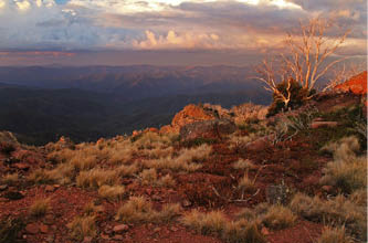
Dawn on 1 January 2016 from GungartanStephen Lake
14 | BWA February 2019

ChallengesThe main one is probably funding. Park agencies are not seen as a high priority by governments, so agencies have to do more with less. The bottom line for bushwalkers is track maintenance and water, especially in Victoria. Winter snow brings down trees every year, and trees fall across the track for several reasons, notably age, wind and fire. Tenacious springy bushes grow over tracks, which may then be invisible. Unless there's a lot of foot traffic or agencies clear the track regularly, progress can be slow and require more effort. Park agencies do their best but cannot keep up. Feral horses in KNP are now a political item, preserved to gather votes at the expense of the environment. This magazine has had feral horse articles in June 2018 and December 2018.
There was a delightful entry in Cleve Cole Hut about a track that is not on the AAWT but applies. In November 2016 a party went from the Bogong High Plains to the west ridges of Bogong. “Lots of dead fall on lower slopes of Quartz Ridge after crossing Big River. Although not a significant obstacle, the repeated over-and-unders are an embuggarance.” This describes what the AAWT is like in too many places. The worst sections vary as park agencies and others attempt to clear tracks. For example, Long
Spur had many logs and high scrub over the track. Volunteers and Parks Victoria are keeping the tracks open.
WaterClimate change means that a number of high water sources are drying. For example, in autumn 2018 there was no water at Cleve Cole Hut. At times it means a longer walk to water than before, such as at Viking Saddle. Mac Springs has never flowed strongly, and the flow is now less than was the case. It would be good if there were more tanks. Inadequate funding and competing priorities mean that some things are simply not done. There's been a suggestion for a tank at Viking Saddle to replace the diminishing water in the creek. Not everyone supports tanks and tracks in remote regions.
The design and manufacturing of a tank storing drinking water must comply with the provisions of Australian Standard 4020 (Materials in Contact with Drinking Water). There are three tanks at critical spots in the Barry Mountains: Barry Saddle, Selwyn Track and near The Twins. The Barry Saddle tank is very old, perhaps an AWT vintage, with lots of wrigglies, good if you like fresh protein. The tank should be replaced. The age of this tank means that AS4020 and health guidelines may be breached, possibly causing lead poisoning.
Quartz Ridge and the northern Bogong High PlainsStephen Lake
BWA February 2019 | 15
The Cotter Gap creek is somewhat hard to access and has silt. A simple low dam with a short overflow pipe would make this much better.
Most AAWT water is potable and does not need treatment. BWA December 2018 has an article about treating water.
The NPWS recommends "that people treat water, especially when a lot of visitors are accustomed to drinking treated water instead of perhaps tank water and so may not react well to water from natural sources even though it may not have any significant health risks." I do not share this view. For many years I have sought science to support the need to treat water, but none has been provided. While care is needed near huts and popular places, most wild water is clean. Treating or not treating is a personal choice based on where the water is obtained and an individual assessment. I always get wild water.
New routes and maintenanceA number of suggestions have been made about new routes, clearing some sections, or marking existing ones. One theme in the list below is that having a variety of tracks and routes giving several ways to walk from A to B will spread the impact. In some places there is no need for many or any new tracks or signs, just say that the AAWT options exist and to leave it up to the party to decide. The numbers 31, 49, 82 etc are the distances in John Chapman's book Australian Alps Walking Track.
31 Consideration could be given to establishing a campsite north-east of the rock shelter on the Baw Baw Plateau, 10-15 minutes from the AAWT. This area is popular with skiers and a modern toilet would be a boon, enhancing water quality.
49 One walker said that the "Thomson River diversion was terrible (not that I am familiar with what it used to be, but it had to be better than it is now). This was the worst part of the walk by far, for me." A logical route is on the Upper Thomson Road and Basalt Hill Track. This comes out nearly opposite the track to Mount Easton, and avoids a boring walk on the Thomson Jordan Divide Road.
82 There's a hut with a tank on Short Spur. When this hut was built it was intended that half would be kept open with access to all parties. The hut and especially the tank could be mentioned in track notes. See the next point for an alternative.
83 A number of parties have a food drop and stop at Fiddlers Green, so maybe a formal campsite could be established with a tank. To avoid use by people in vehicles, this would need to be a little distance from the road.
101 The track at the top of Mt Shillinglaw is vague, needs attention.
105 The climb from the Jamieson Licola Road is seriously scrubby, and it's better to use the Mount McKinley Road at present
110 The track from the Mount Skene road to Rumpf Saddle is overgrown, and described as "a pretty serious scrub bash".
116 Just north of Middle Ridge Road the Mount McKinty Road goes steeply down to the west. A better gradient is to have switchbacks going generally north-west to meet the road in the saddle. If this was marked then over time boots would form the track.
141 There's not much reliable or convenient water between Low Saddle and Chesters Yard, 26 kilometres and 13 hours of walking. A tank about mid-way would be useful. The best place seems to be The Nobs, just off the 4WD track.
166 Mac Springs is now often dry towards the end of summer. One option is to have a small dam with an overflow pipe. A tank may be useful. However, the number of people visiting means that the roof would need to be large.
176 The nearest water to Catherine Saddle is some distance away, and a tank at the saddle would be useful.
182 The Viking Saddle water is becoming less reliable, and it's a long hard day from Catherine Saddle to Barry Saddle. A tank at Viking Saddle would be good.
16 | BWA February 2019
182 Razor Viking is designated wilderness, and Parks Victoria have decided that there shall be no track. Unfortunately, old AWT markers away from the current alignment are in place, making it confusing. AWT markers should be moved to the current alignment. I see no problem with a foot track in wilderness. By keeping walkers in one place there is less trampling of habitat. Not everyone shares this view or having a tank at Viking Saddle.
191 The following sections need cutting. Selwyn Track 191.1 to 196.9; 203.6 over Mount Selwyn, and 216.6 near Murrays Hut site to 224.2 The Twins tank.
226 From The Great Alpine Road at Mount St Bernard it's seven kilometres to the Mount Feathertop turnoff at Diamantina Hut. Most of this is on the road, uncomfortable. A foot track should bypass the road as much as possible. This track could be on the old coach road and probably new benched tracks.
233 Mount Feathertop is a beautiful mountain, and is very popular. The AWT had two routes over Mount Bogong, West Peak and T Spur. Similarly, there could be an AAWT option to Mount Feathertop, Diamantina Spur, Westons Hut and the main pole line. This would require very little expenditure. There's a thread on this on Bushwalk.com forum.
272 The brilliant AWT route over Quartz Ridge and Bogong could be reinstated. Again, this is just something to decide; the tracks exist. New signs would cost a pittance.
309 The track on the east side of Gill Creek could go nearly due east to meet the current track at about 870 metres altitude. This is very steep but would be shorter, even with switchbacks.
322 Realign the track and add 2.5 kilometres of new track on the west side of the Mitta Mitta River, from the end of the vehicle track near Kennedys Hut, with a foot bridge at the big bend. This would eliminate the tedious road walking between Taylors Crossing and the ascent to the ridge above Morass Creek. Alternatively, cut a track on the east side downstream from the bridge.
328 The track to Morass Creek has blackberries and needs clearing on a regular basis.
330 A bridge over the very grotty Morass Creek would be nice. A less satisfactory alternative is a cable or chain.
331 A track from Stony Creek north to meet the current route at about 750 metres altitude would be good, a more direct route with no road walking for people camping at the creek. It's mainly open forest, just needs to be marked.
353 The track at the north end of the Johnnies Top ridge peters out just above Corner Creek and needs to be marked. While east of here is easy enough, a track would assist to avoid the marshy areas. All it needs is markers and boots will make the track. A few sections may need small simple bridges.
382 The track after Smoke Oh Creek needs a few markers to avoid going on the many feral horse tracks.
Sunrise from The VikingNorth-north-west
Mount Feathertop from Mount LochNorth-north-west
BWA February 2019 | 17
447 The more scenic route from Dead Horse Gap is up the spur to Rams Head, and this could be an alternative AAWT. However, it's highly likely that all parties go to Thredbo for a food drop and stay overnight in the village. North-bound parties could go back to Dead Horse Gap and onto the Main Range. It seems likely that in fine weather most take the chairlift to Eagles Nest, following the tourists to Rawson Pass.
455 From Rawson Pass one option is on the Summit Road then north along Spencers Creek, across the bridge at Illawong Lodge, and then to Tate or the Rolling Ground. This would need a track along Spencers Creek, which is scrubby. The new track from Charlotte Pass to Guthega will assist and may avoid the need for the Spencers Creek route.
455 As detailed above, from Rawson Pass a splendid option is Mount Twynam, Mount Tate, The Rolling Ground and Whites River or Dicky Cooper Bogong to Schlink Pass.
472 The east side of Mount Tate has a number of tracks; only one is needed and the rest should be closed and revegetated. There's a vague track from Mount Tate north along the ridge, and then it's much more defined east to Consett Stephen Pass. This could be more defined on the ridge, allowing the slow regeneration of plant communities currently being walked on in a harsh windswept area. I favour having the ridge track as the only one; it's easier to maintain than one on the steep east side.
479 From Whites River Hut there are a number of creeks and rivers that can be obstacles. In October 2018 I was at Whites River Hut when a party was struggling to cross the unbridged creek in front of the hut. A tent came loose and fell into the creek, with one person jumping in the creek to get the tent. A few days earlier another party forced their way across Doubtful Creek, which was running dangerously high. Small bridges would make it safer. However, the same bridges would allow inexperienced walkers and cyclists to go further into the park. If faced with deep, swift water and an urgency to get to the other side, then some people will have a go. I see no easy solution.
Possible bridges could be at Whites River Hut, 488 Valentine Hut, 509 Bogong Creek, 512 Doubtful Creek, and 517 Tibeaudo Creek. Doubtful Creek is the most pressing.
503 There's a soggy track from the infant Tumut River up Jagungal. The river section could have boardwalks or something to protect the wet parts.
528 The plains at the Doctor Phillips Hut site could have an AAWT option to Happys Hut. This is far nicer than the road, less
Jagungal from Mawsons Hut, October 2018Stephen Lake
Doubtful Creek, deeper, swifter and more treacherous than it looksStephen Lake
18 | BWA February 2019

climbing and shorter in time and distance. This would be very easy to mark. This section could be a little soggy and may need some minor works, with one small bridge across Happy Jacks Creek. Alternatively, go to just east of the bridge on the Happys Hut Trail.
531 While Happys Hut is a lovely place to camp, a toilet is needed for the 2-300 annual visitors. The hill north of here was open scrub, but is now thicker after fires. A track to the ridge would be useful. If marked at 10-20 metre intervals it would not need to be cut very much, as boots would do the job.
567 In 2018 the track between Witzes Hut and the Murrumbidgee River was a mess, Snowy Hydro 2.0 project operations. There were exposed pipes, porta potties, fencing, vehicles and general construction-related material scattered around. It has been suggested that walkers go cross-country between the track and Tantangara Creek for this whole section, much more enjoyable and the navigation is very easy.
576 From Tantangara Creek the 4WD AAWT goes north-west up a hill and then north down the hill to the Murrumbidgee. It's far more logical to have a track
either contouring the hill or along the Murrumbidgee. Find the best way, mark it and let boots make the track.
615 The east side of Murray Gap is swampy, and picking a path through this is a little tricky. Consideration should be given to establishing a boardwalk. It may be that treated pine on the ground will suffice, which costs a lot less than more sophisticated tracks such as Royal NP, from the Eagles Nest to Rawson Pass, and parts of Tasmania's Overland Track.
632 The Orroral Valley has a long section of broad dusty road, and a better option exists. Leave the road at the elbow at 743577 and go east through forest for about a kilometre to where the valley is cleared. There are old tracks, patches of trees, light scrub and clearings, should be easy to mark, hopefully not much need to cut a track.
Feeder tracksOne AWT concept that the AAWT lacks is feeder tracks. The AAWT feeder tracks suggested below are mainly existing tracks, the idea being to formalise them, giving flexibility and ideas to people who want to walk a portion of the AAWT. It would also give a bigger AAWT footprint with more AAWT recognition, and hence more publicity.
Townsend rock, Jagungal in the distanceStephen Lake
BWA February 2019 | 19
Feeder tracks also give bushwalkers an insight into the AAWT.
St Gwinear Car Park to the rock shelter. An easy hour one way, 3 kilometres.
Baw Baw Village to north of Mount St Phillack. An hour one way, 4 kilometres.
Warburton to north-west of Mount Whitelaw. This is an old major route that has fallen into disuse.
Howqua River to Mount Howitt. Apart from the river eroding the track a short way below Howitt Spur, there's minimal work to be done. This was an AWT Feeder Track.
Kelly Track. This is a well-established track from Shannonvale.
The Everards Flat Track near Pretty Plain was a good way to Grey Mare Hut and the Jagungal region from the west. Bushfire regrowth has make this quite hard. This would be an excellent feeder track, and open up the Pretty Plain region to circuit walkers. NPWS and Kosciuszko Huts Association volunteers spent a lot of time, money and effort rebuilding Pretty Plain Hut, but due to poor access from Grey Mare Hut it's not used much.
The walk Round Mountain, Farm Ridge, Jagungal and back on the Toolong Range is quite popular, and could be a feeder track. There should be encouragement to do this clockwise, to cross the Tumut River on the first day rather than risk having a flooded Tumut River to cross on the last day.
SoNo or NoSo?Over several years I read hut log books and found that direction numbers seem to be fairly evenly split, with more north-bound. For example, in October 2015 Barry Saddle had nine south-bound and six north-bound AAWT parties. Cascade Hut in December 2016 had 14 north-bound and 11 south-bound. The reasons for going in a particular direction vary with the parties. It might be that leaving in spring means that going north is best as this reduces the chance of bad weather in KNP. One person from Canberra walking north had a log book entry "Walking home." This was why my AWT party walked south – it seemed better to head towards home in Melbourne. Also, we did not have the sun in our eyes in the morning.
Mount Wills is close to halfway on the AAWT. For the period November 2013 to March 2018 the log book had 59 AAWT entries. Some parties did not give the direction or the number of days. The following is a summary.
South-bound 25 parties taking 12-30 days to reach the hut, with most walkers taking 17-24 days.
North-bound 32 parties taking 9-25 days to reach the hut, with most walkers taking 17-25 days. North-bound parties stated their times much less than the south-bound parties.
This is how the Mount Wills Hut AAWT entries looked.
Month
Parties
Month
Parties
January
8
July
0
February
1
August
1
March
6
September
0
April
5
October
4
May
1
November
21
June
0
December
12
SummaryThe AAWT is a must-do for any experienced walker. I did the AWT in one trip, and that experience has stayed with me for 45 years, defined who I am. A long walk such as the AAWT, Larapinta, or Bibbulmun - especially if done in one trip - will be a journey worth remembering.
Information
John Chapman's book Australian Alps Walking Track has excellent track notes. Updates are on his website.
This is the official AAWT website.
There's a terrific contemporaneous source on the Bushwalk.com AAWT forum.
GPX files on page 2 towards the top. Note that the route may not be the AAWT.
Fastest known times is for long-distance runners, and includes the AAWT.
Many people have posted AAWT information online – just search. Some will be useful, some not. Some will be accurate, some not. It's best to check information.
20 | BWA February 2019
Stephen started bushwalking in Scouts, then became involved in a number of bushwalking clubs. He sub-edits Bushwalk Australia.

The Bushwalk.com AAWT forum cited before is probably the best place to seek information.
AcknowledgementsThe following people gave valuable advice about the article, causing me to revise and add to many sections. Their advice enhanced the article and is greatly appreciated.
Kevin Moss provided detailed insights regarding the state of the track.
Kevin, NNW, Terry Cornall and Stefan De Montis read near-final drafts, and found too many corrections.
John McRae, Program Manager, Australian Alps National Parks Cooperative Management Program, directed me to good sources of information, read the draft, and gave good feedback.
Craig Wainwright, Ranger in Charge, Namadgi National Park, ACT Parks and Conservation Service, read a near-final draft and gave good feedback.
Pam O’Brien, Manager, Snowy River Area, Southern Ranges Branch, NPWS read a near-final draft and provided good feedback.
Klaus Hueneke and Robert Green provided advice about KNP historical tracks.
Mark Williams of Environment NSW obtained KNP details for me.
Jess Enge, District Support Officer, Namadgi National Park Visitor Centre, gave me good advice on the ACT sections.
Any errors in the article are mine.
Trackless plains near Boundary CreekStephen Lake


BWA February 2019 | 21