Elevation and slope are the two elements that determine how landforms physically appear and connect.
The ‘contour interval’ – the elevation between contours – is the vertical distance between adjacent contour lines. On 1:25,000 maps usually used by bushwalkers, contours are either 10 or 20 m apart.

The rate of rise or fall of a terrain feature is known as its slope. The speed at which a bushwalking group can move is affected by the slope of the ground or terrain features. This slope can be determined from the map by studying the contour lines—the closer the contour lines, the steeper the slope; the farther apart the contour lines, the gentler the slope. Totally flat ground has no contour lines.
Four types of slopes that concern bushwalkers are gentle, steep, concave, and convex.
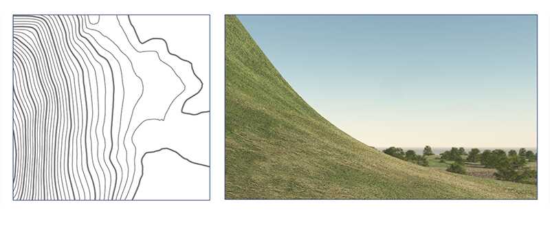
Contour lines showing a uniform, gentle slope will be evenly spaced and wide apart. Easy walking.
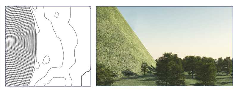
Contour lines showing a uniform, steep slope on a map will be evenly spaced, but close together. Very challenging, or impossible walking (i.e. contour lines may be so close that they create an impassable cliff line).
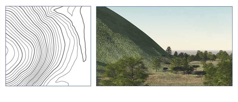
Contour lines showing a concave slope on a map will be closely spaced at the top of the terrain feature and widely spaced at the bottom. Bushwalkers going up the slope will find the terrain increasingly steep and challenging.
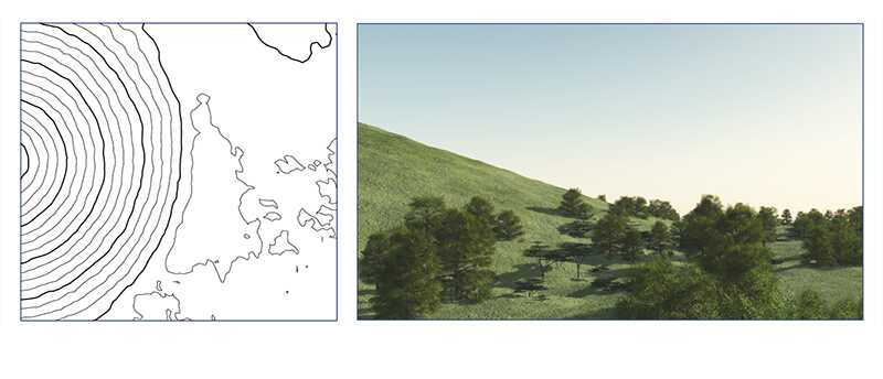
Contour lines showing a convex slope on a map will be widely spaced at the top and closely spaced at the bottom. Bushwalkers going down the slope cannot observe most of the slope or the terrain at the bottom, so extra care must be taken when route finding.