All terrain features are derived from a complex landmass known as a ridgeline, not to be confused with a ridge.
The US Army states that “A ridgeline is a line of high ground, usually with changes in elevation along its top and low ground on all sides from which a total of 10 natural or constructed terrain features are classified”.[1] By comparison, a ridge is a sloping line of high ground.
Major terrain features include hills, saddles, gullies, ridges, and depressions, and they each have characteristic contour lines that make it easy to pick them out in the landscape.
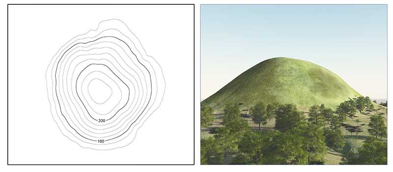
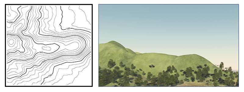
A hill, peak, knoll or mountain is an area of high ground. From a hilltop, the ground slopes down in all directions. A hill is shown on a map by contour lines forming concentric circles. The inside of the smallest closed circle is the hilltop.
- Hill = an area of high ground; generally, a smaller and rounder than a mountain, and less steep.
- Knoll = small, rounded natural hill.
- Mountain = a very tall hill, generally with a minimum size of 600m, but varies around the world.
- Peak = a mountain with a pointed top.
- Munro = a Scottish mountain taller than 3,000 feet (914 m).
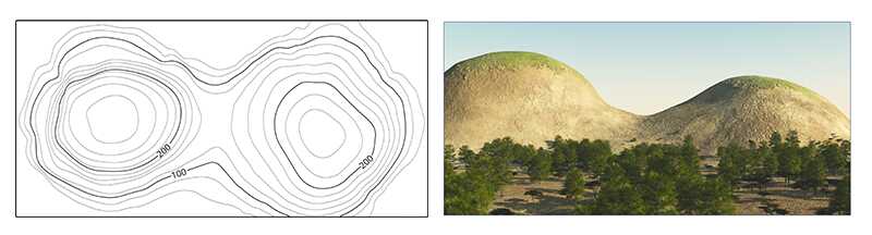
A saddle is a dip or low point between two areas of higher ground. A saddle is not necessarily the lower ground between two hilltops; it may be simply a dip or break along a level ridge crest. When standing in a saddle, there is high ground in two opposite directions and lower ground in the other two directions. A saddle typically looks like an hourglass.
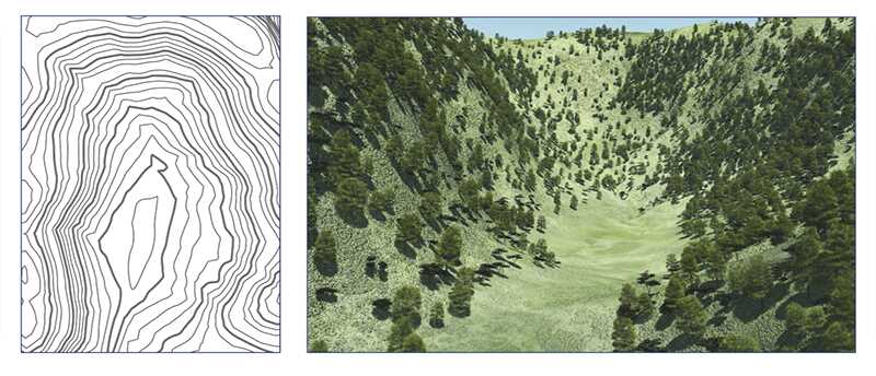
A gully is a stretched-out groove in the land, usually formed by a watercourse, and has high ground on three sides. Depending on its size and location water sometimes flows through it, from high to low. Contour lines forming a gully are either U-shaped or V-shaped. To determine the direction water is flowing, look at the contour lines. The closed end of the contour line (U or V) always points upstream or toward high ground. A valley is a large gully, often very flat, wide and open with a large watercourse running through it.
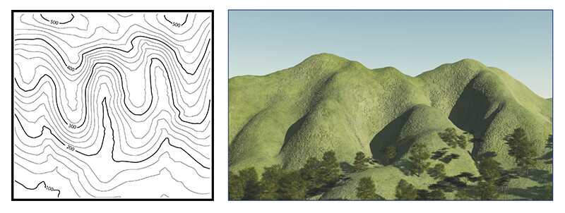
A ridge is a sloping line of high ground. When standing on the centerline of a ridge, there is usually low ground in three directions and high ground in one direction with varying degrees of slope. When crossing a ridge at right angles, there is a steep climb to the crest and then a steep descent to the base. When moving along the path of the ridge, depending on the geographic location, there may be either an almost unnoticeable slope or a very visible incline. Contour lines forming a ridge tend to be U-shaped or V-shaped. The closed end of the contour line points away from high ground.
On a map, a ridge is depicted as two contour lines (often of the same contour) running side by side at the same elevation for some distance. When the lines diverge, the ridge is either flattening out to a high plateau or continues to rise with additional contour lines. When the lines converge, the ridge is falling in elevation, creating a spur.
Closed contour loops represent hills or bumps along the ridgeline.
A spur is a short, continuous sloping line of higher ground, normally jutting out from the side of a ridge. A spur is often formed by two roughly parallel streams cutting draws down the side of a ridge. The ground will slope down in three directions and up in one. Contour lines on a map depict a spur with the U or V pointing away from high ground.
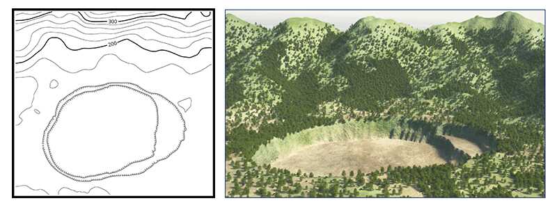
A depression is a low point in the ground or a sinkhole. It could be described as an area of low ground surrounded by higher ground in all directions, or simply a hole in the ground. Usually, only depressions that are equal to or greater than the contour interval will be shown. On maps, depressions are represented by closed contour lines that have tick marks pointing toward low ground.
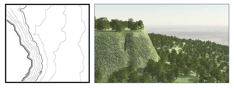
A cliff is a vertical or near vertical feature; it is an abrupt change of the land. When a slope is so steep that the contour lines converge into one “carrying” contour of contours, this last contour line sometimes has tick marks pointing toward low ground (image below). Cliffs are also shown by contour lines very close together and, in some instances, touching each other.
Topographic maps cannot always be used to identify cliffs, however, particularly on those with 20m contour intervals, and hence some steep areas require careful negotiation.