Best Walks of Tasmania
Matt McClelland aka Wildwalks
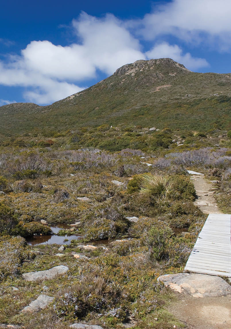
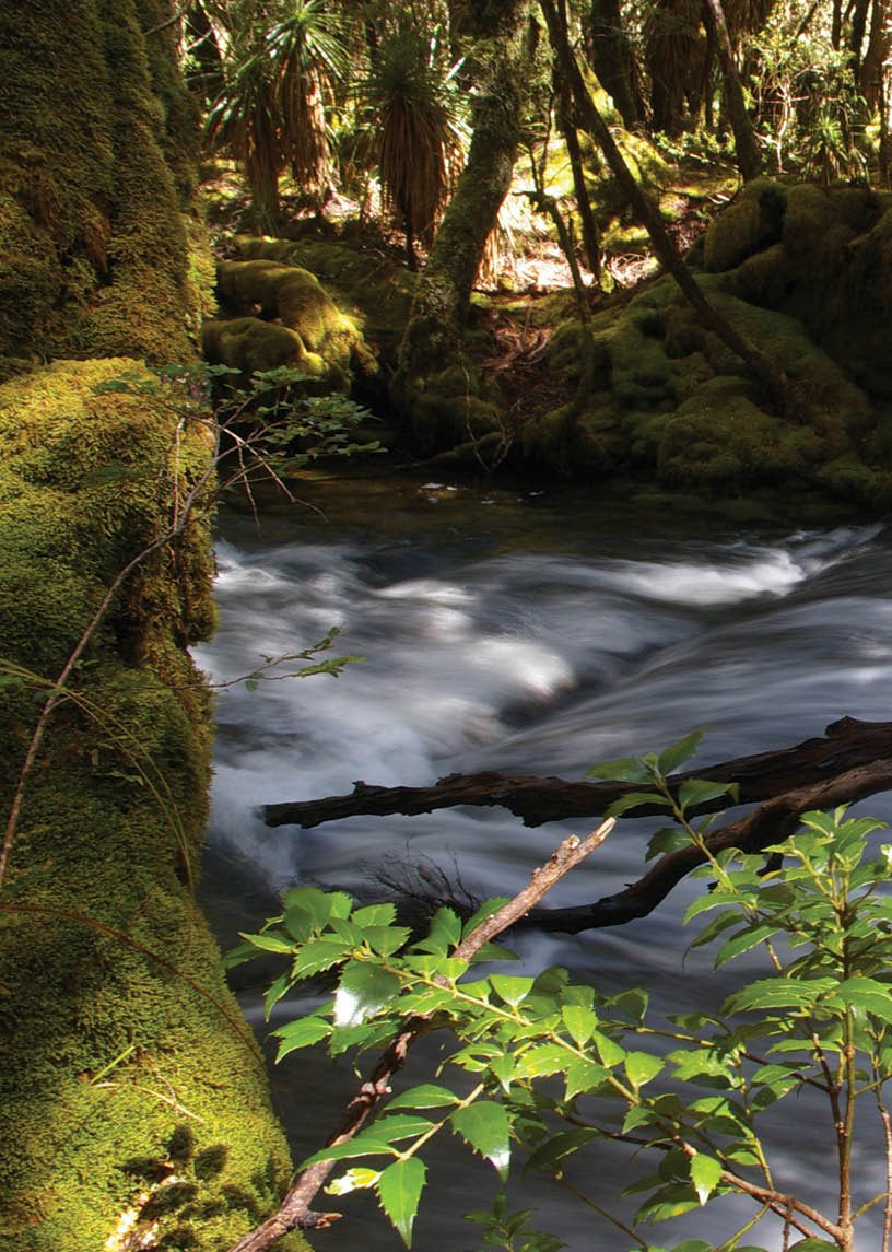
Tasmania has a special place in the heart of every Australian bushwalker. If you have not walked there yet, you must. If you have walked there, you are most likely planning another trip back, with a better raincoat.
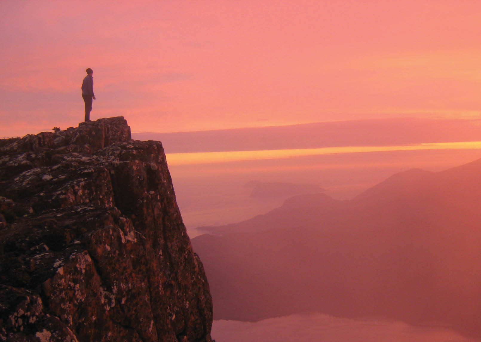
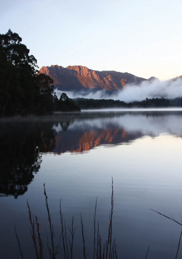
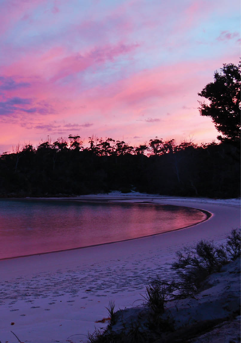
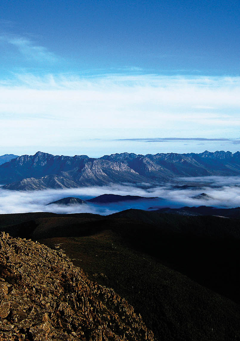
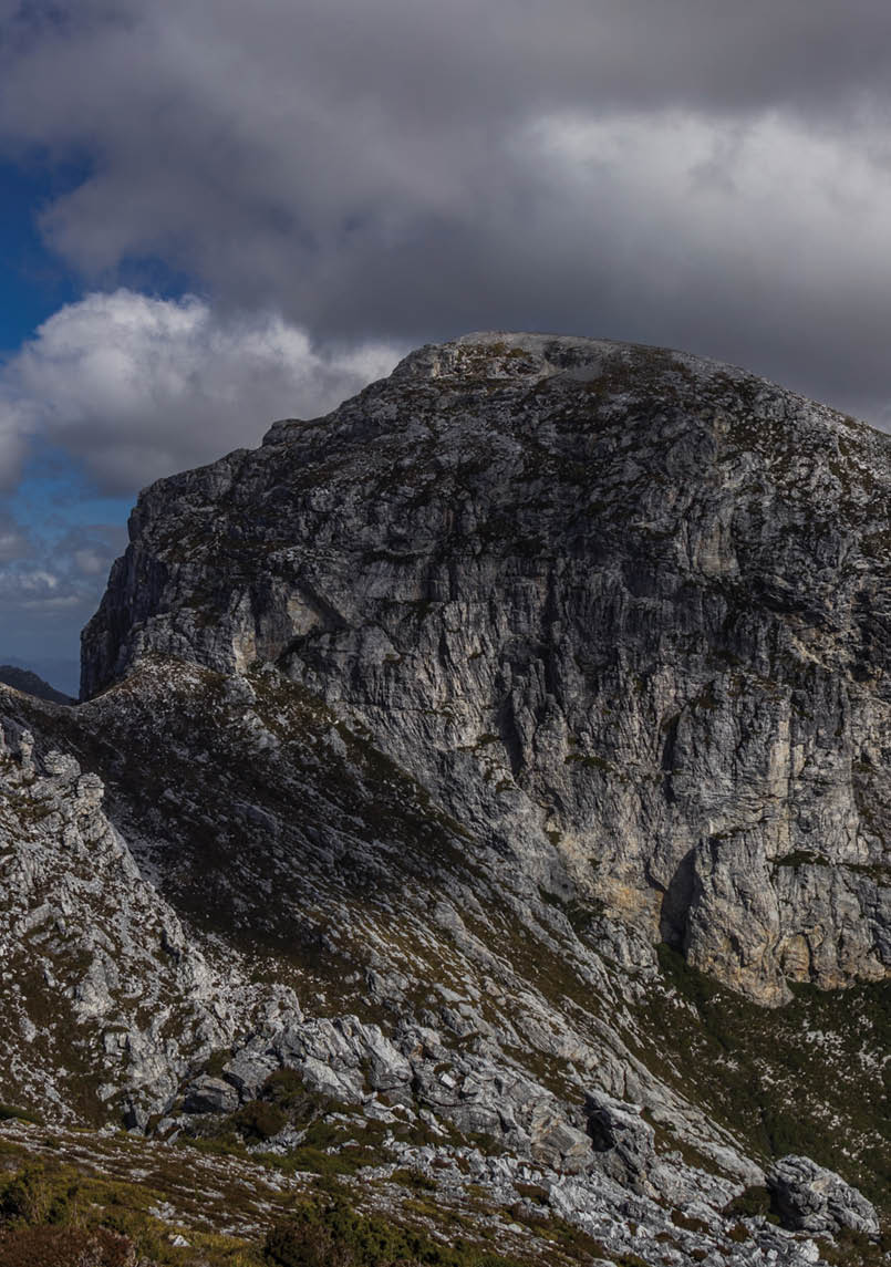
Sunset on Precipitous BluffKoolix
6 | BWA December 2015
My first walking trip to Tasmania was as a 16-year-old Venturer (Senior Scout). I led a small group of five friends for 10 days on the Overland Track. I was horribly under-prepared for the trip - I even forgot to pack a billy. Regardless of my poor preparation we had the most amazing trip, and it really hooked me into a lifetime love of walking. I’ve been back and done versions of the track in different seasons; winter is my favorite time.
My most recent Tassie walking trip was just a few days wandering into Lake Meston and the Walls of Jerusalem. This was a stunning walk just as the fagus was turning golden and the snow was falling. Scott was going to teach me to fly fish, we saw no fish, not one – but we had an amazing time exploring the lakes and the peaks. I need about 10 life times to get through all the walking I would love to.
Now, let’s get one thing straight, the title of this article boldly claims that I will share with you a list of the best walks in Tasmania. I know there will be some debate. How about we just agree to call it “a bunch of bloody good walks in Tasmania”. This list of walks was created by you, our readers through the voting system (vote now for next edition, Best of Victoria). People cast over 200 votes for different walks. Many of you made comments like “How can you make me choose just a few favorite walks”. Most of the walks suggested made it in, a few were cut out because they pass through very sensitive areas and we thought it unwise to promote them. Many of these listed walks are in sensitive areas, so we all always need to make sure we Leave No Trace.
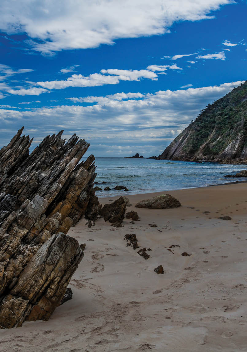
Tasmania is the smallest and only island state in Australia. It has a significant area dedicated to national parks and other protected areas. You will also find vast wilderness areas – often contiguous - that are largely protected. All walks have stunning views, either from summits, open plains or at beautiful beaches and lakes. This island state is one of the most mountainous islands in the world. People come to Tassie to see and experience nature. There is a risk that places like this can be loved to death. Some seek to “develop” places, in the hope of making it even better, but in doing so destroy the very
reason they loved it in the first place. Equally, as places become more popular, a lack of infrastructure and a lack of “Leave No Trace” principles can lead to great damage. It is a tough game keeping these places pristine for our children’s grandchildren, but a challenge we must take on and win.
Some easier walks
Tassie is dotted with many easier and shorter walks. Even the cities have walks that are worthy of a wander. My kids enjoyed Cataract Gorge at Launceston and Mt Wellington in Hobart is an amazing place for the variety of terrain, vegetation and weather. Freycinet and Maria Island are very popular with families, couples and, well, most people. The Mt Field plateau, Cape Hauy/Raoul, The Walls of Jerusalem, Mt Murchison, Mt Anne area, Bay of Fires are all worth seeing. It’s encouraging that park management have created good access and comfortable trail heads, giving many people a taste of what these wild places are like. My hope is that, those who start with the shorter walks will enjoy them and continue to develop a lifelong love of walking and caring for these places.
Harder walks
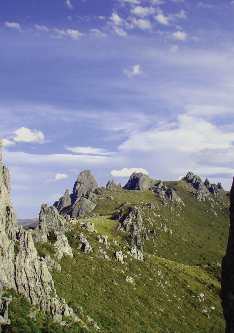
The western, central and south parts of Tasmania abound with major destinations that experienced bushwalkers dream of – Western Arthurs, Federation, Port Davey and South Coast Tracks, the Walls of Jerusalem, the Central Plateau and Tarkine are but a few among many. There are areas that you can walk that are not documented or promoted to help limit numbers and avoided the creation of tracks in very fragile ecosystems.
There are several very well maintained multi-day walks on offer. The most renowned is The Overland Track in the Cradle Mountain-Lake St Clair National Park. The 65-83 kilometre track goes from the north to south and can be done in 5-6 days. I reckon 5-10 days is better, as it gives you time to explore the side trips to Cradle Mountain, Mount Ossa (highest peak in Tasmania), Barn Bluff, the waterfalls and many more great places. My favorite side trip is into the Pine Valley, where you can make your way up to The Acropolis and The Labyrinth.
BWA December 2015 | 7

The following pages are a compilation of best walks based on a survey by readers from last edition of BWA.
The latest edition to the overnight walks is the Three Capes Track near Port Arthur. This is brand new four day, 46 kilometre walk follows a rugged coastline. At just shy of $500 an adult, my jaw dropped, but that is for three night’s comfortable accommodation, a boat trip to the start, a bus trip back to Port Arthur and maps. Way more expensive than most bushwalks, but this is not just another bushwalk. I reckon it will be popular and a great way for many people, particularly those who don’t like the idea of a tent or heavy pack to try overnight walking.
Want to know more?
Websites
Bushwalk.com is obviously a great place to share and discover information. Other websites where you can find more information on walks include
App
The 60 Great Short Walks App shows you how to get a good taste of Tasmania’s wild places.
Books
John Chapman and his classic books:
Cradle Mountain & Walls of Jerusalem National Parks
,
Hobart’s Best Bush, Coast & City Walks
Happy Walking


BWA December 2015 | 9


Tasmania

Mt Murchison (West Coast Range)
2.5 km return, 5 hours, Abels Vol 2; ajwatton.customer.netspace.net.auInitially the track climbs steeply through knurled rainforest, then takes you through a range of different alpine vegetation zones to an amazing glacial landscape of sharp mountains and lakes that resembles the Western Arthurs Range but on a day trip. Did I mention it is the highest peak in western Tasmania and so has far-reaching views of the west coast in one direction and the Cradle Mountain-Lake St Clair National Park close at hand in another?This is an imposing mountain when viewed from the Murchison Highway after having driven through Tullah. Pencil pines towards the summit are a nice reminder of being in Tasmania. Views over the towns of Tullah and Roseberry put life into perspective. Its ruggedness gives a taste of unique Tasmanian landscape, without having to spend days in mud in the south-west. Steep drop-offs and sloping rock require care, but no special skills. The full traverse (car shuffle needed) produces a great longish day walk but just out & back to the summit is one of the best five hours walk around.A relatively short steep ascent has you in a fantastic bowl of an amphitheatre with scattered alpine lakes/tarns. The easiest way to get an idea of what the Western Arthurs are like.
Mt Murchison dawnLouise Fairfax
Mt Anne (Southwest NP)
22 km return, 10 hours, South West Tasmania by ChapmanChallenging day walk, spectacular scenery.Sense of isolation. Tricky summit climb. Tough due to amount of elevation gain.Effort and time required, scenery, level of technical difficulty.Great views from the Mt Eliza plateau and a rewarding climb to the summit for the brave.
Mt Wedge (Southwest NP)
7 km return, 5 hours, 50 Family Walks in and around Hobart - Hardy & ElsonMt Wedge stands out as an accessible alpine summit that offers a reasonable challenge in that it’s a fairly strenuous but mostly protected and safe climb with simple navigation. It’s a relatively short walk of about 7 kilometres return and doable as a day trip from Hobart. The ascent through the forest is pretty and there is a short but steep scramble into the alpine zone before finally ascending to the summit. On a clear day the views over the southwest region are spectacular (acknowledging the unfortunate drowning of the area prominent from many viewpoints in the area). Apart from meeting a single descending party I had the mountain to myself.360 degree views of the Southwest World Heritage Area including Lake Pedder and Lake Strathgordon.
10 | BWA December 2015
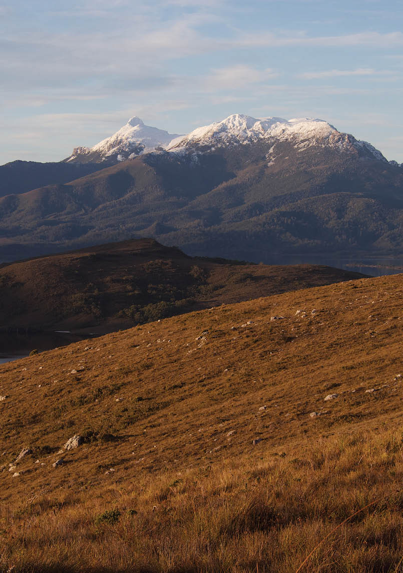
Mt Anne from Red Knoll Nicholas Clark

Tasmania


Mt Anne (Southwest NP)
22 km return, 10 hours, South West Tasmania by ChapmanChallenging day walk, spectacular scenery.Sense of isolation. Tricky summit climb. Tough due to amount of elevation gain.Effort and time required, scenery, level of technical difficulty.Great views from the Mt Eliza plateau and a rewarding climb to the summit for the brave.
Mt Wedge (Southwest NP)
7 km return, 5 hours, 50 Family Walks in and around Hobart - Hardy & ElsonMt Wedge stands out as an accessible alpine summit that offers a reasonable challenge in that it’s a fairly strenuous but mostly protected and safe climb with simple navigation. It’s a relatively short walk of about 7 kilometres return and doable as a day trip from Hobart. The ascent through the forest is pretty and there is a short but steep scramble into the alpine zone before finally ascending to the summit. On a clear day the views over the southwest region are spectacular (acknowledging the unfortunate drowning of the area prominent from many viewpoints in the area). Apart from meeting a single descending party I had the mountain to myself.360 degree views of the Southwest World Heritage Area including Lake Pedder and Lake Strathgordon.
BWA December 2015 | 11
Mt Field West (Mount Field NP)
18 km return, 8 hours, hikinginsetasmania.blogspot.si; 120 Walks in Tasmania
by Tyrone Thomas; South West Tasmania by ChapmanClimb Mt Field West with a visit to an alpine shelf walk with lakes, mountains and some beech trees. Good track, brilliant environment, magnificent views. Absolute fairytale land in April, with the nothofagus turning bright orange, the snow over everything and the tarns sparkling like multi-coloured jewels in the sunshine. A long day walk but well worth the effort. The side trip along the Tarn Shelf Track is gold and worth while, there are plenty of places to explore. Just under an hour’s drive from Hobart starting from Mt Mawson ski field.
Hartz MountainJJ Harrison


Tasmania
Hartz Peak (Hartz Mountains NP)
7.4 return, 3 to 5 hours, parks.tas.gov.auClose to Hobart. Alpine area, awesome views.Anyone can get up Hartz and the views are extensive across the SW including the iconic Federation Peak. It is the closest part of the World Heritage area to Hobart. You can be walking at altitude in 1 hour 20 minutes. Lovely alpine tarns and plenty of time to visit the Devils Backbone or Snowy along the ridgeline.The variety of flora in such a small space is wonderful. Feels quite remote, mountain scenery and views further south if you have decent weather. If you go at the right time (Dec - Jan I think) you should see a decent display of waratah flowering.Stunning views toward Federation peak (which is a couple of valleys across) and the south west. Not difficult, and has constantly changing features along the way. You are not just waiting to get there, the whole walk is a feast for your eyes!
12 | BWA December 2015

Tasmania
Mt Field West (Mount Field NP)
18 km return, 8 hours, hikinginsetasmania.blogspot.si; 120 Walks in Tasmania
by Tyrone Thomas; South West Tasmania by ChapmanClimb Mt Field West with a visit to an alpine shelf walk with lakes, mountains and some beech trees. Good track, brilliant environment, magnificent views. Absolute fairytale land in April, with the nothofagus turning bright orange, the snow over everything and the tarns sparkling like multi-coloured jewels in the sunshine. A long day walk but well worth the effort. The side trip along the Tarn Shelf Track is gold and worth while, there are plenty of places to explore. Just under an hour’s drive from Hobart starting from Mt Mawson ski field.
The edge, Tarn ShelfGayet
BWA December 2015 | 13

Tasmania
Wineglass Bay (Freycinet NP)
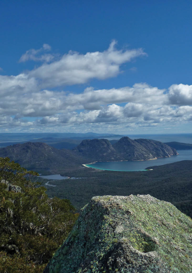
5 km return, 3 hours, parks.tas.gov.auIconic Tasmanian day walk. Coastal walk with interesting rock formations and being able to have a swim.Beautiful rock slab coastline interspersed with the whitest beaches imaginable and stunning azure waters, all overlooked by towering granite peaks. By walking the circuit you get to experience beaches on both sides of the peninsula, relative solitude on the coastal track and stunning views of Wineglass Bay from the Saddle Lookout (which can be a sociable time and seeing so many folk of different ways of life getting into the great outdoors can add to the experience).
Sunrise at Wineglass Bay Iaindtiler
Mt Amos (Freycinet NP)
4 km return, 3 hours, tastrails.comLovely views, nice track over granite rock, avoids the big crowds of the Hazards and Wineglass Bay Track.Constant views as you climb over Coles Bay and then the reward of Wineglass Bay on the other side. Just non-stop views that stretch so far.
14 | BWA December 2015
Mt Freycinet view Dan Broun

Tasmania
Mt Amos (Freycinet NP)
4 km return, 3 hours, tastrails.comLovely views, nice track over granite rock, avoids the big crowds of the Hazards and Wineglass Bay Track.Constant views as you climb over Coles Bay and then the reward of Wineglass Bay on the other side. Just non-stop views that stretch so far.
BWA December 2015 | 15

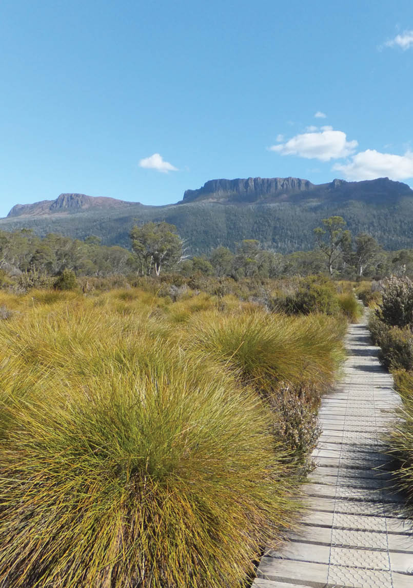
Walls of Jerusalem
(Walls of Jerusalem NP)
17 km return, 7 hours to Damascus Gate, parks.tas.gov.auA big day for the fit with great high scenery from King Davids Peak and Solomons Throne. The climb up Solomons Throne was steep but well worth while.While possible to do as day trip, The Walls is best done as a two or three day trip to take in all the peaks. Camp at Wild Dog Creek or Dixons Kingdom.

Tasmania
Cape Raoul (Tasman NP)
14 km return, 5 hours, tastrails.com; Day Walks Tasmania by ChapmanThe 200 metre high sea cliffs at the destination are spectacular. You walk through mixed vegetation from rainforest to heath. Breathtaking coastal views including down to the iconic surfing mecca of Shipstern Bluff. The ridgeline at the end of the steps 230 metres down to the sea. A short detour to the east allows a view down onto a seal haul out area on the cape. This is a great walk in winter as the clouds rarely obscure the view and the seas are big.
Cape RaoulLee
16 | BWA December 2015

Tasmania

Walls of Jerusalem
(Walls of Jerusalem NP)
17 km return, 7 hours to Damascus Gate, parks.tas.gov.auA big day for the fit with great high scenery from King Davids Peak and Solomons Throne. The climb up Solomons Throne was steep but well worth while.While possible to do as day trip, The Walls is best done as a two or three day trip to take in all the peaks. Camp at Wild Dog Creek or Dixons Kingdom.
The Walls Doogs
BWA December 2015 | 17

Tasmania
Cradle Mountain
(Cradle Mountain-Lake St Clair NP)
12.8 km return, 6 to 8 hours, parks.tas.gov.au; Day Walks Tasmania by ChapmanA longer and more challenging walk but the points of scenic beauty are many, from Marions Lookout to the Twisted Lakes, button grass, changing and challenging weather, colours, and the view from the top is one of the must see places in Tassie that you can get to in a day.Fantastic scenery, goes right up onto the Cradle plateau and then to the summit. Long and rewarding day walk, amazing views in good weather.I tried but just couldn’t leave this out, and it could just as easily be number one as could other variations in the Cradle Mountain day walk area. This really stands out as an icon, symbolic of Tasmanian bushwalking. Travelling down to Dove Lake on the shuttle bus for the first time the mountain is breathtaking as it appears to rear up above you and the surrounding landscape. You start the walk with that classic view from the lake and it just gets better (and steeper) from there. The ascent from near Kitchen Hut is a challenge for the uninitiated and the final summmit climb is not for the faint hearted. But if the weather is kind the views are absolutely worth it. The walk has sufficient challenge to feel like you’ve achieved something.Absolutely wonderful in winter.
Autumn light, Cradle Mountain Damien Walker
Marions Lookout
(Cradle Mountain-Lake St Clair NP)
4 km return from Dove Lake carpark or 7 km return from Ronny Creek carpark, 3 hours, bushwalktasmania.comSpectacular scenery in all weathers. Deciduous beech in Autumn, snow in winter, wild flowers in spring, great views any time.Steep uphill section to a great viewpoint over Cradle Mountain and Dove Lake.
Mt Pillinger
(Cradle Mountain-Lake St Clair NP)
9 km return, 3 hours,
Cradle Mountain-Lake St Clair & Walls of Jerusalem National Parks by ChapmanEasy access from Arm River track to Pelion Hut and expansive views of the SW over Lees Paddocks are the reward.A solid day walk to this dramatic peak gives access to front row seats to the spectacular mountains in the middle of the Overland Track - Mt Ossa, Pelion East and West, Ducane Range etc.
18 | BWA December 2015


Marions Lookout
(Cradle Mountain-Lake St Clair NP)
4 km return from Dove Lake carpark or 7 km return from Ronny Creek carpark, 3 hours, bushwalktasmania.comSpectacular scenery in all weathers. Deciduous beech in Autumn, snow in winter, wild flowers in spring, great views any time.Steep uphill section to a great viewpoint over Cradle Mountain and Dove Lake.
Tasmania

Mt Pillinger
(Cradle Mountain-Lake St Clair NP)
9 km return, 3 hours,
Cradle Mountain-Lake St Clair & Walls of Jerusalem National Parks by ChapmanEasy access from Arm River track to Pelion Hut and expansive views of the SW over Lees Paddocks are the reward.A solid day walk to this dramatic peak gives access to front row seats to the spectacular mountains in the middle of the Overland Track - Mt Ossa, Pelion East and West, Ducane Range etc.
Winter on the Overland Tigercat
BWA December 2015 | 19
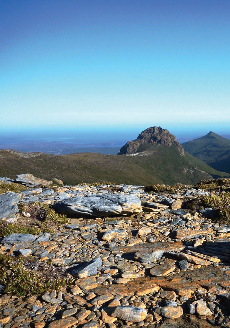
Mt Olympus from the Overland Track Hellsbellstaz


Overland Track
(Cradle Mountain-Lake St Clair NP)
65-83 km one way (depends where you start and end), 5-10 days (depends onhow much time you spend on side trips), Overland Track by Chapman andThe Overland Track guide by Frank and Sue Wall and Warwick Sprawson’s The Overland TrackOne of the world’s best bushwalks. Scenery changes every day. Fantastic facilities, organised from hut to hut, and easy access by public bus. Just awesome!Brilliant walk in winter, when the plateaus are covered in snow and there are very few people. The OLT has a remote feel due to the constant spatial vistas. Whether using a tent or the convenience of the huts it remains a must do on my list. Overnighting at Pine Valley was a feature for me along with a side trip to the Labyrinth. A final highlight was finishing the whole track by walking the length of Lake St Clair, spending a night at the tiny Echo Point Hut with the dramatic Mt Ida as a backdrop.Amazing! I’m looking forward to the day I can take my teenage daughter on this one.Get there by ferry or air. Self or professionally guided. Inexpensive if out of season. Great start. Varied vegetation and landscape. Gondwanaland Antarctic Beech trees (golden leaves about Anzac day).Never Never valley is beautiful. Nice scenic walk in Walls. No hard technical bits, just a good chance to relax and enjoy the views when it is not too crowded. It passes through amazing landscapes with every day offering a varied landscape. Mountains, lakes, rivers, forests, meadows, waterfalls. It has everything. The OLT is popular and must be booked early.


Tasmania
20 | BWA December 2015


Lees Paddocks
(Cradle Mountain-Lake St Clair NP)
31 km circuit, 3 days, bushwalk.com and Champan’s books
It is an easy walk to either Lees Hut or a little further on to Reg Wadley. Where there are plenty of lovely camping spots or you can stay in one of the huts (if you contact the owners for permission). The paddocks have a lot of history which combined with the old huts gives this area a wonderful nostalgic feel, particularly if the owners have their cattle on the property. A little bit like the Victorian high country (while not actually looking anything like it). Can be linked up with other “tracks” for longer walks. You can camp via the river, or at a Lees hut, summer evenings you can’t beat it.

Mt Ossa
(Cradle Mountain-Lake St Clair NP)
25.5 km return, 2 days,
Cradle Mountain-Lake St Clair & Walls of Jerusalem National Parks by ChapmanEasy access to great peaks in close proximity. Go in to Pelion Hut via Arm River Track. Use Pelion as a base then climb Mt Oakleigh, Mt Ossa, Pelion East and Pelion West.Effort required, scenery, climbing the state’s highest mountain.
Tasmania
Ossa, Pelion West & Pelion East from the Twin Spires MJD
BWA December 2015 | 21


Du Cane Range Traverse
(Cradle Mountain-Lake St Clair NP)
41 km circuit, 4 days,
Cradle Mountain-Lake St Clair & Walls of Jerusalem National Parks by ChapmanAnother spectacular walk with views of most of the mountains of the Reserve.A moderate off-track experience linked by on-track sections at either end of the walk, this walk is challenging and full of opportunities to explore and wander as the weather and energy allows. A myriad of lakes and mountains around The Labyrinth provide unparalleled scenery and side trip variations from the gentle Walled Mt to the sawtooth peaks of Mt Geryon and Mt Hyperion (confidence with heights and exposure essential). Lake Hyperion is gorgeous to camp at and explore.

Tasmania
Geryon and the Ducane range covered in spring snow ILUVSWTAS
22 | BWA December 2015


Pine Valley
(Cradle Mountain-Lake St Clair NP)
15 km return, 8 hours, 120 Walks in Tasmania by Tyrone Thomas and
Cradle Mountain-Lake St Clair & Walls of Jerusalem National Parks by ChapmanPine Valley is my most favourite place in the whole world. It can be done in a day (with the Lake St Clair Ferry), but that would be doing it an injustice.Narcissus Hut is easily accessible by ferry or a pleasant walk around the lake, and you are then a few hours away from Pine Valley, which makes a good base. Acropolis is a fun, satisfying summit with stellar views. The Labyrinth is a fascinating area with its myriad tarns and lakes, interesting vegetation and magical views of surrounding peaks.
Tasmania
Cephissus Falls, Pine ValleyAshley Carr
BWA December 2015 | 23

A shy Mt Anne Dan Broun


Mt Anne Circuit (Southwest NP)
4 days circuit, South West Tasmania by ChapmanThe best of South West Tasmania condensed into three brilliant days.Spectacular alpine scenery and opportunity to explore some interesting features for those in the known.Very beautiful, on a good day from Mt Eliza you can see the whole of the SW. Don’t be fooled by the apparent short distance, it’s tough and worth taking more than four days.A spectacular 3 night 4 day walk with options galore. You need good weather the day you climb Mt Anne so if your day 1 is poor start via Mt Sarah Jane, side-trip to Lots Wife, over Lot & tackle Anne on day 3 or 4. The Notch is slightly more awkward from the Mt Lot side but that adds to the challenge.
Tasmania
24 | BWA December 2015

South Coast Track (Southwest NP)
85 km one way, 7 days, tastrails.com; South West Tasmania by ChapmanCoastal scenery with the chance of seeing whales and dolphins as well as traversing alpine ranges and forests.Peter Dombrovskis said you don’t go out there to get away from it all, you go out there to get back to it all. The south coast is so wild, when you’re walking along a beach by yourself, with the ocean crashing beside you and the salty wind skimming over the waves, you’re like, hell yeah I’m in the wilderness.I did it alone and it’s a great walk because of the varied terrain. Ranges and rivers, mud and beaches. Walked it in late March and met no-one which gave me four days of isolated bliss.Isolation and the need to be completely self-sufficient. Diversity of Eco-systems from beach to mountain peaks above the tree line. Freezing fresh water shower/ waterfall at Granite Bay. Wow!
Tasmania
Surprise Bay, South Coast TrackNNW
BWA December 2015 | 25


Tasmania

Federation Peak via Eastern Arthurs
(Southwest National Park)
3 days return, Hobart Walking Club, Champan’s booksSpectacular views, challenge and achievement.
Federation Peak from the Four Peaks in the Eastern Arthurs ILUVSWTAS
26 | BWA December 2015

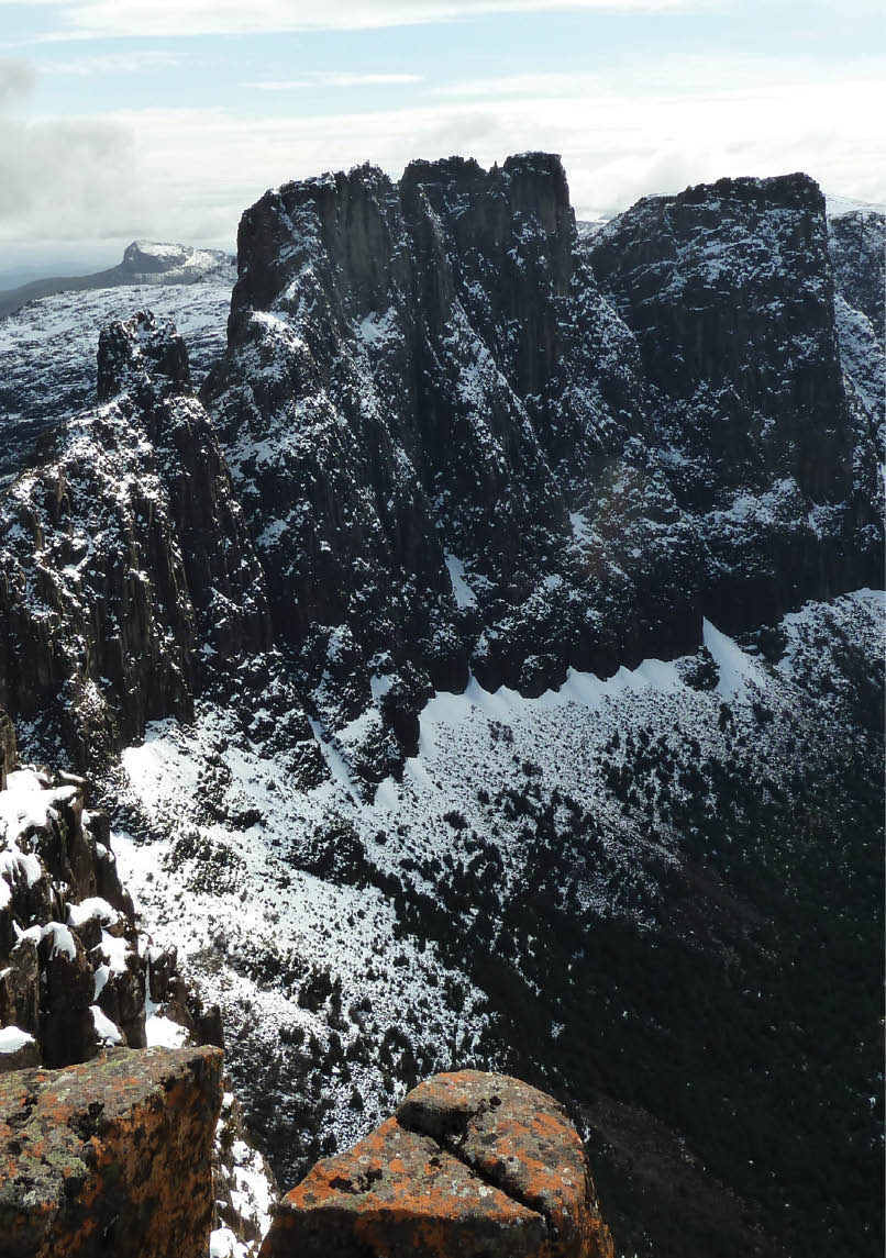
Western Arthurs Traverse
72 km one way, 9 days, South West Tasmania by Chapman; Bushwalk.comThe most amazing alpine scenery of Precipitous Peaks towering over Hanging Lakes that sparkle like jewels on a sunny day. Challenging walking, stunning campsite locations, great mountain climbing options on every day. Heaven on a stick.Australia’s best walk. Pretty tough at times but the scenery is unmatched anywhere.Challenging, worth taking plenty of time to enjoy the side trips and to stop for a day in places if you want to or if the weather is bad. We took 10 days and loved the beauty, serenity, grandeur, the challenge of the walk (we are both nearly 60). Every day is different. Experience in steep rocky terrain, and thorough preparation with lightweight gear, a four season tent, warm sleeping bag, waterproof gear, PLB, maps and good rope is absolutely essential. The first time we visited we didn’t take the rope we needed and headed back from Pegasus, determined to do it again, and we did. The weather cannot be underestimated and you will get torrential rain, wind, gales, possibly hail and snow. We had all of these in summer.
Tasmania
The Mighty Western Arthurs Dan Broun
BWA December 2015 | 27

Southern Ranges Traverse
33 km return, 6 days, gang-gang.netExtended trip - many nights.Great variety of mountains and coastal walking, including perhaps the most picturesque mountain in Tasmania, Precipitous Bluff. Reaching the campsite of Precipitous Bluff - amazing. Real hard “ track” walk - with some technical bits and unblemished wilderness and volatile weather. Real sense of isolation and escape with some navex ( in fog) to boot. Nice camping.It has a bit of everything - high range traverse and then out via the South Coast track so you get a coastal walking as well.Pure wilderness: rugged, remote, high mountains, amazing geology and vegetation, PB, New River Lagoon, South Coast Track.
Tasmania
Late afternoon on Moonlight Ridge, Southern Ranges Stuart Bowling
28 | BWA December 2015


Mt Jerusalem
(Walls of Jerusalem NP)
30 km one way, 2 days, parks.tas.gov.au/;
Cradle Mountain-Lake St Clair & Walls of Jerusalem National Parks by ChapmanWalk from the car park near Lake Rowallan up through the forest and in to the open alpine area then to Herods Gate. Continue onto Mt Jerusalem via the hut and campsite at Dixons Kingdom. Optional side trips to Solomons Throne and The Temple.Away from the crowds of Cradle Mountain, fantastic scenery in all directions, beautiful campsites.Great off season walk .Just lovely scenery and fairly easy to do. Favourite part is the walk between Dixons Kingdom and Wild Dog Campsite. Campsite and tracks are really superb as well.Truly spectacular alpine scenery including lovely stands of old pencil pines and the ability to do a variety of different walks. Because it’s all reasonably high you have amazing views to other mountain ranges (weather permitting). Fairly easy to link with the Overland Track with several off-track options.
Tasmania
King Davids Peak, West Wall and the main basin from the West WallGenesis
Mt Rogoona (Walls of Jerusalem NP)
9.5 km return, 2 days,
Cradle Mountain-Lake St Clair & Walls of Jerusalem National Parks by ChapmanPleasant climb through eucalyptus forest to more open areas passing Lake Bill and on to the camp at beautiful Lake Myrtle. Rogoona towers behind the campsite and is easily climbed in a three hour return trip. Great views from the summit.Camping by the lake, then summiting to get stunning views of all the main peaks along the Overland Track. It can be done as a day walk though.
BWA December 2015 | 29


Frenchmans Cap
(Franklin-Gordon Wild Rivers NP)
46 km return, 4 days, parks.tas.gov.au/; Frenchmans Cap map and notes 1:50,000Fantastic scenery, great outlook on the way up. Beautiful lakes, and the view from the summit is absolutely stunning.The huts are great and the climb to Baron Pass is rewarded with great views. Adventurous feeling but with track upgrades highly accessible walking.
Tasmania
Frenchmans from the Irenabyss TrackNNW
30 | BWA December 2015


Lake Rhona (Franklin-Gordon Wild Rivers NP)
28 km return, 2 days, tastrails.com and South West Tasmania by ChapmanSpectacular photogenic lake with quartzite beach.Magnificent views along the Dennisons. Not as crowded as the more popular Overland Track or Walls of Jerusalem.You can camp on a pink quartz beach 70 kilometres from the sea. An easy ascent to Reeds Peak 400 metres above your campsite and on to Bonds Craig and then a steep descent to your campsite.

Tasmania
Morning mist around Lake Rhona, SW Tasmania Stuart Bowling
BWA December 2015 | 31


Cape Pillar (Tasman NP)
30 km return, 2 days, tastrails.comBeautiful 300 metre sea cliffs, ocean views. Now also part of the Three Capes Walk and currently going through significant maintenance. Will be re-opened at the end of December. It can be done separately to Three Capes Walk.

Tasmania
Cape Pillar and Tasman Island Steve
32 | BWA December 2015


Tasmania
Freycinet Doogs
Freycinet Peninsula Circuit
(Freycinet National Park)
31 km circuit, 3 days, parks.tas.gov.au
It’s a coastal national park walk with easy tracks and lovely campsites over looking sheltered beaches like Wineglass Bay, Harzards Beach and Cooks Beach. Unusually, in the height of the season you would only find a few other tents along the beach from you. It’s uncrowded wilderness with pristine clear water in which you can to swim naked.It’s can be a 2 or 3 day walk with choices of entirely coastal tracks or over Mt Freycinet and Graham for some stunning views and even a patch of rain forest.

Wineglass Bay
(Freycinet National Park)
12 km return, 2 days, discovertasmania.com.auCrystal blue water and dazzling white sand. Fantastic little camping area at the end away from the crowds. The serenity and beauty of the beach, swimming, the colours of sunrise and sunset, and the possibility to stretch your self and go up Mount Freycinet as a day trip.
BWA December 2015 | 33