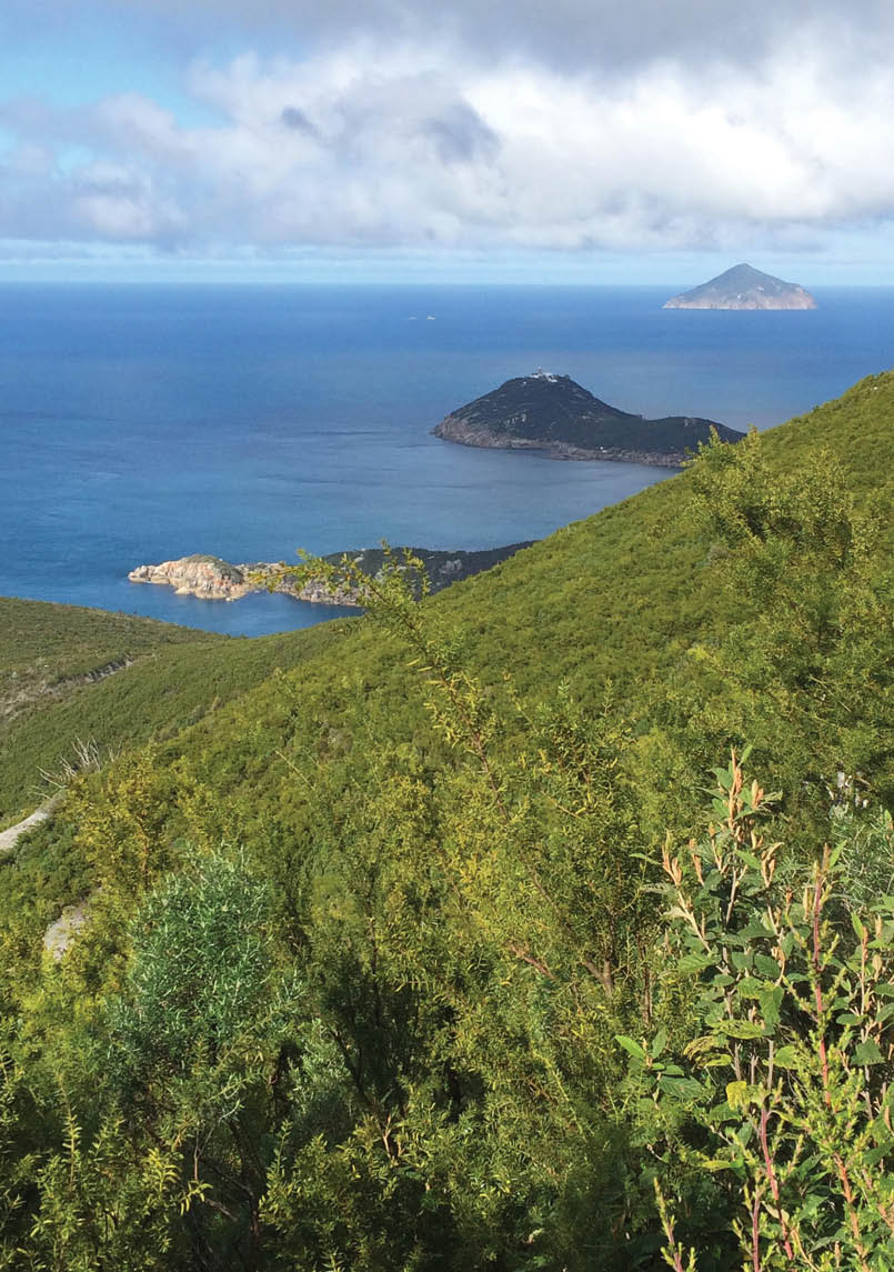

A view towards South East Point and Rodondo Island, Tasmania in the background

Wilsons Prom - Southern CircuitHamish Scott aka Scoha

There’s no doubt The Prom is a gem, and for people living in Melbourne or south-east Victoria it’s a jewel in the crown of terrific walking trips with easy access. The Prom is a place which can be overlooked, or considered “done” and hence there’s no need to return. This article describes a walk in August 2015.
30 | BWA February 2016
I’ve just completed two fabulous Prom trips and could go back this weekend and get something different again. (But don’t tell anyone because then it might get crowded.)
In August 2015 I turned to the southern circuit, which is very much more popular and more straightforward than the northern Prom, but every bit as rewarding. This time I did the trip solo as a final preparation for my solo AAWT later in the year.
Day oneBeing winter I parked at Telegraph Saddle. In summer or busier periods there’s a shuttle service from Tidal River. Leave Telegraph Saddle and head south down a closed road. It’s not that exciting being on a road so this stage is just about refamiliarisation of body and pack and getting a steady rhythm going. It’s about 6.5 kilometres to the Oberon Bay turnoff to the west and the Waterloo Bay turnoff to the east. Then a short walk south to Halfway Hut, built to support the lighthouse and connected telegraph line. The hut has withstood the ravages of weather, bushfire, flood and campers for over a hundred years and is still in great shape.
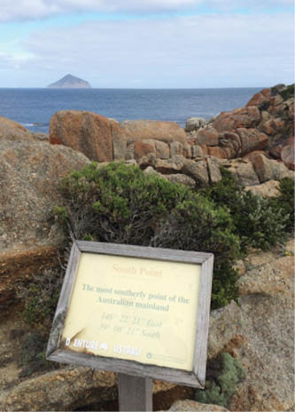
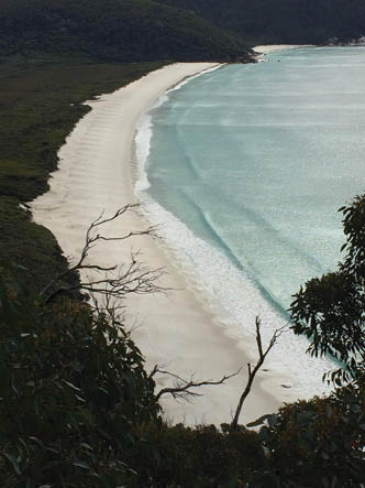
Not long after the hut the road becomes a walking track to the Roaring Meg campsite, a nice camp by a little river with very inquisitive ravens. Set up the tent and then walk 3.6 kilometres to South Point, the southern-most point on the Australian mainland. Just off the coast are a number of islands. The closest is Rodondo Island, about 10 kilometres away, which is interestingly in Tasmanian waters. So you can very definitely see Tasmania from South Point, an inspiring sight.
Day twoNext day I headed across the very well kept track to South East Point, all the while getting nice views across Bass Strait and the various Tasmanian islands. South East Point is where the famous lighthouse built in 1857 sits gazing across some of the world’s roughest oceans, though on this day it was pancake flat (well a bit of a lumpy pancake anyway).
There’s a really interesting museum as part of the lighthouse, and if you get the opportunity, it’s very worthwhile to get a tour of the lighthouse itself. Sea Eagles soaring in the constant breeze were beautiful to watch.
Southern tip of Australian mainland
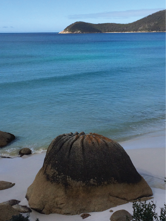
Dim Sum Prom-style! Waterloo Point from Waterloo Bay
BWA February 2016 | 31
Then I went northish on a relatively new track, the South East Walking Track, which connects South East Point with Waterloo Bay on the east coast of The Prom. There are lots of little runoffs along the way so there’s plenty of water. After about 10 kilometres the track descends to Waterloo Bay, a classic intense white quartz sand beach and oh, so beautiful. The sea is clear and blue and looked very tempting for a swim, but being winter I knew it would be a bit brisk so opted to just enjoy it from the beach. From
Waterloo the trail cuts over headlands to get to the Little Waterloo Bay camping area, which was empty. Some really nice rainforest walking followed before gradually climbing to the lookout at Kersop Peak, with distant views way back to the lighthouse about 12 kilometres away.
Its only about 45 minutes to the Refuge Cove camp site, again deserted. Refuge Cove competes for the most beautiful place in the world. Big call I know but go there and let me know why it isn’t! Had the place to myself which was sublime, and the ever present ever inquisitive ravens. The water was so clear it looked like liquid glass.
Day threeBreakfast looking over Refuge Cove makes porridge and dates like the full buffet at the Windsor - too much to look at and hoping you can absorb more than is actually possible. Unfortunately, I had to eventually leave this little slice of heaven and headed through tall eucalyptus forest up to Horn Point, where it started to rain in true winter style and didn’t stop for the rest of the day. The track went to the hugely popular Sealers Cove, though at this time it was completely deserted. Boots off for the fording of Sealers Creek; fortunately the tide was low and therefore it’s calf height only. High tide means swimming, so match the time of your crossing with your enthusiasm for a dip and you’ll be fine. In my case, torrential rain and a temperature hovering around 8 degrees Celsius made low tide a great time for crossing!
There was a 500 metre walk up the beach and then into the forest. It seems unlikely that the stubbies and beach BBQ rubbish on the track would have been left by bushwalkers, which means that the culpits were probably boaties, horrifying and disappointing all in one. How people could come here and selfishly desecrate such a place in incomprehensible - surely the place was enjoyed at the time.
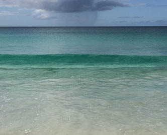
Pristine water - cold in winter!
Waterloo Bay
“... it was seriously considered that the trail might never be able to be re-opened ...
“... too much to look at and hoping you can absorb ...
32 | BWA February 2016

Anyway, onwards through the rain - really raining rain - through the rainforest on the duckboards that have been installed through there swamp. It felt just right to be walking through such heavy rainforest swamp in such heavy rain.
I negotiated a few areas where the floods of March 2011 had closed the track, re-opened in June 2013 after much painstaking dedicated and effort by Parks Victoria - a great job. At one point there was discussion on whether the track could be repaired because the damage was so extensive.
Wilsons Prom - Southern Circuit map
Refuge Cove
Refuge Cove
Roaring Meg Hut
Roaring Meg Hut
BWA February 2016 | 33

Refuge Cove - most beautiful place in the world?
Having the track closed would have been a huge blow to Australian walking. Leaving the duckboards the trail gradually climbs up to Windy Saddle.
Eventually I reached Telegraph Saddle and the warmth of the waiting car.
This is a must do walk. It’s on great tracks, well set up camps and has spectacular scenery - if it’s summer don’t dare do it without some discreet means of swimming.
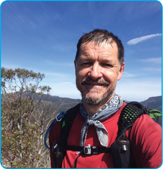
Hamish has been bushwalking from a early age, initially accompanying his botanist father on field plant collection trips. Memorable walks include the Western Arthurs, Overland Track, Walls of Jerusalem, Kiandra to Kosciusko both ways and during winter and anywhere in Wilsons Prom. Most recently he completed the AAWT solo from the north between Canberra and Walhalla. Hamish lives in Melbourne with his family and loves eating, Shiraz and Gippsland in roughly that order. Planning for the next trip has not yet been socialised!


“ Having the track closed would have been a huge blow to Australian walking

34 | BWA February 2016