

Best walks of Victoria
Stephen Lake

Victoria has a wide range of landscapes, including desert, alpine, beach, and rainforest.
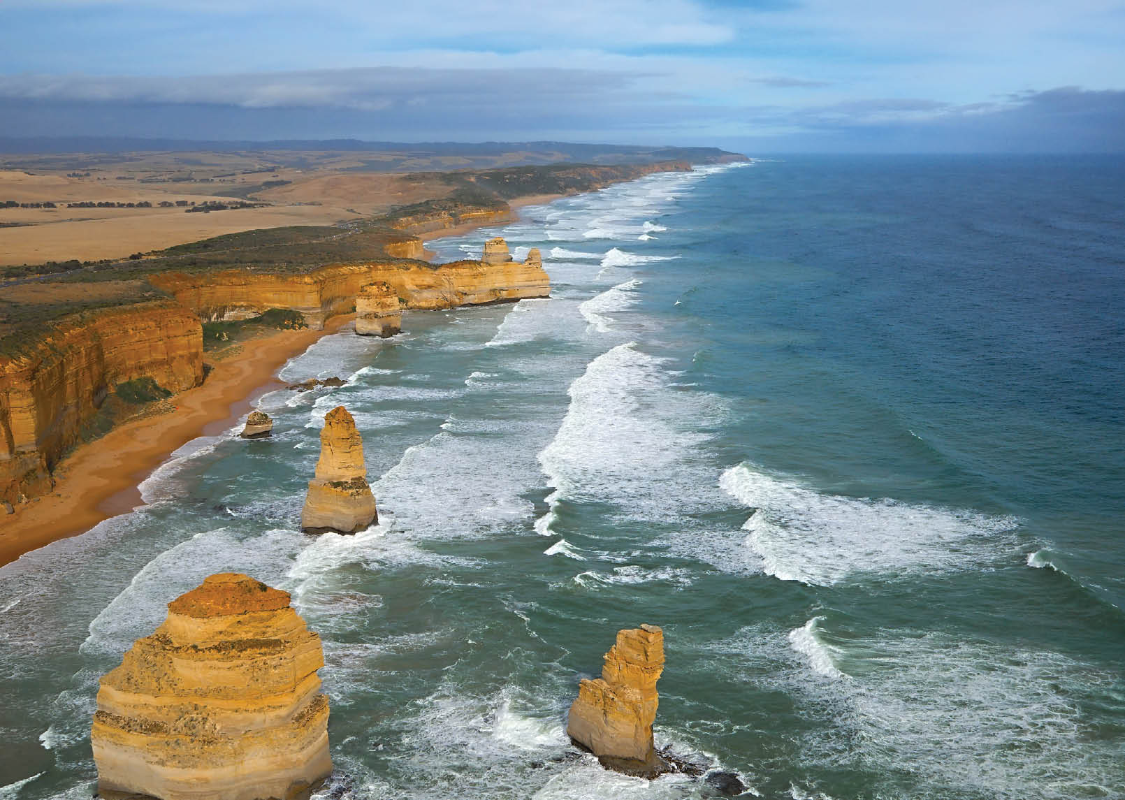
Great Ocean RoadGudellaphoto
6 | BWA February 2016

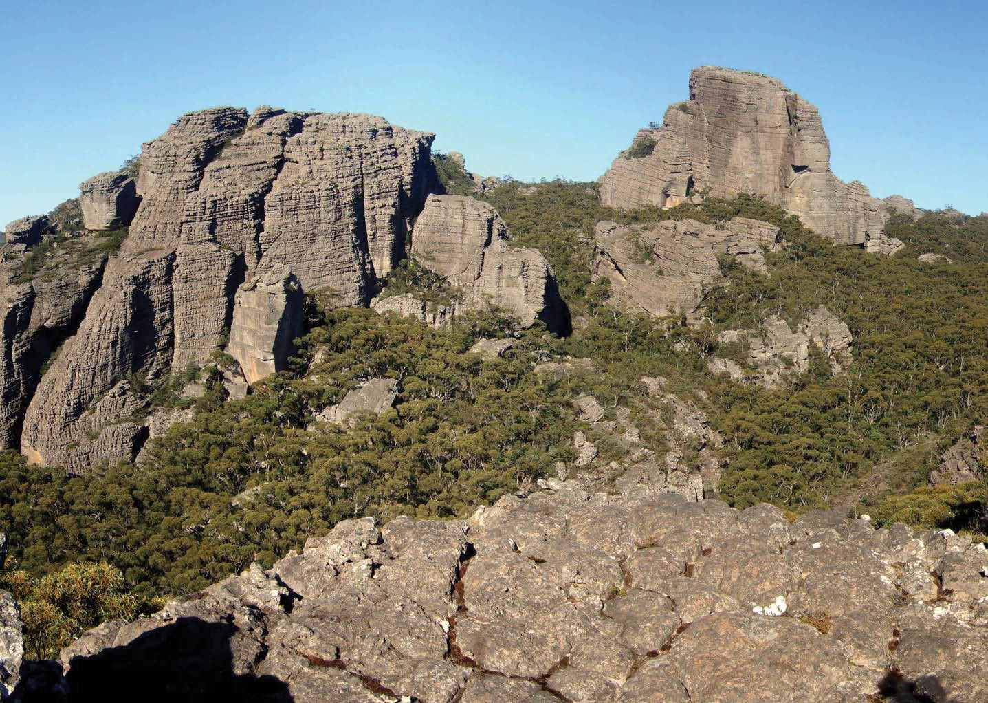
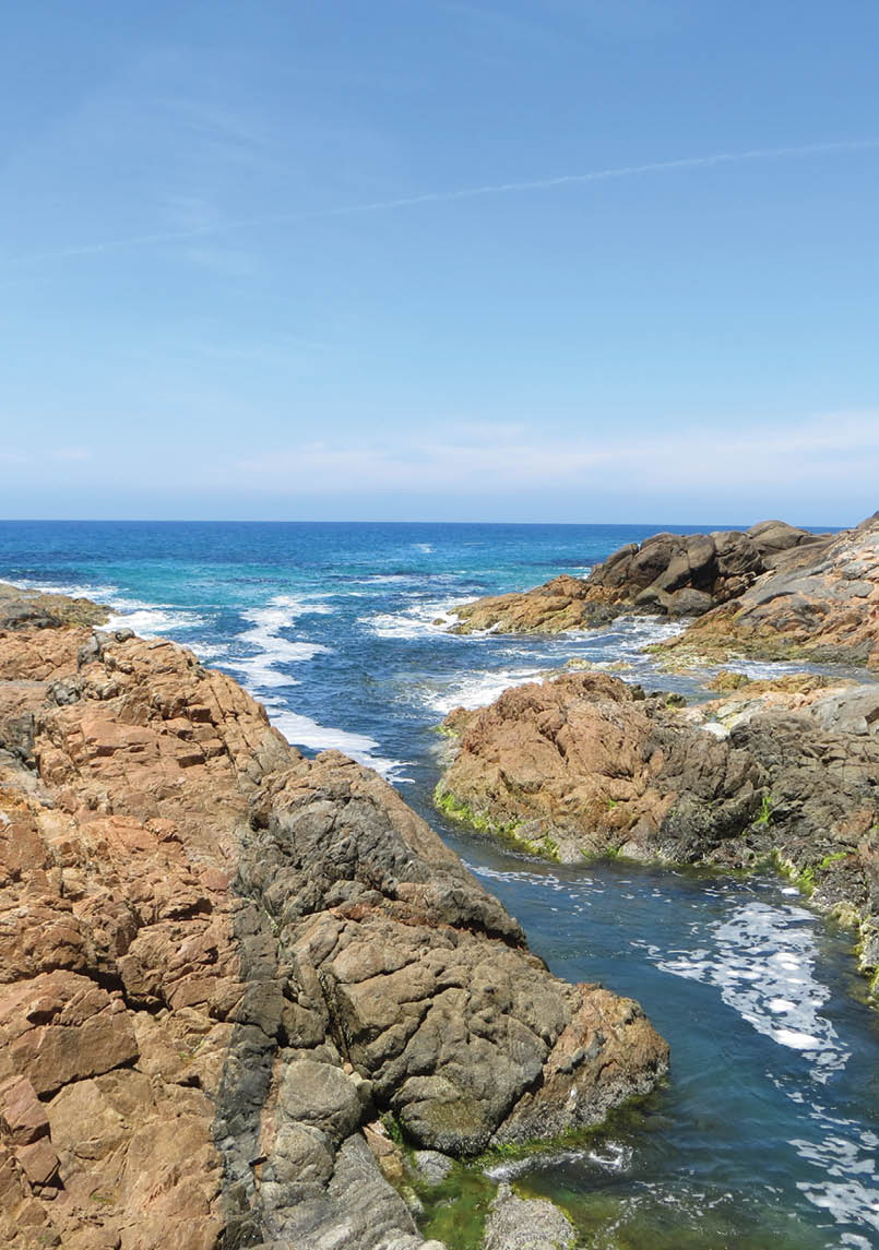
The west and north-west are hot, dry and arid, with Hattah-Kulkyne NP, Wyperfeld NP and Little Desert NP offering flat walking that’s delightful in spring when flowers bloom. The Grampians aka Gariwerd NP has rugged cliffs and terrain such as The Fortress that challenges and delights many. In the south-west, Discovery Bay Coastal Park, Lower Glenelg NP, Port Campbell NP and the Great Otway NP have an excellent range of walks, with the Great South West Walk and the Great Ocean Walk for longer trips.
Central Victoria includes a large number of parks and pleasant walking areas – Mt Cole, Wombat State Forest, Whipstick, Strathbogies, and many more. The apparent small size is often deceiving; it’s possible to get a sense of remoteness close to the road.
There are numerous bushwalking areas near Melbourne: You Yangs, Brisbane Ranges NP, Werribee Gorge, Lerderderg Gorge, Mt Macedon, Kinglake NP, Cathedral Ranges, Yarra Ranges NP, Mt Donna Buang, Dandenong Ranges NP and Blue Range. Most of these are quite suitable for day trips or easy overnight trips. The sprawl that’s Melbourne has many small areas of bush or places away from the vehicles that choke our streets. The Yarra River and its tributaries have tracks, usually shared with cyclists. One innovation has been to turn disused railway alignments into paths, rail to trail. These
are quite lovely to walk on, and can also be found in rural areas, like the Wangaratta-Bright and Wodonga-Cudgewa Rail Trails.
Gippsland has a good selection of areas: Baw Baw NP, Avon River, Mitchell River NP, Grand Strzelecki Trail, Snowy River NP, Reedy Creek Chasm, and Croajingalong NP. One of the gems of Victorian bushwalking is Wilsons Promontory NP, known more simply as Wilsons Prom or The Prom, a good place for beginner overnight walks. To cater for the significant demand and preserve the environment there’s a booking system, which some find to be a burden. I can’t see another option.
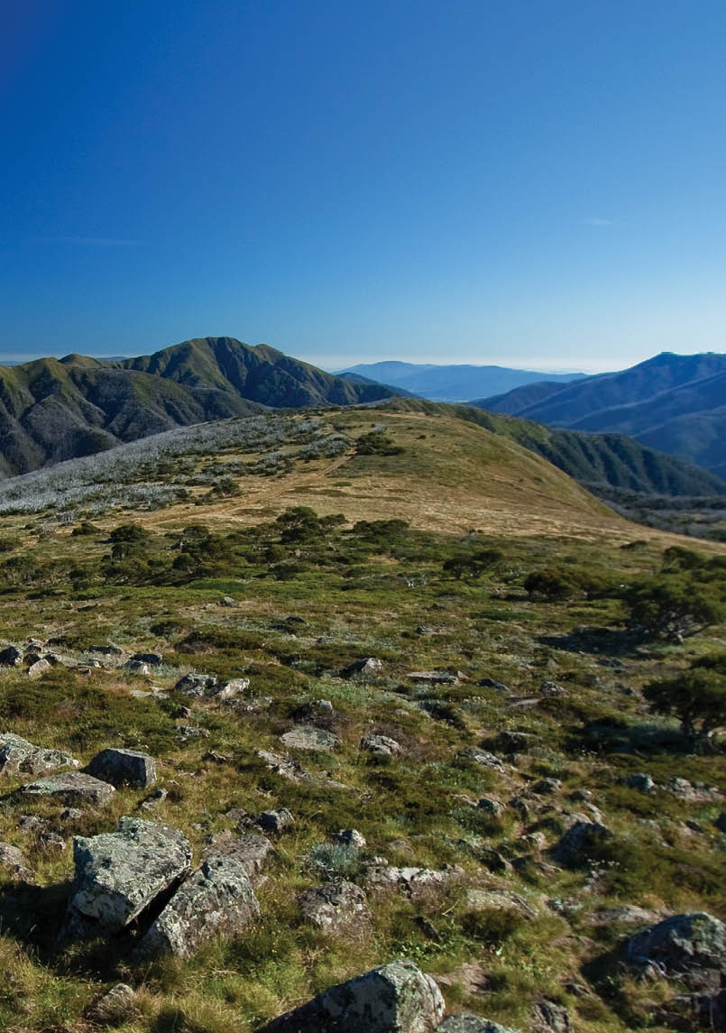
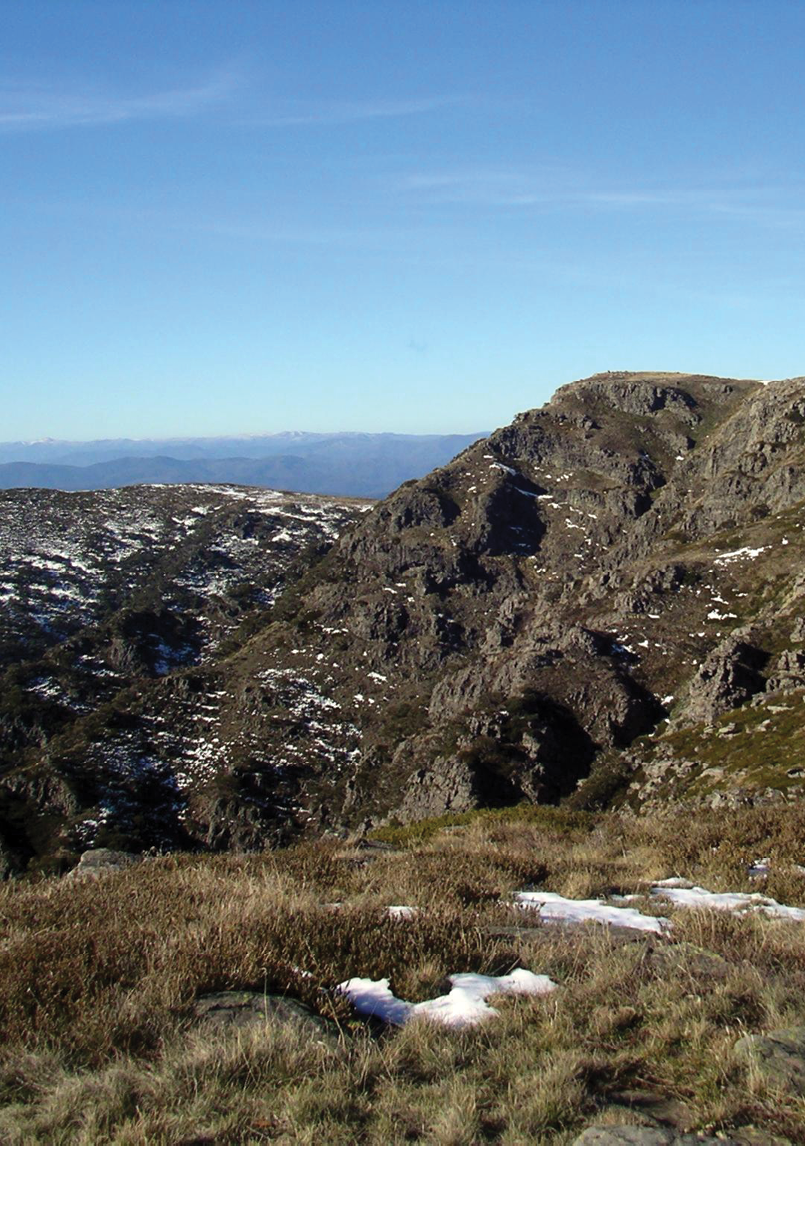
The north-east has the highest and most remote peaks, with arguably the best walking for experienced people. This region is big – 200 kilometres from Baw Baw to the NSW border, covering about 40,000 square kilometres with a lot of relatively pristine bush. Between Baw Baw and NSW there’s only a handful of through sealed roads.
Mt Buffalo NP is a pretty place with stunning views over granite cliffs. The Alpine NP is extensive and covers 6400 square kilometres. While suffering from adverse flora and fauna, not to mention ill-advised developments, the Bogong High Plains are well worth visiting. It does not take long to leave the masses. The start of a favourite walk leaves the car park and 90 minutes
BWA February 2016 | 7

The following pages are a compilation of best walks based on a survey of readers of the last edition of BWA, from reviews of various websites and books as well as from chatting with people who know Victoria’s walks.
later I’m at a camp site that very few visit. No track is one reason. The next day involves light scrub, and again no track. I’ve done the walk several times and not seen anyone, four days of solitude and bliss.
Mt Feathertop has a deserved reputation as a friendly mountain. The Bungalow Spur is well graded with a few creeks and soaks, climbing in a sheltered forest until Federation Hut. The summit is 45 minutes away. You can also approach Feathertop from Mt Hotham on The Razorback, an easier flatter trip of a few hours, and a slightly challenging return day trip. In winter the snow gets deep. One year it took three hours to flounder a kilometre to Federation Hut. The North-west and Diamantina Spurs are steep, long and ill-suited for beginners. South of Feathertop the Dargo High Plains attracts.
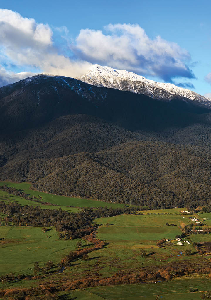
Mt Bogong has no easy approach – 1300 metres up from the north, 7-900 metres up from the south. It’s worth it. I rate Bogong aesthetically better than Kosciuszko: no tourists. In winter it’s a wild mountain.
The Snowy Plains are approached from Gippsland, with gems such as Moroka and Bryces Gorges, Snowy Bluff, Mt Howitt, Crosscut Saw, Razor Viking, Tali Karng and Wonnangatta. The Howitt region can also be approached from the west via Mansfield. Tali Karng is a lake hidden deep in the mountains
and was not discovered by whites until relatively late. This is the only natural lake in the Victorian Alps.
Whilst subjective, I’ve left the best to last, the Australian Alps Walking Track. The AAWT started as a dream in the late 1960s as the Alpine Walking Track going from Baw Baw to the NSW border west of Thredbo at Tom Groggin. By the mid-1990s the AAWT was on a new route to Cowombat Flat near the head of the Murray River, whence the track continued north to the ACT. Whilst I’m biased, I reckon the AAWT takes some beating. Tassie’s Overland Track is shorter, the NT’s Larapinta and SA’s Heysen are longer. Which is better? Can you tell? Does it matter? All are good.
LinksNeil Fahey bushwalkingblog.com.au/Chapman john.chapman.name/Tempest osp.com.au/
Hattah Lakes
(Hattah-Kulkyne National Park)
various, parkweb.vic.gov.au and australiannationalparks.comHattah-Kulkyne NP is best visited in autumn, winter or spring – the summer heat is harsh. Wander in an arid and enchanting landscape on tracks or cross country to seasonal lakes. Campsites are also available. Four main walking tracks, from a 600 metres lookout walk to the 10 kilometres 3.5 hours Mournpall Lake Loop.
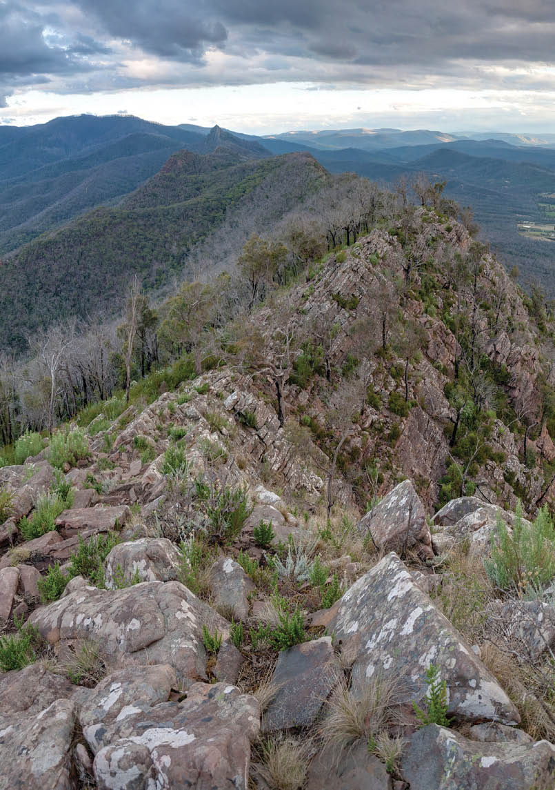
Southern GrampiansChristopher Howey


8 | BWA February 2016
Hattah Lake Cogs


Victoria


Hattah Lakes
(Hattah-Kulkyne National Park)
various, parkweb.vic.gov.au and australiannationalparks.comHattah-Kulkyne NP is best visited in autumn, winter or spring – the summer heat is harsh. Wander in an arid and enchanting landscape on tracks or cross country to seasonal lakes. Campsites are also available. Four main walking tracks, from a 600 metres lookout walk to the 10 kilometres 3.5 hours Mournpall Lake Loop.
BWA February 2016 | 9


Victoria


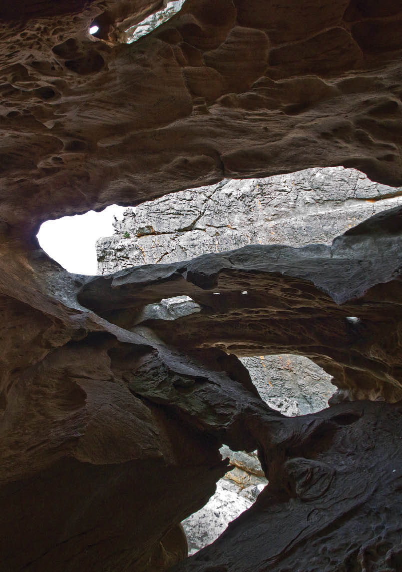
Hollow Mountain (Grampians NP)
2.2 km return, 1.5 hours, visithallsgap.com.auThe rock formations and the views south along Gariwerd. Caves, walls, overhangs, weird shaped lumps and some really fun scrambling.
Inside Hollow MountainBrian Eglinton
Mt Rosea (Grampians NP)
12 km return, 5 hoursThis is the highest peak near Halls Gap. Light forest, rocky sections and excellent views.
Mt Abrupt (Grampians NP)
7 km return, 4 hours, redzaustralia.com andbushwalkingblog.com.auSteep climbing leads to a panorama of the southern Grampians, a most scenic outlook.
10 | BWA February 2016

Victoria
Mt Rosea (Grampians NP)
12 km return, 5 hoursThis is the highest peak near Halls Gap. Light forest, rocky sections and excellent views.
Grampians National Park, just North of DunkeldGav Owen
Mt Abrupt (Grampians NP)
7 km return, 4 hours, redzaustralia.com andbushwalkingblog.com.auSteep climbing leads to a panorama of the southern Grampians, a most scenic outlook.
BWA February 2016 | 11

Historic Cape Nelson LighthouseIna van Hateren


Victoria

Great South West Walk sections
(SW coast)
various, greatsouthwestwalk.comMainly flat beach walking on good tracks trails. Watch the tides! Much wildlife with diverse ocean and forest views. Definitely recommend the GSWW. See page 36 for details.
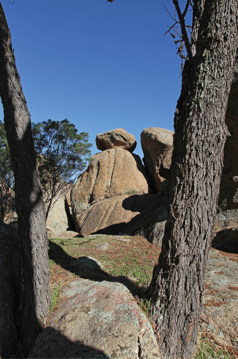
Melville Caves (Kooyoora State Park)
5-10 km return, 3-5 hours, several options, parkweb.vic.gov.auInteresting day walks with a variety of fascinating rocks. Large granite boulders and distant district views, great photography and exploring the area.
Mt Cole (Mount Cole State Forest)
4 km return, 1.5 hours, bpadula.tripod.comLarge district views and granite boulder country. Lots of walking tracks and options in the area. Longer options available to make a day of it.
Cumberland Falls
(Cumberland Falls State Resort Park)
9 km return, 4-5 hours, visitgreatoceanroad.org.auJust off the Great Ocean Road, south of Lorne. Great varied scenery including a sheoak forest and views from the top of cliffs. Castle Rock well worth a visit. Start with a picnic on the Cumberland River near the beginning of the walk.
12 | BWA February 2016

Victoria
Melville Caves (Kooyoora State Park)
5-10 km return, 3-5 hours, several options, parkweb.vic.gov.auInteresting day walks with a variety of fascinating rocks. Large granite boulders and distant district views, great photography and exploring the area.
Mt Cole (Mount Cole State Forest)
4 km return, 1.5 hours, bpadula.tripod.comLarge district views and granite boulder country. Lots of walking tracks and options in the area. Longer options available to make a day of it.
Cumberland Falls
(Cumberland Falls State Resort Park)
9 km return, 4-5 hours, visitgreatoceanroad.org.auJust off the Great Ocean Road, south of Lorne. Great varied scenery including a sheoak forest and views from the top of cliffs. Castle Rock well worth a visit. Start with a picnic on the Cumberland River near the beginning of the walk.
Melville Caves, Kooyoora National ParkRaider of gin
BWA February 2016 | 13

Waterhole on Lerderderg River, Lerderderg GorgeRexness

Victoria
Mt Macedon (Macedon Regional Park)
variousEnjoy a mixed forest of snow gum and alpine ash. The large Macedon Memorial Cross war memorial has a sealed path. Views limited from the area, but you get glimpses in places along the walk. See the lights of Melbourne from the cross at night. Various walks in the area from 2 to 30 kilometres. Douglas Road to Macedon Memorial Cross is a 2 kilometres 1 hour walk.
Lerderderg Gorge (Lerderderg State Park)
18 km circuit, full day (or overnight walk), trailhiking.com.auLovely river with series of course sand beaches and granite outcrops. For experienced walkers only.
Brisbane Ranges
(Brisbane Ranges NP)
8 km circuit , 3 hours, bushwalkingblog.com.au Nice circuit walk up a hill. Good variety of vegetation. Short side trips to some lookouts, Nelson Lookout provides distant views. Walks start from the Stony Creek Picnic Area.
Flinders Peak (You Yangs Regional Park)
3 km return, 1 hour, bushwalkingblog.com.auA pretty easy and very popular walk. Granite peak with views at top. There is a lookout platform at the top providing 360 degree view. Sometimes get fighter aircraft from RAAF flying low in area.
Cathedral Ranges
(Cathedral Range State Park)
9 km return, 5 hours, bushwalkingblog.com.au and bushwalkingblog.com.auSpectacular narrow ridge walk. Not viable in bad weather. Southern Circuit - fun, technical (almost) rock climb on the ascent of Sugarloaf Peak. Incredible views and geology. Stunning district views. Northern and southern circuit options, both are good.
Cape Schanck, Baldrys Crossing
(Mornington Peninsula NP)
2 km circuit, 30-60 minutes, bushwalkingblog.com.au, bushwalkingblog.com.au, bushwalkingblog.com.auA few options to around the main headland. Nice beach and stunning water views. Time it well and you may spot a penguin. Popular well maintained clear path. Longer options in area available.
14 | BWA February 2016

Victoria
Flinders Peak (You Yangs Regional Park)
3 km return, 1 hour, bushwalkingblog.com.auA pretty easy and very popular walk. Granite peak with views at top. There is a lookout platform at the top providing 360 degree view. Sometimes get fighter aircraft from RAAF flying low in area.

Cathedral Ranges
(Cathedral Range State Park)
9 km return, 5 hours, bushwalkingblog.com.au and bushwalkingblog.com.auSpectacular narrow ridge walk. Not viable in bad weather. Southern Circuit - fun, technical (almost) rock climb on the ascent of Sugarloaf Peak. Incredible views and geology. Stunning district views. Northern and southern circuit options, both are good.
Cape Schanck, Baldrys Crossing
(Mornington Peninsula NP)
2 km circuit, 30-60 minutes, bushwalkingblog.com.au, bushwalkingblog.com.au, bushwalkingblog.com.auA few options to around the main headland. Nice beach and stunning water views. Time it well and you may spot a penguin. Popular well maintained clear path. Longer options in area available.
Cathedral Ranges Diliff
BWA February 2016 | 15

Victoria

Mt St Phillack (Baw Baw National Park)
10 km return, 3-4 hours, bushwalkingvictoria.org.au and bushwalk.comClimb both Mount St Gwinear and Mount St Phillack. Great views and open alpine country. Snow shoe or ski in winter.
Bryces Gorge (Alpine NP)
8 km return, 2-3 hours, bushwalkingmelb.blogspot.com.auGreat walk in the high country. Stunning views from looking into Bryces Gorge. Views to Piemans and Conglomerate falls. Check out Guys Hut whilst in the area.

The Big Walk, Mt Buffalo
(Mount Buffalo NP)
12 km one way, 5 hours (add extra time for side trip to Rollasons Falls), parkweb.vic.gov.au The well named (it is a big) walk up Mt Buffalo. Stunning variety of vegetation and even more stunning views. Great views, needs good weather and fitness. Need a car shuttle.
Heathy Spur, Mt Nelse
(Alpine NP)
14 km return, 4-5 hours, parkweb.vic.gov.au Wonderful open grasslands and snow gums. Watch the weather, best on a cooler day in summer. Part of the walk is on the AAWT, then a short side-trip to Mt Nelse. Views that go on forever.
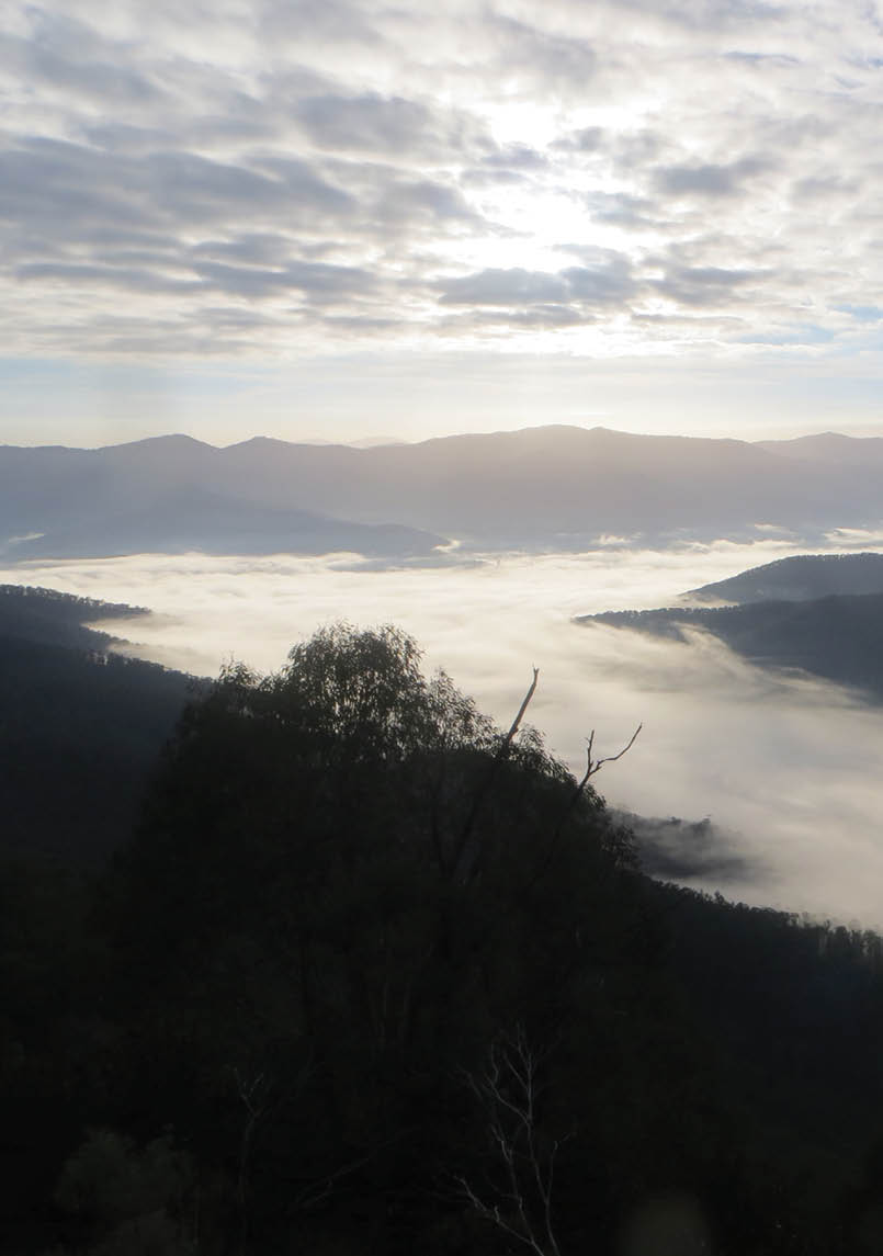
Morning mist from Mt BuffaloHallu
16 | BWA February 2016

Cape Bridgewater coastlineMattinbgn


Great South West Walk
250 km one way, 15 days, greatsouthwestwalk.comEasy to follow, well maintained track, varied terrain. This can be done in one trip or in sections. See page 36 for more details.


Victoria
BWA February 2016 | 17

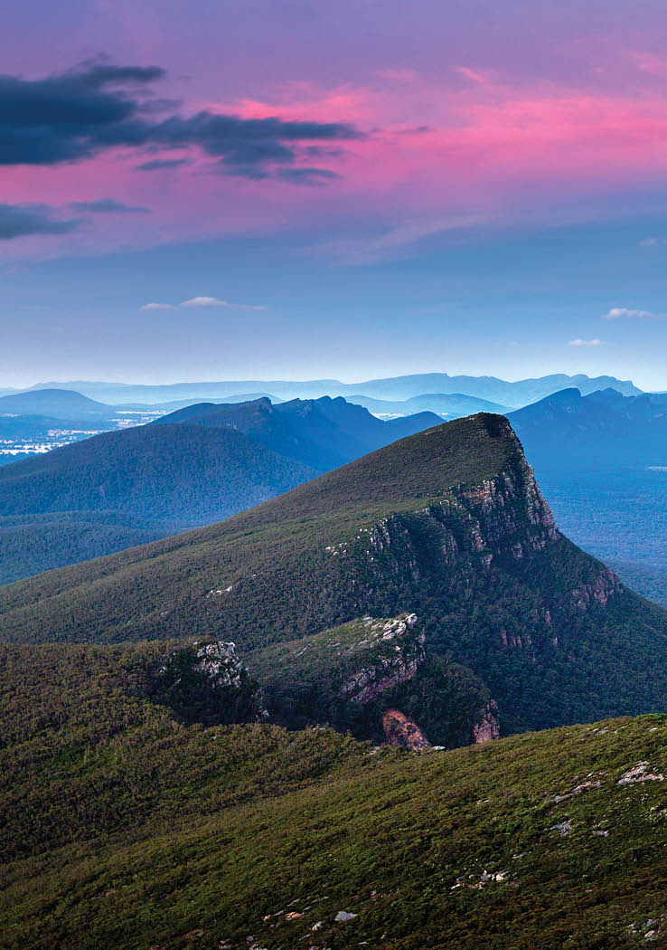
Mt Difficult Range (Grampians NP)
20-25 km one way, 2 days, hike-australia.comThe Mt Difficult Range is like a giant horseshoe, with Difficult on the west and the spectacular Briggs Bluff at the north. In fine weather there’s 360 degrees views. Spring and early summer are the best seasons. Starting points are usually Roses Gap or the Mt Difficult campsite. Allow two days, perhaps 20-25 kilometres depending on the route.

Victoria
The Fortress, GrampiansStevage
18 | BWA February 2016

Fortress (Grampians NP)
20-30 km circuit, 2 daysThis is in the wildest part of the Grampians. There are numerous off-track variations, scenic vertical drops into Deep Creek and near The Arch. See page 44 for more details.

Victoria
The Fortress, GrampiansStevage
BWA February 2016 | 19
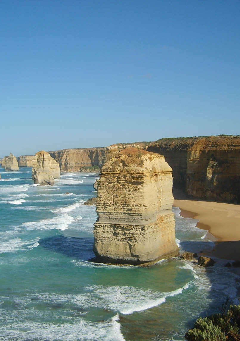
Twelve ApostlesThomas Enguehard


Great Ocean Walk (SW coast)
100 km one way, 8 days or walk one or two sections at a time, visitgreatoceanroad.org.auWalk from Apollo Bay to the Twelve Apostles. Stunning coast line. Luxury guided options available. Camp or use accommodation options. Several places to resupply to reduce your pack load. Stunning ocean views.

Victoria
20 | BWA February 2016

Victoria

Mt Feathertop (Alpine NP)
20-25 km return, 2 days, visitharrietville.com.auDue to easy safe access on the Bungalow Spur, a mix of sub-alpine and alpine vegetation and having a classic peak, Feathertop is justly popular. Other routes include the Bon Accord Spur, Razorback, and the much steeper Diamantina Spur. Winter or summer, the Razorback ridge to Feathertop is one of mainland Australia’s best and most popular walks. Camping on the Razorback has stunning views to the Bogong High Plains, the Kiewa Valley, St Bernard and Hotham.
Feathertop and the Fainters from Machinery Spur North-north-west
BWA February 2016 | 21
Mount BogongJoe Ritson


Razor Viking (Alpine NP)
varies, 3 daysThis is in a remote part of the alps. There’s no easy way in other then on foot, which can be from the AAWT or the Wonnangatta River. Stunning wilderness area with limited signs, you need to be an experience walker and navigator.

Victoria

Bogong High Plains (Alpine NP)
various distances and timesWalk at about 1600 metres, with many relatively easy tracked and untracked trips possible over a large area. There’s reliable water and sheltered camping in many places. You’re only limited by your imagination.
Mt Bogong (Alpine NP)
16 km or longer depending on route, 2-3 days, weekendnotes.comHighest point in Victoria, challenging, it takes you from the valley floor to above the tree line. While it is somewhat about peak bagging, the location and scenery make this a fantastic and rewarding walk. Generally starting at Mountain Creek, the start is flat until you reach the Staircase Spur, then the fun begins. Possible water at Bivouac Hut, have a snack then push on to the summit. There’s plenty of route variations, with a transition from forest to an almost bleak alpine zone. Can be done as a day trip – but why rush?
22 | BWA February 2016
The north face of Howitt from West PeakAlex Cohen

Sealers Cove (Wilsons Promontory NP)
9.5 km, 3 hours one way, 2 days for the circuit, parkweb.voc.gov.auA classic. Sure it gets busy, but the distance is short the scenery fantastic. This is a perfect introduction to bushwalking and is worth multiple visits. Take the bus to the start then walk 10 kilometres via eucalypt forest and rain forest to the cove and a perfect beach. After this there’s the rest of The Prom to explore.
Victoria

Moroka Gorge and Snowy Bluff
(Alpine NP)
various, 2-4 daysMoroka and Snowy Bluff offer wild and isolated off-track walking for experienced people. Be prepared for river walking, cliffs, posible abseils and camping on rock.

Mt Howitt (Alpine NP)
15-25 km, 2 days, longer if you can manage it, bushwalk.com, Wild magazine, WildPeak Bagging bookletShowcases the Victorian high country. You stand on the edge of wilderness with seemingly endless hills and forest of the Alpine National Park. The other way is the Mt Buller ski resort. Howitt is the heart of the Victorian alps with probably the most spectacular part of the AAWT. Several routes make Howitt a highly accessible walk – Speculation, Crosscut Saw, Magdala, Wonnangatta. The spring and early summer alpine wildflowers are second to none.
BWA February 2016 | 23


Avon River (Gippsland)
15-25 km, 2 daysThis is a very pretty river with good access and a number of routes, grade easy to medium. Some walks go from ridges to the river, where in hot weather you may average two swims per kilometre.
Victoria
Grand Strzelecki Track (Alpine NP)
varies, 3-5 days, grandstrzeleckitrack.org.auWalk between parks, with longer walks beyond park boundaries. There are waterfalls, sweeping views, rare and endangered ecosystems, and flora and fauna such as Mountain Ash and lyrebirds that most visitors never see. Enjoy walks for everyone.

Snowy River (Snowy River NP)
various, 3-4 daysThis is a wild and remote river for experienced walkers. You may be walking in the river or floating with your pack, so warmer seasons are best. Allow 3-4 days, several routes and distances.
Grand Strzelecki TrackDarryl Whitaker
24 | BWA February 2016
Beach near Wingan inlet, Croajingolong Hallu

Cobberas (Alpine NP)
various, 2-4 days, mickbeckers.com/Cobberas, Cleft Peak, Moscow Peak and the surrounding bush are well worth visiting. Plan 2-4 days to take in all the peaks and surrounds.
Victoria
Croajingolong Wilderness Coast Walk
(Croajingolong NP)
100 km, parkweb.vic.gov.auThe Croajingolong Wilderness Coast Walk has a remote beach setting for most of its length, and is partly in NSW.

AAWT (Alpine NP)
660 km, 40-60 days, takeawalk.com.auThis is a major undertaking, 660 kilometres from Walhalla to the ACT, 40-60 days. If you have the experience, stamina, gear, motivation and time, give it a go. You will not be disappointed. Some parties do the AAWT a week at a time, about 100 kilometres.
BWA February 2016 | 25