Longpoint West/East Loop
Text and photosNigel Woodman
Mount Difficult/Gar
Located 3.5 hours NW of Melbourne, the Grampians National Park, known as Gariwerd in local Aboriginal language, offers more than just a hiking experience. It is a journey through diverse landscapes, ancient history, and cultural transformation.


22 | Bushwalk February 2024
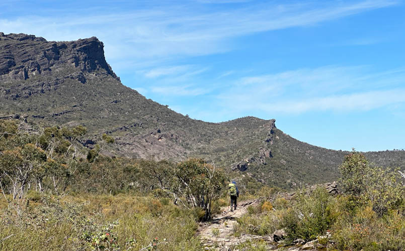
Close to the GPT track junction with Mt Difficult in the background
Over two days, 23-24 September 2023, we embarked on a trek that furthered our love and respect for this remarkable region. Having walked the full Grampians Peaks Trail in 2021 we were keen to return. The Longpoint West/East Loop avoids a car shuffle and has some of the last remaining free hikers campsites in the National Park.
Key pointsHiker InformationRefer to the Parks Website for latest information. Click on “This area has reported issues” for key updates.
WaterWater cannot be relied on in the Grampians at any time of the year. We have been caught out before, even at a designated campsite with a Serviced Water Tank. It is worthwhile calling Parks to get the latest information.
Parks VictoriaPhone: 8427 2058
Water tanks on this hike
Gar hike-in campsite but note this is not a serviced water tank, so may be unreliable during summer months.
Longpoint West (free campsite). This is filled from the roof of the toilet block, so again, it may be unreliable during summer months.
GeologyThe geological story of the Grampians begins approximately 430 million years ago, during the Silurian period. At this time, the area was part of a deep sea where sediments accumulated over millions of years. The thick layers of sediment that formed on the sea floor eventually solidified into sandstone. This sandstone is predominantly quartz-rich, contributing to its durability and the distinctive colouration in the ranges. The Grampians mountains, known as a horst, were formed due to significant earth movements, particularly during the Devonian
23
period (around 400 million years ago). These movements caused the crust to fracture and uplift in places, raising the sandstone layers above the surrounding landscape. Over millions of years, erosion sculpted the uplifted sandstone into the dramatic ranges and rock formations visible today. Weathering and erosion are responsible for creating the Grampians' notable features, such as rugged ridges, steep slopes, and the many unique rock formations.
Aboriginal heritageThe Grampians are deeply rooted in Aboriginal history, serving as a cultural and spiritual site for the Jardwadjali and Djab Wurrung peoples for over 20,000 years. The park's numerous rock art sites, some of the most extensive in south-eastern Australia, offer a window into the lives and beliefs of its original inhabitants.
In the Dreamtime stories, Bunjil, often depicted as a wedge-tailed eagle, is an influential and respected figure in Aboriginal mythology. He is considered the world's creator and is associated with life, leadership, and justice. The landscapes of the Grampians/Gariwerd, with their dramatic rock formations and rich biodiversity, are often attributed to Bunjil's creative work.
European settlementThe landscape underwent significant changes with the arrival of European settlers in the 19th century, led by the Scottish surveyor Sir Thomas Mitchell (born 1792), who named the ranges after Scotland's Grampian Mountains in 1836. From his journal:
“I ascended one of the low sandstone ridges and obtained a satisfactory view of the Grampians. Seeing the grand outlines of these mountains lying to the westward, I named them at once from their similarity in outline to the Grampian mountains of Scotland. These hills, or rather mountains, with their lofty, rocky, and inaccessible summits, formed a most magnificent feature in the otherwise uninteresting country around them.”
This period marked a new chapter in the region’s history, characterized by agricultural development and the consequent impact on the Aboriginal communities.
The making of a national parkIn 1984, recognizing its unique natural, historical, and cultural value, the Grampians was declared a national park. This designation has been instrumental in preserving the area's diverse ecosystems, Aboriginal heritage, and geological wonders.

Briggs Bluff

24 | Bushwalk February 2024
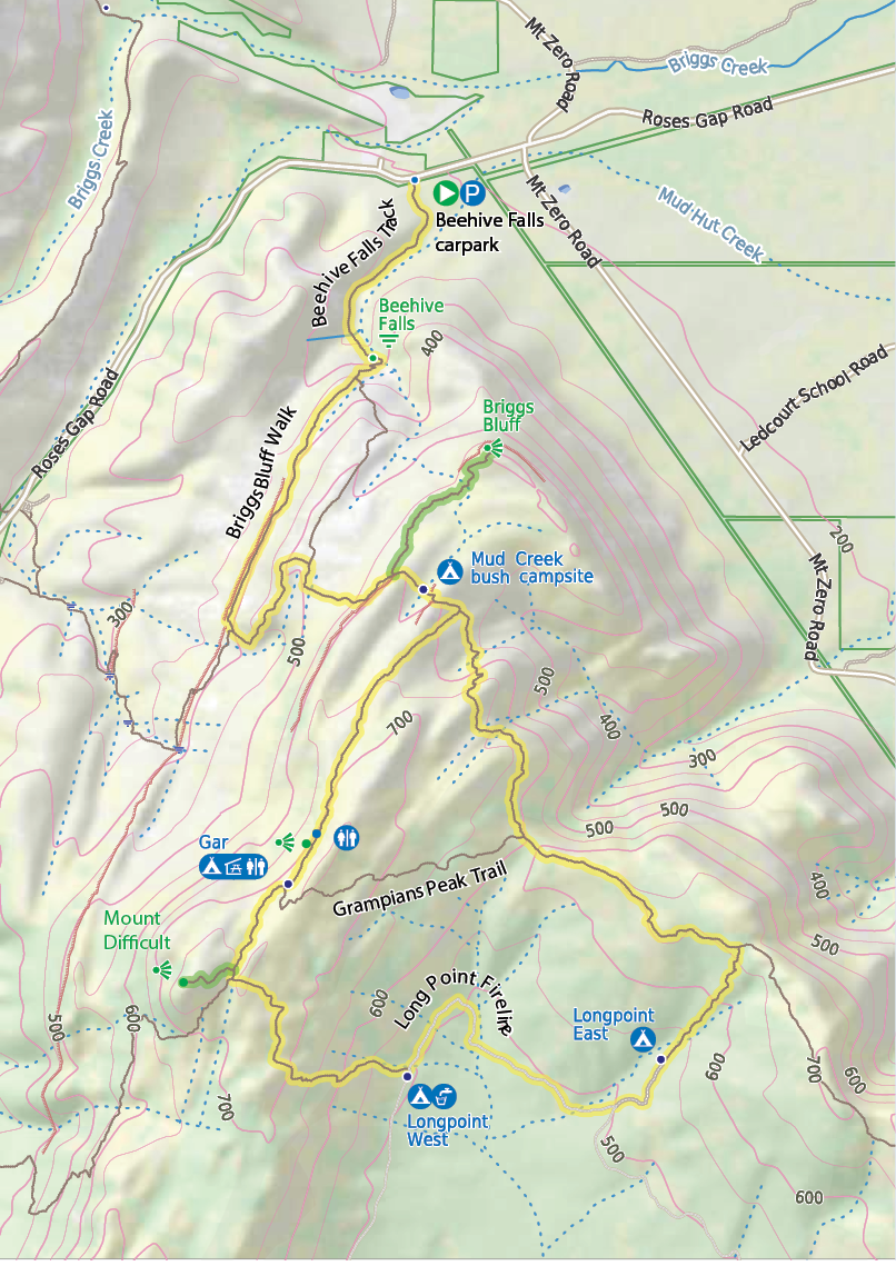


Bushwalk.com notes and maps on webpage, GPX and PDFThis map is © Bushwalk.com and is created using data © OpenStreetMap contributors.

Road, four-wheel drive track, walking track (treed)
Main track, side trip, alternative route
Cliff, major contour line, minor contour line (50 metre interval)
Lake, river, waterfall or creek


Start of the walk
Picnic shelter
Campsite
Toilet
Parking
Waterfall
Lookout

Mount Difficult Circuit


0 km 0.5 1 1.5 km


25
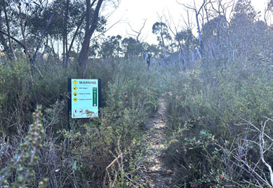
Day 1: Roses Gap to Longpoint East, 20 km, 6 hrsMy son Ollie and I set off from Beehive Falls Carpark in Roses Gap just after 10 am, winding our way through the park's signature sandstone terrain. The track took us on a leisurely stroll to Beehive Falls. Just past the falls, a sign left in little doubt that the work rate was about to increase considerably.
The climb from here was steep, with some minor scrambling. These days, Ollie sets a cracking pace; the torch has well and truly been passed. After about 30 minutes, the track joined the main GPT trail. Wildflowers were in abundance, and though it was warm, there wasn’t the intensity of heat we had encountered a couple of years back. Early spring hiking in this part of Victoria is a joy.
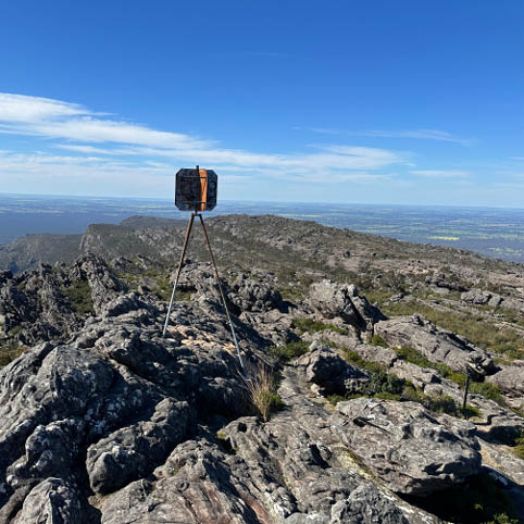
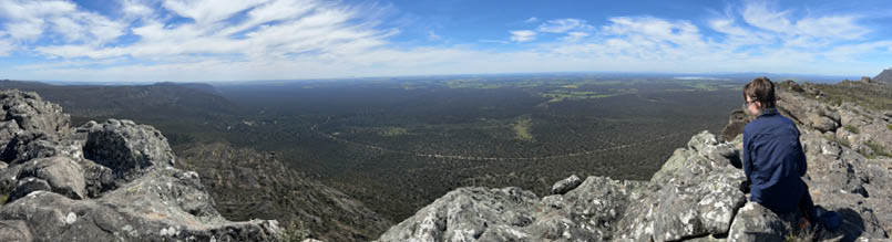
As we had plenty of time, we took the short walk to Briggs Bluff (30 minutes each way). The track headed north from the GPT along the cliff line. Avoid the temptation to swing east (right) about 200 m along the track as the markers are a little obscured, and bias left. The track eventually swung around to the NE to climb up to the Bluff. The views across the surrounding farmland and Lake Lonsdale were spectacular.
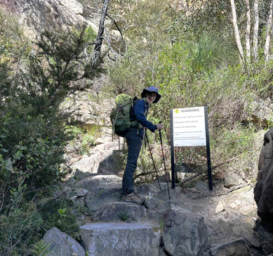
Track steepens after Beehive Falls
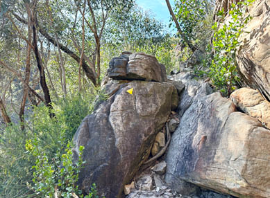
Track is well marked but requires some scrambling
Ollie at Briggs Bluff
"
These days, Ollie sets a cracking pace; the torch has well and truly been passed.


26 | Bushwalk February 2024
From the Briggs Bluff turnoff it is approximately 40 minutes to the Gar hike-in campsite. We noted that a helicopter pad was under construction a few minutes from the campsite. We had lunch in the shelter there. A tap on the tank indicated it was full. A site glass or indicator on the tank would be welcomed to make sure.
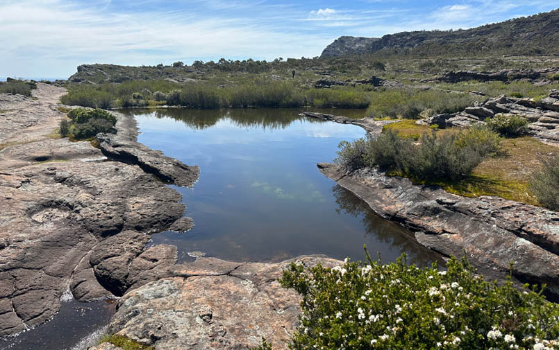
Tarn near the turnoff to Briggs Bluff

"
We noted that a helicopter pad was under construction a few minutes from the campsite.
Communal shelter at Gar Hike-In Campground

Lunch in the shelter
27
Muscle memory had us drop our packs at the turnoff to Mt Difficult. We soon realised our mistake, fetched the packs, and carried them to the turnoff to Mt Difficult/Longpoint West. From there, it was a 10-minute climb to the top of Mt Difficult/Gar. The track here works its way around a small ridge, so favour any track that leads slightly north of west (bias right initially). Even if you miss the track, the climb is not too technical. The track was more obvious on the descent, so a glance back can often give you some clues. Again, there were great views, this time across Lake Wartook.
The track to Longpoint West descends and is quite fast. We reached Longpoint West after a 30-minute brisk walk. The campsite has some basic infrastructure, a toilet, a tank and some reasonably flat tent sites. The water tank was appreciated, and we took advantage of it and had an early dinner. However, we decided to hike to Longpoint East with enough water for the following day.
We reached Longpoint East in 30 minutes after an easy hike along the 4WD trail. The campsite at Longpoint East was a step up in our opinion. While small, it was nice and flat. There was also a little amount of water flowing across the road so we had a late supper. As no rain was forecast we opted for some cowboy camping.
Ollie at Mount Difficult/Gar

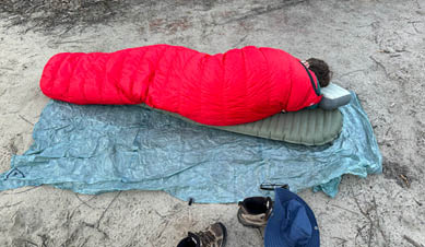
Cowboy camping at Long Point East Hike-in camping area
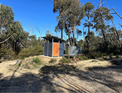
Amenities at Longpoint West Hike-in camping area
28 | Bushwalk February 2024
Nigel has been an avid hiker for more years than cares to remember. His enjoyment of the outdoors is all the better for sharing it with his children and as they got older, their peers in the wider community of Scouts. He has had the good fortune and privilege to lead hikes on the Larapinta Trail, The Grampians Peaks Trail, the Overland Track and the South Coast Track. He is heading back to Nepal this year for a trek to Mera Peak (6476m) after 2023‘s trek to Everest Base Camp (5364m) and Island Peak (6189m).
.jpg)
<


Nigel (on the right) with guide Kumar (Scenic Nepal Treks and Expeditions) in front of Khumbutse Peak
Track from Longpoint East

Descending the Mount Difficult Range to close the loop
Day 2: Longpoint East to Roses Gap, 10 km, 3 hrsThe next day, we set off early for us (7 am), and it was nice not to have to pack up tents covered in condensation. The track started a short distance back down the 4WD trail from the campsite. It was pretty overgrown but still reasonably fast. We crossed over the creek, which is 5 minutes up the track from the campsite. It was flowing well by Grampians standards, but it looked like it would dry out quickly.
From here, the track linked up with the GPT for a short section, then became rockier and the navigation a little more challenging. Some well-placed cairns supplemented the markers
nicely. This was our favourite part of the trail, and the descent down the little creek was really good fun.
The track then re-joined the GPT, completing the loop. We then backtracked back to Beehive Falls and Roses Gap car park.
While it was interesting to travel up via Beehive Falls, a potentially more scenic route, especially after rain, would be to ascend from the Troopers Creek Campground (Gar Trailhead) following Bullocks Creek. This was one of my favourite sections of the GPT. The Longpoint West/East Loop turned out to be a great spring overnighter in one of my favourite national parks in Victoria. The free camping was a bonus in this age of user pays.
29