Day 3: At Consett Stephen Pass looking down the Guthega River valley

Kosciuszko's Main Range loop seems to be more popular with each passing season, but you don't have to go too far to find walks that provide solitude.

Mount Twynam Circuit
Text and photosMark Jekabsons
16 | Bushwalk June 2024
To the north of Mt Kosciuszko lies Mt Twynam, Australia's third highest peak (2195m) and the equally impressive Mt Tate. Both can be visited on a 23km loop starting at Guthega. While it is possible to do this walk in a day, I chose to camp out for two nights to experience the alpine night skies and hopefully, those sunsets and sunrises that photos don't do justice.
Day 1: Guthega to Mt Twynam 8km, 3 hrs
Arriving in Guthega by motorcycle, I was able to park close to the start of the walk, but there is plenty of parking available no matter your means of transport. I chose to walk in a clockwise direction which meant
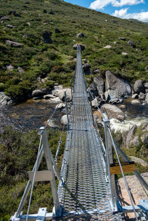
I shared the first 2.5km with those walking south along the Guthega-Charlotte Pass section of the Snowies Alpine Walk, opened in 2022. This follows the Snowy River upstream from Guthega Pondage to the Illawong swing bridge. At this point I turned west, crossing the bridge and the gentle slope of the Snowies Walk suddenly became a more serious climb as Mt Twynam loomed directly in front of me.
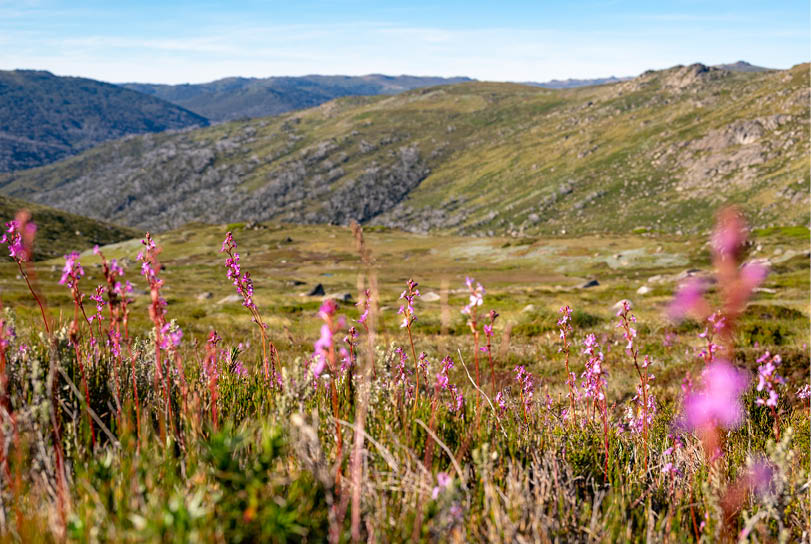
The track from here is a narrow but well-worn footpad winding its way up a ridgeline and past a stand of the oldest and gnarliest looking snow gums that you'll find anywhere on the Main Range. Before the final kick up to the peak of Twynam, lies a small wetland near the source of Pounds Creek. The terrain levels out here and with some lush, grassy patches between the pools, I decided to pitch my tent here. I had only started walking mid-afternoon, but the wind had increased considerably in the last couple of hours. I knew that this would be the last sheltered spot before the exposed ridgeline on top of the range. The only drawback was not having a view of the impending sunset, and when a
Illawong swing bridge
"
I chose to camp out for two nights to experience the alpine night skies and hopefully, those sunsets and sunrises that photos don't do justice.


Day 1: Campsite at the foot of Mt Twynam
17

Start of the walk
Hut
Bridge
Toilet
Parking


Bushwalk.com notes and maps on webpage, GPX and PDFThis map is © Bushwalk.com and is created using data © OpenStreetMap contributors

Road, four-wheel drive track, walking track (treed)
Main track, side trip, alternative route
Cliff, major contour line, minor contour line (50 metre interval)
Lake, river, waterfall or creek


Mount Twynam Circuit
0 0.5 1 1.5 2 2.5km


18 | Bushwalk June 2024
bright orange glow appeared on the summit of Mt Anton to the north, I knew I’d missed out on a good one.
Day 2: Mt Twynam to Consett Stephen Pass 10km, 3.5 hrs
When the sun hit the other side of Mt Anton the next morning, there was just a light breeze and a full moon was setting. From my campsite it was only 500 metres to the ridegeline where the loop turned to the north. The summit of Mt Twynam is just off the route to the south so I dropped my pack at the junction and walked the short side trip to enjoy the views over Hedley Tarn to Mt Kosciuszko.
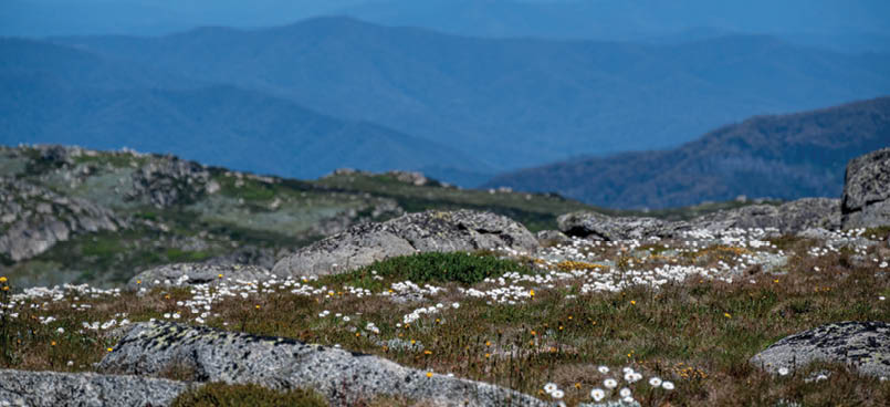
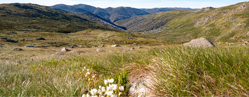
By the time I descended from the peak and returned to my pack, the wind was more noticeable and grew stronger as I passed Mounts Anton, Anderson, David and Mann Bluff. This section of track afforded spectacular views across endless ranges to the west. While not peak wildflower season, some of the slopes were still carpeted with the yellow and white of yam daisies, billy buttons and alpine sunrays. The numerous boulder fields provided shelter from the wind when I needed to boil the billy for morning tea and lunch.
Day 2: Yam daisies and billy buttons on the slopes
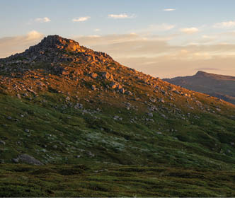
Day 2: View over Mt Anton in the early morning light
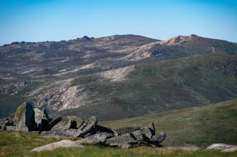
Day 2: View from the summit of Mt Twynam
19
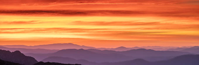
At Mt Tate the track drops off the ridgeline and starts the descent to Consett Stephen Pass. I persevered with the wind and stayed high, looking for a sheltered campsite so I wouldn’t miss the sunset again. I eventually found a flat spot below the peak’s boulders just the size of my tent’s footprint. The afternoon was spent enjoying reading with cups of tea. When the sun was close to the horizon I ventured back upslope. My camera tripod could only barely withstand the wind coming directly in from the
west but the scene of layers of violet ridges under oranges and reds kept me up on that exposed ridge for a couple of hours. Behind me, the lights of Guthega were turned on as the stars came out.
Day 3: Consett Stephen Pass to Guthega 6km, 2 hrs
Day three started with another colourful lightshow over a bumpy white sea of fog in the valley below. After breaking camp, I dropped down into the bowl of Consett
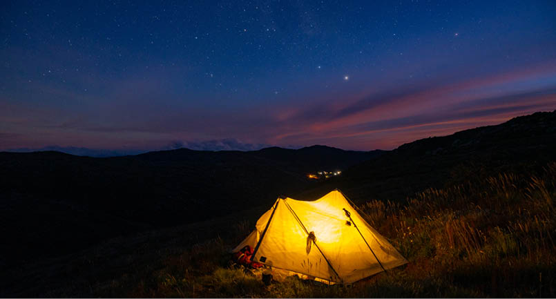
Day 2: Stars over the campsite below the summit of Mt Tate
Day 2: Sunset from Mt Tate

20 | Bushwalk June 2024
Day 3: At Consett Stephen Pass looking down the Guthega River valley
Stephen Pass. From here there is the option of continuing north to the Rolling Ground, however I turned to the south where I could see Guthega in the distance. I lost the footpad at this point, but the Guthega River valley pointed the way and crossing the meadow-like grassland was easy walking. I picked up the track again near Guthega Trig where it drops sharply off a spur.
The descent was tough on the legs, not only because it drops nearly 300 metres in 2 kilometres but because the low woody shrubs that have almost entirely engulfed the track take a toll if you are wearing shorts, as I was.
Where the track isn’t visible, take the path of least resistance through the scrub. I emerged at Guthega Dam and from here it’s a short ascent back up to the village car park on formed track.
I had seen no one on the final day’s walking, and few other hikers on the entire loop once I had veered off the Alpine Snowies Walk. My total ascent was just over 1000 metres with most of this being on the first day approaching Mt Twynam. Like other walks on the Main Range, the main hiking season is from November to April but plan for bad weather at any time of year.
Mark is a keen bushwalker and amateur photographer with a particular interest in our natural environment through his thirty-year career as an ecologist, predominantly working on aquatic projects. From his home in Canberra he has extensively explored Namadgi National Park, both for work and recreation, and feels he is still getting to know Kosciuszko National Park. He will soon be moving to a rural property with his partner where he is hoping to restore some natural habitat to the cleared land.
Flickr: https://www.flickr.com/photos/jekabsons/
Instagram:@markjek

<

21