Constructed features on a map include physical infrastructure (buildings, roads, fences, tracks) through to human-perceived boundaries (e.g. private properties vs. national parks). Here are some examples below.
Different shapes are used to mark physical features on a map such as roads, pathways, railways lines. Check the map key for more information.
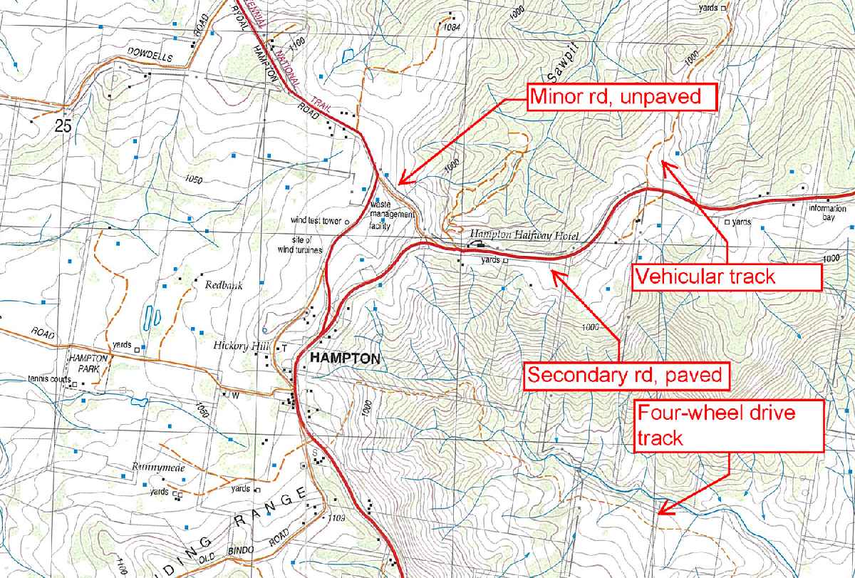
Solid orange lines indicate minor unpaved roads, and wide dashes indicate vehicular tracks. These roads are usually two-wheel drivable. Narrow orange dashes are four-wheel drive tracks. Dotted black lines are bushwalking tracks, and can vary from a well-worn concrete track right down to a faint footpad.
Some minor tracks or roads may not be accurately drawn or missing on topographic maps because these tracks overgrown or new roads have been created since the map data was collected. Checking the year of publication of the map can give an indication of how likely the tracks are to be accurate. Tracks and trails sometimes have locked gates: in general, walkers can get across locked gates but cars cannot. The exception is, of course, private property where bushwalkers must get permission to access.

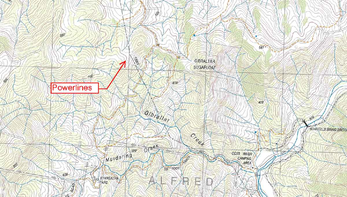
Large power lines can be useful landmarks for navigation although minor power lines are likely to have changed since map data publication. Use power transmission lines to determine locations with caution.
In Australia, it is illegal to trespass on private property without permission, regardless of whether a road or walking track runs through the property, or if it is the only access point to a national park.
On NSW topo maps, property boundaries are usually marked in light grey lines and are generally fields shaped into rectangles, rhombus or squares. Sometimes these properties include a number which is the designated title of the private land.
The best course of action is to plan the bushwalking route carefully and check for private property boundaries. If the track passes through a private property then a phone call ahead of time to ask for permission to enter is best. If the owners do not grant permission, do not enter.

Determining where property boundaries lie enables a bushwalker to figure out what is allowed in certain areas. For instance, in NSW dogs are not allowed in national parks, but they are in state forests. Bushwalkers cannot walk on private properties without permission.
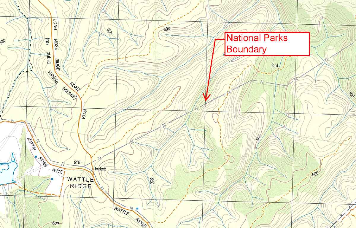
Different shades are used to mark regional boundaries (e.g. National Park boundaries, councils, state forests, etc.). Check the key to confirm regional boundaries.
On the image is a National Park boundary for the Nattai National Park, north of the grey boundary line.